Hampton dates to 1610, and 31 of its places are on the National Register
More historic than 86% of U.S. towns · #23 of 253 in Virginia. What drives it
Most of Hampton was built recently: 7% of its homes predate 1940 and the median home dates from 1974. 31 places in town are on the National Register, among them 7 National Historic Landmarks and ten historic districts with 2,939 buildings between them. Below: 19 old photos and papers, maps from 1885 on, and the census since 1850.
Founding year: Wikidata. First post office: 1774.The full story ↓
History grade
What drives Hampton’s History grade
On its age, its old homes and the National Register, Hampton is more historic than 86% of U.S. towns, #23 of 253 in Virginia. Its age holds the grade up; its share of homes from before 1940 pulls it down.
A
HistoryA character grade: shown, never part of Hampton’s overall grade.
Among the 400 U.S. cities of 100,000 or more, Hampton ranks #95 on History.
Virginia towns list more on the Register than most of the country (a typical Virginia town has 3.6 per 10,000 residents, the U.S. 2.4), so Hampton’s 215 sits above most of its state (79% of Virginia towns have fewer) while its 2,956 historic buildings outnumber those of 100% of U.S. towns.
NoteThe founding year comes from Wikidata alone; no second source gives 1610.
How sure. Graded on any two of the three inputs instead, the letter would range from B+ to A+. The pre-1940 share (±0.8 points) is firm at this size.
Founding year: Wikidata (other dates in Quick answers). Homes: Census ACS 2020–24. National Register: National Park Service, May 2026 list; each listing counted once (boundary changes and added documentation belong to their listing), and a historic district counts its contributing buildings. How TownRatings grades history →
What stands out about Hampton’s past
Read from the archive, the National Register and the record. The page puts what stands out first.
Indigenous people settled in present-day Hampton before 10,000 BCE. In the early 1600s, the Tidewater region was populated by the Algonquian peoples who called the lands Tsenacommacah. The Powhatan Confederacy was made up of over 30 tribes numbering an estimated 25,000 people before the arrival of English colonists.
In December 1606, three ships carrying men and boys left England on a mission sponsored by a proprietary company. Led by Captain Christopher Newport, they sailed across the Atlantic Ocean to North America. After a long voyage, they first landed at the entrance to the Chesapeake Bay on the south shore at a place they named Cape Henry (for Henry Frederick, Prince of Wales, the elder son of their king).
Passages that mention Hampton, cut from the printed page as they were published.
History of Hampton and Elizabeth City County, Virginia1922Read the page →
Read the text
Hampton in the Revolution At the time of the American Revolution the population of Hampton was probably about one thousand people. There, as elsewhere, the spirit of patriotic resistance had its home, and the following gentlemen chosen 23 of November, 1775, constituted the Committee of Safety for Elizabeth City and the town of Hampton: William Roscow Wilson Curie, Chairman, John Tabb, George Wray, John
Text read by machine from the scan; it may contain errors.
History of Hampton and Elizabeth City County, Virginia1922Read the page →
Read the text
Captain Squires, however, did not relinquish his desire for revenge, and on October 24 appeared in Hampton River with six armed tenders sent by Dunmore, and a message was received at Hampton that he would that day land and burn the town. The Virginia troops, who were then in the vicinity, consisting of a company of regulars under Captain George Nicholas, a company of minute men, and a small body of militia, made the best disposition they could to pre-
Text read by machine from the scan; it may contain errors.
Scans and text from the Internet Archive. Books published in 1930 or earlier, which are in the public domain.
By decade
Hampton, decade by decade
One decade in the archive so far: the 1860s. Scroll each row; tap a photo for its story.
Every edition of the U.S. Geological Survey’s map of Hampton. Tap a year, or press play to watch the town change.
1907Hampton sheet · 1:62,500
U.S. Geological Survey historical topographic maps (public domain), via Esri’s collection of the scans. The red ring marks the center of Hampton.
Every building
Hampton, building by building, 1885–1916
Fire insurance maps drew every building, what it was made of and what it was used for, so insurers could price the risk of fire. Pick a year, then a sheet.
Lost post offices, old corners, places now gone and burying grounds
Hampton’s post office has been open since 1774. Six other post offices opened and closed inside today’s town.
Hampton
1774–today
Old Point Comfort
1824–1880
Kecoughton
1836–1955
Phoebus
1885–1953
Rip Raps
1892–1916
Buckroe Beach
1905–1953
Fort Monroe
1941–1972
17701900today
Hamlets and corners on the map
Aberdeen GardensArmistead HeightsArmstrong GardensBack RiverBellview TerraceBig BethelBloxom Trailer CourtBloxoms CornerBuckroe BeachBuckroe GardensBuckroe Mobile Home ParkCarver CourtCedar ParkChapel VillageCherry AcresChesapeake HeightsClarkdaleDebman's Mobile Home ParkDrummonds CornerEast HamptonEdgewaterElizabeth Lake EstatesElmwood Mobile Home ParkFairview Farms
Gone or out of use
Back River LighthouselocaleBattery AndersonmilitaryBattery BarbermilitaryBattery BomfordmilitaryBattery ChurchmilitaryBattery ClaibornemilitaryBattery De RussymilitaryBattery DyermilitaryBattery EustismilitaryBattery GatesmilitaryBattery HindmanmilitaryBattery IrwinmilitaryBattery LeemilitaryBattery MontgomerymilitaryBattery ParrottmilitaryBattery RugglesmilitaryCharles H Taylor Memorial LibrarybuildingElizabeth City County Courthousebuilding
17cemeteries and burying grounds inside Hampton
BarnesBassetBethel AME ChurchClarkEbenezerElmertonGreenlawnHampton NationalHampton National Cemetery (VAMC)Hampton Veterans Memorial ParkHebrewLincoln ParkMount OliveOaklandParklawn MemorialPleasantSaint John's
US Post Offices dataset (Blevins & Helbock, CC0). Places and cemeteries from the USGS Geographic Names Information System (2021).
Help out
Finish Hampton’s story
Most archives stop around 1920. The photos from after that are in family albums, not libraries.
Decades since 1900 with photos
00s10s20s30s40s50s60s70s80s90s
0 of 10 decades. The empty ones are waiting for someone’s album.
In 1610, according to Wikidata. Hampton’s post office opened in 1774, and the census of 1850 counted 787 people here.
How does Hampton rank for history?
Hampton is more historic than 86% of U.S. towns, #23 of 253 in Virginia. The History grade combines the town’s founding era, the share of homes built before 1940 and its National Register listings. It’s a character grade, so it isn’t part of the overall grade. How it works.
What is on the National Register in Hampton?
31 listings, 7 of them National Historic Landmarks: 12 buildings, 10 historic districts with 2,939 contributing buildings, 2 sites, 6 structures, and 1 object. 2,956 historic buildings in all.
How old are the homes in Hampton?
7% of Hampton’s homes were built before 1940 (Census estimate), against a typical 1.9% for a Virginia town; the median home was built in 1974.
Founding dates: Wikidata, Wikipedia, the U.S. post office records of Blevins & Helbock (CC0) and the Census. Homes by year built: Census ACS 2020–24. National Register of Historic Places: National Park Service (list of May 22, 2026). Old photos, postcards and papers: Wikimedia Commons, the Library of Congress and other public archives, credited on each item’s page. Maps: U.S. Geological Survey historical topographic maps (via Esri) and Sanborn fire-insurance maps (Library of Congress). History text and census tables: Wikipedia (CC BY-SA 4.0). Places that used to be: USGS Geographic Names Information System (2021).
From Wikimedia Commons (12), the Library of Congress (7), Wikidata (4), the National Register of Historic Places (31), Wikipedia, Wikidata and Wikipedia for famous people, U.S. Geological Survey historical maps, U.S. Census counts (via Wikipedia), the US Post Offices dataset (Blevins & Helbock), the USGS Geographic Names Information System, Sanborn fire insurance maps (Library of Congress) and old county and town histories (Internet Archive). Archive images are copied here with their credits and licenses, shown on each photo’s page. Refreshed monthly.


 ★ Landmark
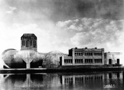 ★ Landmark
 ★ Landmark
 ★ Landmark
 ★ Landmark
 ★ Landmark


 1861
 1861
 1861
 1862
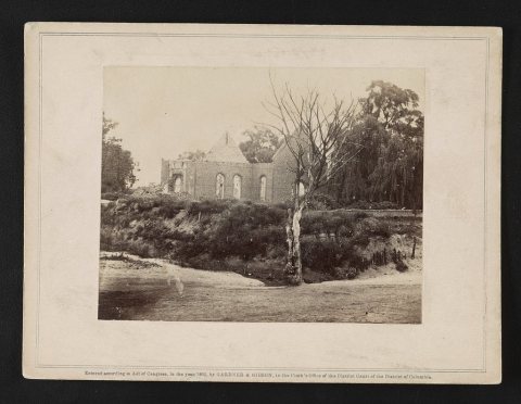 1862
 1862
 1862
 1862
 1862
 1862
 1862
 1862
 1862
 1862
 1862
 1862
 1864
 1864


