Guest, Sign inJoin

Post to Arlington

We’ll email a one-tap link to publish your post. No password, and nothing is public until you click it.
Already a member? Sign in
A−History
History · Arlington

Arlington dates to 1801, and 62 of its places are on the National Register

More historic than 83% of U.S. towns · #34 of 253 in Virginia. What drives it

Most of Arlington was built recently: 8% of its homes predate 1940 and the median home dates from 1976. 62 places in town are on the National Register, among them 5 National Historic Landmarks and ten historic districts with 12,036 buildings between them. Below: 9 old photos and papers, maps from 1900 on, and the census since 1800.

1801founded
62on the National Register
8%homes built before 1940
9old photos & papers
84famous people
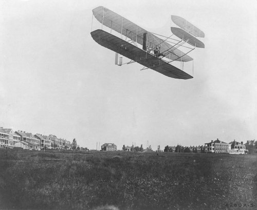
From Arlington’s archive · credits on each photo
Quick answers

How Arlington began

When was Arlington founded?

1801

Arlington dates its founding to 1801 (Wikidata). The census first counted it in 1800.

First census: 5,949 in 18002020 census: 238,643225 years

How historic is Arlington?

A−

More historic than 83% of U.S. towns, on its age, its old homes and the National Register.

What drives the grade ↓
Founding year: Wikidata. First post office: 1862.The full story ↓
History grade

What drives Arlington’s History grade

On its age, its old homes and the National Register, Arlington is more historic than 83% of U.S. towns, #34 of 253 in Virginia. Its National Register listings hold the grade up; its share of homes from before 1940 pulls it down.

A−
HistoryA character grade: shown, never part of Arlington’s overall grade.
All U.S. towns we grade (21,289)Ahead of 83%
NewerOlder
Virginia towns of 2,500+ (253)Ahead of 87%

Among the 400 U.S. cities of 100,000 or more, Arlington ranks #112 on History.

Virginia towns list more on the Register than most of the country (a typical Virginia town has 3.6 per 10,000 residents, the U.S. 2.4), so Arlington’s 520 sits above most of its state (90% of Virginia towns have fewer) while its 12,292 historic buildings outnumber those of 100% of U.S. towns.

NoteThe founding year comes from Wikidata alone; no second source gives 1801.
How sure. Graded on any two of the three inputs instead, the letter would range from B to A. The pre-1940 share (±0.5 points) is firm at this size.

Founding year: Wikidata (other dates in Quick answers). Homes: Census ACS 2020–24. National Register: National Park Service, May 2026 list; each listing counted once (boundary changes and added documentation belong to their listing), and a historic district counts its contributing buildings. How TownRatings grades history →

What stands out about Arlington’s past

Read from the archive, the National Register and the record. The page puts what stands out first.

★ What stands out · On the National Register

62 listings protect 12,292 historic buildings

The country’s official list of buildings and places worth saving. 5 are National Historic Landmarks, the highest tier. Boundary changes and added documentation are counted with their listing.

places listed
62
National Historic Landmarks
5
Fort Myer Historic District
historic buildings protected
12,292
each building in a district counts
first listed
1966
Arlington House, The Robert E. Lee Memorial
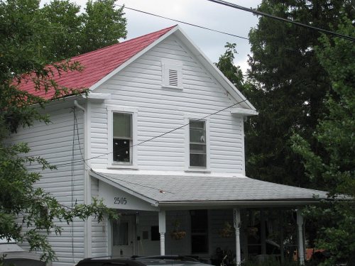
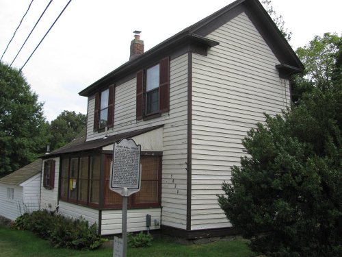
Arlington House, The Robert E. Lee Memorial, built 1803Glebe, TheBall-Sellers House, built 1760Hume SchoolColonial Village, built 1935US Post Office-Arlington, built 1937Carlin HallBarcroft Community HouseCherrydale Volunteer Fire House, built 1919Washington National Airport Terminal and South Hangar Line, built 1938Calvert Manor, built 1948Buckingham Historic DistrictClarendon SchoolFort C. F. Smith Historic District, built 1863Lyon Village Historic DistrictArlington Village Historic DistrictCherrydale Historic DistrictGeorge Crossman House, built 1892Maywood Historic DistrictSaegmuller House, built 1927Walter Reed Gardens Historic DistrictAshton Heights Historic DistrictAl's MotorsLyon Park Historic DistrictColumbia Forest Historic DistrictGlebe CenterGlebewood Village Historic DistrictHarry W. Gray House, built 1881Lomax African Methodist Episcopal Zion ChurchLee Gardens North Historic DistrictStratford Junior High SchoolWaverly Hills Historic DistrictArlington Forest Historic District, built 1939Westover Historic DistrictClaremont Historic DistrictArlington Heights Historic DistrictMonroe Courts Historic DistrictVirginia Heights Historic DistrictGlencarlyn Historic DistrictAurora Highlands Historic DistrictArlington Ridge ParkBuckingham Historic District Boundary IncreaseEarle Micajah Winslow HouseHighland Park-Overlee KnollsDominion Hills Historic DistrictArlington National Cemetery Historic District, built 1854Unitarian Universalist Church of ArlingtonNorthwest No. 1 Boundary Marker of the Original District of ColumbiaNorthwest No. 2 Boundary Marker of the Original District of ColumbiaSouthwest No. 4 Boundary Marker of the Original District of ColumbiaSouthwest No. 5 Boundary Marker of the Original District of ColumbiaSouthwest No. 6 Boundary Marker of the Original District of ColumbiaFairlington Historic DistrictPenrose Historic DistrictArlington House Historic DistrictGlebe ApartmentsWindsor ApartmentsFort Myer Historic District, built 1881★Quarters 1, Fort Myer, built 1899★Benjamin Banneker: SW 9 Intermediate Boundary Stone★Charles Richard Drew House★Pentagon, The, built 1941★
BuildingsDistrictsSitesObjects★ landmark

Architectural styles listings

Colonial Revival27
Tudor Revival11
Queen Anne9
Bungalow/Craftsman9
Moderne6
Late Victorian4
All 62 listings
Hume SchoolBuilding · listed 1979Colonial VillageBuilding · listed 1980US Post Office-ArlingtonBuilding · listed 1986Carlin HallBuilding · listed 1993Barcroft Community HouseBuilding · listed 1995Cherrydale Volunteer Fire HouseBuilding · listed 1995Washington National Airport Terminal and South Hangar LineBuilding · listed 1997Calvert ManorBuilding · listed 1997Buckingham Historic DistrictDistrict · listed 1999Clarendon SchoolBuilding · listed 1999Fort C. F. Smith Historic DistrictDistrict · listed 2000Lyon Village Historic DistrictDistrict · listed 2002Arlington Village Historic DistrictDistrict · listed 2003Cherrydale Historic DistrictDistrict · listed 2003George Crossman HouseBuilding · listed 2003Maywood Historic DistrictDistrict · listed 2003Saegmuller HouseBuilding · listed 2003Walter Reed Gardens Historic DistrictDistrict · listed 2003Ashton Heights Historic DistrictDistrict · listed 2003Al's MotorsBuilding · listed 2003Lyon Park Historic DistrictDistrict · listed 2003Columbia Forest Historic DistrictDistrict · listed 2004Glebe CenterBuilding · listed 2004Glebewood Village Historic DistrictDistrict · listed 2004Harry W. Gray HouseBuilding · listed 2004Lomax African Methodist Episcopal Zion ChurchBuilding · listed 2004Lee Gardens North Historic DistrictDistrict · listed 2004Stratford Junior High SchoolBuilding · listed 2004Waverly Hills Historic DistrictDistrict · listed 2004Arlington Forest Historic DistrictDistrict · listed 2005Westover Historic DistrictDistrict · listed 2006Claremont Historic DistrictDistrict · listed 2006Arlington Heights Historic DistrictDistrict · listed 2008Monroe Courts Historic DistrictDistrict · listed 2008Virginia Heights Historic DistrictDistrict · listed 2008Glencarlyn Historic DistrictDistrict · listed 2008Aurora Highlands Historic DistrictDistrict · listed 2008Arlington Ridge ParkSite · listed 2009Buckingham Historic District Boundary IncreaseDistrict · listed 2010Earle Micajah Winslow HouseBuilding · listed 2011Highland Park-Overlee KnollsDistrict · listed 2011Dominion Hills Historic DistrictDistrict · listed 2012Arlington National Cemetery Historic DistrictDistrict · listed 2014Unitarian Universalist Church of ArlingtonBuilding · listed 2014Northwest No. 1 Boundary Marker of the Original District of ColumbiaObject · listed 1991Northwest No. 2 Boundary Marker of the Original District of ColumbiaObject · listed 1991Southwest No. 4 Boundary Marker of the Original District of ColumbiaObject · listed 1991Southwest No. 5 Boundary Marker of the Original District of ColumbiaObject · listed 1991Southwest No. 6 Boundary Marker of the Original District of ColumbiaObject · listed 1991Fairlington Historic DistrictDistrict · listed 1999Penrose Historic DistrictDistrict · listed 2004Arlington House Historic DistrictPlace · listed 2014Glebe ApartmentsBuilding · listed 2020Windsor ApartmentsDistrict · listed 2021

National Park Service, National Register of Historic Places. Photos from Wikimedia Commons, credited on each place’s page.

Famous people

84 famous people were born in Arlington

Writers, athletes, leaders and more, ranked by how widely they’re known.

See all →
The story

How Arlington came to be

From Wikipedia’s history of Arlington.

Read it all →

Arlington County was inhabited by prehistoric Native American cultures from the arrival of the Paleo-Indians 10,000 years before European colonization. Archeological evidence, including pottery fragments, tools, and arrowheads, suggests sporadic habitation during the Archaic Period, with more permanent communities during the Formative stage and Early Woodland period. Some objects unearthed during archeological digs have been found to be from as far as southern Ontario, indicating the existence of a trade route that ran through the area.

Text from Wikipedia, licensed CC BY-SA 4.0.

Timeline

Arlington, 1801 to 1972

Woven from the archive, old maps, post office records, the National Register and the people born here.

  1. 19th century
  2. 1801
    FoundingArlington is established
  3. 1803BuiltArlington House, The Robert E. Lee Memorial is built
  4. 1860In the archiveCity of Washington, from Arlington Heights
  5. 1862Post officeThe Arlington post office opens
  6. 1881BuiltFort Myer Historic District is built
  7. 1885Post officeThe Ballston post office opens
  8. 1886Post officeThe Walker Chapel post office opens
  9. 1888Post officeThe Walker Chapel post office closes
  10. 1896In the archiveArlingtonville ad
  11. 1899BuiltQuarters 1, Fort Myer is built
  12. 20th century
  13. 1900On the mapFirst mapped by the U.S. Geological Survey
  14. 1936Post officeThe Ballston post office closes
  15. 1941BuiltPentagon, The is built
  16. 1955Born hereMary Landrieu is born here
  17. 1956Born hereDavid M. Brown is born here
  18. 1957Born hereKatie Couric is born here
  19. 1964Born hereSandra Bullock is born here
  20. 1972LandmarkFort Myer Historic District named a National Historic Landmark
By decade

Arlington, decade by decade

2 decades in the archive, from the 1860s to the 1890s. Scroll each row; tap a photo for its story.

On the map

Arlington on the map, 1900 to 1980

Every edition of the U.S. Geological Survey’s map of Arlington. Tap a year, or press play to watch the town change.

Arlington on the 1900 USGS mapArlington on the 1945 USGS mapArlington on the 1951 USGS mapArlington on the 1965 USGS mapArlington on the 1971 USGS mapArlington on the 1980 USGS map1900Washington sheet · 1:62,500

U.S. Geological Survey historical topographic maps (public domain), via Esri’s collection of the scans. The red ring marks the center of Arlington.

Then & now

Stand where they stood

No then-and-now pairs yet. Take a photo from the same spot as an old one and they appear here side by side.

City of Washington, from Arlington Heights
Retake this viewCity of Washington, from Arlington Heights, 1860–1890

Find the spot, match the angle, and add your photo. It becomes the first then-and-now pair on Arlington’s page.

Retake this view · +15
People over time

Arlington, census by census

020,00040,00060,00080,000100,000120,000140,000160,000180,000200,000220,000240,000260,0001800185019001950200018,597 in 1890Low: 6,430

Lost two-thirds of its people between 1890 and 1900, then grew more than tenfold.

23 censuses, 1800–2020.

U.S. Census Bureau decennial counts, from the census table on Arlington’s Wikipedia page.

Places that used to be

Lost post offices, old corners, places now gone and burying grounds

Arlington’s post office has been open since 1862. 12 other post offices opened and closed inside today’s town.

Arlington
1862–today
Ballston
1885–1936
Walker Chapel
1886–1888
Halls Hill
1888–1905
Rosslyn
1888–1936
Carlins
1889–1896
East End
1891–1903
Cherrydale
1893–1918
Fort Myer
1895–1942
Glencarlyn
1896–1936
18601940today
Hamlets and corners on the map
Addison HeightsAlcova HeightsAllencrestArlington ForestArlington HeightsArlington VillageArlingwoodArna ValleyAurora HillsBallstonBarcroftBeechwood HillsBellevue ForestBerkshireBluemont JunctionBon AirBrandon VillageBrockwoodBroyhill ForestBuckinghamCherrydaleClaremontClarendonColonial Village
Gone or out of use
Arlington ChapelchurchClay SchoolschoolDonaldson ParkparkFort BarnardmilitaryFort C F SmithmilitaryFort Ethan AllenmilitaryFort StrongmilitaryHume SchoolschoolKemper Schoolschool
33family graveyards and cemeteries inside Arlington
Arlington NationalBall - CarlinBall FamilyBasil Halls FamilyBerry-Whitehead FamilyBirch - CampbellBirch - Payne FamilyBirch FamilyCallowayColumbia GardensCorbett FamilyCustisDeuterman FamilyDonaldson FamilyDonaldson FamilyHarrison FamilyHicks FamilyLomax AME Zion ChurchMarcey FamilyMary Randolph GraveMills FamilyMinor FamilyMount OlivetPelham FamilyPhillips FamilySaint Charles SchoolShelleySouthern - Shreve FamilySyphax FamilyTomb of the Unknown SoliderWalker ChapelWinslow-Whiting-Wilson FamilyWunder Family
See all 33

Arlington National Cemetery · Ball - Carlin Cemetery · Ball Family Graveyard · Basil Halls Family Graveyard · Berry-Whitehead Family Graveyard · Birch - Campbell Graveyard · Birch - Payne Family Graveyard · Birch Family Graveyard · Calloway Cemetery · Columbia Gardens Cemetery · Corbett Family Graveyard · Custis Burying Ground · Deuterman Family Graveyard · Donaldson Family Graveyard · Donaldson Family Graveyard · Harrison Family Graveyard · Hicks Family Graveyard · Lomax AME Zion Church Cemetery · Marcey Family Graveyard · Mary Randolph Grave · Mills Family Graveyard · Minor Family Cemetery · Mount Olivet Cemetery · Pelham Family Graveyard · Phillips Family Graveyard · Saint Charles School Cemetery · Shelley Graveyard · Southern - Shreve Family Graveyard · Syphax Family Graveyard · Tomb of the Unknown Solider · Walker Chapel Cemetery · Winslow-Whiting-Wilson Family Graveyard · Wunder Family Graveyard

US Post Offices dataset (Blevins & Helbock, CC0). Places and cemeteries from the USGS Geographic Names Information System (2021).

Help out

Finish Arlington’s story

Most archives stop around 1920. The photos from after that are in family albums, not libraries.

Decades since 1900 with photos
00s10s20s30s40s50s60s70s80s90s
0 of 10 decades. The empty ones are waiting for someone’s album.
Stories next door

History across the town line

Each neighbor’s History grade, on the same three inputs.

Questions about Arlington’s history

What year was Arlington founded?

In 1801, according to Wikidata. Arlington’s post office opened in 1862, and the census of 1800 counted 5,949 people here.

How does Arlington rank for history?

Arlington is more historic than 83% of U.S. towns, #34 of 253 in Virginia. The History grade combines the town’s founding era, the share of homes built before 1940 and its National Register listings. It’s a character grade, so it isn’t part of the overall grade. How it works.

What is on the National Register in Arlington?

62 listings, 5 of them National Historic Landmarks: 25 buildings, among them the Arlington House, The Robert E. Lee Memorial (listed 1966, the first), 29 historic districts with 12,036 contributing buildings, 1 site, and 6 objects. 12,292 historic buildings in all.

How old are the homes in Arlington?

8% of Arlington’s homes were built before 1940 (Census estimate), against a typical 1.9% for a Virginia town; the median home was built in 1976.

Memory lane

What the archives can’t tell you, neighbors can.

Town Square →
Start a conversation
Sources

Where this page comes from

Founding dates: Wikidata, Wikipedia, the U.S. post office records of Blevins & Helbock (CC0) and the Census. Homes by year built: Census ACS 2020–24. National Register of Historic Places: National Park Service (list of May 22, 2026). Old photos, postcards and papers: Wikimedia Commons, the Library of Congress and other public archives, credited on each item’s page. Maps: U.S. Geological Survey historical topographic maps (via Esri) and Sanborn fire-insurance maps (Library of Congress). History text and census tables: Wikipedia (CC BY-SA 4.0). Places that used to be: USGS Geographic Names Information System (2021).

From Wikimedia Commons (7), the Library of Congress (2), Wikidata (9), the National Register of Historic Places (62), Wikipedia, Wikidata and Wikipedia for famous people, U.S. Geological Survey historical maps, U.S. Census counts (via Wikipedia), the US Post Offices dataset (Blevins & Helbock) and the USGS Geographic Names Information System. Archive images are copied here with their credits and licenses, shown on each photo’s page. Refreshed monthly.