 I
Church · listed 1950St MaryOn the list as Church of St MaryPhoto: Martinevans123 · CC BY-SA 3.0
 Church of St Mary · Photo: Martinevans123 · CC BY-SA 3.0
AHistory Grade
History of Hadleigh · Historic England
230 listed buildings, 4 of them Grade I
Historic England counts them inside Hadleigh’s built-up area, 266 for every 10,000 residents. 202 of Hadleigh’s listed buildings are Grade II. We have photos of 23 of its listed buildings and 2 old views of the town. 15% of its homes were built before 1919. Hadleigh grades A for history: #6 of 34 in Suffolk.
Listed buildings
230
266 per 10,000 residents
Grade I
4
exceptional interest
Grade II*
24
more than special interest
Scheduled monuments
0
nationally important sites
Homes built before 1919
15%
typical UK town 15%
In pictures
Hadleigh in 24 photos and old views
Nearly every Grade I and II* building, photographed, and the town before 1950. Tap a photo to step through them full screen.
 GuildhallGrade I listed
 Deanery TowerGrade I listed
 Former Hadleigh Railway StationGrade II listed
 King's Arms InnGrade II listed
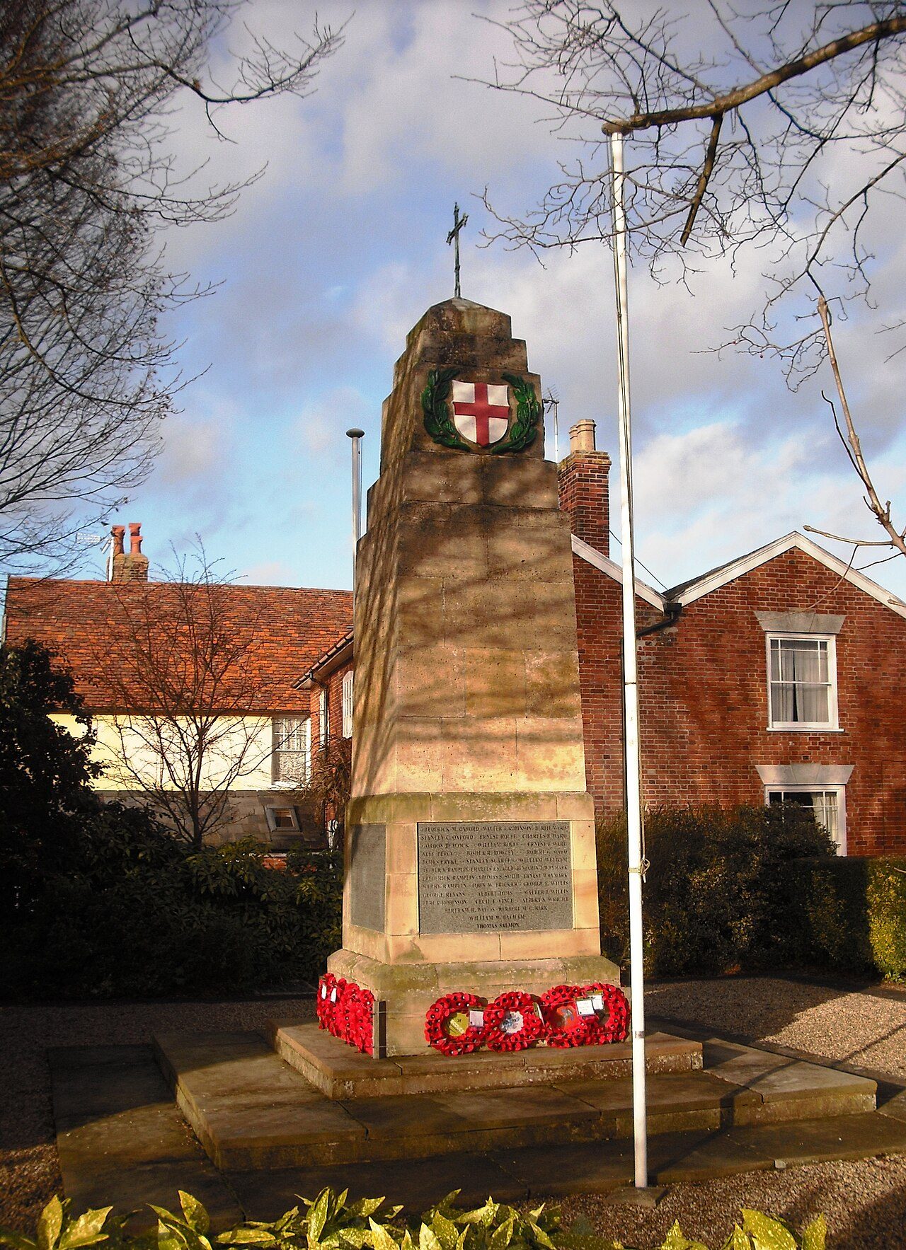 The War MemorialGrade II listed+19See all photos
Photos from Wikimedia Commons and Geograph, copied to our own server, each credited to its photographer with its licence; names open the building’s page or its official list entry.
Through time
Hadleigh in old photos
2 old photos and postcards, in date order. All public domain, made before 1950.
 c. 1890

Public domain, from Wikimedia Commons, copied to our own server. Each credit opens the image’s page with its full description and history.
The map
Where Hadleigh’s history is
Every Grade I and II* building, monument and historic park, over the age of each neighbourhood’s homes.
Grade IGrade II*400 m from St Mary
Homes built before 1919, by neighbourhoodunder 10%10–25%25–50%50%+
4 of 4Grade I buildings stand within 400 m of St Mary, a five-minute walk. So do 152 of the 230 listed buildings.
0 of 6neighbourhoods have mostly pre-1919 homes; in the oldest, 29% were built before 1919.
Hover a dot for its name; tap one with a photo to open it.
230 listed buildings by grade
4 Grade I24 Grade II*202 Grade II
Historic England lists buildings in three grades: Grade I for buildings of exceptional interest (about 2.5% of all listed buildings), Grade II* for particularly important buildings of more than special interest (about 5.8%), and Grade II for buildings of special interest (about 91.7%). Listing protects the whole building, inside and out.
Every entry on the National Heritage List for England whose point lies inside the ONS 2022 built-up-area boundary. One list entry can cover a terrace or a group of buildings. Neighbourhood dots: the population-weighted centre of each Census 2021 output area, coloured by its neighbourhood’s (LSOA’s) share of homes built before 1919 (Valuation Office Agency, March 2025).
Grade I
The 4 Grade I listed buildings in Hadleigh
Buildings of exceptional interest, about 2.5% of all listed buildings; 4 of these stand within 400 m of St Mary. Every one is photographed. Each opens its own page, with the official list entry.
 I
Public · listed 1950GuildhallPhoto: Joan Vaughan · CC BY-SA 2.0
 I
Public · listed 1950Deanery TowerPhoto: Keith Evans · CC BY-SA 2.0
 I
House · listed 195062-66, High StreetPhoto: Chelmsfordblue · CC BY 2.0
Grade II*
The 24 Grade II* listed buildings in Hadleigh
Particularly important buildings of more than special interest. 16 are photographed.
 II*
Inns & shops · listed 1950Bank House and the White Lion HotelPhoto: Robert Edwards · CC BY-SA 2.0
 II*
Public · listed 1972DeaneryPhoto: Dave.Dunford · CC BY-SA 3.0
 II*
Inns & shops · listed 1950Barclays BankOn the list as Former Barclays BankPhoto: Tilman2007 · CC BY-SA 4.0
 II*
Public · listed 1950Sun CourtPhoto: Tilman2007 · CC BY-SA 4.0
 II*
Inns & shops · listed 1950White Hart InnPhoto: Robert Edwards · CC BY-SA 2.0
 II*
House · listed 1950108 and 110, High StreetPhoto: Jo Turner · CC BY-SA 2.0
 II*
House · listed 195011 and 13, Bridge StreetPhoto: JThomas · CC BY-SA 2.0
 II*
House · listed 1950124 and 126, High StreetPhoto: Keith Evans · CC BY-SA 2.0
House · listed 195015, Bridge StreetPhoto: JThomas · CC BY-SA 2.0
 II*
House · listed 195021, Bridge StreetPhoto: David Kemp · CC BY-SA 2.0
 II*
House · listed 195022-26, George StreetPhoto: Sandy Gerrard · CC BY-SA 2.0
 II*
House · listed 195046 and 48, High StreetPhoto: Martinevans123 · CC BY-SA 3.0
Show the other 12
 II*
House · listed 195077-81, Benton StreetPhoto: David Kemp · CC BY-SA 2.0
 II*
House · listed 195079-83, High StreetPhoto: Tilman2007 · CC BY-SA 4.0
 II*
House · listed 195092 and 94 Benton StreetPhoto: David Kemp · CC BY-SA 2.0
 II*
House · listed 195097 and 99, High StreetPhoto: Jo Turner · CC BY-SA 2.0
House · listed 1950East House
Public · listed 1950Sun Court
House · listed 1950The Manse
House · listed 195028, George Street
House · listed 195045 and 47, High Street
House · listed 195048, George Street
House · listed 195049, High Street
House · listed 195095, 97 and 99 Angel Street
Historic streets
High Street has the most listed buildings
Streets by the listed entries with an address on them. One entry can be a whole terrace, so long rows count once.
High Street70 listed · 1 Grade I · 7 II*


Angel Street24 listed · 1 II*
Benton Street21 listed · 2 II*


George Street18 listed · 3 II*

Bridge Street9 listed · 3 II*


Church Street5 listed
Duke Street5 listed
Of the 230 entries, 157 are named by a street address; the rest are named buildings such as churches, halls and bridges.
What’s protected
Most of Hadleigh’s listed buildings are homes
Every listed building sorted by what its list name says it is.
Houses, terraces & villas186
Public & civic buildings17
Inns, shops & warehouses11
Walls, gates & bridges9
Churches, chapels & priories6
Memorials, crosses & tombs1
186 entries (81%) are houses, terraces and villas. 6 are churches, chapels and priories, including 1 of the 4 Grade I buildings.
Buildings are sorted by words in each entry’s name (church, gate, inn, memorial…): the list’s open data has no building type. An entry named only by its address counts as a house.
Grade II
202 Grade II listed buildings
Most listed buildings are in this grade, which covers buildings of special interest. Open any building to read its official list entry.
The first 150 of 202 Grade II listed buildings, A to Z
Ancient Walls North and East Toppersfield HallAshwoodBaptist ChapelBarn of Priory FarmCemetery LodgeChapel to AlmshousesCherry Tree CafeCock InnCongregational ChurchCorn ExchangeEight Bells InnFalcon InnFormer Hadleigh Railway StationFront Wall Adjoining and to West of the GuildhallFront Wall of Garden of Deanery LodgeFront Wall of Garden of Deanery to NorthFront Wall of Number 81Garden Wall North, East and South of Number 90 (The Manse)George InnGroves GarageHadleigh HallHolbeck's CottageK6 Telephone Kiosk Outside the Old Post OfficeKerseys BuildingKing's Arms InnKing's Head InnMalthouse Adjoining Number 23Malthouse Range to West of the Store and Kerseys BuildingMathouseMethodist ChapelMilestone Obelisk Adjacent to Number 55 and at the Junction with Church StreetMyholmeOld Bakehouse in Grounds of Guildhall to SouthwestOutbuilding Next to and to East of Number 2Outbuilding at Rear South of Number 90 (The Manse)Police StationPost OfficePremises Occupied by Tooks (Wing on Return Rear of Number 56 Facing George Street)Pump at South West Corner of Town HallRam InnRiver ViewShrub EndSidewaysSunday School and Meeting Hall (Formerly Congregational Day School)Taviton HouseThe CottageThe LawnsThe ManorThe Old HouseThe Pink HouseThe StoreThe War MemorialToppesfield Hall (Urban District Council Offices)Town HallTring HouseTudor HouseTye HouseWall on North Boundary of Grounds of the CastleWall on West Side of Churchyard South of Deanery TowerWalls Both Bordering the Road and Within the Site at Samsons MotorworksWilson's MalthouseWing to East of Ram Inn1, Bridge Street1, Duke Street1, George Street1-5, Benton Street1-9, Queen Street10 and 12, High Street100, High Street101 Angel Street101, High Street102, 102A and 102B, High Street102-108 Benton Street104, High Street105, High Street106, High Street109, George Street109-113 Benton Street11 and 13, George Street11, Benton Street11, Duke Street11, High Street110-118 Benton Street111 and 113, High Street111, George Street111-115 Angel Street114, High Street116, High Street117 and 119, High Street120 and 122, High Street121, High Street123-129, High Street124 and 126, Benton Street125 and 127 Benton Street128, High Street13-17, Benton Street130-134, Benton Street131, High Street133, High Street14, High Street145, Angel Street147, Angel Street149 and 151, Angel Street15, George Street15, High Street16 and 18, High Street17 and 19, High Street2, Bridge Street2, Church Street2, Duke Street2, High Street2, Station Road2-10, Queen Street20, Angel Street20, High Street21 and 23, High Street22-26, High Street23, Bridge Street23, George Street24, Angel Street25 and 27, High Street25-27 and 29, George Street28, 30 and 32, Benton Street28, High Street28-34, Bridge Street29, Benton Street3 and 5, Church Street3 and 5, George Street3 and 5, High Street30, High Street31 and 33, George Street31, High Street31-35, Benton Street32, High Street33, High Street34, 36 and 36A, Angel Street35 and 37, George Street35, High Street37 and 39, High Street37-41, Benton Street38 and 40, Bridge Street39-45, George Street4, Church Street4-8 Duke Street40 and 42, George Street43, Benton Street44, Bridge Street47 and 49, George Street5, Pound Lane50, High Street
Conservation areas
1 conservation area covers 21% of Hadleigh
Areas the council protects as a whole: demolition and changes to how buildings look need consent, and trees are protected.
Hadleigh 196954 ha
54 hain conservation areas, of 261 ha inside the built-up area.
225 of the 230 listed buildings stand in one.
Historic England’s conservation areas layer, supplied by councils (incomplete in places, so a page fact, never graded). Hectares are the part of each area inside the built-up area.
How the list grew
More than half of Hadleigh’s listed buildings were added in one year, 1972
The year each building now on the list was first listed.
1972 · 1431950 · 81
19501960197019801990200020102020
The first 81 entries were listed in 1950, 4 of the 4 Grade I buildings among them. 143 came in 1972, in the national resurvey of the 1970s and 80s. Only 0 have been added in the last 15 years.
History Grade
Hadleigh grades A for history
Protected heritage and the age of the town’s homes, against all UK towns.
Protected heritage, for its size and in all (262 points, 303 per 10,000 residents)More than 94% of UK towns
Homes built before 1919 (15%)More than 43% of UK towns
Two measures, each ranked against every UK town of 1,000 or more, with protected heritage counting twice as much as the age of homes. Protected heritage counts each listed building by its grade (Grade I three points, II* two, II one), each scheduled monument and battlefield two, and each registered park or garden by its grade; it is ranked both per 10,000 residents and as a total, so a village with one fine church doesn’t outrank a historic city. The second measure is the share of homes built before 1919, from the Valuation Office Agency’s council tax records. History is a character grade: it describes the town and isn’t part of the overall grade.
Born here
4 notable people born in Hadleigh before 1900
Their lives on one timeline, earliest first.
John Overall
Joseph Beaumont
Thomas Woolner
Charles Bayliss
155016001650170017501800185019001950

Thomas Woolner1825–1892 · English poet and sculptor (1825–1892)
JO
John Overall1560–1619 · Bishop of Norwich

Joseph Beaumont1616–1699 · British academic and poet

Charles Bayliss1850–1897 · Australian photographer (1850–1897)
Everyone born in Hadleigh → Birthplaces from Wikidata; portraits from Wikimedia Commons.
Towns its size
Hadleigh has the 27th most Grade I buildings of 721 towns its size
Places of 5,000–14,000 people outside London, by Grade I listed buildings.
Hadleigh4
#29 of 721for listed buildings per resident (266 per 10,000). Brecon, Dartmouth and Malmesbury lead.
26 have more. The typical town its size has 0.
Neighbours
Listed buildings in the places around Hadleigh
| Town | People | Listed | Grade I | History |
|---|---|---|---|---|
| Hadleigh | 8,638 | 230 | 4 | A |
| Elmsett | 1,001 | 12 | 0 | B+ |
| Bildeston | 1,096 | 71 | 0 | A+ |
| Capel St Mary | 2,992 | 12 | 0 | C |
| Great Bricett | 1,518 | 0 | 0 | D |
| East Bergholt | 2,211 | 72 | 1 | A |
| Bramford | 2,335 | 22 | 1 | B |
| Great Blakenham | 2,188 | 9 | 1 | C |
In brief
Hadleigh in brief
For its size, Hadleigh has more listed heritage than 94% of UK towns. In all there are 230 listed buildings, 4 of them Grade I. St Mary sits at the heart of it all, with 4 of the town’s Grade I buildings within 400 m. Only 26 of the 721 towns nearest its size have more Grade I buildings.
On High Street alone there are 70 listed buildings. A conservation area has protected part of it since 1969. Of the whole list, 81% are houses, terraces and villas. Beyond that, 15% of its homes were built before 1919, close to the 15% in the typical UK town.
Questions about Hadleigh’s history
How many listed buildings are there in Hadleigh?
Historic England lists 230 buildings inside Hadleigh’s built-up area: 4 Grade I, 24 Grade II* and 202 Grade II.
What are the Grade I listed buildings in Hadleigh?
4, including Church of St Mary, Deanery Tower, Guildhall and 62-66, High Street.
Which street in Hadleigh has the most listed buildings?
High Street (70), Angel Street (24) and Benton Street (21) have the most listed entries named by an address. One entry can be a whole terrace.
How many conservation areas are there in Hadleigh?
1, covering about 54 hectares of the town. The largest is Hadleigh.
When were Hadleigh’s buildings listed?
The first in 1950; the most, 143, in 1972.
Are there old photos of Hadleigh?
Yes: 2 public-domain photos and postcards from 1890 to 1890, all on this page.
Who was born in Hadleigh?
Among people born before 1900: Thomas Woolner (1825), John Overall (1560), Joseph Beaumont (1616) and Charles Bayliss (1850).
How old are the homes in Hadleigh?
15% of homes were built before 1919 and 19% before 1940, from the Valuation Office Agency’s council tax records (March 2025).
© Historic England 2026. Contains Ordnance Survey data © Crown copyright and database right 2026. The National Heritage List for England is the official, up-to-date register of all nationally protected historic buildings and sites in England; check an entry on Historic England’s website before relying on it.
Sources: Historic England, National Heritage List for England (listed buildings, scheduled monuments, registered parks and gardens, battlefields, World Heritage Sites), October 2026, inside the ONS 2022 built-up-area boundary · Valuation Office Agency, Council Tax: stock of properties by build period (31 March 2025) · TownRatings grades: our own summary of the data, ranked against UK towns only · Historic England conservation areas (supplied by local planning authorities; October 2026). All under the Open Government Licence v3.0.
Contains public sector information licensed under the Open Government Licence v3.0. Contains HM Land Registry data © Crown copyright and database right 2026. Contains OS data © Crown copyright and database right 2026 (ONS boundaries). Northern Ireland: Source: NISRA; contains Land & Property Services data and Ordnance Survey of Northern Ireland information, © Crown copyright, licensed under the Open Government Licence v3.0. Scotland: contains National Records of Scotland data, Registers of Scotland data and SEPA data, © Crown copyright / © SEPA 2025, licensed under the Open Government Licence v3.0.