 I
Church · listed 1952Church of the Holy Trinity, Berwick-on-TweedOn the list as Church of Holy TrinityPhoto: James@hopgrove · Public domain
 Church of Holy Trinity · Photo: James@hopgrove · Public domain
A+History Grade
History of Berwick-upon-Tweed · Historic England
291 listed buildings, 14 of them Grade I
Historic England counts them inside Berwick-upon-Tweed’s built-up area, 221 for every 10,000 residents. It also has 4 scheduled monuments. 24% of its homes were built before 1919. We have photos of 35 of its listed buildings and 5 old views of the town. Berwick-upon-Tweed grades A+ for history: #1 of 20 in Northumberland.
Listed buildings
291
221 per 10,000 residents
Grade I
14
exceptional interest
Grade II*
21
more than special interest
Scheduled monuments
4
nationally important sites
Homes built before 1919
24%
typical UK town 15%
In pictures
Berwick-upon-Tweed in 38 photos and old views
Nearly every Grade I and II* building, photographed, and the town before 1950. Tap a photo to step through them full screen.
 Town HallGrade I listed
 Shore GateGrade I listed
 The Old BreweryGrade II listed
 The Berwick ArmsGrade II listed
 The medieval and post-medieval fortifications at Berwick upon TweedScheduled monument+33See all photos
Photos from Wikimedia Commons and Geograph, copied to our own server, each credited to its photographer with its licence; names open the building’s page or its official list entry.
Through time
Berwick-upon-Tweed from 1743 to 1905
5 old photos and postcards, in date order. All public domain, made before 1950.
 c. 1743
 1833
 c. 1863
 1905
 1905
Public domain, from Wikimedia Commons, copied to our own server. Each credit opens the image’s page with its full description and history.
The map
Where Berwick-upon-Tweed’s history is
Every Grade I and II* building, monument and historic park, over the age of each neighbourhood’s homes.
Grade IGrade II*Scheduled monument400 m from Premises Occupied by the Card Shop, Premises Occupied by the Town House Coffee House and Premises Occupied by the Boutique All at the Town Hall
Homes built before 1919, by neighbourhoodunder 10%10–25%25–50%50%+
11 of 14Grade I buildings stand within 400 m of Premises Occupied by the Card Shop, Premises Occupied by the Town House Coffee House and Premises Occupied by the Boutique All at the Town Hall, a five-minute walk. So do 245 of the 291 listed buildings.
1 of 9neighbourhoods have mostly pre-1919 homes; in the oldest, 63% were built before 1919.
Hover a dot for its name; tap one with a photo to open it.
291 listed buildings by grade
14 Grade I21 Grade II*256 Grade II
Historic England lists buildings in three grades: Grade I for buildings of exceptional interest (about 2.5% of all listed buildings), Grade II* for particularly important buildings of more than special interest (about 5.8%), and Grade II for buildings of special interest (about 91.7%). Listing protects the whole building, inside and out.
Every entry on the National Heritage List for England whose point lies inside the ONS 2022 built-up-area boundary. One list entry can cover a terrace or a group of buildings. Neighbourhood dots: the population-weighted centre of each Census 2021 output area, coloured by its neighbourhood’s (LSOA’s) share of homes built before 1919 (Valuation Office Agency, March 2025).
Grade I
The 14 Grade I listed buildings in Berwick-upon-Tweed
Buildings of exceptional interest, about 2.5% of all listed buildings; 11 of these stand within 400 m of Premises Occupied by the Card Shop, Premises Occupied by the Town House Coffee House and Premises Occupied by the Boutique All at the Town Hall. 13 are photographed. Each opens its own page, with the official list entry.
 I
Public · listed 1952Town HallPhoto: Nilfanion · CC BY-SA 3.0
 I
Walls & gates · listed 1971Shore GatePhoto: Jonathan Oldenbuck · CC BY-SA 3.0
 I
Walls & gates · listed 1952Berwick CastleOn the list as Berwick Castle (Fragments, Including Towers and Walls and Steps)Photo: Euan Nelson · CC BY-SA 2.0
 I
Public · listed 1971Clock House Building, Berwick Barracks MuseumPhoto: JThomas · CC BY-SA 2.0
 I
Public · listed 1971East Barrack, Berwick Barracks MuseumPhoto: Chris Gunns · CC BY-SA 2.0
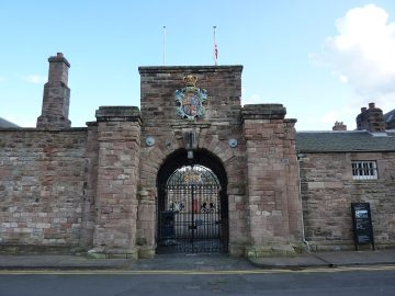 I
Public · listed 1971Gateway and Guard House, Berwick Barracks MuseumPhoto: Andrew Bowden from London, United Kingdon · CC BY-SA 2.0
 I
Public · listed 1971Premises Occupied by the Card Shop, Premises Occupied by the Town House Coffee House and Premises Occupied by the Boutique All at the Town HallPhoto: Nicholas Mutton · CC BY-SA 2.0
 I
House · listed 1971ScotsgatePhoto: Alan Murray-Rust · CC BY-SA 2.0
 I
Public · listed 1971The Custom HousePhoto: Nicholas Mutton · CC BY-SA 2.0
 I
House · listed 1971Town Fortifications Including the Bell TowerPhoto: Nilfanion · CC BY-SA 3.0
 I
Walls & gates · listed 1971Wall of Berwick Castle to North of the Ruins of Constable TowerPhoto: Simon Cobb · CC0
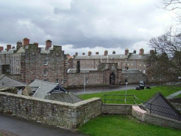 I
Walls & gates · listed 1971West Barrack and Attached Perimeter Wall, Berwick Barrack MuseumPhoto: Richard Webb · CC BY-SA 2.0
Public · listed 1952Berwick Castle Ruins of the Constable Tower (Part of Berwick Castle)
Grade II*
The 21 Grade II* listed buildings in Berwick-upon-Tweed
Particularly important buildings of more than special interest. 20 are photographed.
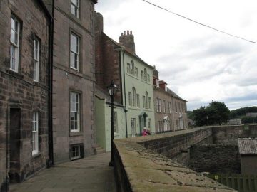 II*
House · listed 1952Edina HousePhoto: Ian Petticrew · CC BY-SA 2.0
 II*
Public · listed 1971Entrance Gateway to Military HospitalPhoto: Simon Cobb · CC0
 II*
House · listed 1952Garfield Guest HousePhoto: Simon Cobb · CC0
 II*
Public · listed 1952Grammar SchoolPhoto: Barbara Carr · CC BY-SA 2.0
 II*
Public · listed 1971Military HospitalPhoto: Simon Cobb · CC0
 II*
Inns & shops · listed 1952Red Lion Public HousePhoto: Alan Murray-Rust · CC BY-SA 2.0
 II*
House · listed 1952The Governor's HousePhoto: Barbara Carr · CC BY-SA 2.0
 II*
House · listed 1971The Lions HousePhoto: Nicholas Mutton · CC BY-SA 2.0
 II*
Walls & gates · listed 1971The Magazine, Including Enclosing Wall and Entrance to the MagazinePhoto: Richard Law · CC BY-SA 2.0
 II*
House · listed 1971The Old GuardhousePhoto: Ian Petticrew · CC BY-SA 2.0
 II*
House · listed 1952Wallace Green MansePhoto: Simon Cobb · CC0
 II*
House · listed 19521, Wellington TerracePhoto: Ian Petticrew · CC BY-SA 2.0
Show the other 9
 II*
House · listed 195219, Quay WallsPhoto: Jim Barton · CC BY-SA 2.0
House · listed 19522, Wellington TerracePhoto: Ian Petticrew · CC BY-SA 2.0
House · listed 195220, Quay WallsPhoto: Jim Barton · CC BY-SA 2.0
 II*
House · listed 195233 and 37, RavensdownePhoto: Simon Cobb · CC0
 II*
House · listed 19524, Main StreetPhoto: Victuallers · CC BY-SA 4.0
 II*
House · listed 19524, Quay WallsPhoto: Barbara Carr · CC BY-SA 2.0
House · listed 19525, Quay WallsPhoto: Barbara Carr · CC BY-SA 2.0
 II*
House · listed 195252 and 54, RavensdownePhoto: Simon Cobb · CC0
House · listed 19522 and 4, Ravensdowne
Historic streets
Ravensdowne has the most listed buildings
Streets by the listed entries with an address on them. One entry can be a whole terrace, so long rows count once.
Ravensdowne32 listed · 3 II*


Bridge Street25 listed
Marygate19 listed
Church Street17 listed
Quay Walls12 listed · 4 II*


Hide Hill11 listed
West Street11 listed
Main Street10 listed · 1 II*

Castlegate5 listed
Palace Green5 listed
Eastern Lane4 listed
Ness Street4 listed
Of the 291 entries, 186 are named by a street address; the rest are named buildings such as churches, halls and bridges.
What’s protected
Most of Berwick-upon-Tweed’s listed buildings are homes
Every listed building sorted by what its list name says it is.
Houses, terraces & villas228
Public & civic buildings19
Walls, gates & bridges17
Inns, shops & warehouses13
Churches, chapels & priories8
Memorials, crosses & tombs5
Street furniture1
228 entries (78%) are houses, terraces and villas. 8 are churches, chapels and priories, including 1 of the 14 Grade I buildings.
Buildings are sorted by words in each entry’s name (church, gate, inn, memorial…): the list’s open data has no building type. An entry named only by its address counts as a house.
Grade II
256 Grade II listed buildings
Most listed buildings are in this grade, which covers buildings of special interest. Open any building to read its official list entry.
The first 150 of 256 Grade II listed buildings, A to Z
A Group of Cottages in Long Narrow Yard Leading to Number 58J (11/60)Avenue HouseBank Hill Ladies public convenienceBarclays BankBerwick Baptist ChurchBerwick HouseBerwick Scout Hall and Attached Dwarf Wall and GatesBower VillaBoys' National SchoolCellars beneath 10-14 (even) Silver StreetChurch of ScotlandChurch of St Bartholomew and St BoisilClassical StatueCleadonClub HouseConduit HeadCustoms Watch HouseEagle HouseEast Ord FarmhouseEast Ord War MemorialFishing ShielFlagstaff HouseFormer Berwick Court House and Prison with attached wall and detached rear stable rangeFormer Church of St MaryFormer Corn ExchangeFormer Spa WellFormer toll house, 2, Castle TerraceGarden Wall and Spiral Volutes at Front of Number 5 (Grammar School)Garden Wall and Walled Garden North, North West and West of Ord HouseGarden Walls Attached to South of East Ord FarmhouseGate HouseGate Piers and Front Garden Walls to the Lions HouseGate Piers at Number 4Gatekeeper's LodgeGatepiers at the Church of Holy TrinityGlen AlvaGravestone of John Mackay Wilson, ChurchyardK6 Telephone Kiosk South of Kings Arms Hotel and Outside Trustee Savings BankKing's Head InnMain StreetManserghMasonic HallMounting BlockNess Gate HotelNo. 33, PALACE STREETNumber 1 and RailingsNumber 26 (Incorporating 28)Number 62 (Incorporating 64)Numbers 34 and 36 (Ravensholme Hotel)Numbers 44 and 46 (Harvest House) and 48Numbers 59 and 61 and Entry to Numbers 61A and 61BOrd HouseOur Lady and St Cuthbert's Roman Catholic Church, To Rear of Number 64Pair of Chapels, Lodge, Wall and Gate Piers at Tweedmouth CemeteryPair of SmokehousesPier MaltingsPolice Station and Magistrates CourtPost OfficeQuayside GranaryRailway StationRampart HouseSally PortSpittal School and Surrounding Walls and RailingsSt Cuthbert's Roman Catholic PresbyteryStocks, By the Town HallThe Berwick ArmsThe Free Trade InnThe GranaryThe Hen and Chickens HotelThe King's Arms HotelThe Leaping SalmonThe Old BreweryThe Old VicarageThe Queen's Head HotelTower HouseUnited Presbyterian ChurchVictoria HouseWar MemorialWar MemorialWar Memorial1 and 2 Brewery Bank1 and 2, Greenside Avenue1 and 3, Hide Hill1 and 3, Ravensdowne1 and 3, Walkergate1, 3, 3A, 3B and 3C, Wallace Green1, Bridge Terrace1-3, St Mary's Place1-5, Bridge Street1-7, Scott's Place1-9, Church Street1-9, Marygate10 and 12, Hide Hill10, Sandgate10-13, Quay Walls10-14, Ravensdowne101-109, Marygate11 and 13, Castlegate11, Ravensdowne11, Sandgate11, Wedell's Lane11-15, Church Street114, 116 and 116A, Marygate12 and 14, Bridge Street12, Tweed Street12-18, Marygate12-18, Parade124 and 126, Marygate13 and 15, Bridge Street13, Ravensdowne13, Sandgate13-19, West Street14, Ness Street14, Palace Green14, Palace Street14-20, Hide Hill15 and 17, Ravensdowne15, Hide Hill16 and 17, Quay Walls16 and 18, Bridge Street16 and 18, Eastern Lane16, Ravensdowne16-20, Ness Street17, Bridge Street17, Church Street178-180, Main Street18, Ravensdowne18-22, West Street19, Church Street2 and 4, Eastern Lane2 and 4, Hide Hill2 and 4, Parade2 and 4, West Street2, Love Lane2, Marygate2, Palace Green2, Quay Walls2-12, Bridge End2-12, Ness Street2-6, Bridge Street20 and 22, Parade20, Ravensdowne22 Main Street23 and 25, Church Street23, Castlegate24 and 26, West Street24, Bridge Street25 and 25A, Bridge Street25 and 27, Palace Street26 Ravensdowne
Conservation areas
3 conservation areas cover 21% of Berwick-upon-Tweed
Areas the council protects as a whole: demolition and changes to how buildings look need consent, and trees are protected.
Berwick-upon-Tweed 197060 ha
Tweedmouth 199125 ha
Spittal 199524 ha
108 hain conservation areas, of 523 ha inside the built-up area.
The first, Berwick-upon-Tweed, was designated in 1970; the newest, Spittal, in 1995. 284 of the 291 listed buildings stand in one.
Historic England’s conservation areas layer, supplied by councils (incomplete in places, so a page fact, never graded). Hectares are the part of each area inside the built-up area.
How the list grew
More than half of Berwick-upon-Tweed’s listed buildings were added in one year, 1971
The year each building now on the list was first listed.
1971 · 1601952 · 83
19501960197019801990200020102020
The first 83 entries were listed in 1952, 4 of the 14 Grade I buildings among them. 160 came in 1971, in the national resurvey of the 1970s and 80s. Only 7 have been added in the last 15 years.
Monuments & landscapes
Monuments, parks and gardens
Designations that overlap the town by a tenth of their area or half a hectare.
4 scheduled monuments
Nationally important archaeological sites and monuments, protected by law; work on them needs consent from the Secretary of State, advised by Historic England.
History Grade
Berwick-upon-Tweed grades A+ for history
Protected heritage and the age of the town’s homes, against all UK towns.
Protected heritage, for its size and in all (348 points, 264 per 10,000 residents)More than 94% of UK towns
Homes built before 1919 (24%)More than 72% of UK towns
Two measures, each ranked against every UK town of 1,000 or more, with protected heritage counting twice as much as the age of homes. Protected heritage counts each listed building by its grade (Grade I three points, II* two, II one), each scheduled monument and battlefield two, and each registered park or garden by its grade; it is ranked both per 10,000 residents and as a total, so a village with one fine church doesn’t outrank a historic city. The second measure is the share of homes built before 1919, from the Valuation Office Agency’s council tax records. History is a character grade: it describes the town and isn’t part of the overall grade.
Homes by age
24% of Berwick-upon-Tweed’s homes were built before 1919
Every home by when it was built, from council tax records, against England & Wales (the dark tick).
23%
Before 1900
1.6%
1900–18
2.4%
1919–29
12%
1930s
13%
1945–54
6.2%
1955–64
11%
1965–72
12%
1973–82
5.8%
1983–92
3.7%
1993–99
3.2%
2000–08
3.7%
2009–15
2.8%
2016–25
Berwick-upon-TweedEngland & Wales
23% of homes are Victorian or older, against 16% across England and Wales. The busiest period since was 1945–54, which added 13% of today’s homes.
Valuation Office Agency, council tax stock of properties by build period, 31 March 2025, for the neighbourhoods (LSOAs) that make up the town, split by where their residents live. Homes with no recorded build period (0 here) are left out; 1939–44 is not a period in the data.
Born here
17 notable people born in Berwick-upon-Tweed before 1900
Their lives on one timeline, earliest first.
Patrick Tonyn
Richard Duncan
Ralph Hush
William Mark
Tweedy John Todd
William Hutcheon Hall
William Turnbull Leach
Robert Clow Todd
James Cockburn
William John Hurst
James Redpath
W. H. Paxton
William Adam
Maggie Moffat
Alex Crombie
Joe Blythe
Hugh Miller
170017501800185019001950

James Cockburn1819–1883 · Canadian Conservative politician, and a father of Canadian Confederat…

Maggie Moffat1873–1943 · British actress and suffragette (1873–1943)
WA
William Adam1846–1931 · English painter (1846-1931)
HM
Hugh Miller1889–1976 · British actor (1889–1976)
AC
Alex Crombie1876– · Footballer (1876-?)
JB
Joe Blythe1881–1944 · English footballer (1881-?)
WM
William Mark1782–1849 · British consul in Spain

William Hutcheon Hall1797–1878 · British Royal Navy admiral (1797-1878)
Everyone born in Berwick-upon-Tweed → Birthplaces from Wikidata; portraits from Wikimedia Commons.
Towns its size
Berwick-upon-Tweed has the 4th most Grade I buildings of 582 towns its size
Places of 8,000–21,000 people outside London, by Grade I listed buildings.
Berwick-upon-Tweed14
#29 of 582for listed buildings per resident (221 per 10,000). Brecon, Ludlow and Richmond lead.
Only Armagh, Ely and Wells have more. The typical town its size has 0.
Neighbours
Listed buildings in the places around Berwick-upon-Tweed
| Town | People | Listed | Grade I | History |
|---|---|---|---|---|
| Berwick-upon-Tweed | 13,181 | 291 | 14 | A+ |
| Eyemouth | 3,698 | 54 | 2 | — |
In brief
Berwick-upon-Tweed in brief
For its size, Berwick-upon-Tweed has more listed heritage than 94% of UK towns. All told, the list holds 291 listed buildings, 14 of them Grade I, including Church of the Holy Trinity, Berwick-on-Tweed. Of its homes, 24% were built before 1919, against 15% in the typical UK town. Premises Occupied by the Card Shop, Premises Occupied by the Town House Coffee House and Premises Occupied by the Boutique All at the Town Hall sits at the heart of it all, with 11 of the town’s Grade I buildings within 400 m.
Only 3 of the 582 towns nearest its size have more Grade I buildings. Its older streets lie in 3 conservation areas, the first designated in 1970. Of the whole list, 78% are houses, terraces and villas. Otherwise the figures are ordinary: it also has 4 scheduled monuments.
Questions about Berwick-upon-Tweed’s history
How many listed buildings are there in Berwick-upon-Tweed?
Historic England lists 291 buildings inside Berwick-upon-Tweed’s built-up area: 14 Grade I, 21 Grade II* and 256 Grade II.
What are the Grade I listed buildings in Berwick-upon-Tweed?
14, including Berwick Castle (Fragments, Including Towers and Walls and Steps), Berwick Castle Ruins of the Constable Tower (Part of Berwick Castle), Church of Holy Trinity, Clock House Building, Berwick Barracks Museum, East Barrack, Berwick Barracks Museum and Gateway and Guard House, Berwick Barracks Museum.
Which street in Berwick-upon-Tweed has the most listed buildings?
Ravensdowne (32), Bridge Street (25) and Marygate (19) have the most listed entries named by an address. One entry can be a whole terrace.
Are there scheduled monuments in Berwick-upon-Tweed?
Yes, 4 scheduled monuments, including Enclosure castle, two 16th century gun turrets and an early 17th century house, Medieval church and graveyard 330m north west of Berwick Castle, Spades Mire linear earthwork and section of rig and furrow and The medieval and post-medieval fortifications at Berwick upon Tweed.
How many conservation areas are there in Berwick-upon-Tweed?
3, covering about 108 hectares of the town. The largest are Berwick-upon-Tweed and Tweedmouth.
When were Berwick-upon-Tweed’s buildings listed?
The first in 1952; the most, 160, in 1971.
Are there old photos of Berwick-upon-Tweed?
Yes: 5 public-domain photos and postcards from 1743 to 1905, all on this page.
Who was born in Berwick-upon-Tweed?
Among people born before 1900: James Cockburn (1819), Maggie Moffat (1873), William Adam (1846), Hugh Miller (1889) and Alex Crombie (1876).
How old are the homes in Berwick-upon-Tweed?
24% of homes were built before 1919 and 39% before 1940, from the Valuation Office Agency’s council tax records (March 2025).
© Historic England 2026. Contains Ordnance Survey data © Crown copyright and database right 2026. The National Heritage List for England is the official, up-to-date register of all nationally protected historic buildings and sites in England; check an entry on Historic England’s website before relying on it.
Sources: Historic England, National Heritage List for England (listed buildings, scheduled monuments, registered parks and gardens, battlefields, World Heritage Sites), October 2026, inside the ONS 2022 built-up-area boundary · Valuation Office Agency, Council Tax: stock of properties by build period (31 March 2025) · TownRatings grades: our own summary of the data, ranked against UK towns only · Historic England conservation areas (supplied by local planning authorities; October 2026). All under the Open Government Licence v3.0.
Contains public sector information licensed under the Open Government Licence v3.0. Contains HM Land Registry data © Crown copyright and database right 2026. Contains OS data © Crown copyright and database right 2026 (ONS boundaries). Northern Ireland: Source: NISRA; contains Land & Property Services data and Ordnance Survey of Northern Ireland information, © Crown copyright, licensed under the Open Government Licence v3.0. Scotland: contains National Records of Scotland data, Registers of Scotland data and SEPA data, © Crown copyright / © SEPA 2025, licensed under the Open Government Licence v3.0.