 A
House · listed 19718 Colquhoun Street Upper, The Hill House with Outbuildings, Boundary Walls and GatesPhoto: Unknown photographer · CC BY-SA 2.5
 Douglas Drive, Red Towers with Boundary Wall, Gatepiers, Gates and Wellhead · Photo: AlasdairW · CC BY-SA 4.0
–Not graded
History of Helensburgh · Historic Environment Scotland
204 listed buildings, 13 of them in the top category
Historic Environment Scotland counts them inside Helensburgh’s locality, 144 for every 10,000 residents. Of the listed buildings in Helensburgh, 113 are Category B. We have photos of 57 of its listed buildings and 5 old views of the town.
Listed buildings
204
144 per 10,000 residents
Category A
13
national importance
Category B
113
regional importance
Scheduled monuments
0
nationally important sites
In pictures
Helensburgh in 62 photos and old views
Tap a photo to step through them full screen.
 8 Colquhoun Street Upper, The Hill House with Outbuildings, Boundary Walls and GatesCategory A listed
 William Street, St Michael and All Angels' Episcopal Church and Church HallCategory A listed
 James Street, Former la Scala CinemaCategory C listed
 Princes Street West, Congregational ChurchCategory B listed
 Colquhoun Square, Bank of ScotlandCategory B listed+57See all photos
Photos from Wikimedia Commons and Geograph, copied to our own server, each credited to its photographer with its licence; names open the building’s page or its official list entry.
Through time
Helensburgh from 1890 to 1903
5 old photos and postcards, in date order. All public domain, made before 1950.
 c. 1890
 c. 1890
 1903
 1903
 1903
Public domain, from Wikimedia Commons, copied to our own server. Each credit opens the image’s page with its full description and history.
The map
Where Helensburgh’s history is
Every Category A and B building, monument and historic park.
Category ACategory B400 m from Dhuhill Drive West, Greycourt
6 of 13Category A buildings stand within 400 m of Dhuhill Drive West, Greycourt, a five-minute walk. So do 19 of the 204 listed buildings.
Hover a dot for its name; tap one with a photo to open it.
204 listed buildings by grade
13 Category A113 Category B78 Category C
Historic Environment Scotland lists buildings in three categories: Category A for buildings of national or international importance (about 7.5% of listed buildings), Category B for buildings of regional importance (about 50%), and Category C for buildings of local importance (about 43%). Listing protects the whole building, inside and out.
Every entry on Historic Environment Scotland’s designations whose point lies inside the NRS 2022 locality boundary. One list entry can cover a terrace or a group of buildings.
Category A
The 13 Category A listed buildings in Helensburgh
Buildings of national or international importance, about 7.5% of all listed buildings; 6 of these stand within 400 m of Dhuhill Drive West, Greycourt. 10 are photographed. Each opens its own page, with the official list entry.
 A
Walls & gates · listed 1971Douglas Drive, Red Towers with Boundary Wall, Gatepiers, Gates and WellheadPhoto: AlasdairW · CC BY-SA 4.0
 A
Public · listed 1971William Street, St Michael and All Angels' Episcopal Church and Church HallPhoto: AlasdairW · CC BY-SA 4.0
 A
House · listed 1971Rhu Road Lower, Cairndhu HousePhoto: AlasdairW · CC BY-SA 4.0
 A
House · listed 1993Rhu Road Lower, Dalmore HousePhoto: AlasdairW · CC BY-SA 4.0
 A
Walls & gates · listed 1993Sinclair Street, Hermitage Park, War Memorial and Walled Garden with Ornamental GatesPhoto: Lairich Rig · CC BY-SA 2.0
 A
House · listed 199315 Colquhoun Street Upper, The White House with Garage and Boundary WallPhoto: Stewart Noble · CC BY-SA 4.0
 A
House · listed 199117 Upper Colquhoun Street, Drumadoon (Formerly Morar House) with Gatepiers and Boundary Wall and Garden PavilionPhoto: AlasdairW · CC BY-SA 4.0
 A
House · listed 199238-40 Sinclair Street, Former Helensburgh and Gareloch Conservative ClubPhoto: AlasdairW · CC BY-SA 4.0
 A
House · listed 19714 Munro Drive West, Brantwoode with Boundary Wall, Gatepiers, Garage and Garden GatePhoto: Brantwoode1966 · CC BY-SA 4.0
House · listed 1993Dhuhill Drive West, Greycourt
House · listed 1980Rossdhu Drive West, Longcroft
House · listed 1971150 Clyde Street East, Rockland and Sundial
Category B
The 113 Category B listed buildings in Helensburgh
Buildings of regional importance. 46 are photographed.
 B
Church · listed 1993Princes Street West, Congregational ChurchPhoto: AlasdairW · CC BY-SA 4.0
 B
Inns & shops · listed 1993Colquhoun Square, Bank of ScotlandPhoto: AlasdairW · CC BY-SA 3.0
 B
Public · listed 1971Ardencaple CastlePhoto: Cmacauley · CC BY 3.0
 B
Walls & gates · listed 1980Charlotte Street, Park Church (Church of Scotland) and Church Hall with Boundary Wall and GatepiersPhoto: Lairich Rig · CC BY-SA 2.0
 B
Walls & gates · listed 1971Clyde Street East, Rockland Lodge with Gatepiers, Gates and Boundary WallPhoto: Richard Sutcliffe · CC BY-SA 2.0
 B
Walls & gates · listed 1971Clyde Street School with East Lodge, West Lodge (No 38 Clyde Street East) and Boundary Wall, Gates and RailingsPhoto: AlasdairW · CC BY-SA 4.0
 B
Memorials · listed 1971Clyde Street West, The Esplanade, Monument to Henry BellPhoto: AlasdairW · CC BY-SA 3.0
 B
Walls & gates · listed 1979Colgrain, Camis Eskan West Lodge with Boundary Wall and GatepiersPhoto: Lairich Rig · CC BY-SA 2.0
 B
Memorials · listed 1971Colquhoun Square, Celtic CrossPhoto: AlasdairW · CC BY-SA 4.0
 B
Church · listed 1971Colquhoun Square, The West Kirk (Church of Scotland)Photo: Michal Klajban · CC BY-SA 4.0
 B
House · listed 1993Dhuhill House and Conservatory, Dhuhill Drive WestPhoto: AlasdairW · CC BY-SA 4.0
 B
Street furniture · listed 1993John Street Provost Lamp Standards at No 68Photo: AlasdairW · CC BY-SA 4.0
Show the other 101
 B
House · listed 1993Kennedy Drive, CuilvonaPhoto: AlasdairW · CC BY-SA 4.0
 B
Church · listed 1993King Street East, Baptist ChurchPhoto: AlasdairW · CC BY-SA 4.0
 B
Walls & gates · listed 1993Lomond Street, St Joseph's Rc Church with Gatepiers and GatesPhoto: J M Briscoe · CC BY-SA 2.0
 B
Walls & gates · listed 1993Old Luss Road, Helensburgh Cemetery Including Boundary Walls, Lodge, Gatepiers and GatesPhoto: Richard Sutcliffe · CC BY-SA 2.0
 B
Walls & gates · listed 2002Princes Street East, Helensburgh Central Station Including Platforms, Canopies, Screen Walls and GatesPhoto: Richard Sutcliffe · CC BY-SA 2.0
 B
Walls & gates · listed 1980Rhu Road Higher, Dalmore, West Lodge with Boundary Wall and GatepiersPhoto: AlasdairW · CC BY-SA 4.0
 B
Walls & gates · listed 1974Rhu Road Lower, Cairndhu Lodge with Boundary Wall and GatepiersPhoto: AlasdairW · CC BY-SA 4.0
 B
Walls & gates · listed 1993Rhu Road Lower, Dalmore Lodge with Boundary Walls and_GatepiersPhoto: AlasdairW · CC BY-SA 4.0
 B
Church · listed 1980Sinclair Street, Church of St Columba (Church of Scotland)Photo: AlasdairW · CC BY-SA 4.0
 B
Walls & gates · listed 1993Sinclair Street, Dhuhill Lodge with Boundary Wall and GatepiersPhoto: Richard Sutcliffe · CC BY-SA 2.0
 B
House · listed 1980Sinclair Street, Old Millig Toll HousePhoto: Lairich Rig · CC BY-SA 2.0
 B
House · listed 1993Sinclair Street, Victoria HallsPhoto: Tom Parnell · CC BY-SA 4.0
 B
House · listed 19931 Princes Street East and 48, 50, 52, 52A Sinclair Street, Municipal BuildingsPhoto: AlasdairW · CC BY-SA 4.0
 B
House · listed 199310 and 12 James Street, Clydesdale BankPhoto: AlasdairW · CC BY-SA 4.0
 B
House · listed 199311 Glasgow Street and 115 Princes Street West, WellcroftPhoto: AlasdairW · CC BY-SA 4.0
 B
House · listed 1993119 Clyde Street West with Boundary Wall and GatepiersPhoto: AlasdairW · CC BY-SA 4.0
 B
House · listed 1993121 Argyle Street West, The LodgePhoto: AlasdairW · CC BY-SA 4.0
 B
House · listed 1993121 Clyde Street EastPhoto: AlasdairW · CC BY-SA 4.0
 B
House · listed 199314-28 (Even Nos) Princes Street WestPhoto: AlasdairW · CC BY-SA 4.0
 B
House · listed 199318 Colquhoun Street, Post OfficePhoto: Tom Sargent · CC BY-SA 2.0
 B
House · listed 199319-25 (Inc Nos) Colquhoun Square and 46-60 (Even Nos)_Prince's Street WestPhoto: Stevie Spiers · CC BY-SA 2.0
 B
House · listed 19932 Adelaide Street with Gatepiers and RailingsPhoto: AlasdairW · CC BY-SA 4.0
 B
House · listed 199324 Clyde Street WestPhoto: AlasdairW · CC BY-SA 4.0
 B
House · listed 199325 and 27 William StreetPhoto: AlasdairW · CC BY-SA 4.0
 B
House · listed 199331 Montrose Street EastPhoto: AlasdairW · CC BY-SA 4.0
 B
House · listed 199336 Clyde Street WestPhoto: AlasdairW · CC BY-SA 4.0
 B
House · listed 199342-45 (Inclusive Nos) Clyde Street WestPhoto: AlasdairW · CC BY-SA 4.0
 B
House · listed 19935, 5A (Bermuda) and 7 William StreetPhoto: AlasdairW · CC BY-SA 4.0
 B
House · listed 199350 Campbell Street, WestburnPhoto: AlasdairW · CC BY-SA 4.0
 B
House · listed 19936 Colquhoun Street Upper, Lynton with Boundary Wall, Gatepiers and GatesPhoto: AlasdairW · CC BY-SA 4.0
 B
House · listed 199372, 74, 76 King Street WestPhoto: AlasdairW · CC BY-SA 4.0
 B
House · listed 199376, 78 Princes Street West and 18, 20 James StreetPhoto: AlasdairW · CC BY-SA 4.0
 B
House · listed 19938, 10, 12 Princes Street WestPhoto: AlasdairW · CC BY-SA 4.0
 B
House · listed 199389 James Street and 13 Queen Street, Lomond SchoolPhoto: AlasdairW · CC BY-SA 4.0
House · listed 1971Clyde Street East, Cromalt Coach House and Stables
Walls & gates · listed 1993Dhuhill Drive West, Brincliffe with Boundary Wall and Gatepiers
House · listed 1991Dhuhill Drive West, Letham Hill
Walls & gates · listed 1980Douglas Drive, Tordarroch with Boundary Wall, Gatepiers and Gates
Public · listed 1993John Street, Provost Lamp Standards at No 51, Helensburgh Library
House · listed 1976Red Gauntlet Road, Drumfork House
House · listed 1993Victoria Road, The Lindens
House · listed 19931 Montrose Street West, Dalfruin with Boundary Wall and Gatepiers
House · listed 19931 Rowallan Street
House · listed 19931 Sutherland Crescent Upper, Rhuarden with Conservatory and Gatepiers
House · listed 1993101 Sinclair Street, Millfield with Gatepiers
House · listed 1993107 Sinclair Street, Thornton Lodge
House · listed 1993108 King Street West, Carisbrooke with Gatepiers, Gates and Conservatory
House · listed 1993109 Sinclair Street, Cawdor Lodge and 111 Sinclair Street, Tower House
House · listed 1993113 Sinclair Street, Moorlands with Conservatory and Gatepiers
House · listed 1993118 Sinclair Street, Rokneys with Boundary Wall, Gatepiers and Conservatory
House · listed 1993127 Sinclair Street, Dhuhill and Gatepiers
House · listed 1993134 Sinclair Street, Albion Lodge
House · listed 1993135 Sinclair Street, Ardluss with Boundary Wall, Gatepiers and Gates
House · listed 1993146 Sinclair Street, Drum-Millig
House · listed 1971148 Clyde Street East, Cromalt House with Boundary Walls and Gatepiers
House · listed 1993150 Princes Street West, Rosebank and 17, 19 Campbell Street
House · listed 1993150, 152 Princes Street East, Giffnock House with Lodge and Boundary Wall
House · listed 1993152 Clyde Street East, Tigh-Na-Mara
House · listed 1993154 Clyde Street East, Rockfort and Folly
House · listed 199317 Abercromby Street East
House · listed 199118 Millig Street, Wester Millig, Boundary Walls, Gatepiers and Gates
House · listed 1993186 and 188 Princes Street West, Leewood with Boundary Wall and Gatepiers
House · listed 199319 Abercromby Street East
House · listed 19802 Colquhoun Street Upper, Whincroft with Boundary Wall and Gatepiers
House · listed 19712 Sutherland Street Upper, Terpersie (Formerly Thurloe)
House · listed 199320 Queen Street, Ardvuela and Gatepiers
House · listed 199322 Glenfinlas Street Upper, Clunie Hill with Boundary Wall and Gatepiers
House · listed 199322 Millig Street
House · listed 199323 Henry Bell Street, Redcote
House · listed 199325 Glasgow Street
House · listed 199325 Suffolk Street, Auchenteil with Boundary Walls and Gatepiers
House · listed 199326 Suffolk Street
House · listed 19933 Easterhill Road
House · listed 19933, 5 Rowallan Street, West and East Gables
House · listed 199332 Argyle Street West with Gatepiers and Gates
House · listed 199333 Charlotte Street, The Crossways with Gatepiers
House · listed 199337, 39 William Street and 71 King Street West
House · listed 199338 and 40 Campbell Street, Burnside
House · listed 19934 Albert Street, Moorgate with Boundary Walls
House · listed 19934 Colquhoun Street Upper, Braeriach with Boundary Wall, Gatepiers and Gates
House · listed 19934 Easterhill Road, Dunluce
House · listed 199341 Charlotte Street
House · listed 199341 Colquhoun Street, Galloway Cottage
House · listed 199343 Charlotte Street
House · listed 199345 Charlotte Street
House · listed 199346 Charlotte Street, Arden and 16 Abercromby Street East, Upper Arden
House · listed 199346 and 48 George Street, Towerville with Boundary Wall, Gatepiers and Lodge
House · listed 199347 Charlotte Street , Greenpark
House · listed 199349 Colquhoun Street, Pynhannot House
House · listed 19936 Munro Drive East, Easterhill
House · listed 19936 Munro Drive West, Strathmoyne with Boundary Wall, Gatepiers and Gates
House · listed 199362-66 (Even Nos) Princes Street West
House · listed 199070 John Street, Corner Argyle Street
House · listed 199376 John Street, Glen Kin with Boundary Wall and Gatepiers
House · listed 199380 John Street with Boundary Wall and Gatepiers
House · listed 198793 King Street East, Victoria Infirmary
Historic streets
Gatepiers and Gates has the most listed buildings
Streets by the listed entries with an address on them. One entry can be a whole terrace, so long rows count once.
Gatepiers and Gates6 listed · 6 II*

Charlotte Street5 listed · 4 II*
Clyde Street East5 listed · 1 II*

Clyde Street West4 listed · 2 II*


Glasgow Street3 listed · 1 II*
Of the 204 entries, 140 are named by a street address; the rest are named buildings such as churches, halls and bridges.
What’s protected
Most of Helensburgh’s listed buildings are homes
Every listed building sorted by what its list name says it is.
Houses, terraces & villas172
Walls, gates & bridges17
Public & civic buildings5
Churches, chapels & priories5
Memorials, crosses & tombs2
Inns, shops & warehouses2
Street furniture1
172 entries (84%) are houses, terraces and villas. 5 are churches, chapels and priories.
Buildings are sorted by words in each entry’s name (church, gate, inn, memorial…): the list’s open data has no building type. An entry named only by its address counts as a house.
Category C
78 Category C listed buildings
This category covers buildings of local importance. Open any building to read its official list entry.
All 78 Category C listed buildings, A to Z
Bust of John Logie Baird, West Esplanade, West Clyde Street, HelensburghClyde Street East, Queen's Court (Formerly Queen's Hotel) and Provost's LampsClyde Street East, Rockfort Lodge, Boundary Walls and GatepiersClyde Street East, Tarandoun Cottage with Boundary Wall, Gatepiers and GatesFlywheel and Anvil, East Bay Esplanade, East Clyde Street, HelensburghHelensburgh Pier, excluding public toilet building, West Clyde Street, Helensburgh.Imperial Hotel, 12 Clyde Street WestJames Street, Former la Scala CinemaKing Street West, West King Street Hall (St Columba's Hall)William Street, St Michael and All Angels' Episcopal Church Rectory1-14 (Inclusive Nos) Glenan Gardens, Argyle Street West10 Argyle Street West and 52, 54 Colquhoun Street, Rosemount with Gatepiers, Gates, Boundary Wall and_Coach-House10 Queen Street, Westward103 Sinclair Street, Rowanmore with Boundary Wall and Piers104 Clyde Street East105, 106 Clyde Street West106 Sinclair Street108 and 110 Clyde Street East, Rimsdale and Traigh-Na-Mara with Stables, Boundary Walls and Gate116 Sinclair Street, Former West Highland Railway, Helensburgh Upper, Station Master's House122 Clyde Street West and 2 Sutherland Street127 Clyde Street East132 Sinclair Street, Ballytrim and Gatepiers149-151 (Odd Nos) Clyde Street East and 1-3 (Odd Nos) Glenfinlas Street15 King's Crescent (Formerly Towerville Lodge)153 Clyde Street East and 2 Glenfinlas Street16 Clyde Street East and 7-9 (Odd Nos) Maitland Street165 Clyde Street East Corner Adelaide Street17 William Street17 and 19 (Odd Nos) John Street17, 18 and 19 Clyde Street West18 Abercromby Street West, Summer House19 Havelock Street19 Suffolk Street and 1 Sutherland Crescent Lower19, 19A, 19B Montrose Street East and 26 Havelock Street217 Clyde Street East, Willowbank and Boundary Walls22, 24, 26, 28 King Street East, Alma Place, 13 Charlotte Street, 38 Grant Street22-34 (Even Nos) Sinclair Street22A Suffolk Street23 Glasgow Street23 Suffolk Street, The Grange with Boundary Wall and Gatepiers and 39 Millig Street, The Ingle24 Queen Street with Boundary Wall, Gatepiers and Coach House25 Queen Street with Boundary Wall25-27 (Odd Nos) King Street West, Strathclyde Regional Council Registry Office27 John Street29 Glasgow Street29 Montrose Street East and 4 Adelaide Street Upper29 and 31 Campbell Street3 Craigendoran Avenue30-34 (Even Nos) Princes Street West32 Queen Street, Deanston with Gatepiers32-44 (Even Nos) John Street33-41 (Odd Nos) Sinclair Street36 Argyle Street West, Westways38 Argyle Street West, Garthland4 Clyde Street East, Tourist Information Centre (Bell Tower of Former Parish Church4 Glasgow Street, Craigbank4 Sutherland Street4-9 (Inclusive Nos) Craigendoran Avenue44 Charlotte Street46-56 (Even Nos) John Street5 Argyle Street West51-55 (Odd Nos) King Street West and 53 James Street56 William Street, Upper Ericstane with Screen and Boundary Wall and 7 a Montrose Street West, Lower Ericstane57 Princes East and 17-21 (Odd Nos) Lomond Street6 Queen Street, Haywood and Sundial6 Sutherland Crescent Lower6 Sutherland Street60 Clyde Street East61-65 (Odd Nos) Princes Street West and 22-28 (Even Nos) John Street62 Colquhoun Street, Kildare Lodge with Boundary Wall and Gatepiers7 Sutherland Crescent Lower73-79 (Odd Nos) Princes Street West74, 76, 78 King Street East77 James Street, Methilfield82 and 84 Clyde Street East9 Argyle Street East93 Sinclair Street95,96 Clyde Street West, Flower Bank
Conservation areas
3 conservation areas cover 32% of Helensburgh
Areas the council protects as a whole: demolition and changes to how buildings look need consent, and trees are protected.
Upper Helensburgh 1970161 ha
Hill House, Helensburgh 19709 ha
Helensburgh Town Centre 19705 ha
175 hain conservation areas, of 544 ha inside the locality.
The first, Upper Helensburgh, Hill House, Helensburgh and Helensburgh Town Centre, were designated in 1970; the newest, Helensburgh Town Centre, in 1970. 118 of the 204 listed buildings stand in one.
Historic Environment Scotland’s conservation areas layer, supplied by councils (incomplete in places, so a page fact, never graded). Hectares are the part of each area inside the locality.
How the list grew
More than half of Helensburgh’s listed buildings were added in one year, 1993
The year each building now on the list was first listed.
1993 · 1681971 · 18
19501960197019801990200020102020
The first 18 entries were listed in 1971, 6 of the 13 Category A buildings among them. 168 came in 1993. Only 1 has been added in the last 15 years.
Born here
13 notable people born in Helensburgh before 1900
Their lives on one timeline, earliest first.
George Campbell, 8th Duke of Argyll
Katherine Arthur Behenna
Herbert Guthrie-Smith
Horatio Scott Carslaw
Allan Douglass Mainds
Norah Neilson Gray
Richard Finlay
Jack Strong
Tina Gray
John Logie Baird
Jack Buchanan
John Inglis Gilmour
Viola Paterson
1800182518501875190019251950
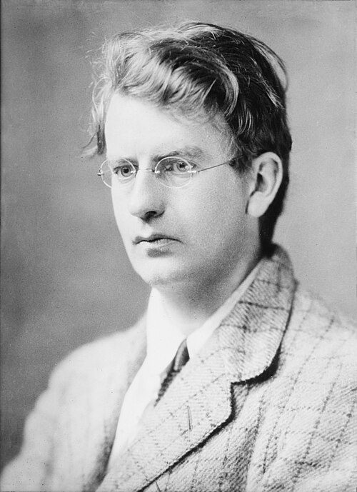
John Logie Baird1888–1946 · Scottish inventor, demonstrating the world's first working television…

George Campbell, 8th Duke of Argyll1823–1900 · Scottish peer, Liberal politician and writer on science, religion, an…

Norah Neilson Gray1882–1931 · British artist of the Glasgow School (1882-1931)

Jack Buchanan1891–1957 · British actor, singer, director and producer (1891-1957)

Herbert Guthrie-Smith1862–1940 · New Zealand farmer, author and conservationist (1861/2–1940)
KB
Katherine Arthur Behenna1860–1924 · Scottish-born US painter (1860-1924)

Horatio Scott Carslaw1870–1954 · British mathematician (1870–1954)

Jack Strong1884–1971 · Australian rules footballer (1884-1971)
Everyone born in Helensburgh → Birthplaces from Wikidata; portraits from Wikimedia Commons.
Towns its size
Helensburgh has the 4th most Category A buildings of 139 towns its size
Scottish towns of 6,000–35,000 people, by Category A listed buildings.
Helensburgh13
#16 of 139for listed buildings per resident (144 per 10,000). Kelso, Kirkwall and Haddington lead.
Only Lanark, Dumfries and St Andrews have more. Helensburgh is level with Elgin. The typical town its size has 1.
Neighbours
Listed buildings in the places around Helensburgh
| Town | People | Listed | Category A | History |
|---|---|---|---|---|
| Helensburgh | 14,128 | 204 | 13 | — |
| Greenock | 42,870 | 112 | 15 | — |
| Gourock | 10,072 | 63 | 0 | — |
| Alexandria | 6,260 | 24 | 2 | — |
| Port Glasgow | 14,260 | 19 | 3 | — |
| Balloch and Haldane | 6,000 | 13 | 2 | — |
| Bonhill | 8,608 | 7 | 2 | — |
| Dumbarton | 21,027 | 49 | 6 | — |
In brief
Helensburgh in brief
The official list counts 204 listed buildings in Helensburgh, 13 of them in the top category, including 8 Colquhoun Street Upper, The Hill House with Outbuildings, Boundary Walls and Gates. Dhuhill Drive West, Greycourt sits at the heart of it all, with 6 of the town’s Category A buildings within 400 m. Only 3 of the 139 towns nearest its size have more Category A buildings. Its older streets lie in 3 conservation areas, the first designated in 1970.
Of the whole list, 84% are houses, terraces and villas. John Logie Baird (1888), George Campbell, 8th Duke of Argyll (1823) and Norah Neilson Gray (1882) are among the 13 people born here before 1900. More than half went on the list in a single year, 1993: 168 of 204.
Questions about Helensburgh’s history
How many listed buildings are there in Helensburgh?
Historic Environment Scotland lists 204 buildings inside Helensburgh’s locality: 13 Category A, 113 Category B and 78 Category C.
What are the Category A listed buildings in Helensburgh?
13, including Dhuhill Drive West, Greycourt, Douglas Drive, Red Towers with Boundary Wall, Gatepiers, Gates and Wellhead, Rhu Road Lower, Cairndhu House, Rhu Road Lower, Dalmore House, Rossdhu Drive West, Longcroft and Sinclair Street, Hermitage Park, War Memorial and Walled Garden with Ornamental Gates.
Which street in Helensburgh has the most listed buildings?
Gatepiers and Gates (6), Charlotte Street (5) and Clyde Street East (5) have the most listed entries named by an address. One entry can be a whole terrace.
How many conservation areas are there in Helensburgh?
3, covering about 175 hectares of the town. The largest are Upper Helensburgh and Hill House, Helensburgh.
When were Helensburgh’s buildings listed?
The first in 1971; the most, 168, in 1993.
Are there old photos of Helensburgh?
Yes: 5 public-domain photos and postcards from 1890 to 1903, all on this page.
Who was born in Helensburgh?
Among people born before 1900: John Logie Baird (1888), George Campbell, 8th Duke of Argyll (1823), Norah Neilson Gray (1882), Jack Buchanan (1891) and Herbert Guthrie-Smith (1862).
Helensburgh has no History Grade.
Listed buildings, scheduled monuments, gardens and designed landscapes, battlefields, conservation areas and World Heritage Sites: Historic Environment Scotland, Open Government Licence v3.0. Check an entry on Historic Environment Scotland’s portal before relying on it.
Sources: Historic Environment Scotland designations (listed buildings, scheduled monuments, gardens and designed landscapes, battlefields, World Heritage Sites), October 2026, inside the NRS 2022 locality boundary · Historic Environment Scotland conservation areas (compiled from councils; October 2026). All under the Open Government Licence v3.0.
Contains public sector information licensed under the Open Government Licence v3.0. Contains HM Land Registry data © Crown copyright and database right 2026. Contains OS data © Crown copyright and database right 2026 (ONS boundaries). Northern Ireland: Source: NISRA; contains Land & Property Services data and Ordnance Survey of Northern Ireland information, © Crown copyright, licensed under the Open Government Licence v3.0. Scotland: contains National Records of Scotland data, Registers of Scotland data and SEPA data, © Crown copyright / © SEPA 2025, licensed under the Open Government Licence v3.0.