107 years in pictures
Census counts: 1,113 in 1950, 8,114 in 2020. The archive holds 4 old photos and papers going back to 2014 and 4 maps from 1930 on.
- 1919Los Fresnos is settled

Each edition grades its towns against each other only.
Los Fresnos grades D overall, 545th of 640 graded towns in Texas, mostly because of safety and health. Its police reported 62 violent crimes reported to the FBI in 2025, a higher rate per resident than 88% of U.S. towns. Residents are less healthy than 84% of U.S. towns on CDC estimates. In its favor, its schools outperform 69% of the state's. 35% of residents live below the poverty line in Los Fresnos, above both Texas’ towns (12%) and U.S. towns (9.6%). Los Fresnos's civic life (library use, community groups, volunteering) trails 99% of U.S. towns. Only 54 of Texas’ 1,000 towns score lower on history.
5,542 counted in 2010 and 8,114 in 2020; an estimated 8,703 in 2025.
Growth hasn’t slowed: 6.8% since 2020, after 46.4% in the decade before.
U.S. Census 2010 & 2020 counts · Census Bureau estimate, July 1, 2025
Each subject compared with towns across the country (schools within Texas), ordered by how far Los Fresnos is from typical.
How TownRatings grades towns →
Census counts: 1,113 in 1950, 8,114 in 2020. The archive holds 4 old photos and papers going back to 2014 and 4 maps from 1930 on.
Who provides power, water and the rest in Los Fresnos, and how to reach them.
EPA SDWIS (Oct 9, 2026) · HIFLD + EIA-861 2025 · Census 2020 ZCTAs · NCES 2024–25 · registration: vote.gov, updated Nov 18, 2024.
Ordered by what stands out in Los Fresnos.
Los Fresnos has more 90° days than nearly all U.S. towns and trades workers with Brownsville and other neighbors, but it reports violent crime at about twice the Texas rate.
Violent crime runs at 7.2 per 1,000 residents, about twice the Texas rate; the Safety Grade counts each violent crime four times, so this weighs most on its D.
Los Fresnos’ violent crime rate is 7.2 per 1,000 residents. Los Fresnos reports more crime per resident than most U.S. towns we grade: about 88% report less. Los Fresnos’ property crime rate is 14.4 per 1,000 residents.
| Los Fresnos | Texas towns | U.S. towns | |
|---|---|---|---|
| Violent crimes per 1,000 (2025) | 7.2 per 1,000 residents | 1.9 | 1.6 |
| Property crimes per 1,000 (2025) | 14.4 per 1,000 residents | 10.7 | 9.9 |
FBI crime data, 2025 · crimes reported to police
Its public schools are run by Los Fresnos CISD. Two of its 4 schools are below, each with why it’s listed. The largest public high school is Los Fresnos H S, with 3,285 students.
| School | Level | Students | Letter |
|---|---|---|---|
| Los Cuates MiddleLargest public middle schoolGrades 6–8 | Grades 6–8 | 825 | B− |
| Los Fresnos H SLargest public high schoolGrades 9–12 | Grades 9–12 | 3,285 | B+ |
NCES · EDFacts · graded within TX on state tests and graduation
36% of adults 18 to 64 have no health insurance in Los Fresnos. Los Fresnos beats the Texas average on 2 of 31 CDC measures and trails it on 15. 37% of adults get no exercise outside work in Los Fresnos.
| Los Fresnos | Texas towns | U.S. towns | |
|---|---|---|---|
| No health insurance, 18–64 (CDC PLACES) | 36% | 18% | 8.1% |
| Fair or poor health (CDC PLACES) | 31% | 24% | 19% |
| Diabetes (CDC PLACES) | 18% | 13% | 12% |
| Get no exercise (CDC PLACES) | 37% | 30% | 25% |
| What stands out | Los Fresnos | TX |
|---|---|---|
| Fewer adults who have had cancer | 4.2% | 6.1% |
| Fewer adults with arthritis | 18.7% | 21.6% |
| More uninsured adults | 35.6% | 19.1% |
CDC PLACES 2025 · modeled estimates for adults · CMS · HRSA
1.4 miles of trail in 3 parks and preserves. The biggest park or preserve is Los Fresnos Nature Park, at 24 acres.
| Los Fresnos | Texas towns | U.S. towns | |
|---|---|---|---|
| Conserved land | 0.6% | 1.9% | 4.3% |
| Miles of trail per square mile | 0.3 miles per square mile | 0.3 | 0.4 |
| Biggest places to walk | Trails | Acres |
|---|---|---|
| 1. Memorial Park | 0.6 mi | 11 |
| 2. Los Fresnos Nature Park | 0.4 mi | 24 |
| 3. City Park | 0.4 mi | 5 |
Trails & parks © OpenStreetMap contributors · Conserved land: USGS PAD-US
34.7% of residents live below the poverty line, against 13.8% across Texas, which weighs on its C for jobs and income.
Children under 18 are 36% of residents (25% statewide); people 65 and older are 9% of residents (13% statewide). The median age in Los Fresnos is 27.6 years. Los Fresnos has grown 6.8% since 2020, to 8,703 residents in the Census Bureau’s 2025 estimate.
| Los Fresnos | Texas towns | U.S. towns | |
|---|---|---|---|
| Under 18 | 36% | 26% | 22% |
| Median age | 27.6 years | 35.9 years | 40.5 years |
| Aged 65 or older | 8.5% | 14% | 18% |
| Bachelor’s degree or more, 25+ | 24% | 23% | 29% |
50% women, 50% men
That’s an even split within the survey’s margin of ±4 points. Across Texas, 50.1% of residents are women.
| Los Fresnos | TX | U.S. | |
|---|---|---|---|
| Under 10 | 15.7% | 13.3% | 11.6% |
| 10 to 17 | 19.8% | 11.7% | 10.3% |
| 18 to 24 | 11.1% | 9.7% | 9.1% |
| 25 to 34 | 10.5% | 14.5% | 13.7% |
| 35 to 44 | 13.9% | 14.1% | 13.2% |
| 45 to 54 | 14.7% | 12.3% | 12.2% |
| 55 to 64 | 5.8% | 11.1% | 12.7% |
| 65 to 74 | 4.5% | 8.2% | 10.2% |
| 75 and older | 4% | 5.2% | 7% |
| No diploma | 26.5% | 14% | 10.4% |
| High school | 22.7% | 24.3% | 26% |
| Some college | 15.8% | 20.1% | 19.1% |
| Associate’s | 11% | 7.7% | 8.8% |
| Bachelor’s | 17.6% | 21.5% | 21.6% |
| Graduate | 6.4% | 12.3% | 14.1% |
Census population estimates, 2025 · U.S. Census Bureau · ACS 2020-2024 5-year estimates
Values rose 2.4% in the past year while the Texas typical home fell 1.5%. Home values rose 28% in five years, to about $221K, against 10% across Texas.
The typical Los Fresnos home is worth about $221,000, 26% below the Texas typical home. 62% of Los Fresnos households own their home.
| Los Fresnos | Texas towns | U.S. towns | |
|---|---|---|---|
| Households that own their home | 62% | 69% | 73% |
| Median rent | $989 a month | $1,208 a month | $1,185 a month |
Census ACS, 2020–24 · Zillow Home Value Index · Redfin Data Center
Expected storm and flood damage is higher than in 71% of U.S. communities. Since 1996, 5 flood insurance claims have been paid out in Los Fresnos.
FEMA flood insurance claims · FEMA National Risk Index · OpenFEMA
The Brownsville weather station, 12 miles away, records that about 141 days a year reach 90°, more than in 99% of U.S. towns. January nights average 51.4°, milder than in 99% of U.S. towns; July afternoons average 94.2°.
Only 6 of the 642 Texas towns we compare have a higher January low than Los Fresnos. Los Fresnos has warm winters and hot summers. Snow is almost unheard of.
| Los Fresnos | Texas towns | U.S. towns | |
|---|---|---|---|
| January low | 51°F | 37°F | 22°F |
| July high | 94°F | 95°F | 85°F |
NOAA U.S. Climate Normals, 1991–2020
Los Fresnos has about as many jobs (3,621) as working residents, but only 417 people both live and work here. Jobs based here grew from 2,206 in 2013 to 3,621.
Most working residents leave Los Fresnos for work: only 14% work in town. Since 2013, Los Fresnos has added 1,415 jobs, to 3,621 in 2023. The top destinations are Brownsville (28%), Harlingen (12%) and South Padre Island (4%).
| Los Fresnos | Texas towns | U.S. towns | |
|---|---|---|---|
| Working residents who work in town | 14% | 8.3% | 8% |
| Average trip to work | 23 minutes | 25 minutes | 25 minutes |
| Median household income | $62,000 | $69,000 | $80,000 |
Census LEHD 2023 · ACS
Museums, parks, gardens and other places to visit around Los Fresnos. Close and well known come first.
Big draw20 mi Park & preserveStarbase
13 mi LandmarkFort Brown
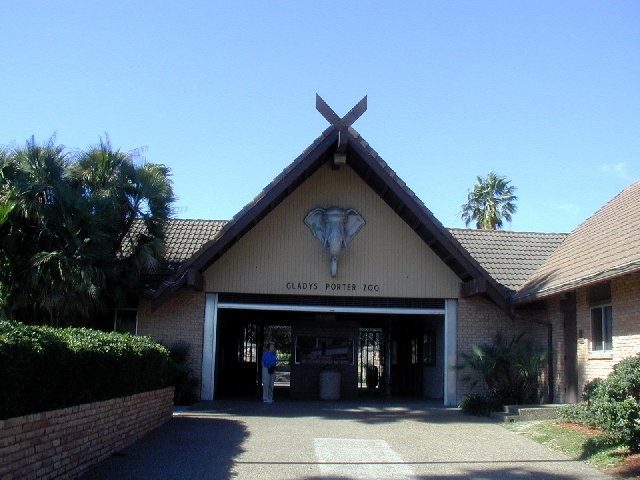
11 mi Zoo & aquariumGladys Porter Zoo
2 mi National Historical ParkPalo Alto Battlefield National Historical Park169K visitors a year
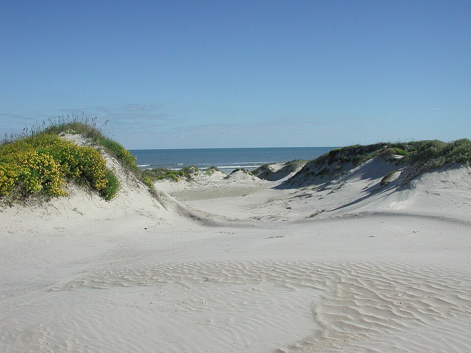
35 mi National SeashorePadre Island National Seashore573K visitors a yearStarbase: Jared Krahn, CC BY-SA 4.0 · Fort Brown: Pi3.124, CC BY-SA 3.0 · Gladys Porter Zoo: Jc161991, CC BY-SA 3.0 · Palo Alto Battlefield National Historical Park: Schmorleitz, CC BY-SA 3.0 · Padre Island National Seashore: Unknown authorUnknown author, Public domain
1 within 15 miles of the center of Los Fresnos
About 3 of every 100 Los Fresnos residents are enrolled in college, against 6 across Texas.
City in Texas, United States
Los Fresnos is a city in Cameron County, Texas, United States. The population was 8,114 at the 2020 census, up from 5,542 at the 2010 census. It is part of the Brownsville–Harlingen–Raymondville and the Matamoros–Brownsville metropolitan areas. Located in south-central Cameron County, the city was named for the fresnos (Fraxinus berlandieriana) scattered in the woods and along streams. In 1912, Lon Hill, an early landowner, formed a company to develop a canal system that would use the Rio Grande to irrigate land for farming. Railroad construction in the early 1900s began to bring settlers to the area, and by 1915, a post office was established. Because of the fertile, irrigated land, farm p…
From Wikipedia, licensed CC BY-SA 4.0 · facts via Wikidata (CC0)
One town shares a border with Los Fresnos.
| Town | TX rank | Overall | Cost | Safety | Schools | Health |
|---|---|---|---|---|---|---|
| Los Fresnos | #545 | D | C− | D | B+ | C− |
| Brownsville | #559 | D | C | C− | B | C− |
Short answers, built from the data on this page.
Los Fresnos grades D overall, better than 7% of U.S. towns and #545 of 640 in Texas. It grades C− for health, D for safety and B+ for schools. Safety is its weak spot, with a D.
Yes. That is 4.2 years of the area's median household income ($52,601 across the Brownsville-Harlingen, TX metro area). Cost of living, which also weighs rents, property taxes and how many households pay 30% or more of their income for housing, grades C−.