More historic than 29% of U.S. towns · #139 of 177 in Tennessee. What drives it
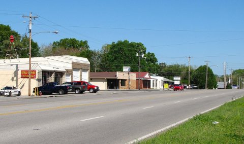
Most of Estill Springs was built recently: 1% of its homes predate 1940 and the median home dates from 1984. Below: 1 old photo or paper, maps from 1936 on, and the census since 1950.
Founding year: Wikidata. First post office: 1833.The full story ↓
History grade
What drives Estill Springs’ History grade
On its age, its old homes and the National Register, Estill Springs is more historic than 29% of U.S. towns, #139 of 177 in Tennessee. Its age holds the grade up; its share of homes from before 1940 pulls it down.
C
HistoryA character grade: shown, never part of Estill Springs’ overall grade.
Tennessee towns list more on the Register than most of the country (a typical Tennessee town has 6.1 per 10,000 residents, the U.S. 2.4), so Estill Springs’ 0.0 sits below most of its state (16% of Tennessee towns have fewer) while its 0 listings outnumber those of 23% of U.S. towns.
How sure. Graded on any two of the three inputs instead, the letter would range from D to C+. The pre-1940 share (±1.0 points) is firm at this size. Two sources give 1840.
Founding year: Wikidata (other dates in Quick answers). Homes: Census ACS 2020–24. National Register: National Park Service, May 2026 list; each listing counted once (boundary changes and added documentation belong to their listing), and a historic district counts its contributing buildings. How TownRatings grades history →
What stands out about Estill Springs’ past
Read from the archive, the National Register and the record. The page puts what stands out first.
Mineral springs in the area had long been known to the Cherokee people of the region. Before they settled here, varying cultures of indigenous peoples had lived in the area for thousands of years.
The European-American town dates from circa 1840, when the Frank Estill family, which owned considerable property in the area, donated a right-of-way for railroad construction. The combination of mineral waters, which were much in vogue as a health remedy at the time, and convenient rail access caused the settlement to develop as a small-scale spa town, which took its name from the springs. Oscar Meyer was appointed the first mayor of Estill.
Nothing in the archives for these yearsWeddings on Main Street, storms, parades, school pictures, the old store. If it’s in your family album, it belongs here.
Every edition of the U.S. Geological Survey’s map of Estill Springs. Tap a year, or press play to watch the town change.
1936Camp Peay sheet · 1:24,000
U.S. Geological Survey historical topographic maps (public domain), via Esri’s collection of the scans. The red ring marks the center of Estill Springs.
Then & now
Stand where they stood
No then-and-now pairs yet. Take a photo from the same spot as an old one and they appear here side by side.
Retake this viewEstill Springs Dam, 1939
Find the spot, match the angle, and add your photo. It becomes the first then-and-now pair on Estill Springs’ page.
In 1840, according to Wikidata. Estill Springs’ post office opened in 1833, and the census of 1950 counted 496 people here.
How does Estill Springs rank for history?
Estill Springs is more historic than 29% of U.S. towns, #139 of 177 in Tennessee. The History grade combines the town’s founding era, the share of homes built before 1940 and its National Register listings. It’s a character grade, so it isn’t part of the overall grade. How it works.
How old are the homes in Estill Springs?
1% of Estill Springs’ homes were built before 1940 (Census estimate, ±1.0 points), against a typical 4.9% for a Tennessee town; the median home was built in 1984.
Founding dates: Wikidata, Wikipedia, the U.S. post office records of Blevins & Helbock (CC0) and the Census. Homes by year built: Census ACS 2020–24. National Register of Historic Places: National Park Service (list of May 22, 2026). Old photos, postcards and papers: Wikimedia Commons, the Library of Congress and other public archives, credited on each item’s page. Maps: U.S. Geological Survey historical topographic maps (via Esri) and Sanborn fire-insurance maps (Library of Congress). History text and census tables: Wikipedia (CC BY-SA 4.0). Places that used to be: USGS Geographic Names Information System (2021).
From Wikimedia Commons (5), Wikipedia, Wikidata and Wikipedia for famous people, U.S. Geological Survey historical maps, U.S. Census counts (via Wikipedia), the US Post Offices dataset (Blevins & Helbock) and the USGS Geographic Names Information System. Archive images are copied here with their credits and licenses, shown on each photo’s page. Refreshed monthly.


 2016
 2016
 2016
 2016


