126 years in pictures
Census counts: 13,264 in 2000, 15,550 in 2020. The archive holds 6 old photos and papers going back to 2008 and 4 maps from 1920 on.
- 1900Ladson is settled
Each edition grades its towns against each other only.
A town of 16,140, settled in 1900. Public schools that outperform most of South Carolina.
FEMA rates its natural-hazard risk higher than 96% of U.S. communities, with hurricanes at the top. Overall it grades B−, ranked 63rd of 167 in South Carolina. It also does better than most on schools: its public schools beat 73% of South Carolina towns on state tests and graduation. A typical home there costs about $314K, 3.7 years of the Charleston metro’s $85K median household income. Ladson’s going rate for rent is $1,785 a month, where South Carolina’s towns sit at $1,058 a month and U.S. towns at $1,185 a month. Only 26 of South Carolina’s 263 towns score lower on history. The biggest park or preserve is Exchange Park, at 38 acres.
Where Ladson beats most towns, and one thing worth knowing.
13,790 counted in 2010 and 15,550 in 2020.
U.S. Census 2010 & 2020 counts
Each subject compared with towns across the country (schools within South Carolina), ordered by how far Ladson is from typical.
How TownRatings grades towns →
Census counts: 13,264 in 2000, 15,550 in 2020. The archive holds 6 old photos and papers going back to 2008 and 4 maps from 1920 on.
Museums, parks, gardens and other places to visit around Ladson. Close and well known come first.
Big draw14 mi MuseumH. L. Hunley
Big draw19 mi MuseumUSS Yorktown
19 mi MuseumUSS Laffey
20 mi Park & preserveAngel Oak
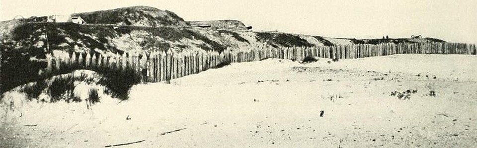
24 mi LandmarkFort Wagner
20 mi DamThe BatteryH. L. Hunley: Sepia wash drawing by R.G. Skerrett, 1902, after a painting then held by the Con, Public domain · USS Yorktown: David Ratledge, CC BY 4.0 · USS Laffey: U.S. Navy, Public domain · Angel Oak: Galen Parks Smith, CC BY-SA 3.0 · Fort Wagner: Unknown authorUnknown author, Public domain · The Battery: Eagledj, CC BY-SA 4.0
Ladson is unincorporated, so Berkeley County and regional agencies provide most services.
EPA SDWIS (Oct 9, 2026) · HIFLD + EIA-861 2025 · Census 2020 ZCTAs · NCES 2024–25 · registration: vote.gov, updated Sep 12, 2025.

Ordered by what stands out in Ladson.
Ladson has added half again as many jobs in ten years, but it carries more natural-hazard risk than most of South Carolina (mostly hurricanes) and has little public open land.
FEMA rates its natural-hazard risk higher than 90% of South Carolina towns, with expected losses of about $1,097 per resident a year; that rating is what its D− for hazard risk is built on.
36 flood insurance claims have been paid in Ladson since 1989. Expected losses in Ladson break down as 49% from hurricanes and 31% from earthquakes. Federal aid has come to Ladson households in 6 declared disasters; the latest was in 2024.
FEMA flood insurance claims · FEMA disaster declarations and aid · FEMA National Risk Index · OpenFEMA
Its public schools are run by the Berkeley 01 school district. One of its 3 schools is below, with the reason it’s listed.
| School | Level | Students | Letter |
|---|---|---|---|
| College Park ElementaryLargest public elementary schoolGrades PK–5 | Grades PK–5 | 750 | C− |
NCES · EDFacts · graded within SC on state tests and graduation
Jobs based here grew from 1,946 in 2013 to 3,033.
For most workers, Ladson is a place to come home to: only 2% work in town. Its typical journey to work stands at 31 minutes. Jobs in Ladson grew by 1,087 from 2013 to 2023, reaching 3,033. Among residents in the town, 12% live below the poverty line.
| Ladson | South Carolina towns | U.S. towns | |
|---|---|---|---|
| Average trip to work | 31 minutes | 24 minutes | 25 minutes |
| Working residents who work in town | 2.4% | 6.3% | 8% |
| Below the poverty line | 12% | 17% | 9.6% |
| Median household income | $79,000 | $57,000 | $80,000 |
Census LEHD 2023 · ACS
July afternoons reach 92°, January nights drop to 37° and snow is almost unheard of.
NOAA U.S. Climate Normals, 1991–2020
In Ladson, 17% of adults binge drink. Of 32 CDC measures, Ladson beats the South Carolina average on 6 and trails it on 5. Among adults in the town, 39% sleep under 7 hours and 13% have diabetes.
| Ladson | South Carolina towns | U.S. towns | |
|---|---|---|---|
| Binge drink (CDC PLACES) | 17% | 15% | 16% |
| No health insurance, 18–64 (CDC PLACES) | 14% | 13% | 8.1% |
| Sleep under 7 hours (CDC PLACES) | 39% | 38% | 36% |
| Diabetes (CDC PLACES) | 13% | 15% | 12% |
| What stands out | Ladson | SC |
|---|---|---|
| Fewer adults who have had cancer | 6.6% | 8.6% |
| Fewer adults with heart disease | 5.4% | 6.8% |
| More adults facing housing insecurity | 15.6% | 13.3% |
CDC PLACES 2025 · modeled estimates for adults · CMS · HRSA
Just 14 of its 4,415 acres are conserved, so there is little public open land in Ladson itself; its outdoors grade is C−.
Across 3 parks and preserves: 1.0 miles of trail. In Ladson, the trail density is 0.1 miles per square mile.
| Ladson | South Carolina towns | U.S. towns | |
|---|---|---|---|
| Conserved land | 0.3% | 1.8% | 4.3% |
| Miles of trail per square mile | 0.1 miles per square mile | 0.3 | 0.4 |
| Biggest places to walk | Trails | Acres |
|---|---|---|
| 1. Exchange Park | 0.3 mi | 38 |
| 2. Tom Conley Park | — | 12 |
| 3. Future Park | — | 1 |
Trails & parks © OpenStreetMap contributors · Conserved land: USGS PAD-US
For households in Ladson, the share who own their home is 77%. Homes here are typically worth about $314,000, down 1.4% in a year, close to the South Carolina typical home. On the market in the town: a median 68 days to sell.
Census ACS, 2020–24 · Zillow Home Value Index · Redfin Data Center
2 within 15 miles of the center of Ladson
About 5 of every 100 Ladson residents are enrolled in college, about the same as South Carolina.
Where Ladson’s working residents go each day. Line width shows the share.
Census LEHD 2023
3 notable people were born in Ladson.
Census-designated place in South Carolina, United States
Ladson is a census-designated place (CDP) in Berkeley, Charleston and Dorchester counties in the U.S. state of South Carolina. The population was 13,790 at the 2010 census. It is named in honor of the Ladson family, one of the oldest planter and merchant families in the Charleston area; one of its members was lieutenant governor James Ladson.
From Wikipedia, licensed CC BY-SA 4.0 · facts via Wikidata (CC0)
3 towns share a border with Ladson.
| Town | SC rank | Overall | Cost | Safety | Schools | Health |
|---|---|---|---|---|---|---|
| Ladson | #63 | B− | B− | — | B+ | C+ |
| North Charleston | #106 | C | C+ | D− | A | B− |
| Goose Creek | #53 | B− | C+ | C+ | B− | B+ |
| Sangaree | #70 | C+ | B+ | — | B− | C− |
Ladson and Sangaree report no FBI crime data of their own. Compare Ladson with a neighbor →
Short answers, built from the data on this page.
Ladson grades B− overall, better than 47% of U.S. towns and #63 of 167 in South Carolina. It grades C+ for health and B+ for schools. Hazard risk is its weak spot, with a D−.
Cost of living, which also weighs rents, property taxes and how many households pay 30% or more of their income for housing, grades B−.
3 notable people were born here, including Robert Quinn and Harold Green.