Guest, Sign inJoin

Post to Charleston

We’ll email a one-tap link to publish your post. No password, and nothing is public until you click it.
Already a member? Sign in
AHistory
History · Charleston

Charleston has 110 places on the National Register, 34 of them National Historic Landmarks

More historic than 89% of U.S. towns · #9 of 169 in South Carolina. What drives it

Dated to 1670 (Wikidata and Wikipedia’s history), with 10% of its homes built before 1940 and 16 historic districts holding 505 contributing buildings. Below: maps from 1884 on, the census since 1790, and every listing on the Register.

1670founded
110on the National Register
10%homes built before 1940
17famous people
Quick answers

How Charleston began

When was Charleston founded?

1670

Charleston dates its founding to 1670 (Wikidata and Wikipedia’s history agree). It appears in the first U.S. census, 1790.

First census: 16,359 in 17902020 census: 150,227356 years

How historic is Charleston?

A

More historic than 89% of U.S. towns, on its age, its old homes and the National Register.

What drives the grade ↓
Founding year: Wikidata; Wikipedia’s history section gives the same year. First post office: 1789.The full story ↓
History grade

What drives Charleston’s History grade

On its age, its old homes and the National Register, Charleston is more historic than 89% of U.S. towns, #9 of 169 in South Carolina. Its age holds the grade up; its share of homes from before 1940 pulls it down.

A
HistoryA character grade: shown, never part of Charleston’s overall grade.
All U.S. towns we grade (21,289)Ahead of 89%
NewerOlder
South Carolina towns of 2,500+ (169)Ahead of 95%

Among the 400 U.S. cities of 100,000 or more, Charleston ranks #72 on History.

South Carolina towns list more on the Register than most of the country (a typical South Carolina town has 3.2 per 10,000 residents, the U.S. 2.4), so Charleston’s 32.7 sits above most of its state (74% of South Carolina towns have fewer) while its 505 historic buildings outnumber those of 97% of U.S. towns.

How sure. Graded on any two of the three inputs instead, the letter would range from B+ to A+. The pre-1940 share (±0.8 points) is firm at this size. Two sources give 1670.

Founding year: Wikidata (other dates in Quick answers). Homes: Census ACS 2020–24. National Register: National Park Service, May 2026 list; each listing counted once (boundary changes and added documentation belong to their listing), and a historic district counts its contributing buildings. How TownRatings grades history →

What stands out about Charleston’s past

Read from the archive, the National Register and the record. The page puts what stands out first.

★ What stands out · On the National Register

110 listings protect 505 historic buildings

The country’s official list of buildings and places worth saving. 34 are National Historic Landmarks, the highest tier. Boundary changes and added documentation are counted with their listing.

places listed
110
National Historic Landmarks
34
Charleston Historic District
historic buildings protected
505
each building in a district counts
first listed
1966
Charleston Historic District
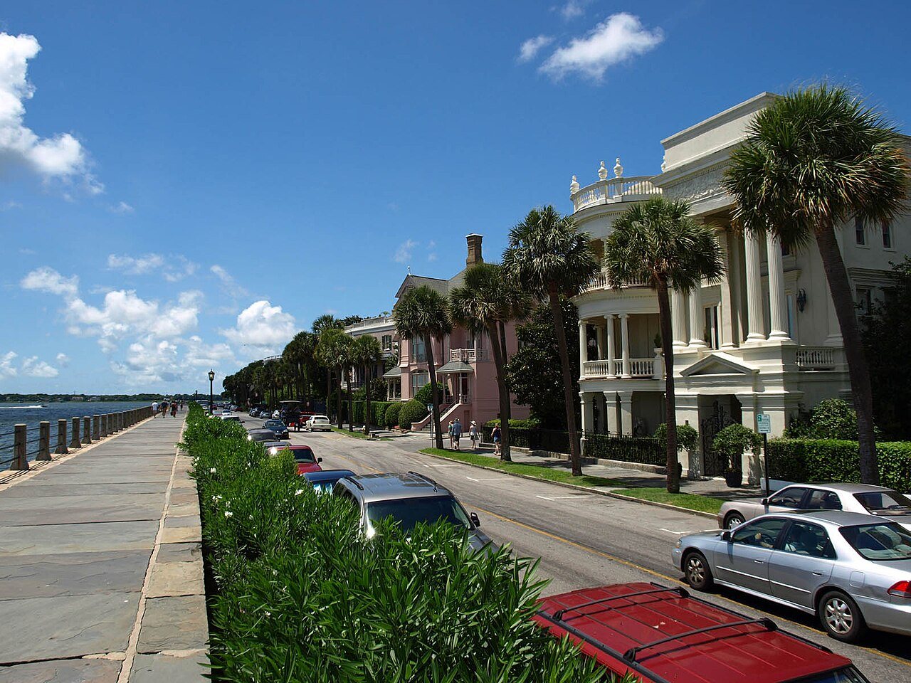
Fort Sumter National MonumentSite of Old Charles TowneCastle PinckneySouth Carolina State ArsenalBlake TenementsBranford-Horry HouseThomas Rose House, built 1733Sword Gate HousesCitizens and Southern National Bank of South CarolinaFenwick Hall, built 1730White ChurchMcCrady's Tavern and Long RoomMagnolia Plantation and GardensSouth Carolina National Bank of CharlestonDock Street TheatreCharleston's French Quarter DistrictSt. Andrews Episcopal Church, built 1706McLeod PlantationU.S. Post Office and Courthouse, built 1896James Nicholson HouseStiles-Hinson HouseU.S. Customhouse, built 1879Bethel Methodist ChurchOld Bethel United Methodist Church, built 1798Old Slave Mart, built 1859St. Mary's Roman Catholic Church, built 1839Central Baptist Church, built 1891Gov. William Aiken HouseGov. Thomas Bennett HouseJonathan Lucas HouseMagnolia CemeteryCharleston Historic DistrictLowndes Grove, built 1786Presqui'ileJosiah Smith Tennent HouseCigar Factory, built 1882Morris Island Lighthouse, built 1767William Robb HouseCharleston Old and Historic DistrictWest Point Rice MillWilliam Enston HomePorter Military AcademyComing Street Cemetery, built 1762Florence Crittenton Home, built 1931Hampton Park Terrace Historic District, built 1912James Sparrow House, built 1818Murray, Andrew B., Vocational SchoolGreek Orthodox Church of the Holy Trinity, built 1953Isaac Jenkins Mikell HouseStandard Oil Company Headquarters, built 1926Cleland Kinloch and Burnet R. Maybank Huger House, built 1857Charleston Consolidated Railway, Electric and Gas Company Car HouseCharleston Cemeteries Historic DistrictSixth Naval District Training Aids LibraryEmanuel African Methodist Episcopal Church, built 1816Faber House, built 1839Robert Mills ManorCainhoy Historic DistrictBattery LeRoyBattery No. 1Battery No. 5Battery TynesFort PringleFort TrenholmBattery WilkesFarmfield Plantation HouseJackson Street Freedman's Cottages, built 1890Meggett, W. Gresham, High and Elementary School, built 1951Giovanni Sottile HouseMosquito Beach Historic DistrictBrown, Dianna, Antique ShopJames Stocker Simmons HouseRead BuildingSpring Street Methodist ChurchWehakenSt. Mark's Episcopal ChurchCharleston Historic District★Clark Mills Studio★Drayton Hall★Miles Brewton House★Robert Brewton House★St. Michael's Episcopal Church★William Aiken House and Associated Railroad Structures★Fireproof Building, built 1827★Exchange and Provost★Heyward-Washington House★William Gibbes House★Col. John Stuart House★Simmons-Edwards House★Nathaniel Russell House★Gov. John Rutledge House, built 1763★College of Charleston, built 1770★Dubose Heyward House, built 1919★Edward Rutledge House, built 1760★Powder Magazine, built 1713★Market Hall and Sheds★Circular Congregational Church and Parish House★Farmers' and Exchange Bank, built 1853★Hibernian Hall★Huguenot Church, built 1844★Joseph Manigault House, built 1803★Old Marine Hospital★Robert Barnwell Rhett House★Robert William Roper House★St. Philip's Episcopal Church★Unitarian Church★William Blacklock House★Denmark Vesey House, built 1850★Kahal Kadosh Beth Elohim Synagogue, built 1840★
BuildingsDistrictsSitesStructures★ landmark

Architectural styles listings

Georgian11
Greek Revival10
Classical Revival6
Regency3
Adam Style3
Gothic Revival3
All 109 listings
Exchange and ProvostBuilding · listed 1969Heyward-Washington HouseBuilding · listed 1970William Gibbes HouseBuilding · listed 1970Col. John Stuart HouseBuilding · listed 1970Simmons-Edwards HouseBuilding · listed 1971Nathaniel Russell HouseBuilding · listed 1971Gov. John Rutledge HouseBuilding · listed 1971College of CharlestonBuilding · listed 1971Dubose Heyward HouseBuilding · listed 1971Edward Rutledge HouseBuilding · listed 1971Powder MagazineBuilding · listed 1972Market Hall and ShedsBuilding · listed 1973Circular Congregational Church and Parish HouseBuilding · listed 1973Farmers' and Exchange BankBuilding · listed 1973Hibernian HallBuilding · listed 1973Huguenot ChurchBuilding · listed 1973Joseph Manigault HouseBuilding · listed 1973Old Marine HospitalBuilding · listed 1973Robert Barnwell Rhett HouseBuilding · listed 1973Robert William Roper HouseBuilding · listed 1973St. Philip's Episcopal ChurchBuilding · listed 1973Unitarian ChurchBuilding · listed 1973William Blacklock HouseBuilding · listed 1973Denmark Vesey HouseBuilding · listed 1976Kahal Kadosh Beth Elohim SynagogueBuilding · listed 1978Fort Sumter National MonumentDistrict · listed 1966Site of Old Charles TowneSite · listed 1969Castle PinckneyStructure · listed 1970South Carolina State ArsenalBuilding · listed 1970Blake TenementsBuilding · listed 1970Branford-Horry HouseBuilding · listed 1970Thomas Rose HouseBuilding · listed 1970Sword Gate HousesBuilding · listed 1970Citizens and Southern National Bank of South CarolinaBuilding · listed 1971Fenwick HallBuilding · listed 1972White ChurchBuilding · listed 1972McCrady's Tavern and Long RoomBuilding · listed 1972Magnolia Plantation and GardensDistrict · listed 1972South Carolina National Bank of CharlestonBuilding · listed 1973Dock Street TheatreBuilding · listed 1973Charleston's French Quarter DistrictDistrict · listed 1973St. Andrews Episcopal ChurchBuilding · listed 1973McLeod PlantationBuilding · listed 1974U.S. Post Office and CourthouseBuilding · listed 1974James Nicholson HouseBuilding · listed 1974Stiles-Hinson HouseBuilding · listed 1974U.S. CustomhouseBuilding · listed 1974Bethel Methodist ChurchBuilding · listed 1974Old Bethel United Methodist ChurchBuilding · listed 1975Old Slave MartBuilding · listed 1975St. Mary's Roman Catholic ChurchBuilding · listed 1976Central Baptist ChurchBuilding · listed 1977Gov. William Aiken HouseBuilding · listed 1977Gov. Thomas Bennett HouseBuilding · listed 1978Jonathan Lucas HouseBuilding · listed 1978Magnolia CemeteryDistrict · listed 1978Charleston Historic DistrictDistrict · listed 1978Lowndes GroveBuilding · listed 1978Presqui'ileBuilding · listed 1978Josiah Smith Tennent HouseBuilding · listed 1979Cigar FactoryBuilding · listed 1980Morris Island LighthouseStructure · listed 1982William Robb HouseBuilding · listed 1983Charleston Old and Historic DistrictDistrict · listed 1985West Point Rice MillBuilding · listed 1995William Enston HomeDistrict · listed 1996Porter Military AcademyDistrict · listed 1996Coming Street CemeterySite · listed 1996Florence Crittenton HomeBuilding · listed 1997Hampton Park Terrace Historic DistrictDistrict · listed 1997James Sparrow HouseBuilding · listed 1998Murray, Andrew B., Vocational SchoolBuilding · listed 2002Greek Orthodox Church of the Holy TrinityBuilding · listed 2004Isaac Jenkins Mikell HouseBuilding · listed 2014Standard Oil Company HeadquartersBuilding · listed 2015Cleland Kinloch and Burnet R. Maybank Huger HouseBuilding · listed 2015Charleston Consolidated Railway, Electric and Gas Company Car HouseBuilding · listed 2017Charleston Cemeteries Historic DistrictDistrict · listed 2017Sixth Naval District Training Aids LibraryBuilding · listed 2017Emanuel African Methodist Episcopal ChurchBuilding · listed 2018Faber HouseBuilding · listed 2019Robert Mills ManorDistrict · listed 2021Cainhoy Historic DistrictDistrict · listed 1982Battery LeRoyStructure · listed 1982Battery No. 1Structure · listed 1982Battery No. 5Structure · listed 1982Battery TynesStructure · listed 1982Fort PringleStructure · listed 1982Fort TrenholmStructure · listed 1982Battery WilkesStructure · listed 1982Farmfield Plantation HouseBuilding · listed 1982Jackson Street Freedman's CottagesBuilding · listed 2017Meggett, W. Gresham, High and Elementary SchoolBuilding · listed 2018Giovanni Sottile HouseBuilding · listed 2019Mosquito Beach Historic DistrictDistrict · listed 2019Brown, Dianna, Antique ShopBuilding · listed 2020James Stocker Simmons HouseBuilding · listed 2022Read BuildingBuilding · listed 2022Spring Street Methodist ChurchBuilding · listed 2024WehakenDistrict · listed 2026St. Mark's Episcopal ChurchBuilding · listed 2026

National Park Service, National Register of Historic Places. Photos from Wikimedia Commons, credited on each place’s page.

Places that used to be

Lost post offices, old corners, places now gone and burying grounds

Charleston’s post office has been open since 1789. Six other post offices opened and closed inside today’s town.

Charleston
1789–today
John's Island
1857–1858
James Island
1882–1909
Stono
1882–1903
Exchange
1889–1918
Myers
1894–1953
John's Island
1903–today
Remleys
1920–1944
17801900today
Hamlets and corners on the map
Anson Borough HomesAshley Hall ManorAshley HarborAshleyvilleAvondaleByrnes DownsCharles Towne VillageCharlestowne EstatesChesterfieldClarks PointCountry Club EstatesCreek PointEssex VillageFenwick CrossroadsForest Acres WestFort BullGadsden Green HomesGarden HillGehlkinGreenwood ParkGrove Creek VillageHarrison AcresHeathwoodHibernian Heights
Gone or out of use
Academy of Fine ArtsschoolAnson Street Presbyterian ChurchchurchBethel ChurchchurchBroad Street TheaterbuildingCalvary ChurchchurchCharleston Orphan HousebuildingChisolm MilllocaleCut Ridge SchoolschoolDaniels Island ChurchchurchFort PembertonmilitaryGirls High School and Normal SchoolschoolGlebe Street Presbyterian ChurchchurchGuard HousebuildingJohn P. Grace Memorial BridgebridgeJohns Island Army Air FieldmilitaryLegare Street Free SchoolschoolMarine HospitalhospitalMeeting Street Free Schoolschool
13cemeteries and burying grounds inside Charleston
AdverseBethanyBrownFirst Scots Presbyterian ChurchHebrewHoly CrossLive Oak Memorial GardensMagnoliaNelliefield CreekQuaker ChurchyardSaint LawrenceSaint PetersSaint Thomas

US Post Offices dataset (Blevins & Helbock, CC0). Places and cemeteries from the USGS Geographic Names Information System (2021).

The story

How Charleston came to be

From Wikipedia’s history of Charleston.

Read it all →

The unified Cusabo people (including sub tribes such as Kiawah) and the Ittiwan people inhabited the area prior to colonial settlement. They were known as "Settlement Indians" by colonists.

Text from Wikipedia, licensed CC BY-SA 4.0.

From the old history books

What they wrote about Charleston, 1872–1886

Passages that mention Charleston, cut from the printed page as they were published.

Some idea can be formed of the comparative insignificancy of the mail matter which came into, and went out of Charleston, even up to a period as recent as 1839. On the 15th of November, 1836, consequent upon a change of schedule in the departure of the United States Mail from Fayettefcille, North C…
The newspaper press of Charleston, S.C.1872 · page 115Read the page →
Read the text

Some idea can be formed of the comparative insignificancy of the mail matter which came into, and went out of Charleston, even up to a period as recent as 1839. On the 15th of November, 1836, consequent upon a change of schedule in the departure of the United States Mail from Fayettefcille, North Carolina, the Charleston papers of that day announced that the Government had established a horse express, between this City and the point

Text read by machine from the scan; it may contain errors.
The Charleston Mercury, a daily morning print, which was established as a literary journal, on the 1st January, 1822, by that classic scholar, Edmund Morford, who had then returned to Charleston, was purchased and converted into a political organ by Henry Laurens Pinckney, June 1, 1823. From that d…
The newspaper press of Charleston, S.C.1872 · page 147Read the page →
Read the text

The Charleston Mercury, a daily morning print, which was established as a literary journal, on the 1st January, 1822, by that classic scholar, Edmund Morford, who had then returned to Charleston, was purchased and converted into a political organ by Henry Laurens Pinckney, June 1, 1823. From that date it became the representative of the Free Trade and State Plights Party, of South Carolina, In the warfare of parties, State and National, Mr.

Text read by machine from the scan; it may contain errors.
The prison-ships of the British were anchored in the harbor of Charleston, between Castle Pinckney and Sullivan's Island, and there they remained till the following June, when the ships were ordered on to Virginia by the British authorities in Charleston, who circulated the statement that the priso…
Biographical sketches of the Huguenot Solomon Legaré and of his family1886Read the page →
Read the text

The prison-ships of the British were anchored in the harbor of Charleston, between Castle Pinckney and Sullivan's Island, and there they remained till the following June, when the ships were ordered on to Virginia by the British authorities in Charleston, who circulated the statement that the prisoners were sent to Virginia to be exchanged ; but what their real intention was in sending them away, will

Text read by machine from the scan; it may contain errors.

Scans and text from the Internet Archive. Books published in 1930 or earlier, which are in the public domain.

Timeline

Charleston, 1670 to 1960

Woven from the archive, old maps, post office records, the National Register and the people born here.

  1. 17th century
  2. 1670
    FoundingCharleston is established
  3. 18th century
  4. 1763BuiltGov. John Rutledge House is built
  5. 1770BuiltCollege of Charleston is built
  6. 1789Post officeThe Charleston post office opens
  7. 19th century
  8. 1827BuiltFireproof Building is built
  9. 1857Post officeThe John's Island post office opens
  10. 1858Post officeThe John's Island post office closes
  11. 1882Born hereJames F. Byrnes is born here
  12. 1882Post officeThe James Island post office opens
  13. 20th century
  14. 1909Post officeThe James Island post office closes
  15. 1916Born hereRobert F. Furchgott is born here
  16. 1919BuiltDubose Heyward House is built
  17. 1948Born hereRobert Jordan is born here
  18. 1948On the mapFirst mapped by the U.S. Geological Survey
  19. 1960LandmarkCharleston Historic District named a National Historic Landmark
  20. 1960LandmarkDrayton Hall named a National Historic Landmark
  21. 1960LandmarkMiles Brewton House named a National Historic Landmark
  22. 1960LandmarkRobert Brewton House named a National Historic Landmark
By decade

No old photos in the archives yet

Weddings on Main Street, storms, parades, school pictures, the old store. If it’s in your family album, it belongs here.

Be the first to add onePhotograph a print flat, in daylight, no flash.
Add from your album
On the map

Charleston on the map, 1948 to 1994

Every edition of the U.S. Geological Survey’s map of Charleston. Tap a year, or press play to watch the town change.

Charleston on the 1948 USGS mapCharleston on the 1958 USGS mapCharleston on the 1971 USGS mapCharleston on the 1994 USGS map1948Charleston sheet · 1:24,000

U.S. Geological Survey historical topographic maps (public domain), via Esri’s collection of the scans. The red ring marks the center of Charleston.

Every building

Charleston, building by building, 1884–1902

Fire insurance maps drew every building, what it was made of and what it was used for, so insurers could price the risk of fire. Pick a year, then a sheet.

Charleston fire insurance map, 1884, sheet 31884Sheet 3 of 25
Edition
BrickWoodStone

Sanborn Map Company, via the Library of Congress. Editions published in 1930 or earlier, which are in the public domain.

People over time

Charleston, census by census

020,00040,00060,00080,000100,000120,000140,000160,00018001850190019502000150,227

Grew from 16,359 people in 1790 to 150,227 in 2020, 9 times over.

24 censuses, 1790–2020.

U.S. Census Bureau decennial counts, from the census table on Charleston’s Wikipedia page.

Famous people

17 famous people were born in Charleston

Writers, athletes, leaders and more, ranked by how widely they’re known.

See all →
Help out

Start Charleston’s collection

The first neighbors to add old photos shape how Charleston’s history is told.

Decades since 1900 with photos
00s10s20s30s40s50s60s70s80s90s
0 of 10 decades. The empty ones are waiting for someone’s album.
Stories next door

History across the town line

Each neighbor’s History grade, on the same three inputs.

Questions about Charleston’s history

What year was Charleston founded?

In 1670, according to Wikidata and Wikipedia’s history of the town. Charleston’s post office opened in 1789, and the first U.S. census counted 16,359 people here in 1790.

How does Charleston rank for history?

Charleston is more historic than 89% of U.S. towns, #9 of 169 in South Carolina. The History grade combines the town’s founding era, the share of homes built before 1940 and its National Register listings. It’s a character grade, so it isn’t part of the overall grade. How it works.

What is on the National Register in Charleston?

110 listings, 34 of them National Historic Landmarks: 82 buildings, 16 historic districts with 382 contributing buildings, 2 sites, and 9 structures. 505 historic buildings in all.

How old are the homes in Charleston?

10% of Charleston’s homes were built before 1940 (Census estimate), against a typical 3.5% for a South Carolina town; the median home was built in 1995.

Memory lane

What the archives can’t tell you, neighbors can.

Town Square →
Start a conversation
Sources

Where this page comes from

Founding dates: Wikidata, Wikipedia, the U.S. post office records of Blevins & Helbock (CC0) and the Census. Homes by year built: Census ACS 2020–24. National Register of Historic Places: National Park Service (list of May 22, 2026). Old photos, postcards and papers: Wikimedia Commons, the Library of Congress and other public archives, credited on each item’s page. Maps: U.S. Geological Survey historical topographic maps (via Esri) and Sanborn fire-insurance maps (Library of Congress). History text and census tables: Wikipedia (CC BY-SA 4.0). Places that used to be: USGS Geographic Names Information System (2021).

From Wikidata (6), the National Register of Historic Places (109), Wikipedia, Wikidata and Wikipedia for famous people, U.S. Geological Survey historical maps, U.S. Census counts (via Wikipedia), the US Post Offices dataset (Blevins & Helbock), the USGS Geographic Names Information System, Sanborn fire insurance maps (Library of Congress) and old county and town histories (Internet Archive). Archive images are copied here with their credits and licenses, shown on each photo’s page. Refreshed monthly.