
Pascoag and vicinity, Rhode Island, 1895, 1895
Pascoag’s story
179 years in pictures
The archive holds 6 old photos and papers going back to 1895.
- 1847Pascoag is settled
Each edition grades its towns against each other only.

Pascoag’s average trip to work is 35 minutes, against 26 minutes in Rhode Island’s towns and 25 minutes across U.S. towns. Only 1 of the 39 Rhode Island towns we compare have a lower January low than Pascoag. The biggest park or preserve is Clear River Open Space, at 37 acres. We don’t grade Pascoag yet; the figures below are still real.
Where Pascoag beats most towns.
Where Pascoag’s working residents go each day. Line width shows the share.
Census LEHD 2023
The archive holds 6 old photos and papers going back to 1895.
Museums, parks, gardens and other places to visit around Pascoag. Close and well known come first.
 Big draw9 mi LakeLake Chaubunagungamaug
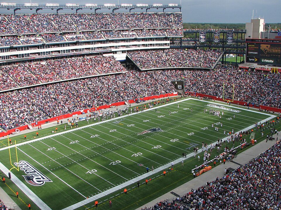 Big draw25 mi Stadium & arenaGillette Stadium
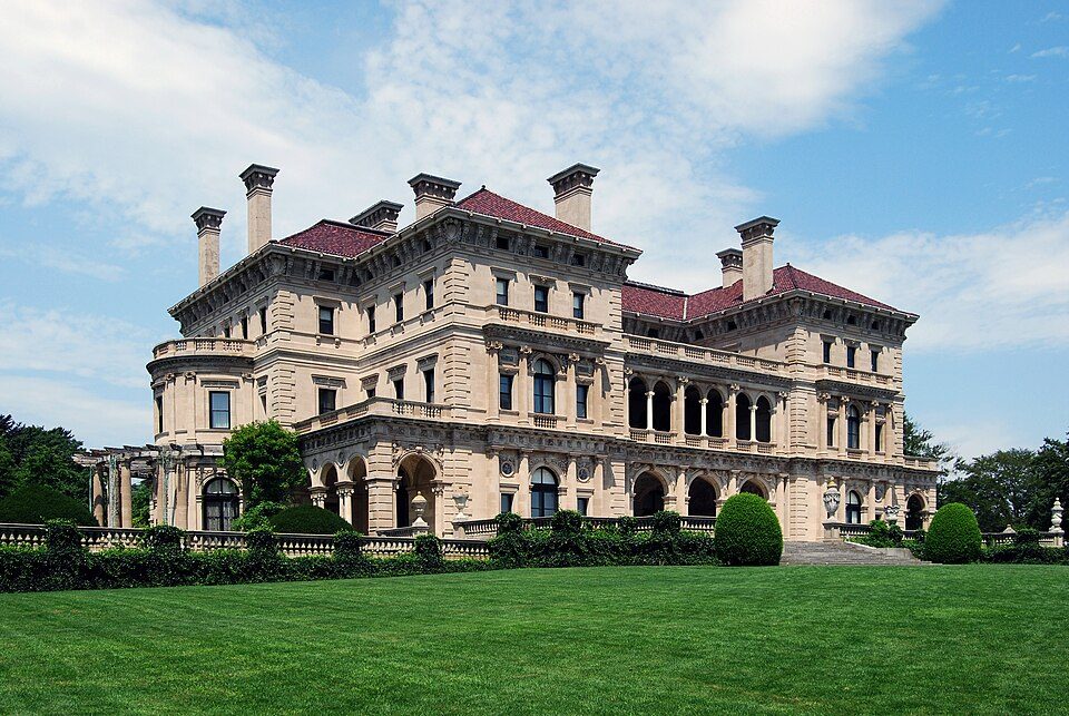 Big draw40 mi MuseumThe Breakers
 31 mi Ancient siteHMS Endeavour
 33 mi MuseumUSS Massachusetts
 38 mi LakeWalden Pond
Lake Chaubunagungamaug: Bree from Worcester, MA, USA, CC BY-SA 2.0 · Gillette Stadium: Bernard Gagnon, CC BY-SA 3.0 · The Breakers: UpstateNYer, CC BY-SA 3.0 · HMS Endeavour: Samuel Atkins (c.1760-1810), Public domain · USS Massachusetts: USN, Public domain · Walden Pond: Victorgrigas, CC BY-SA 3.0
Pascoag is unincorporated, so Providence County and regional agencies provide most services.
EPA SDWIS (Oct 9, 2026) · HIFLD + EIA-861 2025 · Census 2020 ZCTAs · NCES 2024–25 · registration: vote.gov, updated Sep 30, 2026.
Ordered by what stands out in Pascoag.
Most working residents leave Pascoag for work: only 8% work in town. Pascoag’s median household income is $121,000, above both Rhode Island’s towns ($104,000) and U.S. towns ($80,000). Since 2013, Pascoag has added 200 jobs, to 1,569 in 2023.
| Pascoag | Rhode Island towns | U.S. towns | |
|---|---|---|---|
| Median household income | $121,000 | $104,000 | $80,000 |
| Below the poverty line | 11% | 6.8% | 9.6% |
| Working residents who work in town | 7.8% | 12% | 8% |
Census LEHD 2023 · ACS
Pascoag’s FEMA risk score is 70 of 100. Since 2005, 8 flood insurance claims have been paid out in Pascoag.
FEMA flood insurance claims · FEMA National Risk Index · OpenFEMA
Pascoag has chilly, snowy winters and pleasant summers, with plenty of rain. The July high in Pascoag is 82°F.
NOAA U.S. Climate Normals, 1991–2020
26% of adults have been diagnosed with depression in Pascoag. Pascoag beats the Rhode Island average on 2 of 32 CDC measures and trails it on 0. 36% of adults feel lonely in Pascoag.
| Pascoag | Rhode Island towns | U.S. towns | |
|---|---|---|---|
| Feel lonely (CDC PLACES) | 36% | 34% | 33% |
| Frequent mental distress (CDC PLACES) | 19% | 16% | 17% |
| Yearly checkup (CDC PLACES) | 84% | 85% | 79% |
| Depression (CDC PLACES) | 26% | 23% | 23% |
| What stands out | Pascoag | RI |
|---|---|---|
| Fewer older adults who have lost all their teeth | 8.1% | 14.2% |
| Fewer uninsured adults | 6.3% | 8.2% |
CDC PLACES 2025 · modeled estimates for adults · CMS · HRSA
3.5 miles of trail in 4 parks and preserves.
| Pascoag | Rhode Island towns | U.S. towns | |
|---|---|---|---|
| Conserved land | 8.8% | 12% | 4.3% |
| Miles of trail per square mile | 0.6 miles per square mile | 0.8 | 0.4 |
| Biggest places to walk | Trails | Acres |
|---|---|---|
| 1. Clear River Open Space | — | 37 |
| 2. White Mill Park | — | 21 |
| 3. Hauser Field | — | 10 |
Trails & parks © OpenStreetMap contributors · Conserved land: USGS PAD-US
Zillow Home Value Index · Redfin Data Center
3 within 15 miles of the center of Pascoag
About 1 of every 100 Pascoag residents are enrolled in college, against 8 across Rhode Island.
Census-designated place in Rhode Island, United States
Pascoag (PASS-ko or PASS-kog) is a census-designated place (CDP) and village in Providence County, Rhode Island, United States. As of the 2020 census, Pascoag had a population of 4,641. Pascoag is one of eight villages that make up the town of Burrillville.
From Wikipedia, licensed CC BY-SA 4.0 · facts via Wikidata (CC0)
3 towns share a border with Pascoag.
| Town | RI rank | Overall | Cost | Safety | Schools | Health |
|---|---|---|---|---|---|---|
| Pascoag | — | — | — | — | — | — |
| Harrisville | — | — | — | — | — | — |
| Burrillville | #26 | B | C | A | C+ | B+ |
| Glocester | #14 | A | C− | A+ | A− | A− |
Pascoag and Harrisville aren’t graded (fewer than 1,000 residents, or not enough data). Compare Pascoag with a neighbor →
Short answers, built from the data on this page.
We don’t grade Pascoag yet; the figures below are still real.


