
Harrisville School, Harrisville, Burrillville, RI, 1902
Harrisville’s story
Harrisville in pictures
The archive holds 6 old photos and papers going back to 1902.
Explore the history →Each edition grades its towns against each other only.

A town of 1,767.
We don’t grade Harrisville yet; the figures below are still real.
Where Harrisville’s working residents go each day. Line width shows the share.
Census LEHD 2023
The archive holds 6 old photos and papers going back to 1902.
Explore the history →Museums, parks, gardens and other places to visit around Harrisville. Close and well known come first.
 Big draw10 mi LakeLake Chaubunagungamaug
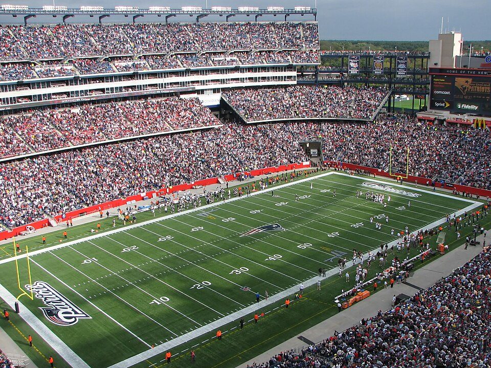 Big draw23 mi Stadium & arenaGillette Stadium
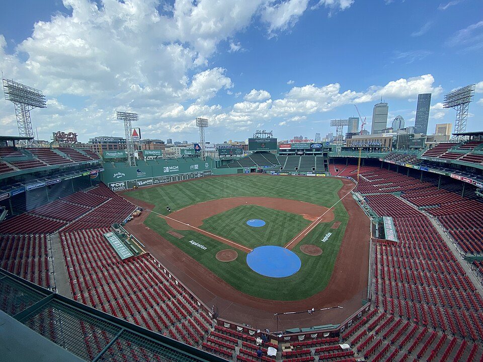 Big draw40 mi Stadium & arenaFenway Park
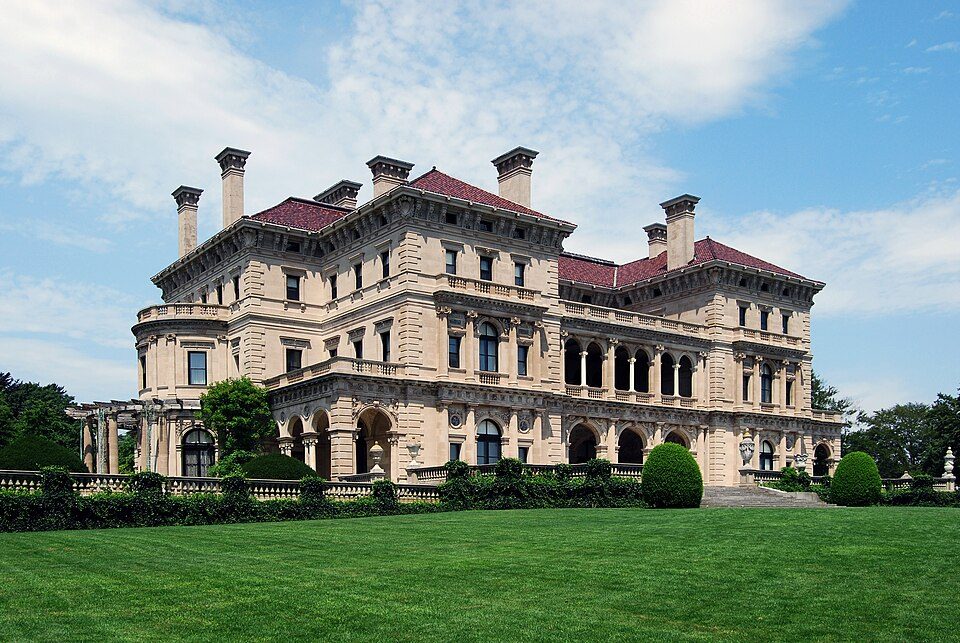 Big draw40 mi MuseumThe Breakers
 31 mi Ancient siteHMS Endeavour
 32 mi MuseumUSS Massachusetts
Lake Chaubunagungamaug: Bree from Worcester, MA, USA, CC BY-SA 2.0 · Gillette Stadium: Bernard Gagnon, CC BY-SA 3.0 · Fenway Park: Gatorfan252525, CC BY-SA 4.0 · The Breakers: UpstateNYer, CC BY-SA 3.0 · HMS Endeavour: Samuel Atkins (c.1760-1810), Public domain · USS Massachusetts: USN, Public domain
Harrisville is unincorporated, so Providence County and regional agencies provide most services.
EPA SDWIS (Oct 9, 2026) · HIFLD + EIA-861 2025 · Census 2020 ZCTAs · NCES 2024–25 · registration: vote.gov, updated Sep 30, 2026.
Ordered by what stands out in Harrisville.
Only 2 of the 39 Rhode Island towns we compare have a lower typical household income than Harrisville. Among residents here, 11% live below the poverty line, where Rhode Island’s towns sit at 6.8% and U.S. towns at 9.6%. Since 2013, Harrisville has added 61 jobs, to 561 in 2023. Half the trips to work are shorter than 15 miles.
| Harrisville | Rhode Island towns | U.S. towns | |
|---|---|---|---|
| Average trip to work | 44 minutes | 26 minutes | 25 minutes |
| Median household income | $63,000 | $104,000 | $80,000 |
| Working residents who work in town | 4.3% | 12% | 8% |
| Below the poverty line | 11% | 6.8% | 9.6% |
Census LEHD 2023 · ACS
Of the losses FEMA expects in Harrisville, 82% come from inland flooding. Expected storm and flood damage is higher than in 70% of U.S. communities.
FEMA National Risk Index · OpenFEMA
The range runs from 18° on a January night to 82° on a July afternoon, with about 48 inches of snow a winter.
NOAA U.S. Climate Normals, 1991–2020
The share of adults in Harrisville who have been diagnosed with depression: 26%. On the CDC’s 32 measures, Harrisville is ahead of Rhode Island on 1 and behind on 3. Among 39 Rhode Island towns, just 3 have a higher share of adults who report frequent physical distress than Harrisville.
| Harrisville | Rhode Island towns | U.S. towns | |
|---|---|---|---|
| Feel lonely (CDC PLACES) | 37% | 34% | 33% |
| Frequent mental distress (CDC PLACES) | 19% | 16% | 17% |
| Depression (CDC PLACES) | 26% | 23% | 23% |
| Frequent physical distress (CDC PLACES) | 15% | 13% | 14% |
| What stands out | Harrisville | RI |
|---|---|---|
| Fewer uninsured adults | 6.2% | 8.2% |
| More adults with COPD | 8% | 6.6% |
CDC PLACES 2025 · modeled estimates for adults · CMS · HRSA
Harrisville has 3 parks and preserves, 5 acres in all.
| Biggest places to walk | Trails | Acres |
|---|---|---|
| 1. Black Hut State Management Area | — | 3 |
| 2. Harrisville Fishing Area | — | 1 |
| 3. Firefighter's Memorial Park | — | 1 |
Trails & parks © OpenStreetMap contributors · Conserved land: USGS PAD-US
74% of households are owner-occupiers in Harrisville.
Census ACS, 2020–24 · Zillow Home Value Index · Redfin Data Center
4 within 15 miles of the center of Harrisville
About 4 of every 100 Harrisville residents are enrolled in college, against 8 across Rhode Island.
Census-designated place in Rhode Island, United States
Harrisville is a census-designated place (CDP) and village in the town of Burrillville, Rhode Island. As of the 2020 census, Harrisville had a population of 1,745. Much of the community composes a historic district listed on the National Register of Historic Places. The village was named after nineteenth century manufacturer Andrew Harris. It was previously named Rhodesville, after eighteenth-century privateer Captain William Rhodes.
From Wikipedia, licensed CC BY-SA 4.0 · facts via Wikidata (CC0)
One town shares a border with Harrisville.
| Town | RI rank | Overall | Cost | Safety | Schools | Health |
|---|---|---|---|---|---|---|
| Harrisville | — | — | — | — | — | — |
| Pascoag | — | — | — | — | — | — |
Harrisville and Pascoag aren’t graded (fewer than 1,000 residents, or not enough data). Compare Harrisville with a neighbor →
Short answers, built from the data on this page.
We don’t grade Harrisville yet; the figures below are still real.


