
Beech Pond Gallery, 2013
Bradford’s story
115 years in pictures
The archive holds 6 old photos and papers going back to 2013.
- 1911Bradford is settled
Each edition grades its towns against each other only.

Today 1,511 people live in this town, first settled in 1911.
Of the 39 Rhode Island towns we compare, none has a lower share of working residents who work in town than Bradford. 41% of the land in Bradford is conserved, against 12% in Rhode Island’s towns and 4.3% across U.S. towns. We don’t grade Bradford yet; the figures below are still real.
Where Bradford’s working residents go each day. Line width shows the share.
Census LEHD 2023
The archive holds 6 old photos and papers going back to 2013.
Bradford takes its name from Bradford in West Yorkshire, England, 3,230 miles across the Atlantic.
 UKUK edition
Bradford, settled in 1911, takes its name from Bradford, a city in West Yorkshire, England.
1 more U.S. town is named after Bradford:Bradford Township, MN3,549
Named after: each U.S. town’s Wikipedia article. Grades compare each town with towns in its own country, so they aren’t a head-to-head.
Museums, parks, gardens and other places to visit around Bradford. Close and well known come first.
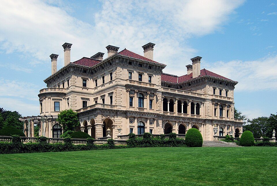 Big draw25 mi MuseumThe Breakers
 26 mi Ancient siteHMS Endeavour
 38 mi MuseumUSS Massachusetts
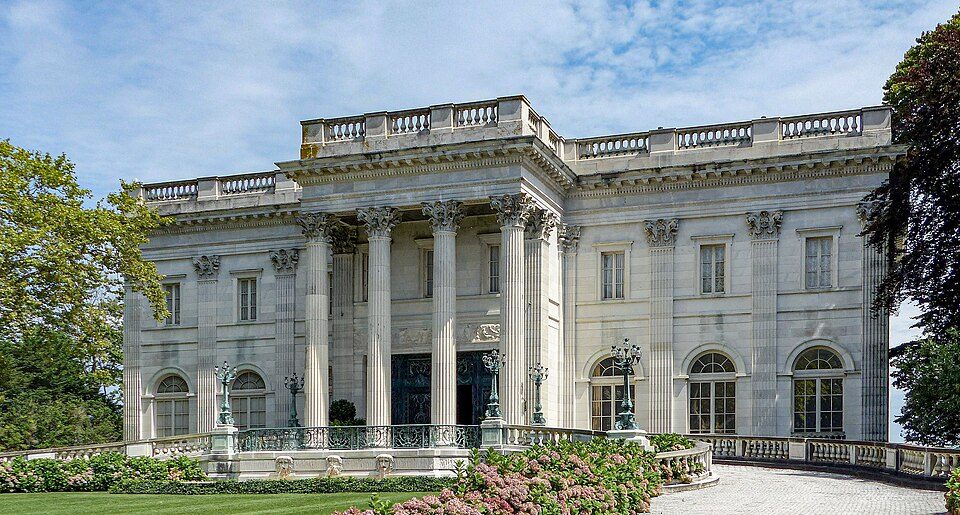 24 mi MuseumMarble House
 18 mi Stadium & arenaMohegan Sun Arena
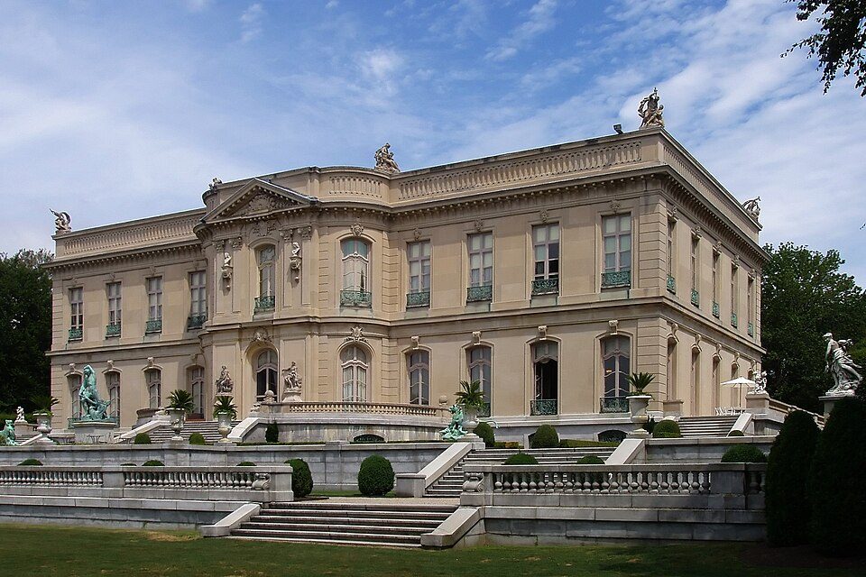 24 mi MuseumThe Elms
The Breakers: UpstateNYer, CC BY-SA 3.0 · HMS Endeavour: Samuel Atkins (c.1760-1810), Public domain · USS Massachusetts: USN, Public domain · Marble House: [email protected], Public domain · Mohegan Sun Arena: Bbjeter, CC BY-SA 3.0 · The Elms: The original uploader was Daderot at English Wikipedia., CC BY-SA 3.0
Bradford is unincorporated, so Washington County and regional agencies provide most services.
EPA SDWIS (Oct 9, 2026) · HIFLD + EIA-861 2025 · Census 2020 ZCTAs · NCES 2024–25 · registration: vote.gov, updated Sep 30, 2026.
Ordered by what stands out in Bradford.
In Bradford, the concentration of trails is 1.5 miles per square mile. Parks and preserves locally: one, of 4 acres. 2.7 miles of trail in 1 park or preserve.
| Biggest places to walk | Trails | Acres |
|---|---|---|
| 1. Bradford Boat Launch And Fishing Area | — | 4 |
Trails & parks © OpenStreetMap contributors · Conserved land: USGS PAD-US
For Bradford, the typical journey to work is 30 minutes. The top destinations are Westerly (26%), Groton (9%) and Providence (6%). Half the trips to work are shorter than 15 miles.
| Bradford | Rhode Island towns | U.S. towns | |
|---|---|---|---|
| Median household income | $120,000 | $104,000 | $80,000 |
| Below the poverty line | 2.3% | 6.8% | 9.6% |
| Average trip to work | 30 minutes | 26 minutes | 25 minutes |
Census LEHD 2023 · ACS
Expected losses in Bradford break down as 78% from inland flooding and 11% from hurricanes. In Bradford, the FEMA risk score is 26 of 100.
FEMA National Risk Index · OpenFEMA
The peak summer temperature in Bradford is 82°F.
NOAA U.S. Climate Normals, 1991–2020
In the year to September 2026, typical home values climbed 5.4%. The share of households in Bradford who are owner-occupiers: 72%.
Census ACS, 2020–24 · Zillow Home Value Index · Redfin Data Center
29% of Bradford adults feel lonely. Of the 39 Rhode Island towns we compare, none has a lower share of adults who have diabetes than Bradford. In Bradford, a fifth of adults binge drink, and 16% get no exercise outside work.
| Bradford | Rhode Island towns | U.S. towns | |
|---|---|---|---|
| Feel lonely (CDC PLACES) | 29% | 34% | 33% |
| Binge drink (CDC PLACES) | 20% | 17% | 16% |
| Get no exercise (CDC PLACES) | 16% | 22% | 25% |
| Diabetes (CDC PLACES) | 7.4% | 10% | 12% |
| What stands out | Bradford | RI |
|---|---|---|
| Fewer adults facing food insecurity | 7.7% | 15.1% |
| Fewer uninsured adults | 4.3% | 8.2% |
CDC PLACES 2025 · modeled estimates for adults · CMS · HRSA
Four-year graduates: 39% of adults 25 and older here, 38% across Rhode Island. People 65 and older are 14% of residents (19% statewide); children under 18 are 23% of residents (19% statewide). For Bradford, the median age is 35 years.
| Bradford | Rhode Island towns | U.S. towns | |
|---|---|---|---|
| Median age | 35 years | 43.9 years | 40.5 years |
| Bachelor’s degree or more, 25+ | 39% | 38% | 29% |
Somewhere between 31% and 63% women
The Census survey reached too few of Bradford’s residents to say more: its margin here is ±16.1 points. Across Rhode Island, 50.9% of residents are women.
| Bradford | RI | U.S. | |
|---|---|---|---|
| Under 10 | 19.7% | 10% | 11.6% |
| 10 to 17 | 3.3% | 8.8% | 10.3% |
| 18 to 24 | 2% | 10% | 9.1% |
| 25 to 34 | 25% | 13.8% | 13.7% |
| 35 to 44 | 13% | 12.7% | 13.2% |
| 45 to 54 | 8.9% | 11.9% | 12.2% |
| 55 to 64 | 14.2% | 13.9% | 12.7% |
| 65 to 74 | 5.4% | 11% | 10.2% |
| 75 and older | 8.6% | 7.8% | 7% |
| No diploma | 1.9% | 10.3% | 10.4% |
| High school | 30.3% | 26.6% | 26% |
| Some college | 24.9% | 17.4% | 19.1% |
| Associate’s | 3.8% | 8% | 8.8% |
| Bachelor’s | 33.2% | 22.4% | 21.6% |
| Graduate | 5.9% | 15.4% | 14.1% |
U.S. Census Bureau · ACS 2020-2024 5-year estimates · in a town of 1,500, single groups can be off by several points
1 within 15 miles of the center of Bradford
About 5 of every 100 Bradford residents are enrolled in college, against 8 across Rhode Island.
Census-designated place in Rhode Island, United States
Bradford is a census-designated place (CDP) and historic district in the towns of Westerly and Hopkinton in Washington County, Rhode Island, United States. As of the 2020 census, Bradford had a population of 1,457. The Bradford Village Historic District was listed on the National Register of Historic Places in 1996 as a 224-acre (91 ha) area including 149 contributing buildings, one other contributing site, and one other contributing structure. The CDP as defined by the United States Census Bureau is located only in Westerly. Bradford was named for Bradford, West Yorkshire, England.
From Wikipedia, licensed CC BY-SA 4.0 · facts via Wikidata (CC0)
3 towns share a border with Bradford.
| Town | RI rank | Overall | Cost | Safety | Schools | Health |
|---|---|---|---|---|---|---|
| Bradford | — | — | — | — | — | — |
| Westerly | #20 | A− | C− | B+ | B | A |
| Hopkinton | #17 | A− | C | A | B+ | A |
| Charlestown | #16 | A | C | A− | B+ | A |
Bradford isn’t graded (fewer than 1,000 residents, or not enough data). Compare Bradford with a neighbor →
Short answers, built from the data on this page.
We don’t grade Bradford yet; the figures below are still real.


