Founding year: the first Summit Hill post office (Blevins & Helbock, CC0). Wikidata: 1880.The full story ↓
History grade
What drives Summit Hill’s History grade
On its age, its old homes and the National Register, Summit Hill is more historic than 90% of U.S. towns, #184 of 1,035 in Pennsylvania. All 3 inputs are above most U.S. towns; its share of homes from before 1940 ranks highest and its National Register listings lowest.
A
HistoryA character grade: shown, never part of Summit Hill’s overall grade.
Pennsylvania towns list about as much on the Register as the country (a typical Pennsylvania town has 2.1 per 10,000 residents, the U.S. 2.4), so Summit Hill’s 3.2 sits near the middle of its state (61% of Pennsylvania towns have fewer) while its 1 listings outnumber those of 51% of U.S. towns.
How sure. Graded on any two of the three inputs instead, the letter would range from B+ to A+. The pre-1940 share is a Census survey estimate (±4.3 points). The founding year is the first post office, not a stated founding date; Wikidata gives 1880.
Founding year: the first post office (other dates in Quick answers). Homes: Census ACS 2020–24. National Register: National Park Service, May 2026 list; each listing counted once (boundary changes and added documentation belong to their listing), and a historic district counts its contributing buildings. How TownRatings grades history →
What stands out about Summit Hill’s past
Read from the archive, the National Register and the record. The page puts what stands out first.
Anthracite coal was discovered on the ridgeline of Sharpe Mountain (now known as Pisgah Mountain) in 1791 by a hunter. News of the find led to the founding of the Lehigh Coal Mining Company, which in 1792 began exploring the area in earnest and buying up promising land. Coal was found in 1794 by Phillip Ginter along the northeast-to-southwest-running ridgeline of Pisgah Mountain lying several hundred feet below the ridge on the north slope in an area that became the boroughs of Summit Hill and Lansford.
Summit Hill High School was added to the National Register of Historic Places in 2001.
Passages that mention Summit Hill, cut from the printed page as they were published.
History of Carbon County, Pennsylvania1918 · page 214Read the page →
Read the text
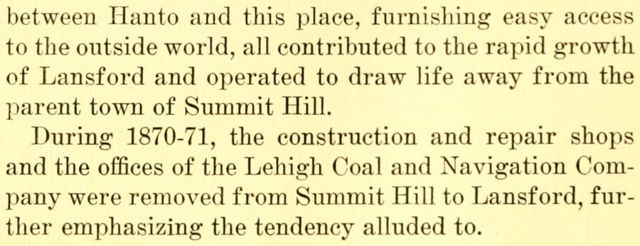
between Hanto and this place, furnishing easy access to the outside world, all contributed to the rapid growth of Lansford and operated to draw life away from the parent town of Summit Hill. During 1870-71, the construction and repair shops and the offices of the Lehigh Coal and Navigation Coml^any were removed from Summit Hill to Lansford, further emphasizing the tendency alluded to.
Text read by machine from the scan; it may contain errors.
History of Carbon County, Pennsylvania1918 · page 220Read the page →
Read the text
Many of the Lansford churches were established as missions by the churches of Summit Hill. First among the number was the First Baptist church, founded about 1872. Its first building stood where the West Ward school house now stands. In 1888 the church was torn down and rebuilt on the present location.
Text read by machine from the scan; it may contain errors.
Scans and text from the Internet Archive. Books published in 1930 or earlier, which are in the public domain.
Timeline
Summit Hill, 1832 to 1930
Woven from the archive, old maps, post office records, the National Register and the people born here.
Nothing in the archives for these yearsWeddings on Main Street, storms, parades, school pictures, the old store. If it’s in your family album, it belongs here.
National Park Service, National Register of Historic Places. Photos from Wikimedia Commons, credited on each place’s page.
People over time
Summit Hill, census by census
Peaked at 5,567 in 1930; 3,120 people lived here in 2020.
14 censuses, 1890–2020.
U.S. Census Bureau decennial counts, from the census table on Summit Hill’s Wikipedia page.
Places that used to be
Old corners and burying grounds
Summit Hill’s post office has been open since 1832.
Hamlets and corners on the map
Bloomingdale
11cemeteries and burying grounds inside Summit Hill
First Presbyterian ChurchGrand ArmyNew Saint Michael's CatholicOld Saint Michael's CatholicSacred Heart Polish National ChurchSaint John the Baptist Byzantine CatholicSaint John's Slovak LutheranSaint Joseph's CatholicSaint Joseph's CatholicSaint Mary's Russian OrthodoxSaint Peter and Saint Pauls' Catholic
US Post Offices dataset (Blevins & Helbock, CC0). Places and cemeteries from the USGS Geographic Names Information System (2021).
Stories next door
History across the town line
Each neighbor’s History grade, on the same three inputs.
The Summit Hill post office opened in 1832, the earliest record of the town by name (U.S. post office records). Wikidata gives 1880.
How does Summit Hill rank for history?
Summit Hill is more historic than 90% of U.S. towns, #184 of 1,035 in Pennsylvania. The History grade combines the town’s founding era, the share of homes built before 1940 and its National Register listings. It’s a character grade, so it isn’t part of the overall grade. How it works.
What is on the National Register in Summit Hill?
One place: the Summit Hill High School (listed 2001).
How old are the homes in Summit Hill?
63% of Summit Hill’s homes were built before 1940 (Census estimate, ±4.3 points), against a typical 18% for a Pennsylvania town; the median home was built in 1938.
Founding dates: Wikidata, Wikipedia, the U.S. post office records of Blevins & Helbock (CC0) and the Census. Homes by year built: Census ACS 2020–24. National Register of Historic Places: National Park Service (list of May 22, 2026). Old photos, postcards and papers: Wikimedia Commons, the Library of Congress and other public archives, credited on each item’s page. Maps: U.S. Geological Survey historical topographic maps (via Esri) and Sanborn fire-insurance maps (Library of Congress). History text and census tables: Wikipedia (CC BY-SA 4.0). Places that used to be: USGS Geographic Names Information System (2021).
From Wikimedia Commons (7), Wikidata (1), the National Register of Historic Places (1), Wikipedia, U.S. Geological Survey historical maps, U.S. Census counts (via Wikipedia), the US Post Offices dataset (Blevins & Helbock), the USGS Geographic Names Information System and old county and town histories (Internet Archive). Archive images are copied here with their credits and licenses, shown on each photo’s page. Refreshed monthly.




 1923
 2025
 2023
 2013
 2013
