From Salisbury Township’s archive · credits on each photo
Quick answers
How Salisbury Township began
When was Salisbury Township founded?
1806
The Salisbury Township post office opened in 1806, the earliest record of the town by name. Ten smaller post offices, Salisbury (1806), Cains (1828) and Piquea (1828), opened inside today’s town and later closed.
First census: 10,012 in 20002020 census: 11,494220 years
How historic is Salisbury Township?
A−
More historic than 76% of U.S. towns, on its age, its old homes and the National Register.
Founding year: the first Salisbury Township post office (Blevins & Helbock, CC0).The full story ↓
History grade
What drives Salisbury Township’s History grade
On its age, its old homes and the National Register, Salisbury Township is more historic than 76% of U.S. towns, #388 of 1,035 in Pennsylvania. All 3 inputs are above most U.S. towns; its age ranks highest and its National Register listings lowest.
A−
HistoryA character grade: shown, never part of Salisbury Township’s overall grade.
Pennsylvania towns list about as much on the Register as the country (a typical Pennsylvania town has 2.1 per 10,000 residents, the U.S. 2.4), so Salisbury Township’s 0.9 sits near the middle of its state (53% of Pennsylvania towns have fewer) while its 1 listings outnumber those of 51% of U.S. towns.
How sure. Graded on any two of the three inputs instead, the letter would range from B+ to A−. The pre-1940 share is a Census survey estimate (±5.0 points). The founding year is the first post office, not a stated founding date.
Founding year: the first post office (other dates in Quick answers). Homes: Census ACS 2020–24. National Register: National Park Service, May 2026 list; each listing counted once (boundary changes and added documentation belong to their listing), and a historic district counts its contributing buildings. How TownRatings grades history →
What stands out about Salisbury Township’s past
Read from the archive, the National Register and the record. The page puts what stands out first.
Cains Post Officepost officeCambridge Post Officepost officeNew Milltown Post Officepost officePequea Post Officepost officeSalisbury Post Officepost officeSouth Hermitage Post Officepost office
26family graveyards and cemeteries inside Salisbury Township
Bellevue PresbyterianBlankBlankBuena Vista AmishGap View MennoniteGaultGospel Tabernacle ChurchHershey Mennonite ChurchHershey Old MennoniteHessLimeville United MethodistMeadville MennoniteMillwood MennoniteMine Road Amish MennoniteMount Airy Evangelical CongregationalMount Hope Christian ChapelMount Zion United Methodist ChurchOld Road MennonitePequea Amish MennonitePequea BaptistPequea Evangelical Congregational ChurchPequea PresbyterianRupSaint Peter's United Methodist - EpiscopalSpring GardenWorst
See all 26
Bellevue Presbyterian Cemetery · Blank Cemetery · Blank Cemetery · Buena Vista Amish Cemetery · Gap View Mennonite Cemetery · Gault Graveyard · Gospel Tabernacle Church Cemetery · Hershey Mennonite Church Cemetery · Hershey Old Mennonite Cemetery · Hess Cemetery · Limeville United Methodist Cemetery · Meadville Mennonite Cemetery · Millwood Mennonite Cemetery · Mine Road Amish Mennonite Cemetery · Mount Airy Evangelical Congregational Cemetery · Mount Hope Christian Chapel Cemetery · Mount Zion United Methodist Church Cemetery · Old Road Mennonite Cemetery · Pequea Amish Mennonite Cemetery · Pequea Baptist Cemetery · Pequea Evangelical Congregational Church Cemetery · Pequea Presbyterian Cemetery · Rup Cemetery · Saint Peter's United Methodist - Episcopal Cemetery · Spring Garden Cemetery · Worst Cemetery
US Post Offices dataset (Blevins & Helbock, CC0). Places and cemeteries from the USGS Geographic Names Information System (2021).
Help out
Start Salisbury Township’s collection
The first neighbors to add old photos shape how Salisbury Township’s history is told.
Decades since 1900 with photos
00s10s20s30s40s50s60s70s80s90s
0 of 10 decades. The empty ones are waiting for someone’s album.
Every edition of the U.S. Geological Survey’s map of Salisbury Township. Tap a year, or press play to watch the town change.
1905Honey Brook sheet · 1:62,500
U.S. Geological Survey historical topographic maps (public domain), via Esri’s collection of the scans. The red ring marks the center of Salisbury Township.
Salisbury Township was carved out of Pequea Township in 1729 and named for Salisbury, England. Though still mostly agricultural, it has been a center of commerce and industry of Lancaster County, with nickel mining beginning in 1718 and a more profitable limestone mining beginning soon after.
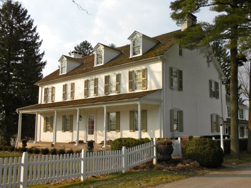
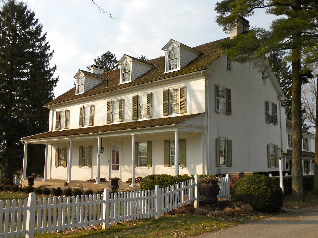
White Chimneys was listed on the National Register of Historic Places in 1975.
Nothing in the archives for these yearsWeddings on Main Street, storms, parades, school pictures, the old store. If it’s in your family album, it belongs here.
The Salisbury Township post office opened in 1806, the earliest record of the town by name (U.S. post office records).
How does Salisbury Township rank for history?
Salisbury Township is more historic than 76% of U.S. towns, #388 of 1,035 in Pennsylvania. The History grade combines the town’s founding era, the share of homes built before 1940 and its National Register listings. It’s a character grade, so it isn’t part of the overall grade. How it works.
What is on the National Register in Salisbury Township?
One place: the White Chimneys (listed 1975).
How old are the homes in Salisbury Township?
19% of Salisbury Township’s homes were built before 1940 (Census estimate, ±5.0 points), against a typical 18% for a Pennsylvania town; the median home was built in 1986.
Founding dates: Wikidata, Wikipedia, the U.S. post office records of Blevins & Helbock (CC0) and the Census. Homes by year built: Census ACS 2020–24. National Register of Historic Places: National Park Service (list of May 22, 2026). Old photos, postcards and papers: Wikimedia Commons, the Library of Congress and other public archives, credited on each item’s page. Maps: U.S. Geological Survey historical topographic maps (via Esri) and Sanborn fire-insurance maps (Library of Congress). History text and census tables: Wikipedia (CC BY-SA 4.0). Places that used to be: USGS Geographic Names Information System (2021).
From Wikimedia Commons (6), the National Register of Historic Places (1), Wikipedia, U.S. Geological Survey historical maps, U.S. Census counts (via Wikipedia), the US Post Offices dataset (Blevins & Helbock) and the USGS Geographic Names Information System. Archive images are copied here with their credits and licenses, shown on each photo’s page. Refreshed monthly.


 2014
 2010
 2007