1 of Fairview Township’s places is on the National Register
More historic than 40% of U.S. towns · #854 of 1,035 in Pennsylvania. What drives it
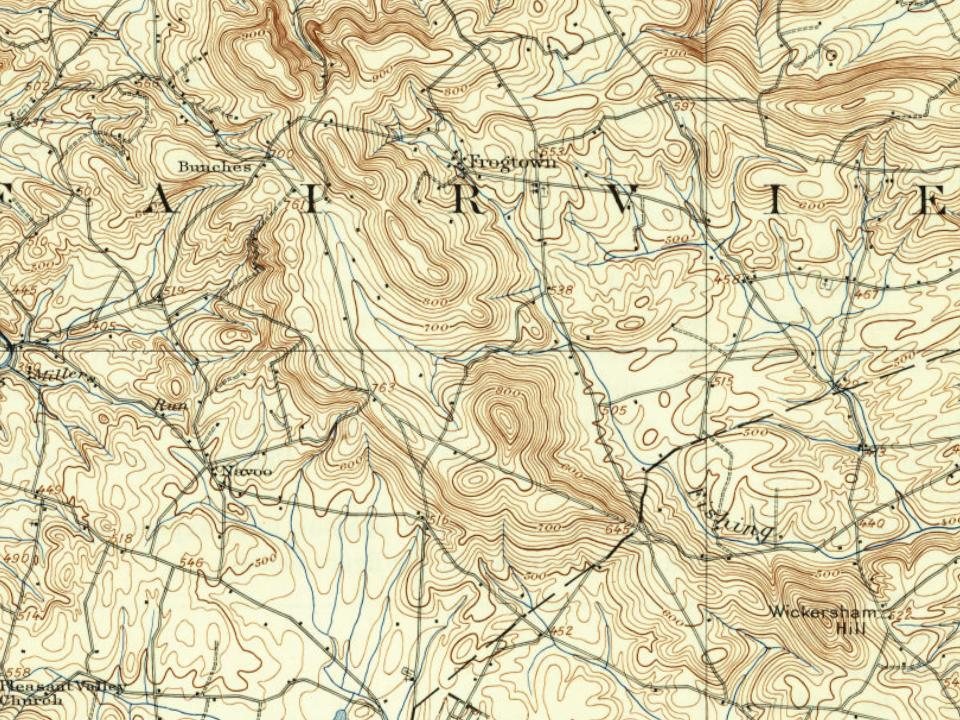
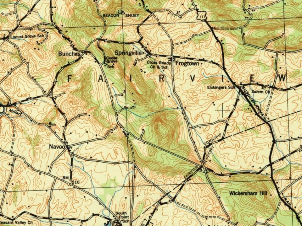
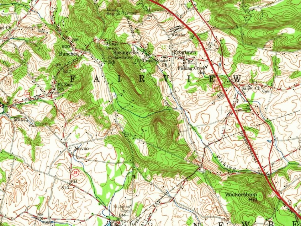
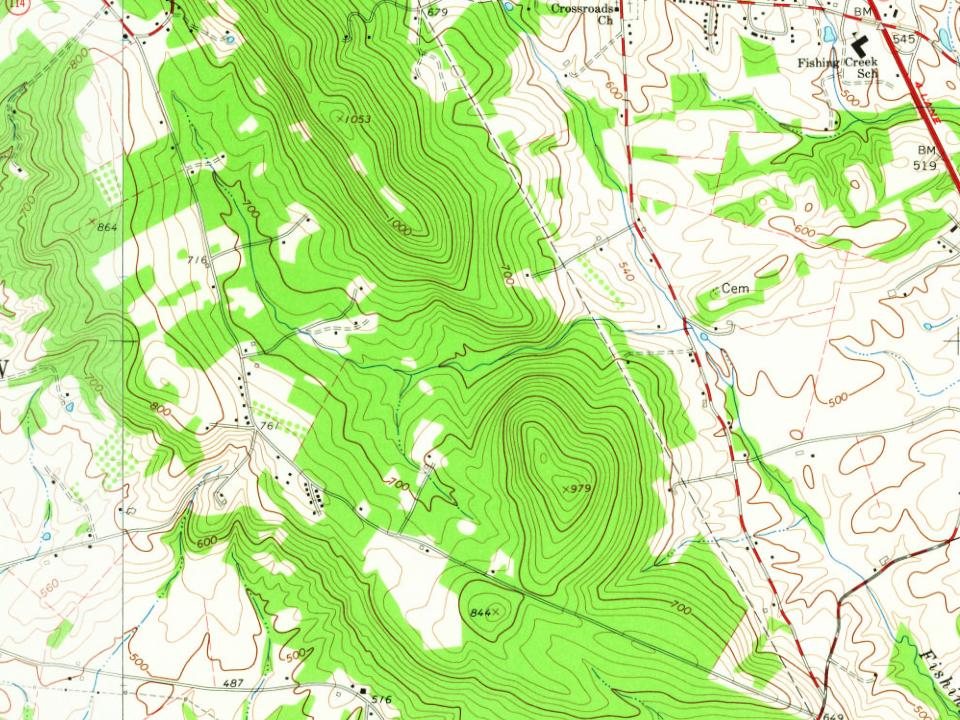
Its Register listing is the Etters Bridge. Most of Fairview Township was built recently: 7% of its homes predate 1940 and the median home dates from 1983. Below: maps from 1906 on and the census since 1850.
On its age, its old homes and the National Register, Fairview Township is more historic than 40% of U.S. towns, #854 of 1,035 in Pennsylvania. Its National Register listings hold the grade up; its share of homes from before 1940 pulls it down.
C+
HistoryA character grade: shown, never part of Fairview Township’s overall grade.
Pennsylvania towns list about as much on the Register as the country (a typical Pennsylvania town has 2.1 per 10,000 residents, the U.S. 2.4), so Fairview Township’s 0.6 sits near the middle of its state (52% of Pennsylvania towns have fewer) while its 1 listings outnumber those of 51% of U.S. towns.
How sure. Graded on two of the three inputs, so a change in either one moves the letter more than it would with three. The pre-1940 share (±2.5 points) is firm at this size.
Founding year: our sources. Homes: Census ACS 2020–24. National Register: National Park Service, May 2026 list; each listing counted once (boundary changes and added documentation belong to their listing), and a historic district counts its contributing buildings. How TownRatings grades history →
What stands out about Fairview Township’s past
Read from the archive, the National Register and the record. The page puts what stands out first.
Lost post offices, old corners, places now gone and burying grounds
Two other post offices opened and closed inside today’s town.
New Market
1823–1918
Cedar Grove
1863–1866
18201920today
Hamlets and corners on the map
BunchesCedar PointCherry HillColonial WoodsColonial Woods SouthFair AcresFairview ParkFrogtownGreen Lane FarmsLocust Manor Mobile Home ParkMarsh RunMeadowbrook Mobile Home ParkNauvooNauvoo EstatesNew MarketPinetownRedland VillageReesers SummitRemeos Mobile Home ParkSlaseman Mobile Home ParkSpringvilleTimber RidgeWestfield Terrace
Gone or out of use
Crossroads SchoolchurchNew Cumberland Army Air Fieldmilitary
5cemeteries and burying grounds inside Fairview Township
Fairview BethelFisherMount OliveRoof Memorial ParkSaint Johns
US Post Offices dataset (Blevins & Helbock, CC0). Places and cemeteries from the USGS Geographic Names Information System (2021).
Help out
Start Fairview Township’s collection
The first neighbors to add old photos shape how Fairview Township’s history is told.
Decades since 1900 with photos
00s10s20s30s40s50s60s70s80s90s
0 of 10 decades. The empty ones are waiting for someone’s album.
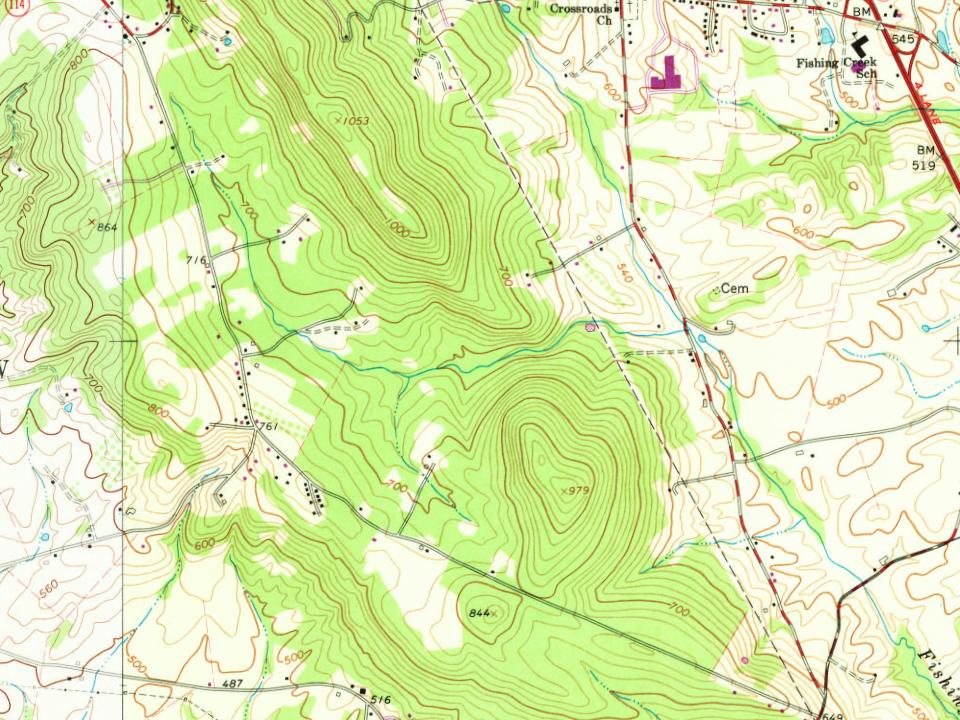
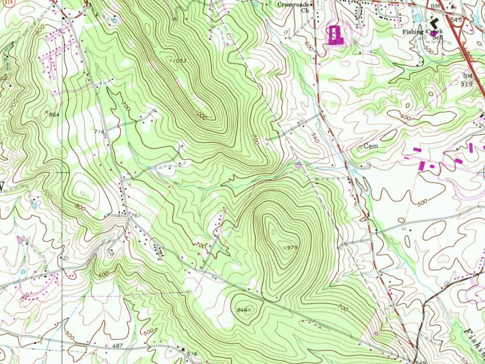
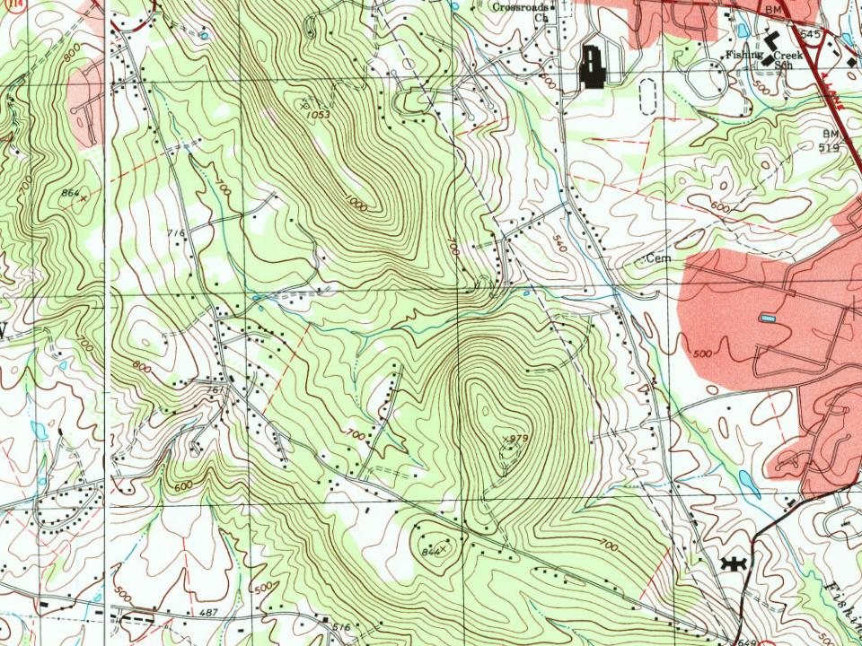
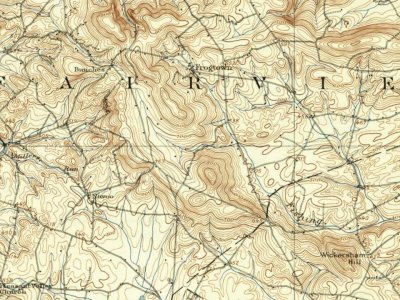
Every edition of the U.S. Geological Survey’s map of Fairview Township. Tap a year, or press play to watch the town change.
1906New Cumberland sheet · 1:62,500
U.S. Geological Survey historical topographic maps (public domain), via Esri’s collection of the scans. The red ring marks the center of Fairview Township.
Originally settled by the English Quakers from Chester County as early as 1730, and German immigrants from the York and Hanover areas in the late 18th century, much of the land now encompassed by Fairview Township was part of Pennsborough Township, Lancaster County. York County, when separated from Lancaster in 1749, had no definitely established northern boundary. In 1751, after the formation of Cumberland from Lancaster County, the Provincial Assembly passed a special act making Yellow Breeches Creek the official boundary between counties. At that time, the lands in this area were annexed to Newberry Township, where they remained until February 1803, when the York County Court approved petitions of area citizens to create the Township of Fairview.
Passages that mention Fairview Township, cut from the printed page as they were published.
History of York County Pennsylvania From the Earliest Time to the Present1886Read the page →
Read the text
thence came down the Susquehanna River on an ark, then a common craft for floating lumber and produce down the stream to market. He located in Fairview Township, in the vicinity of Lewisberry, about 1797. He brought with him many books of science and literature, and soon afterward engaged to teach the youths of the intelligent (Juaker settlement. He was a man of undoubted
Text read by machine from the scan; it may contain errors.
thence came down the Susquehanna River on an ark, then a common craft for floating lumber and produce down the stream to market. He located in Fairview Township, in the vicinity of Lewisberry, about 1797. He brought with him many books of science and literature, and soon afterward engaged to teach the youths of the intelligent (Quaker settlement. He was a man of undoubted
Text read by machine from the scan; it may contain errors.
History of York County, Pennsylvania1886 · page 643Read the page →
Read the text
Mount Zion Lutheran Church. — Religious services were first held in a schoolhouse, about one and a half miles from Mount Zion Church, in Fairview Township. As the membership increased the schoolhouse became too small, and the people felt the need of a larger building. One acre of ground was bought. A building committee composed of
Text read by machine from the scan; it may contain errors.
History of York County Pennsylvania From the Earliest Time to the Present1886Read the page →
Read the text
Fairview Township was one of the seven districts of York County that at once accepted the provisions of the act of 1834, establishing the common school system.
Text read by machine from the scan; it may contain errors.
Scans and text from the Internet Archive. Books published in 1930 or earlier, which are in the public domain.
Timeline
Fairview Township, 1823 to 1918
Woven from the archive, old maps, post office records, the National Register and the people born here.
Fairview Township is more historic than 40% of U.S. towns, #854 of 1,035 in Pennsylvania. The History grade combines the town’s founding era, the share of homes built before 1940 and its National Register listings. It’s a character grade, so it isn’t part of the overall grade. How it works.
What is on the National Register in Fairview Township?
One place: the Etters Bridge (listed 1986).
How old are the homes in Fairview Township?
7% of Fairview Township’s homes were built before 1940 (Census estimate, ±2.5 points), against a typical 18% for a Pennsylvania town; the median home was built in 1983.
Founding dates: Wikidata, Wikipedia, the U.S. post office records of Blevins & Helbock (CC0) and the Census. Homes by year built: Census ACS 2020–24. National Register of Historic Places: National Park Service (list of May 22, 2026). Old photos, postcards and papers: Wikimedia Commons, the Library of Congress and other public archives, credited on each item’s page. Maps: U.S. Geological Survey historical topographic maps (via Esri) and Sanborn fire-insurance maps (Library of Congress). History text and census tables: Wikipedia (CC BY-SA 4.0). Places that used to be: USGS Geographic Names Information System (2021).
From Wikimedia Commons (17), the National Register of Historic Places (1), Wikipedia, U.S. Geological Survey historical maps, U.S. Census counts (via Wikipedia), the US Post Offices dataset (Blevins & Helbock), the USGS Geographic Names Information System and old county and town histories (Internet Archive). Archive images are copied here with their credits and licenses, shown on each photo’s page. Refreshed monthly.



 2026
 2026
 2026
 2025
 2025
 2025
 2025
 2021
 2014
 2014
 2014
 2013
 2013
 2013
 2009
 2009
 2009
