The Fairview Township post office opened in 1813, the earliest record of the town by name. Two smaller post offices, Sterrettina (1851) and Avonia (1869), opened inside today’s town and later closed.
First census: 7,518 in 19802020 census: 11,138213 years
How historic is Fairview Township?
B+
More historic than 69% of U.S. towns, on its age, its old homes and the National Register.
Founding year: the first Fairview Township post office (Blevins & Helbock, CC0).The full story ↓
History grade
What drives Fairview Township’s History grade
On its age, its old homes and the National Register, Fairview Township is more historic than 69% of U.S. towns, #489 of 1,035 in Pennsylvania. All 3 inputs are above most U.S. towns; its age ranks highest and its National Register listings lowest.
B+
HistoryA character grade: shown, never part of Fairview Township’s overall grade.
Pennsylvania towns list about as much on the Register as the country (a typical Pennsylvania town has 2.1 per 10,000 residents, the U.S. 2.4), so Fairview Township’s 0.9 sits near the middle of its state (53% of Pennsylvania towns have fewer) while its 1 listings outnumber those of 51% of U.S. towns.
How sure. Graded on any two of the three inputs instead, the letter would range from B to B+. The pre-1940 share is a Census survey estimate (±3.9 points). The founding year is the first post office, not a stated founding date.
Founding year: the first post office (other dates in Quick answers). Homes: Census ACS 2020–24. National Register: National Park Service, May 2026 list; each listing counted once (boundary changes and added documentation belong to their listing), and a historic district counts its contributing buildings. How TownRatings grades history →
What stands out about Fairview Township’s past
Read from the archive, the National Register and the record. The page puts what stands out first.
Lost post offices, old corners, places now gone and burying grounds
Two other post offices opened and closed inside today’s town.
Fairview
1813–today
Sterrettina
1851–1904
Avonia
1869–1916
18101920today
Hamlets and corners on the map
AvoniaFairviewManchester BeachSterrettania
Gone or out of use
Bethel ChurchchurchKeefers Fieldairport
9cemeteries and burying grounds inside Fairview Township
Allen FamilyDaggettFairviewGate of HeavenOld AlmshouseRuhlSaint James LutheranSaint Stephen's Episcopal Church ColumbariumWeis Library Church
US Post Offices dataset (Blevins & Helbock, CC0). Places and cemeteries from the USGS Geographic Names Information System (2021).
On the map
Fairview Township on the map, 1899 to 1990
Every edition of the U.S. Geological Survey’s map of Fairview Township. Tap a year, or press play to watch the town change.
1899Erie sheet · 1:62,500
U.S. Geological Survey historical topographic maps (public domain), via Esri’s collection of the scans. The red ring marks the center of Fairview Township.
One of Erie County's sixteen original townships, Fairview Township was established in 1797. It reportedly took its name from the utterance that year of a businessman, Colonel Thomas Forster, who said of his land purchase at the mouth of Walnut Creek: "This is the fairest view I have seen yet."
In 1832, the township was downsized with the redistribution of part of its territory to the newly formed Girard Township.
Passages that mention Fairview Township, cut from the printed page as they were published.
History of Erie county, Pennsylvania1884 · page 742Read the page →
Read the text
breast of the dam at Bear's mill. On Trout Run — Culverts, at the grist mill and at the paper mill. On Little Elk Creek — Silverthorn, Galusha and Town line (built jointly by MeKean and Fairview Townships). -■ The manufacturing industries of Fairview Township are as follows: On Bear Run — Nason's grist mill. On Walnut Creek — Weigle's grist mill, Lohrer's grist mill and Morgan & Co.'s paper mill, just below Avonia or Fairview Station (the paper mill was destroyed by fire August 30, 1883), and Feidler's grist mill at the Lake road (now owned by McKee & Kermick).
Text read by machine from the scan; it may contain errors.
History of Erie county, Pennsylvania1884 · page 762Read the page →
Read the text
merging with the main stream. Marsh Run heads in the west, flows eastward, and empties into the Conneaut about a mile from Albion Depot, having a length of four or five miles. The dividing ridge between the waters of the lake and the Allegheny turns to the south in Fairview Township, and follows nearly the line of Conneaut Creek into Crawford County. The frequent streams and their unusiial crookedness are a source of heavy expense to the tax-payers, the number of bridges and the cost of keeping them up being undoubtedly greater than in any other township of the county. Not to name those on the
Text read by machine from the scan; it may contain errors.
Scans and text from the Internet Archive. Books published in 1930 or earlier, which are in the public domain.
Timeline
Fairview Township, 1813 to 1916
Woven from the archive, old maps, post office records, the National Register and the people born here.
The Fairview Township post office opened in 1813, the earliest record of the town by name (U.S. post office records).
How does Fairview Township rank for history?
Fairview Township is more historic than 69% of U.S. towns, #489 of 1,035 in Pennsylvania. The History grade combines the town’s founding era, the share of homes built before 1940 and its National Register listings. It’s a character grade, so it isn’t part of the overall grade. How it works.
What is on the National Register in Fairview Township?
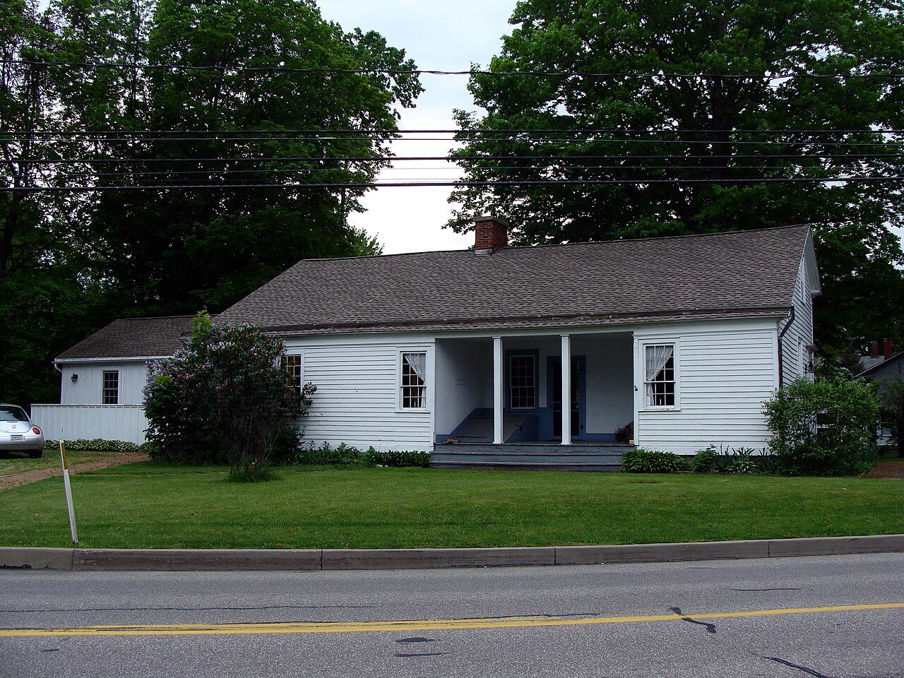
One place: the Sturgeon House (listed 1980).
How old are the homes in Fairview Township?
14% of Fairview Township’s homes were built before 1940 (Census estimate, ±3.9 points), against a typical 18% for a Pennsylvania town; the median home was built in 1974.
Founding dates: Wikidata, Wikipedia, the U.S. post office records of Blevins & Helbock (CC0) and the Census. Homes by year built: Census ACS 2020–24. National Register of Historic Places: National Park Service (list of May 22, 2026). Old photos, postcards and papers: Wikimedia Commons, the Library of Congress and other public archives, credited on each item’s page. Maps: U.S. Geological Survey historical topographic maps (via Esri) and Sanborn fire-insurance maps (Library of Congress). History text and census tables: Wikipedia (CC BY-SA 4.0). Places that used to be: USGS Geographic Names Information System (2021).
From Wikimedia Commons (8), Wikidata (2), the National Register of Historic Places (1), Wikipedia, Wikidata and Wikipedia for famous people, U.S. Geological Survey historical maps, U.S. Census counts (via Wikipedia), the US Post Offices dataset (Blevins & Helbock), the USGS Geographic Names Information System and old county and town histories (Internet Archive). Archive images are copied here with their credits and licenses, shown on each photo’s page. Refreshed monthly.




 2024
 2024
 2024
 2024
 2011
 2009
 2008
 2006