McKean Township dates to 1795, and 1 of its places is on the National Register
More historic than 62% of U.S. towns · #577 of 1,035 in Pennsylvania. What drives it
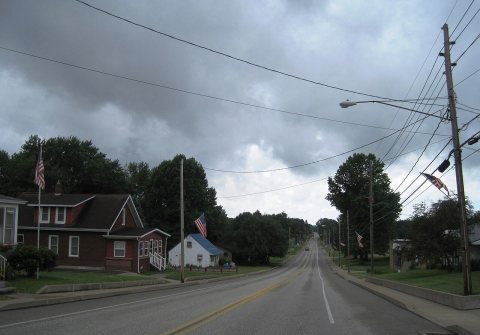
Most of McKean Township was built recently: 8% of its homes predate 1940 and the median home dates from 1982. Its Register listing is the Manchester School No. 3. Below: 3 old photos and papers, maps from 1967 on, and the census since 1870.
On its age, its old homes and the National Register, McKean Township is more historic than 62% of U.S. towns, #577 of 1,035 in Pennsylvania. Its age holds the grade up; its share of homes from before 1940 pulls it down.
B
HistoryA character grade: shown, never part of McKean Township’s overall grade.
Pennsylvania towns list about as much on the Register as the country (a typical Pennsylvania town has 2.1 per 10,000 residents, the U.S. 2.4), so McKean Township’s 2.3 sits near the middle of its state (58% of Pennsylvania towns have fewer) while its 1 listings outnumber those of 51% of U.S. towns.
NoteThe founding year comes from Wikidata alone; no second source gives 1795.
How sure. Graded on any two of the three inputs instead, the letter would range from B− to B+. The pre-1940 share is a Census survey estimate (±3.5 points).
Founding year: Wikidata (other dates in Quick answers). Homes: Census ACS 2020–24. National Register: National Park Service, May 2026 list; each listing counted once (boundary changes and added documentation belong to their listing), and a historic district counts its contributing buildings. How TownRatings grades history →
What stands out about McKean Township’s past
Read from the archive, the National Register and the record. The page puts what stands out first.
Wikipedia doesn’t have a history of McKean Township yet. The photos, dates and memories neighbors add here are how it gets written.
McKean is a borough in Erie County, Pennsylvania. The population was 475 at the time of the 2020 census. It is part of the Erie–Meadville combined statistical area. McKean was known as "Middleboro" until it officially changed its name in 1970.
McKean Township was established in 1795. Its population held steady between the last two censuses: 4,409 in 2010, 4,437 in 2020.
Intro from Wikipedia. Population: U.S. Census Bureau.
From the old history books
What they wrote about McKean Township in 1884
Passages that mention McKean Township, cut from the printed page as they were published.
History of Erie county, Pennsylvania1884 · page 779Read the page →
Read the text
McKEAN TOWNSHIP. 779 The first school in McKean Township was taught during the winter of 1811-12 by Seth Spencer, who hailed from Fredonia, N. Y., and returned thither soon after completing this primal school. Among his pupils were Seth Stancliff, still li-ving at Erie at the age of ninety years, Joseph Weldon, who lives at West Springfield, this county, and who was the tirst male white child born in McKean Township; Anna Stanclift, living in California, at the age of eighty-eight years; Levi Grant, Eunice Joiner and others. Betsy and
Text read by machine from the scan; it may contain errors.
History of Erie county, Pennsylvania1884 · page 781Read the page →
Read the text
Benjamin Oullom built the first house in Middleboro in 1810, on the site of Hartley Lampson's. He died in McKean Township in May, 1883, at the_ age of ninety-six years. Middleboro contains a Catholic and a Methodist Episcopal Church, a schoolhouse, one hotel, two dry goods stores, one grocery, one drug store, four blacksmith shops, one harness shop, one wagon, carriage and sleigh factory, two wagon shops, one saw mill, one saw, planing and shingle mill, two millinery stores and one shoe-maker shop. The public hall of the village is in the upper story of Peck's Block. W. A. Bean's cheese factory is
Text read by machine from the scan; it may contain errors.
Scans and text from the Internet Archive. Books published in 1930 or earlier, which are in the public domain.
By decade
McKean Township, decade by decade
One decade in the archive so far: the 1880s. Scroll each row; tap a photo for its story.
Nothing in the archives for these yearsWeddings on Main Street, storms, parades, school pictures, the old store. If it’s in your family album, it belongs here.
Every edition of the U.S. Geological Survey’s map of McKean Township. Tap a year, or press play to watch the town change.
1967Edinboro North sheet · 1:24,000
U.S. Geological Survey historical topographic maps (public domain), via Esri’s collection of the scans. The red ring marks the center of McKean Township.
Then & now
Stand where they stood
No then-and-now pairs yet. Take a photo from the same spot as an old one and they appear here side by side.
Retake this viewThe Great Kinzua Bridge near Alton, Pa. Highest bridge in the world, 1880
Find the spot, match the angle, and add your photo. It becomes the first then-and-now pair on McKean Township’s page.
In 1795, according to Wikidata. McKean Township’s post office opened in 1876, and the census of 1870 counted 126 people here.
How does McKean Township rank for history?
McKean Township is more historic than 62% of U.S. towns, #577 of 1,035 in Pennsylvania. The History grade combines the town’s founding era, the share of homes built before 1940 and its National Register listings. It’s a character grade, so it isn’t part of the overall grade. How it works.
What is on the National Register in McKean Township?
One place: the Manchester School No. 3 (listed 2014).
How old are the homes in McKean Township?
8% of McKean Township’s homes were built before 1940 (Census estimate, ±3.5 points), against a typical 18% for a Pennsylvania town; the median home was built in 1982.
Founding dates: Wikidata, Wikipedia, the U.S. post office records of Blevins & Helbock (CC0) and the Census. Homes by year built: Census ACS 2020–24. National Register of Historic Places: National Park Service (list of May 22, 2026). Old photos, postcards and papers: Wikimedia Commons, the Library of Congress and other public archives, credited on each item’s page. Maps: U.S. Geological Survey historical topographic maps (via Esri) and Sanborn fire-insurance maps (Library of Congress). History text and census tables: Wikipedia (CC BY-SA 4.0). Places that used to be: USGS Geographic Names Information System (2021).
From Wikimedia Commons (7), the Library of Congress (3), the National Register of Historic Places (1), U.S. Geological Survey historical maps, U.S. Census counts (via Wikipedia), the US Post Offices dataset (Blevins & Helbock), the USGS Geographic Names Information System and old county and town histories (Internet Archive). Archive images are copied here with their credits and licenses, shown on each photo’s page. Refreshed monthly.


 1880
 Date?
 2024
 2024
 2024
 2024
 2024
 2024
 2024

