On its age, its old homes and the National Register, Cambridge Township is more historic than 88% of U.S. towns. All 2 inputs are above most U.S. towns; its National Register listings ranks highest and its share of homes from before 1940 lowest.
A
HistoryA character grade: shown, never part of Cambridge Township’s overall grade.
Pennsylvania towns list about as much on the Register as the country (a typical Pennsylvania town has 2.1 per 10,000 residents, the U.S. 2.4), so Cambridge Township’s 26.9 sits above most of its state (84% of Pennsylvania towns have fewer) while its 4 historic buildings outnumber those of 68% of U.S. towns.
How sure. Graded on two of the three inputs, so a change in either one moves the letter more than it would with three. The pre-1940 share is a Census survey estimate (±6.8 points).
Founding year: our sources. Homes: Census ACS 2020–24. National Register: National Park Service, May 2026 list; each listing counted once (boundary changes and added documentation belong to their listing), and a historic district counts its contributing buildings. How TownRatings grades history →
What stands out about Cambridge Township’s past
Read from the archive, the National Register and the record. The page puts what stands out first.
Every edition of the U.S. Geological Survey’s map of Cambridge Township. Tap a year, or press play to watch the town change.
1923Cambridge Springs sheet · 1:62,500
U.S. Geological Survey historical topographic maps (public domain), via Esri’s collection of the scans. The red ring marks the center of Cambridge Township.
The story so far
Cambridge Township, in brief
Wikipedia doesn’t have a history of Cambridge Township yet. The photos, dates and memories neighbors add here are how it gets written.
Cambridge Township is a township in Crawford County, Pennsylvania, United States. The population was 1,448 at the 2020 census.
Between the 2010 and 2020 censuses its population fell from 1,563 to 1,439 (-8%).
Intro from Wikipedia. Population: U.S. Census Bureau.
From the old history books
What they wrote about Cambridge Township in 1885
Passages that mention Cambridge Township, cut from the printed page as they were published.
history of crawford county, pennsylvania1885 · page 704Read the page →
Read the text
Rockville Methodist Episcopal Church was organized as the Gravel Run Church in 1810, by Rev. Joshua Monroe, at the dwelling-house of John Shearer, situated in the southwest corner of Cambridge Township. In 1817 a log meeting house was built in Cambridge Township, immediately northwest of the Woodcock Borough limits, and services held therein until 1839, when a brick edifice was erected within the borough at a cost of $1,800. It has ever since been the house of worship. In 1879 a parsonage was erected at Woudcock at a cost of $700. An old parsonage stood in the village but has not been occu-
Text read by machine from the scan; it may contain errors.
history of crawford county, pennsylvania1885 · page 518Read the page →
Read the text
Cambridgeboro is located on the banks of French Creek near the center of Cambridge Township. It had in 1880 a population of 674 and in 1870 452. The village is quite an old one, though for many years its growth was very slow. As mentioned in Cambridge Township the Van Court’s were the first settlers on Tract 127, upon which the borough largely stands. Job Van Court’s cabin occupied the site of A. B. Ross’ residence, Venango Avenue.
Text read by machine from the scan; it may contain errors.
History of Crawford County, Pennsylvania1885 · page 970Read the page →
Read the text
now living, viz. : James, William, Jane, Charlotte, Robert, Chester, Loretta, Marian and Ellen. Our subject was educated in the county schools, and at the age of seventeen he left home and engaged in a sawmill knovsm as Marvin's Mill, located in Cambridge Township, this county. At the end of Ave years he was employed at the " Johnstown mill," and at the expiration of three years he bought the "Purse mill," which he operated for thirteen years with success. Selling hig mill he went to Forest County, Penn., and engaged in lumbering and erecting mills for about six years; afterward bought the Isaac
Text read by machine from the scan; it may contain errors.
History of Crawford County, Pennsylvania1885 · page 813Read the page →
Read the text
abeth (Waterhouse) Rhodes, early settlers of that township. Our subject was raised on a farm and received his early educatiou at the common schools. He attended the Mount Union College at Alliance, Ohio, two years, graduating from that institution in 1874. He located in Cambridge Township, this, county, in 1875, and embarked in the manufacture of lumber, in which business he has been profitably engaged up to the present time. Mr. Rhodes was married May 31, 1875, to Aurie, daughter of Philander G. and Clarissa (Mitchell) Porter, of Cambridge Township, this county. By this union there
Text read by machine from the scan; it may contain errors.
Scans and text from the Internet Archive. Books published in 1930 or earlier, which are in the public domain.
Timeline
Cambridge Township, 1866 to 1923
Woven from the archive, old maps, post office records, the National Register and the people born here.
Cambridge Township is more historic than 88% of U.S. towns. The History grade combines the town’s founding era, the share of homes built before 1940 and its National Register listings. It’s a character grade, so it isn’t part of the overall grade. How it works.
What is on the National Register in Cambridge Township?
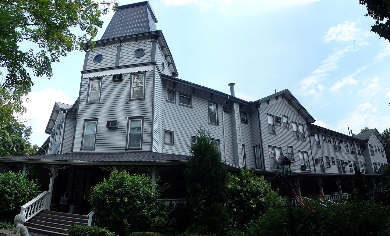
One place: the Riverside Hotel (listed 1978).
How old are the homes in Cambridge Township?
22% of Cambridge Township’s homes were built before 1940 (Census estimate, ±6.8 points), against a typical 18% for a Pennsylvania town; the median home was built in 1974.
Founding dates: Wikidata, Wikipedia, the U.S. post office records of Blevins & Helbock (CC0) and the Census. Homes by year built: Census ACS 2020–24. National Register of Historic Places: National Park Service (list of May 22, 2026). Old photos, postcards and papers: Wikimedia Commons, the Library of Congress and other public archives, credited on each item’s page. Maps: U.S. Geological Survey historical topographic maps (via Esri) and Sanborn fire-insurance maps (Library of Congress). History text and census tables: Wikipedia (CC BY-SA 4.0). Places that used to be: USGS Geographic Names Information System (2021).
From Wikimedia Commons (6), the National Register of Historic Places (1), U.S. Geological Survey historical maps, U.S. Census counts (via Wikipedia), the US Post Offices dataset (Blevins & Helbock), the USGS Geographic Names Information System and old county and town histories (Internet Archive). Archive images are copied here with their credits and licenses, shown on each photo’s page. Refreshed monthly.



 2022
 2015
 2006
 2006
 2006
 2006


