Every edition of the U.S. Geological Survey’s map of Venango Township. Tap a year, or press play to watch the town change.
1923Cambridge Springs sheet · 1:62,500
U.S. Geological Survey historical topographic maps (public domain), via Esri’s collection of the scans. The red ring marks the center of Venango Township.
The story so far
Venango Township, in brief
Wikipedia doesn’t have a history of Venango Township yet. The photos, dates and memories neighbors add here are how it gets written.
Venango is a borough in Crawford County, Pennsylvania, United States. The population was 210 at the 2020 census, down from 239 at the 2010 census, down from 288 in 2000.
Venango Township was established in 1838. Between the 2010 and 2020 censuses its population fell from 997 to 946 (-5%).
Intro from Wikipedia. Population: U.S. Census Bureau.
From the old history books
What they wrote about Venango Township in 1885
Passages that mention Venango Township, cut from the printed page as they were published.
History of Crawford County, Pennsylvania1885 · page 969Read the page →
Read the text
George Newton, of Corning, N. Y. Here he continued one year, when he withdrew to Greene County and engaged in the tan bark business, following the same two years, and then worked on a farm one year. In 1836 he came by canal to Buffalo, by lake to Erie City, and by stage to Venango Township, this county, and there took employment in the Klecknei*8aw-mill, at which he was engaged for four years. While there he built the first house in the village of Venango, soon after having helped to lay out the place. In 1840 Mr.
Text read by machine from the scan; it may contain errors.
History of Crawford County, Pennsylvania1885 · page 1116Read the page →
Read the text
living: Laurin L., of Titusville; Isaiah, in McKean County; Paul and Franklin. Cirrel Hills first settled in Cussewago Township on a part of the farm now owned by James Nash; he afterward bought the farm now owned by Calvin Waldo, and in 1839 came to Venango Township and located on the farm now occupied by our subject, where he remained one year. He then sold his place and went to Michigan, but after an absence of nearly a year returned to this township and repurchased the property he had sold the year previous; this he cleared, improved and lived on till his death, which occurred iu February,
Text read by machine from the scan; it may contain errors.
history of crawford county, pennsylvania1885 · page 608Read the page →
Read the text
northwest corner of Athens, the western part of Bloomfield, the south part of Cambridge, and all of Rockdale that lies east of French Creek. The township was re-formed almost as it now exists in 1829, the portion west of French Creek having been part of Venango Township previous to that date. Itis one of the northern townships, bounded on the north by Erie County, on the east by Bloomfield Township and a corner of Athens, on the south by Richmond and on the west by Cambridge. It contains 20,953 acres, and in 1850 had a population of 1,086; in 1860, of 1,638; in 1870, of 1,664; in 1880, of 1,603.
Text read by machine from the scan; it may contain errors.
Scans and text from the Internet Archive. Books published in 1930 or earlier, which are in the public domain.
By decade
Venango Township, decade by decade
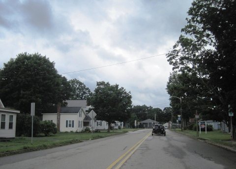
One decade in the archive so far: the 1900s. Scroll each row; tap a photo for its story.
Nothing in the archives for these yearsWeddings on Main Street, storms, parades, school pictures, the old store. If it’s in your family album, it belongs here.
Founding dates: Wikidata, Wikipedia, the U.S. post office records of Blevins & Helbock (CC0) and the Census. Homes by year built: Census ACS 2020–24. National Register of Historic Places: National Park Service (list of May 22, 2026). Old photos, postcards and papers: Wikimedia Commons, the Library of Congress and other public archives, credited on each item’s page. Maps: U.S. Geological Survey historical topographic maps (via Esri) and Sanborn fire-insurance maps (Library of Congress). History text and census tables: Wikipedia (CC BY-SA 4.0). Places that used to be: USGS Geographic Names Information System (2021). How TownRatings grades history →
From Wikimedia Commons (9), U.S. Geological Survey historical maps, U.S. Census counts (via Wikipedia), the USGS Geographic Names Information System and old county and town histories (Internet Archive). Archive images are copied here with their credits and licenses, shown on each photo’s page. Refreshed monthly.


 2024
 2024
 2024
 2024
 2024
 2024
 2006
 2006