Bethlehem dates to 1741, and 31% of its homes were built before 1940
Among the most historic 1% of U.S. towns · #33 of 1,035 in Pennsylvania. What drives it
22 places in town are on the National Register, among them 3 National Historic Landmarks and seven historic districts with 641 buildings between them. Below: 22 old photos and papers, maps from 1894 on, and the census since 1850.
Founding year: Wikidata. First post office: 1793.The full story ↓
History grade
What drives Bethlehem’s History grade
On its age, its old homes and the National Register, Bethlehem is among the most historic 1% of U.S. towns, #33 of 1,035 in Pennsylvania. All 3 inputs put Bethlehem near the top nationally; its age ranks highest.
A+
HistoryA character grade: shown, never part of Bethlehem’s overall grade.
Pennsylvania towns list about as much on the Register as the country (a typical Pennsylvania town has 2.1 per 10,000 residents, the U.S. 2.4), so Bethlehem’s 104 sits above most of its state (89% of Pennsylvania towns have fewer) while its 813 historic buildings outnumber those of 98% of U.S. towns.
NoteThe founding year comes from Wikidata alone; no second source gives 1741.
How sure. Graded on any two of the three inputs instead, the letter would still be A+. The pre-1940 share (±2.1 points) is firm at this size.
Founding year: Wikidata (other dates in Quick answers). Homes: Census ACS 2020–24. National Register: National Park Service, May 2026 list; each listing counted once (boundary changes and added documentation belong to their listing), and a historic district counts its contributing buildings. How TownRatings grades history →
What stands out about Bethlehem’s past
Read from the archive, the National Register and the record. The page puts what stands out first.
The country’s official list of buildings and places worth saving. 3 are National Historic Landmarks, the highest tier. Boundary changes and added documentation are counted with their listing.
Prior to European settlements, the areas around present-day Bethlehem and its surrounding locales along the Delaware River and its tributaries in eastern Pennsylvania were inhabited by various indigenous peoples, including the Algonquian-speaking Lenape, which had three main divisions, known by the dialects, the Unami, Unalachtigo, and Munsee. They traded with the Dutch and then British colonialists in the Mid-Atlantic region in present-day Connecticut, Delaware, Long Island, Maryland, New Jersey, the lower Hudson Valley in New York, and other regions in Pennsylvania.
Passages that mention Bethlehem, cut from the printed page as they were published.
A history of Bethlehem, Pennsylvania, 1741-18921903 · page 737Read the page →
Read the text
Besides the damage doiie to the old bridge, one span of which was carried away, and the great loss sufifered by the Lehigh Coal and Navigation Company, the Lehigh Valley Railroad Company and the Lehigh Zinc Company, the heaviest losers at Bethlehem were naturally those who owned industries in the old part of Bethlehem, along the Monocacy, in Old South Bethlehem and on the Sand Island.
Text read by machine from the scan; it may contain errors.
A history of Bethlehem, Pennsylvania, 1741-18921903 · page 163Read the page →
Read the text
During those months of 1743, while further minor improvements were being added in the village of Bethlehem itself, the cleared and cultivated area on the original Allen tract was being extended, and a first orchard was planted with young apple trees brought from Oley on March 27, further activities were prosecuted on the south side of the Lehigh. It early became clear to the men of Bethlehem that the land lying along the south bank of the river and rising to the south-west, where they traveled the path to Maguntsche, was too
Text read by machine from the scan; it may contain errors.
Mr. Schwab has told his vision of the community of Bethlehem as an ideal industrial city, with homes, parks, libraries, educational, art, and musical facilities that shall be exceptional. Upon several public occasions he has referred to his purpose of presenting to the city of Bethlehem a temple of music to be the home of the Bach Choir and also of the Lehigh Valley Symphony
Text read by machine from the scan; it may contain errors.
Scans and text from the Internet Archive. Books published in 1930 or earlier, which are in the public domain.
Timeline
Bethlehem, 1741 to 1962
Woven from the archive, old maps, post office records, the National Register and the people born here.
Nothing in the archives for these yearsWeddings on Main Street, storms, parades, school pictures, the old store. If it’s in your family album, it belongs here.
In 1741, according to Wikidata. Bethlehem’s post office opened in 1793, and the census of 1850 counted 1,516 people here.
How does Bethlehem rank for history?
Bethlehem is among the most historic 1% of U.S. towns, #33 of 1,035 in Pennsylvania. The History grade combines the town’s founding era, the share of homes built before 1940 and its National Register listings. It’s a character grade, so it isn’t part of the overall grade. How it works.
What is on the National Register in Bethlehem?
22 listings, 3 of them National Historic Landmarks: 15 buildings, among them the Old Waterworks (a National Historic Landmark since 1981), and 7 historic districts with 641 contributing buildings. 813 historic buildings in all.
How old are the homes in Bethlehem?
31% of Bethlehem’s homes were built before 1940 (Census estimate, ±2.1 points), against a typical 18% for a Pennsylvania town; the median home was built in 1957.
Founding dates: Wikidata, Wikipedia, the U.S. post office records of Blevins & Helbock (CC0) and the Census. Homes by year built: Census ACS 2020–24. National Register of Historic Places: National Park Service (list of May 22, 2026). Old photos, postcards and papers: Wikimedia Commons, the Library of Congress and other public archives, credited on each item’s page. Maps: U.S. Geological Survey historical topographic maps (via Esri) and Sanborn fire-insurance maps (Library of Congress). History text and census tables: Wikipedia (CC BY-SA 4.0). Places that used to be: USGS Geographic Names Information System (2021).
From Wikimedia Commons (8), the Library of Congress (14), Wikidata (2), the National Register of Historic Places (22), Wikipedia, Wikidata and Wikipedia for famous people, U.S. Geological Survey historical maps, U.S. Census counts (via Wikipedia), the US Post Offices dataset (Blevins & Helbock), the USGS Geographic Names Information System and old county and town histories (Internet Archive). Archive images are copied here with their credits and licenses, shown on each photo’s page. Refreshed monthly.


 ★ Landmark
 ★ Landmark
 ★ Landmark


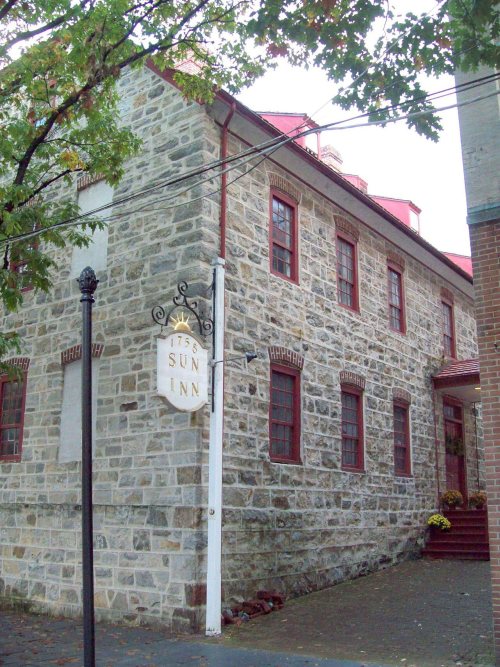


 1886
 1896
 1896
 1908
 1908
 1908
 1912
 1912
 1935
 1935
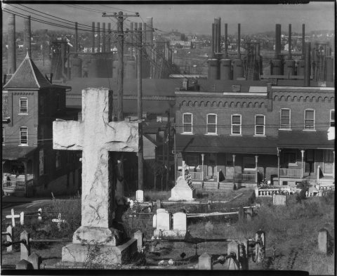 1935
 1935
 1935
 1935
 1935
 1935


