Guest, Sign inJoin

Post to Salem

We’ll email a one-tap link to publish your post. No password, and nothing is public until you click it.
Already a member? Sign in
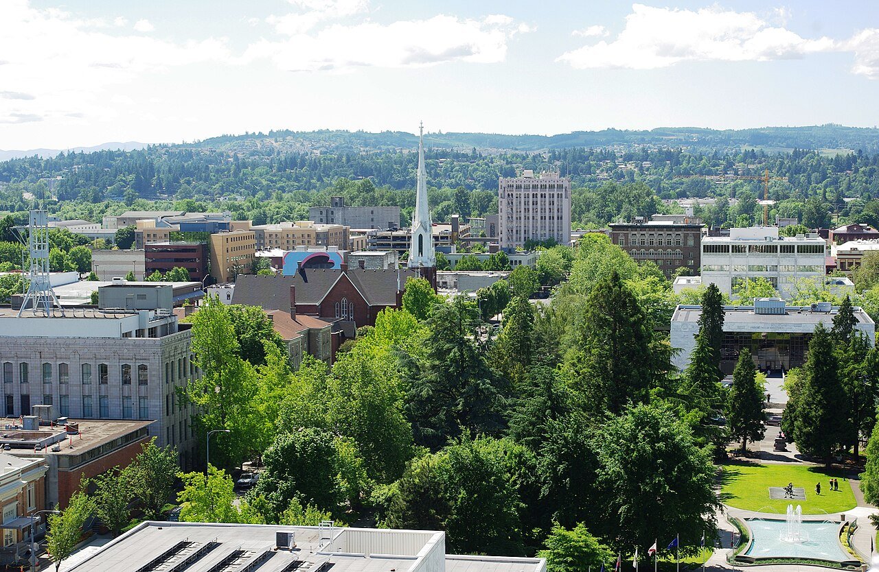
Salem Oregon downtownPhoto: M.O. Stevens · CC BY-SA 3.0
A−Outdoors
Outdoors in Salem

Salem has 55 miles of mapped trails, 1.1 for every square mile of land

93% of residents live within a half mile of a park. The biggest trail networks: Minto-Brown Island Park (8.8 mi), Wallace Marine Park (2.6 mi), Cascades Gateway Park (2.1 mi). 7% of Salem’s land is conserved, about 2,179 acres.

Ahead of 80% of U.S. towns · #52 of 142 in Oregon. What drives it

Conserved land
7%
2,179 acres · of 49.0 sq mi of land
Trails
55 mi
1.1 per sq mi of land
Park land
1,967 ac
11 acres per 1,000 residents
Near a park
93%
of residents within ½ mile
Bike routes
150 mi
119 mi lanes · 27 mi paths
Highest peak
656 ft
Reese Hill
Lakes & rivers
14
4 boat launches

What kind of outdoors town is Salem?

Read from the map. The page puts what stands out first.

Outdoors grade

How much outdoors does Salem have?

On conserved land, trails, park land and how close residents live to a park, Salem is ahead of 80% of U.S. towns, #52 of 142 in Oregon. Trail miles hold the grade up; park acres per resident pull it down.

A−
OutdoorsA character grade: shown, never part of Salem’s overall grade.
All U.S. towns we grade (21,298)Ahead of 80%
LessMore
Oregon towns of 2,500+ (142)Ahead of 64%

Among the 400 U.S. cities of 100,000 or more, Salem ranks #190 on Outdoors.

How sure. Graded on any three of the four inputs instead, the letter would range from B+ to A. Trails and many small parks come from OpenStreetMap, mapped by volunteers, so coverage varies from town to town; the half mile is a straight line from each census block, so a river or highway in the way isn’t counted against it.

PAD-US, OpenStreetMap (© OpenStreetMap contributors), Census 2025 Gazetteer and 2020 blocks; details in Sources below. How TownRatings grades the outdoors →

The map

Conserved land, trails & bike routes

Tap a number to zoom to a park. Tap a layer to hide it.

12345678
Easements protect land from building but are usually private.© OpenStreetMap contributors · USGS PAD-US
Places to walk

Pick a walk

The longest trail network is Minto-Brown Island Park, with 8.8 miles. Directions go to the nearest trailhead or public parking.

Minto-Brown Island Park

Managed by City of Salem
1,193 acres8.8 mi of trail
Dog rules not recorded
Directionsto the parking lotWebsite ↗

Wallace Marine Park

Park
155 acres2.6 mi of trail
Dog rules not recorded
Directionsto the parking lot

Cascades Gateway Park

Managed by City of Salem
104 acres2.1 mi of trail
Mill Creek Path
Dog rules not recorded
Directionsto the parking lot

Woodmansee Park

Park
29 acres2 mi of trail
Dog rules not recorded
Directionsto the parking lot

Bush's Pasture Park

Park
83 acres1.9 mi of trail
Dog rules not recorded
Directionsto the parking lotWebsite ↗

Sprague School/Skyline Park

Park
42 acres1.4 mi of trail
Dog rules not recorded
Directionsto the parking lot

Orchard Heights Park

Park
29 acres1 mi of trail
Dog rules not recorded
Directionsto the parking lot

Fairview Wetlands Scenic Trail

Nature preserve
30 acres0.8 mi of trail
Dog rules not recorded
Directionsto the parking lot
All 86 parks & preserves
Minto-Brown Island Park1,193 acres · 8.8 mi of trail · City of Salem
Directions
Wallace Marine Park155 acres · 2.6 mi of trail
Directions
Cascades Gateway Park104 acres · 2.1 mi of trail · City of Salem
Directions
Woodmansee Park29 acres · 2 mi of trail
Directions
Bush's Pasture Park83 acres · 1.9 mi of trail
Directions
Sprague School/Skyline Park42 acres · 1.4 mi of trail
Directions
Orchard Heights Park29 acres · 1 mi of trail
Directions
Fairview Wetlands Scenic Trail30 acres · 0.8 mi of trail
Directions
Geer Park45 acres · 0.6 mi of trail
Directions
West Salem High School Park17 acres · 0.5 mi of trail
Directions
Salem Audubon Nature Reserve8 acres · 0.5 mi of trail · Audubon
Directions
Deepwood Estate5 acres · 0.5 mi of trail · Friends of Deepwood
Directions
Willson Park6 acres · 0.4 mi of trail · State of Oregon
Directions
State Capitol State Park28 acres · 0.3 mi of trail · Oregon Parks and Recreation Department
Directions
Bryan Johnston Park17 acres · 0.3 mi of trail
Fairmount Park13 acres · 0.3 mi of trail
Directions
Straub Nature Park10 acres · 0.3 mi of trail
Directions
Secor Park9 acres · 0.3 mi of trail
Englewood School Park7 acres · 0.3 mi of trail
Croisan Trail5 acres · 0.3 mi of trail
Ellen Lane Park5 acres · 0.3 mi of trail · City of Salem
College Heights Park3 acres · 0.3 mi of trail
Gilmore Field City Park13 acres · 0.2 mi of trail
Directions
Chandler Nature Park7 acres · 0.2 mi of trail
Robert and Susie Lee School Park5 acres · 0.2 mi of trail
Fairview Park30 acres · 0.1 mi of trail · City of Salem
Directions
Riverfront Park29 acres · 0.1 mi of trail · City of Salem
Directions
McKay School Park15 acres · 0.1 mi of trail
Directions
Brush College Park9 acres · 0.1 mi of trail · City of Salem
Sunnyslope Park5 acres · 0.1 mi of trail
Fircrest Park5 acres · 0.1 mi of trail
Directions
Hoodview Park4 acres · 0.1 mi of trail
Highland School Park4 acres · 0.1 mi of trail
Wiltsey Road Property2 acres · 0.1 mi of trail
Clarmount Park1 acres · 0.1 mi of trail
Directions
Harry and Grace Thorp Park1 acres · 0.1 mi of trail
Minto Island Conservation Area298 acres
Directions
Battle Creek Park57 acres
Claggett Creek Natural Area42 acres · City of Salem
Directions
Walker Park23 acres
Directions
Audubon Riparian Reserve23 acres · Audubon
Directions
River Road City Park17 acres
Directions
Stephens-Yoshikai School Park16 acres
Civic Center12 acres
Directions
Nelson Park11 acres
Directions
Northgate City Park8 acres
Lansing Park7 acres
Directions
Wendy Kroger Park7 acres
Directions
Edgewater Parkway7 acres
Directions
Barrick Field City Park7 acres
Directions
Clark Creek Park6 acres
Directions
Chapman Hill School Park6 acres
Directions
Eola Ridge Park6 acres
Royal Oaks Park5 acres · City of Salem
Bailey Ridge Park5 acres · City of Salem
Sunnyside-Mildred Property5 acres
Weathers Street Park5 acres
Directions
Morningside Park5 acres
Directions
Sumpter School Park5 acres
Hoover School Park4 acres
Directions
Capitol Park4 acres · State of Oregon
Directions
Pringle Park4 acres
Directions
Wes Bennett Park4 acres
Bill Riegel Park4 acres
Directions
Union Street Railroad Bridge4 acres
Directions
Hillview Park3 acres
Directions
Mill Race Beautification3 acres
Directions
Livingston Park2 acres
Marion Square Park2 acres
Directions
Lee Park2 acres
McRae Park2 acres
North Mall Heritage Park2 acres
Directions
Aldrich Park2 acres
Directions
McKinley School Park2 acres
Directions
Pringle Creek Trail2 acres
Directions
Highland Park1 acres
West Salem Park1 acres
Directions
Richmond School Park1 acres
Glen Creek Park1 acres
South Village Park1 acres
Rees Park1 acres
Hammond School Park1 acres
Grant School Park1 acres
Directions
Woodscape Linear Park1 acres
Candalaria Park1 acres
SAIF Salem Campus Park1 acres
Directions
Who protects it

2,179 conserved acres

7% of Salem’s land. Who manages Salem’s conserved land, from the USGS Protected Areas Database. Approximate, because parcels can overlap.

Town or city1,907 ac
USDA easements (NRCS)169 ac
Other state land94 ac
State parks12 ac
Land trusts & nonprofits8 ac
State Department of Land1 ac
Local Park · 1,656 acState Other or Unknown · 203 acConservation Easement · 169 acLocal Conservation Area · 68 acState Park · 51 ac
Good to know

Conserved doesn’t always mean open to visitors. 169 acres are conservation easements, usually private land. The walks above are places people visit.

The biggest protected parcels
Parcel (PAD-US)Managed byAcresPublic access
Minto-brown Island
Local Park
Town or city703Open
Oregon Exposition Center
State Other or Unknown
Town or city168Open
Wallace Marine Park
Local Park
Town or city151Open
Bush Pasture
Local Park
Town or city101Open
Cascade Gateway
Local Park
Town or city101Open
Battle Creek Property
Local Park
Town or city57Open
Geer Park
State Park
Other state land44Open
Sprague-skyline School
Local Park
Town or city42Open
Claggett Creek Natural Area
Local Conservation Area
Town or city41Open
Walker Park
State Other or Unknown
Other state land35Open

5 smaller protected places aren’t shown.

Things to do

145 places to go in Salem

Beaches, playgrounds, peaks, falls and more. Pick a kind.

Peaks in Salem
Reese Hill656 ft elevation
Directions
Zosel Hill627 ft elevation
Directions
Wallace Hill427 ft elevation
Directions
Chapman Hill400 ft elevation
Directions
Illahe Hill240 ft elevation
Directions
Trails & water

5 named trails and 14 lakes & rivers

Named trails
Open to bikes · 5.0 miUnpaved · 18.9 mi
Mill Creek Path1.0 mi
Hilfiker Park Foot Path0.2 mi
Wiltsy Road Property Foot Path0.1 mi
Titan Path0.1 mi
Strong Road Southeast0.1 mi
Lakes & rivers tap for directions
Biking & sports

150 miles of bike routes

Bike lanes are often missing from the map in smaller towns, so that number is likely low.

119 mi
painted or protected bike lanes
27 mi
off-road bike paths
3.1 mi
shoulders & shared lanes
Courts & fields
67Tennis
56Basketball
55Baseball
29Soccer
17Tracks
15Pickleball
12Football
11Multi-sport

Includes school and college facilities, which aren’t always open to the public.

History along the way

70 places on the National Register

The country’s official list of places worth saving (National Park Service). The map also marks 24 historic points from OpenStreetMap: plaques, memorials and old buildings.

History →
Jason Lee HouseBuilding · listed 1973
About it
Kay, Thomas, Woolen MillDistrict · listed 1973
About it
Dr. Luke A. Port HouseBuilding · listed 1973
About it
Asahel Bush HouseBuilding · listed 1974
About it
Methodist Mission ParsonageBuilding · listed 1974
About it
John D. Boon HouseBuilding · listed 1975
About it
Boon Brick StoreBuilding · listed 1975
About it
Waller Hall, Willamette UniversityBuilding · listed 1975
About it
David McCully HouseBuilding · listed 1978
About it
Bush-Breyman BlockBuilding · listed 1978
About it
William Lincoln Wade HouseBuilding · listed 1978
About it
Reed Opera House and McCornack Block AdditionBuilding · listed 1978
About it

58 more on the History page.

When to get out

The best walking months in Salem: April to September

NOAA’s 1991–2020 normals for the town and the daylight at its latitude. Outlined months have long days, highs of 59 to 86 °F and little rain for the place.

JanFebMarAprMayJunJulAugSepOctNovDec
Daylight (h)9.110.311.813.414.815.615.314.112.510.99.58.8
High (°F)475156616874828377645346
Rain (in)6.34.54.73.32.51.40.30.51.53.76.27.1

July is the driest month (0.3 in) and August the warmest (highs of 83 °F). 7.1 inches fall in December, the wettest month. The climate in Salem →

Next door

Salem and its neighbors

Salem has the most mapped trails of the 4 towns around it. Tap a town to see its outdoors.

TownConserved
of land
Trail mi
per sq mi
Park acres
per 1,000
Near a park
½ mile
Outdoors
Salem7%1.11193%A−
Hayesville1%0.1164%C−
Four Cornersunder 1%0.8184%C+
Keizer3%0.4491%B−

The four inputs of the Outdoors grade, from the engine; shares are of land, not water.

Questions about parks and trails in Salem

Where can I hike in Salem?

The longest trail networks: Minto-Brown Island Park, 8.8 miles; Wallace Marine Park, 2.6 miles; Cascades Gateway Park, 2.1 miles; Woodmansee Park, 2 miles. Each one is on the map above, with directions to the nearest trailhead or parking.

How much of Salem is conserved land?

7% of its land, against a typical 4% for an Oregon town and 4% nationally (PAD-US). Conserved doesn’t always mean open to visitors: easements are usually private land.

Are dogs allowed on Salem’s trails?

Minto-Brown Island Park and Wallace Marine Park don’t have dog rules recorded on the map; check the signs at the trailhead.

Where can I bike in Salem?

150 miles of bike routes are on the map: 119 of painted or protected lanes, 27 of off-road paths and 3.1 of shoulders and shared lanes.

Is there public land near Salem?

5,145 acres of parks and open public land lie inside Salem or within 10 miles of it (PAD-US), 2,150 of them inside the city line.

How much outdoors does Salem have?

Ahead of 80% of U.S. towns on the Outdoors grade, #52 of 142 in Oregon. The grade combines the share of land that is conserved, miles of mapped trail per square mile of land, park acres per 1,000 residents and the share of residents within a half mile of a park. It’s a character grade, so it isn’t part of the overall grade. How it works.

Trail talk

Conditions, parking and favorite walks from Salem neighbors.

Town Square →
Share a tip
Sources

Where this page comes from

Conserved and public land: USGS Protected Areas Database of the United States (PAD-US), service updated July 2026. Parks, trails, playgrounds, beaches and other places: OpenStreetMap (© OpenStreetMap contributors, ODbL), map data as of 2026-10-28. Land and water area: Census 2025 Gazetteer. Residents near a park: 2020 Census blocks. National Register: National Park Service. How TownRatings grades the outdoors →