
Hebo, Oregon-2, 2013
Hebo’s story
144 years in pictures
The archive holds 6 old photos and papers going back to 2013.
- 1882Hebo is settled
Each edition grades its towns against each other only.
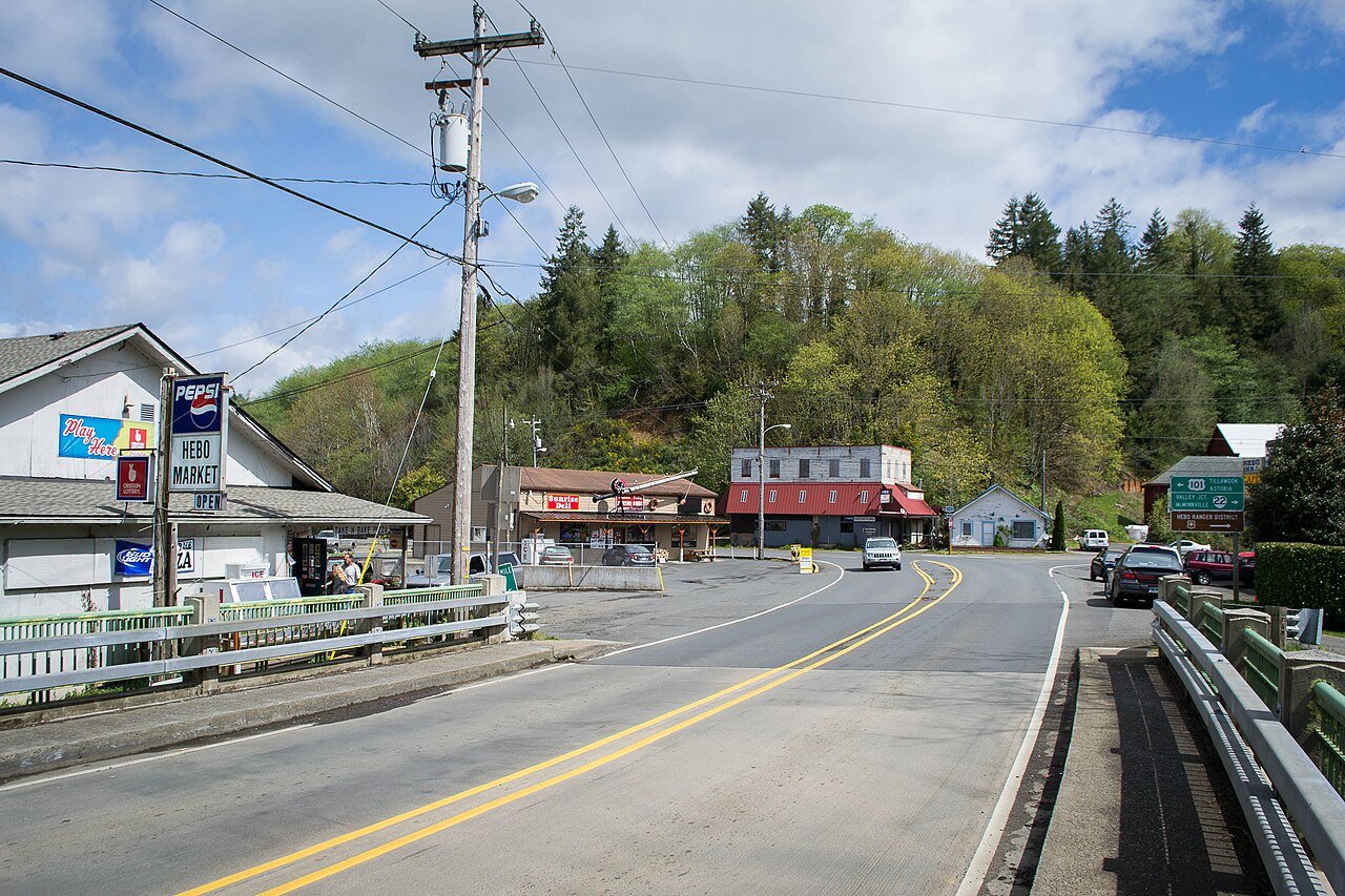
Population 311: a town settled in 1882.
80% of residents live below the poverty line in Hebo, above both Oregon’s towns (11%) and U.S. towns (9.6%). The biggest park or preserve is Siuslaw National Forest, at 52 acres. Hebo has fewer than 1,000 residents, too few for fair grades; the figures below are still real.
The archive holds 6 old photos and papers going back to 2013.
In a town this size, neighbors are the best guide. Ask them anything.
Ordered by what stands out in Hebo.
Hebo’s FEMA hazard score stands at 91 of 100. 38% of the town’s expected losses from natural hazards come from tsunamis, followed by inland flooding at 36%. Households here have drawn federal disaster aid once, in 2007.
FEMA National Risk Index · OpenFEMA
Half commute less than 41 miles. The top destinations are Pacific City (12%), Portland (11%) and Tillamook (9%).
Census LEHD 2023 · ACS
In the year to September 2026, typical home values climbed 6.9%. For households in Hebo, the share who own their home is 52%.
Census ACS, 2020–24 · Zillow Home Value Index · Redfin Data Center
In Hebo, the peak summer temperature is 72°F.
NOAA U.S. Climate Normals, 1991–2020
In Hebo, 27% of adults have been diagnosed with depression. Among adults here, 72% had a checkup this year.
| Hebo | Oregon towns | U.S. towns | |
|---|---|---|---|
| Yearly checkup (CDC PLACES) | 72% | 72% | 79% |
| Depression (CDC PLACES) | 27% | 27% | 23% |
| Sleep under 7 hours (CDC PLACES) | 32% | 32% | 36% |
| Frequent physical distress (CDC PLACES) | 15% | 15% | 14% |
| What stands out | Hebo | OR |
|---|---|---|
| More uninsured adults | 10.8% | 8.5% |
| Fewer adults seeing a dentist | 60.1% | 64.7% |
CDC PLACES 2025 · modeled estimates for adults · CMS · HRSA
Count the trails in 1 park or preserve and they come to 0.3 miles. Hebo’s trail density comes in at 0.2 miles per square mile.
| Hebo | Oregon towns | U.S. towns | |
|---|---|---|---|
| Miles of trail per square mile | 0.2 miles per square mile | 0.8 | 0.4 |
| Conserved land | 5% | 4.4% | 4.3% |
| Biggest places to walk | Trails | Acres |
|---|---|---|
| 1. Siuslaw National Forest | — | 52 |
Trails & parks © OpenStreetMap contributors · Conserved land: USGS PAD-US
Hebo is unincorporated, so Tillamook County and regional agencies provide most services.
EPA SDWIS (Oct 9, 2026) · HIFLD + EIA-861 2025 · Census 2020 ZCTAs · NCES 2024–25 · registration: vote.gov, updated Oct 2, 2026.
Where Hebo’s working residents go each day. Line width shows the share.
Census LEHD 2023
None within 15 miles of Hebo; the nearest are
About 0 of every 100 Hebo residents are enrolled in college, against 6 across Oregon.
Unincorporated community in the state of Oregon, United States
Hebo is an unincorporated community in Tillamook County, Oregon, United States. For statistical purposes, the United States Census Bureau has defined Hebo as a census-designated place (CDP). As of the 2020 census, Hebo had a population of 207.
From Wikipedia, licensed CC BY-SA 4.0 · facts via Wikidata (CC0)
Short answers, built from the data on this page.
Hebo has fewer than 1,000 residents, too few for fair grades; the figures below are still real.
Ask a question, answer one, post a photo or an event. Free, and the parts only a neighbor would know are the parts worth reading.