6 of Union Township’s places are on the National Register
More historic than 70% of U.S. towns · #421 of 993 in Ohio. What drives it
Most of Union Township was built recently: 6% of its homes predate 1940 and the median home dates from 1991. Below: maps from 1912 on and old-book passages.
On its age, its old homes and the National Register, Union Township is more historic than 70% of U.S. towns, #421 of 993 in Ohio. Its National Register listings hold the grade up; its share of homes from before 1940 pulls it down.
B+
HistoryA character grade: shown, never part of Union Township’s overall grade.
Ohio towns list about as much on the Register as the country (a typical Ohio town has 2.9 per 10,000 residents, the U.S. 2.4), so Union Township’s 54.8 sits above most of its state (89% of Ohio towns have fewer) while its 69 historic buildings outnumber those of 87% of U.S. towns.
How sure. Graded on two of the three inputs, so a change in either one moves the letter more than it would with three. The pre-1940 share is a Census survey estimate (±3.0 points).
Founding year: our sources. Homes: Census ACS 2020–24. National Register: National Park Service, May 2026 list; each listing counted once (boundary changes and added documentation belong to their listing), and a historic district counts its contributing buildings. How TownRatings grades history →
What stands out about Union Township’s past
Read from the archive, the National Register and the record. The page puts what stands out first.
Albright SchoolschoolAnderson Post Officepost officeAndersonville Post Officepost officeBowill SchoolschoolBriggs SchoolschoolDry Run SchoolschoolDunlap SchoolschoolGreenland Post Officepost officeMetzger SchoolschoolMona SchoolschoolPleasant Valley SchoolschoolRouse SchoolschoolShiloh SchoolschoolSpringbank SchoolschoolSulphur Lick Post Officepost officeSulphur Lick SchoolschoolTootle SchoolschoolView Post Officepost office
10cemeteries and burying grounds inside Union Township
National Park Service, National Register of Historic Places. Photos from Wikimedia Commons, credited on each place’s page.
The story so far
Union Township, in brief
Wikipedia doesn’t have a history of Union Township yet. The photos, dates and memories neighbors add here are how it gets written.
Union Township is one of the sixteen townships of Ross County, Ohio, United States. The 2020 census found 12,530 people in the township.
Between the 2010 and 2020 censuses its population fell from 13,345 to 12,530 (-6%).
Intro from Wikipedia. Population: U.S. Census Bureau.
From the old history books
What they wrote about Union Township in 1917
Passages that mention Union Township, cut from the printed page as they were published.
a standard history of ross county ohio1917 · page 751Read the page →
Read the text
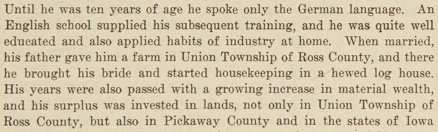
Until he was ten years of age he spoke only the German language. An English school supplied his subsequent training, and he was quite well educated and also applied habits of industry at home. When married, his father gave him a farm in Union Township of Ross County, and there he brought his bride and started housekeeping in a hewed log house. His years were also passed with a growing increase in material wealth, and his surplus was invested in lands, not only in Union Township of Ross County, but also in Pickaway County and in the states of Iowa
Text read by machine from the scan; it may contain errors.
a standard history of ross county ohio1917 · page 818Read the page →
Read the text
who was a native of Virginia and served with the Continental troops in the struggle for American independence during the revolution. After the close of that struggle he emigrated west to Ohio, and was one of the first to claim a farm from the wilderness in Union Township of Ross County. He located in the midst of the woods, and lived there until death overtook him.
Text read by machine from the scan; it may contain errors.
Scans and text from the Internet Archive. Books published in 1930 or earlier, which are in the public domain.
Timeline
Union Township, 1846 to 1929
Woven from the archive, old maps, post office records, the National Register and the people born here.
Every edition of the U.S. Geological Survey’s map of Union Township. Tap a year, or press play to watch the town change.
1912Roxabell sheet · 1:62,500
U.S. Geological Survey historical topographic maps (public domain), via Esri’s collection of the scans. The red ring marks the center of Union Township.
Famous people
Famous people close to Union Township
Nobody well known was born in Union Township itself, so here are the best known from just nearby.
Union Township is more historic than 70% of U.S. towns, #421 of 993 in Ohio. The History grade combines the town’s founding era, the share of homes built before 1940 and its National Register listings. It’s a character grade, so it isn’t part of the overall grade. How it works.
What is on the National Register in Union Township?
6 listings: 4 buildings and 2 historic districts, the Mound City Group National Monument and the Chillicothe Veterans Administration Hospital, with 51 contributing buildings. 69 historic buildings in all.
How old are the homes in Union Township?
6% of Union Township’s homes were built before 1940 (Census estimate, ±3.0 points), against a typical 15% for an Ohio town; the median home was built in 1991.
Founding dates: Wikidata, Wikipedia, the U.S. post office records of Blevins & Helbock (CC0) and the Census. Homes by year built: Census ACS 2020–24. National Register of Historic Places: National Park Service (list of May 22, 2026). Old photos, postcards and papers: Wikimedia Commons, the Library of Congress and other public archives, credited on each item’s page. Maps: U.S. Geological Survey historical topographic maps (via Esri) and Sanborn fire-insurance maps (Library of Congress). History text and census tables: Wikipedia (CC BY-SA 4.0). Places that used to be: USGS Geographic Names Information System (2021).
From Wikimedia Commons (2), the National Register of Historic Places (6), U.S. Geological Survey historical maps, the US Post Offices dataset (Blevins & Helbock), the USGS Geographic Names Information System and old county and town histories (Internet Archive). Archive images are copied here with their credits and licenses, shown on each photo’s page. Refreshed monthly.




 2015
 2013


