Founding year: Wikidata. First post office: 1850.The full story ↓
History grade
What drives Dover Township’s History grade
On its age, its old homes and the National Register, Dover Township is more historic than 71% of U.S. towns, #413 of 993 in Ohio. All 3 inputs are above most U.S. towns; its age ranks highest and its National Register listings lowest.
B+
HistoryA character grade: shown, never part of Dover Township’s overall grade.
Ohio towns list about as much on the Register as the country (a typical Ohio town has 2.9 per 10,000 residents, the U.S. 2.4), so Dover Township’s 2.3 sits near the middle of its state (53% of Ohio towns have fewer) while its 1 listings outnumber those of 51% of U.S. towns.
NoteThe founding year comes from Wikidata alone; no second source gives 1806.
How sure. Graded on any two of the three inputs instead, the letter would range from B to B+. The pre-1940 share is a Census survey estimate (±6.3 points).
Founding year: Wikidata (other dates in Quick answers). Homes: Census ACS 2020–24. National Register: National Park Service, May 2026 list; each listing counted once (boundary changes and added documentation belong to their listing), and a historic district counts its contributing buildings. How TownRatings grades history →
What stands out about Dover Township’s past
Read from the archive, the National Register and the record. The page puts what stands out first.
Lost post offices, old corners, places now gone and burying grounds
Another post office, Winfield, opened and closed inside today’s town.
Hamlets and corners on the map
Candlelight VillasColumbiaLoudonWinfield
Gone or out of use
Brandywine SchoolschoolMarino PitmineOak Grove SchoolschoolPenobscot SchoolschoolSchool Number 12schoolSchool Number 2schoolSchool Number 3schoolSchool Number 4schoolSchool Number 5school
6cemeteries and burying grounds inside Dover Township
BrandywineCrooked Run United MethodistPleasant HillRuslin HillSaint Joseph CalvarySalem
US Post Offices dataset (Blevins & Helbock, CC0). Places and cemeteries from the USGS Geographic Names Information System (2021).
Timeline
Dover Township, 1806 to 1986
Woven from the archive, old maps, post office records, the National Register and the people born here.
Originally named Canal Dover due to its location and origins along the Ohio and Erie Canal, the land was platted in 1807, with Christian Deardorff and Jesse Slingluff recognized as the founders. Beginning in 1815, the post office first began operation. Canal Dover incorporated as a village in 1842 and became a city under the Ohio municipal code of 1903. On February 12, 1916, the city officially changed its name to Dover.
Passages that mention Dover Township, cut from the printed page as they were published.
The History of Tuscarawas County, Ohio1884 · page 252Read the page →
Read the text
the vicinity of the mouth of what is known as Broad Run, about a mile south of the village of Strasburg, thence up the valley of the latter stream to the place of encampment, which was in the vicinity of the present village of Winfield, in the northwestern part of Dover Township. The distance traveled was nine miles. On Tuesday, the 23d, the army marched sixteen miles to Camp No. 15, and halted there one day. This march carried the army into Coshocton County. The route, continues our former authority, was up the Broad Run
Text read by machine from the scan; it may contain errors.
The History of Tuscarawas County, Ohio1884 · page 531Read the page →
Read the text
In the extreme northwestern part of Dover Township, on the southeast quarter of Section 13, stands a little village now called Winfield, having a population in 1870 of 126, and in 1880, of 115. The village was formerly known as Mechanicsburg, and under that name William Haverstock, in 1849, laid out eleven lots, all situated on the south side of Main street. An addition of seventeen lots north of Main street was made the same year by Eli Booth. In November, 1853, James Delany platted eight lots in the same locality and gave to them the title of Winfield. Eli Booth in the following March, made
Text read by machine from the scan; it may contain errors.
Scans and text from the Internet Archive. Books published in 1930 or earlier, which are in the public domain.
By decade
Dover Township, decade by decade
One decade in the archive so far: the 1890s. Scroll each row; tap a photo for its story.
Nothing in the archives for these yearsWeddings on Main Street, storms, parades, school pictures, the old store. If it’s in your family album, it belongs here.
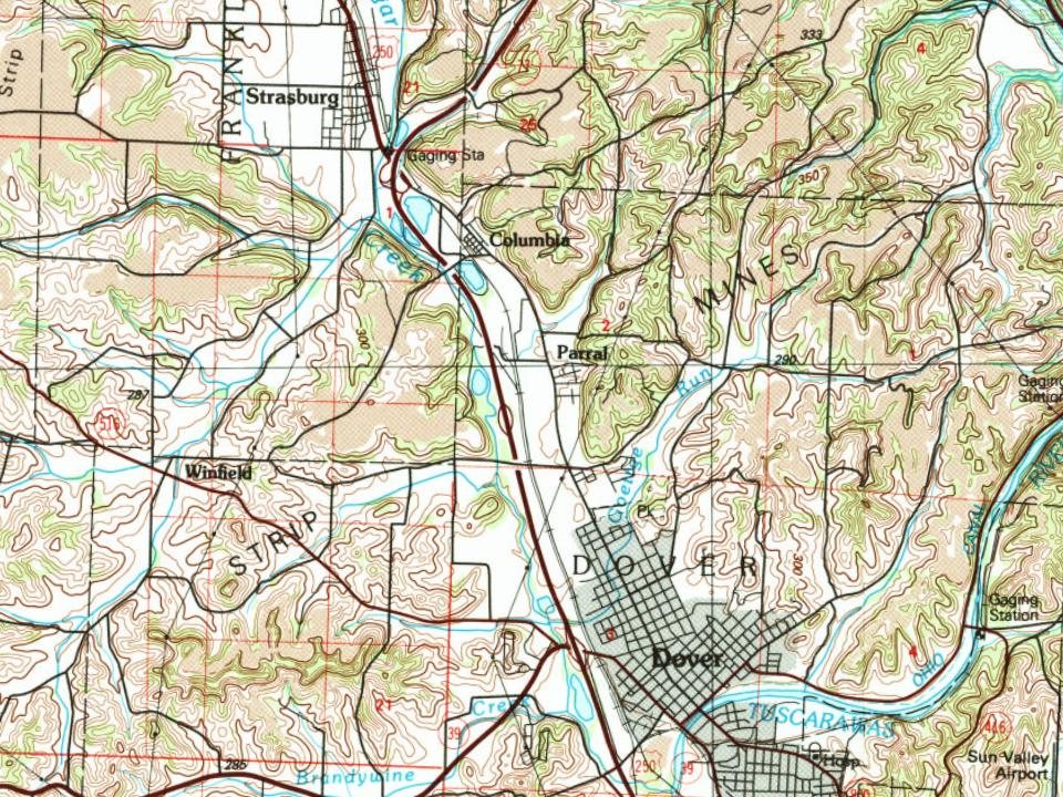
The U.S. Geological Survey’s map of Dover Township.
1986Canton sheet · 1:100,000
U.S. Geological Survey historical topographic maps (public domain), via Esri’s collection of the scans. The red ring marks the center of Dover Township.
Then & now
Stand where they stood
No then-and-now pairs yet. Take a photo from the same spot as an old one and they appear here side by side.
Retake this viewJacob A. Horn's Coal Mines - Canal Dover Ohio - 1899, 1899
Find the spot, match the angle, and add your photo. It becomes the first then-and-now pair on Dover Township’s page.
In 1806, according to Wikidata. Dover Township’s post office opened in 1850, and the census of 1840 counted 598 people here.
How does Dover Township rank for history?
Dover Township is more historic than 71% of U.S. towns, #413 of 993 in Ohio. The History grade combines the town’s founding era, the share of homes built before 1940 and its National Register listings. It’s a character grade, so it isn’t part of the overall grade. How it works.
What is on the National Register in Dover Township?
One place: the Christian Pershing Barn (listed 1992).
How old are the homes in Dover Township?
15% of Dover Township’s homes were built before 1940 (Census estimate, ±6.3 points), against a typical 15% for an Ohio town; the median home was built in 1977.
Founding dates: Wikidata, Wikipedia, the U.S. post office records of Blevins & Helbock (CC0) and the Census. Homes by year built: Census ACS 2020–24. National Register of Historic Places: National Park Service (list of May 22, 2026). Old photos, postcards and papers: Wikimedia Commons, the Library of Congress and other public archives, credited on each item’s page. Maps: U.S. Geological Survey historical topographic maps (via Esri) and Sanborn fire-insurance maps (Library of Congress). History text and census tables: Wikipedia (CC BY-SA 4.0). Places that used to be: USGS Geographic Names Information System (2021).
From Wikimedia Commons (3), Wikidata (3), the National Register of Historic Places (1), Wikipedia, U.S. Geological Survey historical maps, U.S. Census counts (via Wikipedia), the US Post Offices dataset (Blevins & Helbock), the USGS Geographic Names Information System and old county and town histories (Internet Archive). Archive images are copied here with their credits and licenses, shown on each photo’s page. Refreshed monthly.




 2018
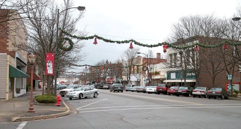 2006