Guest, Sign inJoin

Post to Columbus

We’ll email a one-tap link to publish your post. No password, and nothing is public until you click it.
Already a member? Sign in
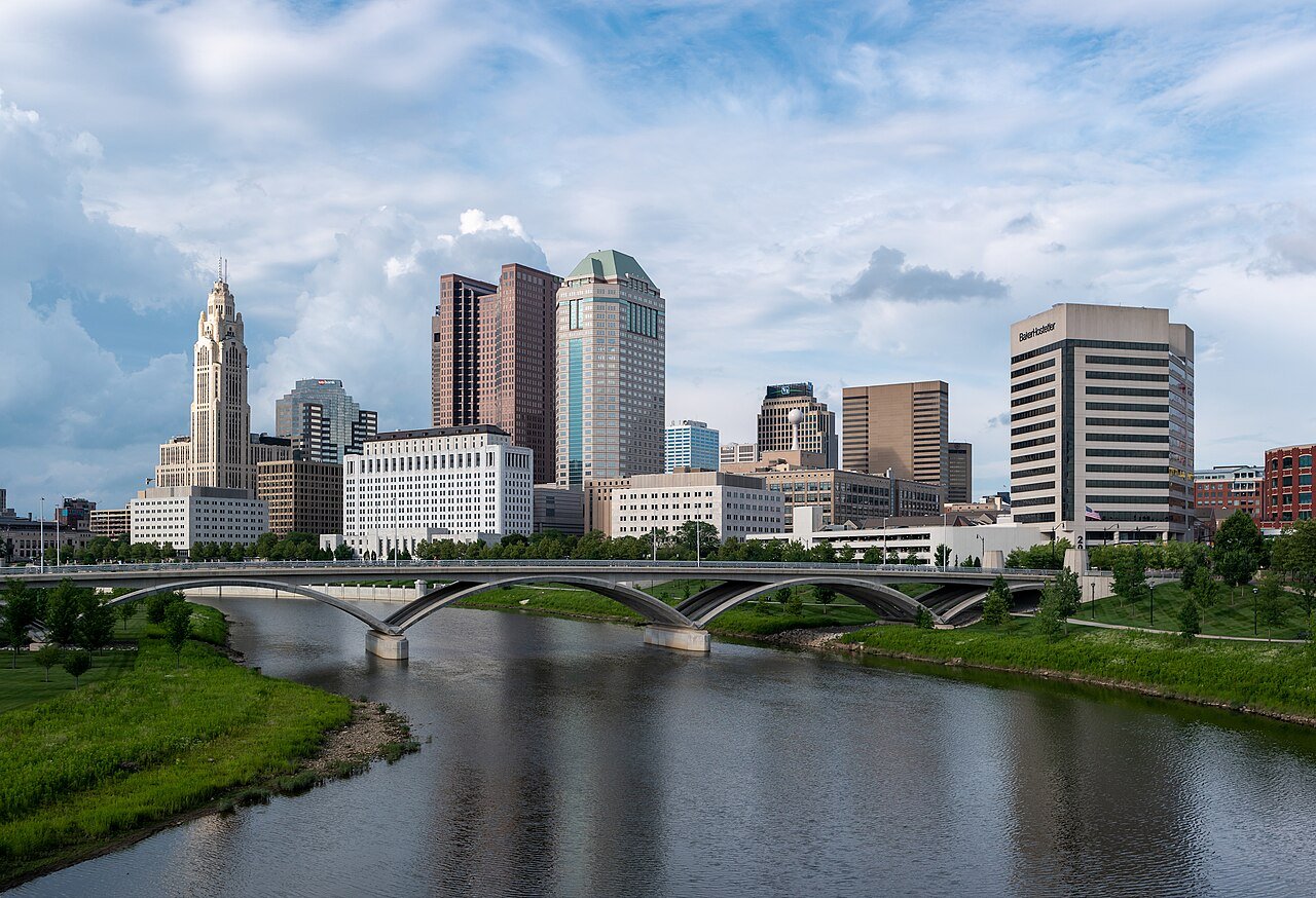
Downtown Columbus View from Main St Bridge - edit1Photo: Paul Wasneski · Public domain
A−Outdoors
Outdoors in Columbus

9% of Columbus’ land is conserved: 12,257 acres

94% of residents live within a half mile of a park. The biggest trail networks: Blendon Woods Metro Park (6.7 mi), Franklin Park (5.3 mi), Three Creeks Metro Park (5 mi). 138 miles of mapped trail cross Columbus, 0.6 per square mile of land.

Ahead of 79% of U.S. towns · #171 of 993 in Ohio. What drives it

Conserved land
9%
12,257 acres · of 221.9 sq mi of land
Trails
138 mi
0.6 per sq mi of land
Park land
11,694 ac
13 acres per 1,000 residents
Near a park
94%
of residents within ½ mile
Bike routes
313 mi
59 mi lanes · 153 mi paths
Highest peak
797 ft
Spangler Hill
Lakes & rivers
32
1 beach · 4 boat launches

What kind of outdoors town is Columbus?

Read from the map. The page puts what stands out first.

Outdoors grade

How much outdoors does Columbus have?

On conserved land, trails, park land and how close residents live to a park, Columbus is ahead of 79% of U.S. towns, #171 of 993 in Ohio. All four inputs are above most U.S. towns; the share of residents near a park ranks highest, park acres per resident lowest.

A−
OutdoorsA character grade: shown, never part of Columbus’ overall grade.
All U.S. towns we grade (21,298)Ahead of 79%
LessMore
Ohio towns of 2,500+ (993)Ahead of 83%

Among the 400 U.S. cities of 100,000 or more, Columbus ranks #208 on Outdoors.

How sure. Graded on any three of the four inputs instead, the letter would range from B+ to A−. Trails and many small parks come from OpenStreetMap, mapped by volunteers, so coverage varies from town to town; the half mile is a straight line from each census block, so a river or highway in the way isn’t counted against it.

PAD-US, OpenStreetMap (© OpenStreetMap contributors), Census 2025 Gazetteer and 2020 blocks; details in Sources below. How TownRatings grades the outdoors →

The map

Conserved land, trails & bike routes

Tap a number to zoom to a park. Tap a layer to hide it.

12345678
Easements protect land from building but are usually private.© OpenStreetMap contributors · USGS PAD-US
Places to walk

Pick a walk

The longest trail network is Blendon Woods Metro Park, with 6.7 miles. Directions go to the nearest trailhead or public parking.

Blendon Woods Metro Park

Nature preserve
660 acres6.7 mi of trail
Sugarbush TrailGoldenrod TrailBrookside TrailOverlook Trail+1
Dog rules not recorded
Directionsto the parking lot

Franklin Park

Park
83 acres5.3 mi of trail
Dog rules not recorded
Directionsto the parking lot

Three Creeks Metro Park

Nature preserve
1,151 acres5 mi of trail
Evergreen TrailBluebell Trail
Dog rules not recorded
Directionsto the parking lot

Quarry Trails Metro Park

Park
224 acres4.8 mi of trail
Dog rules not recorded
Directionsto the parking lot

Scioto Audubon Metro Park

Park
124 acres2.7 mi of trail
Columbus Rotary Obstacle CourseHermit Thrush Trail
Dog rules not recorded
Directionsto the parking lot

Pickerington Ponds Metro Park

Nature preserve
721 acres2.5 mi of trail
Arrowhead TrailMeadow Lark Trail
No dogs
Directionsto the parking lot

Antrim Park

Park
130 acres2.5 mi of trail
Antrim Lake LoopEMS Access to Dam
Dog rules not recorded
Directionsto the parking lotWebsite ↗

Krumm Park

Park
37 acres1.4 mi of trail
Dog rules not recorded
Directionsto the parking lot
All 290 parks & preserves
Blendon Woods Metro Park660 acres · 6.7 mi of trail
Directions
Franklin Park83 acres · 5.3 mi of trail
Directions
Three Creeks Metro Park1,151 acres · 5 mi of trail
Directions
Quarry Trails Metro Park224 acres · 4.8 mi of trail
Directions
Scioto Audubon Metro Park124 acres · 2.7 mi of trail
Directions
Pickerington Ponds Metro Park721 acres · 2.5 mi of trail
Directions
Antrim Park130 acres · 2.5 mi of trail
Directions
Krumm Park37 acres · 1.4 mi of trail
Directions
Wilma H. Shiermeier Olentangy River Wetland Research Park33 acres · 1.4 mi of trail
Directions
Whetstone Park153 acres · 1.2 mi of trail
Directions
Great Southern Metro Park113 acres · 1.2 mi of trail
Directions
Big Run Park263 acres · 0.9 mi of trail · Columbus Recreation and Parks
Directions
James J. Thomas Park107 acres · 0.9 mi of trail
Directions
Tuttle Park44 acres · 0.9 mi of trail
Directions
Hard Road Park43 acres · 0.9 mi of trail
Directions
Kenney Park Nature Preserve20 acres · 0.9 mi of trail
Directions
Maloney Park24 acres · 0.8 mi of trail
Directions
Indian Mound Park23 acres · 0.8 mi of trail
Directions
Westmoor Park16 acres · 0.8 mi of trail
Directions
Disc Golf Course14 acres · 0.8 mi of trail
Directions
Easton Oval11 acres · 0.8 mi of trail
Directions
Capitol Square10 acres · 0.8 mi of trail
Directions
Walnut Hill Park71 acres · 0.7 mi of trail
Directions
Nafzger Park57 acres · 0.7 mi of trail
Directions
Warner Woods Park54 acres · 0.7 mi of trail
Driving Park24 acres · 0.7 mi of trail
Directions
Mock Park20 acres · 0.7 mi of trail
Linden Park14 acres · 0.7 mi of trail · City of Columbus
Directions
Berliner Park236 acres · 0.6 mi of trail
Directions
Westgate Park39 acres · 0.6 mi of trail
Directions
Hoover Park27 acres · 0.6 mi of trail
Directions
Northcrest Park21 acres · 0.6 mi of trail
Directions
The Oval20 acres · 0.6 mi of trail
Directions
South Oval13 acres · 0.6 mi of trail
Directions
Topiary Park6 acres · 0.6 mi of trail
Directions
Columbus and Franklin County Metropark District117 acres · 0.5 mi of trail
Fred Beekman Park41 acres · 0.5 mi of trail
Directions
Schiller Park26 acres · 0.5 mi of trail
Directions
Mill Run Park14 acres · 0.5 mi of trail
Directions
Dexter Falls Park10 acres · 0.5 mi of trail
Glen Echo Park9 acres · 0.5 mi of trail
Directions
Ingram Spirit of Women Park6 acres · 0.5 mi of trail
Directions
Highbanks Metro Park293 acres · 0.4 mi of trail
Directions
Galloway Sports Complex111 acres · 0.4 mi of trail
Directions
Duranceau Park17 acres · 0.4 mi of trail
Southern Pines Park11 acres · 0.4 mi of trail
Directions
Barnett Park10 acres · 0.4 mi of trail
Directions
Westbank Park10 acres · 0.4 mi of trail
Directions
Chadwick Arboretum Lane Ave. Gardens10 acres · 0.4 mi of trail
Dorrian Green7 acres · 0.4 mi of trail
Directions
Wheeler Park6 acres · 0.4 mi of trail
Directions
Riverside Green Park4 acres · 0.4 mi of trail
Innis Park106 acres · 0.3 mi of trail
Directions
Spindler Sports Complex70 acres · 0.3 mi of trail
Directions
Willow Creek Park26 acres · 0.3 mi of trail
Directions
Chadwick Arboretum North24 acres · 0.3 mi of trail
Marion Franklin Park23 acres · 0.3 mi of trail
Directions
Harrison Smith Park21 acres · 0.3 mi of trail
Sawmill Wetlands Education Area20 acres · 0.3 mi of trail
Directions
Greene Countrie Park17 acres · 0.3 mi of trail
Albany Crossing Park13 acres · 0.3 mi of trail
Directions
Summitview Park13 acres · 0.3 mi of trail
Directions
Deshler Park10 acres · 0.3 mi of trail
John W Galbreath Bicentennial Park7 acres · 0.3 mi of trail
Directions
Mifflin Park7 acres · 0.3 mi of trail
Weinland Park7 acres · 0.3 mi of trail
Directions
Scioto Mile Promenade6 acres · 0.3 mi of trail
Directions
Granville Park6 acres · 0.3 mi of trail
Directions
Smith Road School Park6 acres · 0.3 mi of trail
Grandview Crossing Community Park3 acres · 0.3 mi of trail
Directions
Lazelle Woods Park43 acres · 0.2 mi of trail
Directions
Cherry Bottom Park43 acres · 0.2 mi of trail
Directions
Stoneridge Park23 acres · 0.2 mi of trail
Directions
Beechwold Park21 acres · 0.2 mi of trail
Clinton-Como Park19 acres · 0.2 mi of trail
Directions
Eddie Saunders Park19 acres · 0.2 mi of trail
Directions
Johnson Memorial Park13 acres · 0.2 mi of trail
Directions
Lindberg Park9 acres · 0.2 mi of trail
Directions
Genoa Park7 acres · 0.2 mi of trail
Directions
Wynstone Park7 acres · 0.2 mi of trail
Directions
Devonshire Park6 acres · 0.2 mi of trail
Directions
Beechcroft Park4 acres · 0.2 mi of trail
Directions
Highbluffs Park4 acres · 0.2 mi of trail
Directions
Roosevelt Park3 acres · 0.2 mi of trail
Directions
Columbus Ohio Temple Grounds1 acres · 0.2 mi of trail · Church of Jesus Christ of Latter-Day Saints
Directions
Buckeye Grove1 acres · 0.2 mi of trail
Directions
Big Walnut Park170 acres · 0.1 mi of trail
Directions
Rhodes Park53 acres · 0.1 mi of trail
Directions
Casto Park50 acres · 0.1 mi of trail
Directions
Wilson Road Park44 acres · 0.1 mi of trail
Directions
Thompson Park43 acres · 0.1 mi of trail
Directions
Redick Park23 acres · 0.1 mi of trail
Directions
Dodge Park20 acres · 0.1 mi of trail
Directions
Sills Park17 acres · 0.1 mi of trail
Directions
Glenwood Park17 acres · 0.1 mi of trail
Directions
Independence Park10 acres · 0.1 mi of trail
Olde Sawmill Park9 acres · 0.1 mi of trail
Directions
Walnut View Park7 acres · 0.1 mi of trail
Holton Park7 acres · 0.1 mi of trail
Directions
Broadmeadows Park7 acres · 0.1 mi of trail
Directions
Kenney Park7 acres · 0.1 mi of trail
Directions
Dream-Filled Park7 acres · 0.1 mi of trail
Woodbridge Green Park4 acres · 0.1 mi of trail
Directions
Iuka Park4 acres · 0.1 mi of trail
Northtowne Park4 acres · 0.1 mi of trail
Shepard Park4 acres · 0.1 mi of trail
Directions
Wrexham Park4 acres · 0.1 mi of trail
Alkire Lakes Community Park4 acres · 0.1 mi of trail
McKinley Park3 acres · 0.1 mi of trail
Directions
Galloway Ridge Park3 acres · 0.1 mi of trail
Parkview Parkland3 acres · 0.1 mi of trail
Directions
Founders Park3 acres · 0.1 mi of trail
Directions
Harrison Park3 acres · 0.1 mi of trail
Brevoort Park3 acres · 0.1 mi of trail
Directions
Phyllis A Jones Legacy Park3 acres · 0.1 mi of trail
Directions
Brookside Woods Park3 acres · 0.1 mi of trail
Jastram Memorial Grove1 acres · 0.1 mi of trail
Lehman Estates Park1 acres · 0.1 mi of trail
Karns Park1 acres · 0.1 mi of trail
Jeffrey Square1 acres · 0.1 mi of trail
Directions
Summerlyn Neighborhood Park1 acres · 0.1 mi of trail
Gazebo Park1 acres · 0.1 mi of trail
McPherson and Smith Courtyard1 acres · 0.1 mi of trail
Directions
Italian Village Park1 acres · 0.1 mi of trail
Directions
Glen High Parkland1 acres · 0.1 mi of trail · Columbus Department of Parks & Recreation
Directions
Earth Day Park1 acres · 0.1 mi of trail
Directions
Edward F. Hutchins Nature Preserve194 acres
Portman Park151 acres
Directions
Clover Groff Natural Area91 acres
Directions
Refugee Road Parklands54 acres
Directions
Elk Run Park54 acres
Delawanda Park47 acres
Directions
Wolfe Park46 acres
Directions
Parkridge Park44 acres
Directions
Helsel Park41 acres
Directions
Olentangy Nature Preserve40 acres
Goodale Park36 acres
Directions
Cooper Park33 acres
Directions
Woodward Nature Preserve31 acres
Directions
Woodstream Park29 acres
Walden Waterfowl Refuge29 acres
Fairwood Park27 acres
Directions
Olentangy River Parklands24 acres
Northern Olentangy Parkland Extension24 acres
Directions
Stockbridge Park23 acres
Directions
Scioto Trail Park23 acres
Woodward Park21 acres
Directions
Strawberry Farms Park21 acres
North Bank Park20 acres
Directions
McCoy Park20 acres
Directions
Academy Park19 acres
Directions
Nelson Park19 acres
Directions
Westford Village Parkland17 acres
Windward Farms Park16 acres
Directions
Hilliard Green Park16 acres
Directions
Lincoln Park16 acres
Directions
Brentnell Park16 acres
Directions
Carriage Place Park and Recreation Center14 acres
Directions
Catalpa Park13 acres · Columbus Recreation and Parks
Willow Creek Preserve13 acres
Directions
Sharon Meadows Park13 acres
Directions
Westerville Woods Parkland11 acres
Livingston Park11 acres
Directions
Haydens Crossing Park10 acres
Directions
Maybury Park10 acres
Hayden Park10 acres
Directions
Georgian Heights Park10 acres · Columbus Recreation and Parks
Cassady Park10 acres
Georgesville Green Parkland10 acres · Columbus Recreation and Parks
Directions
Connor Park9 acres
Hilltonia Park9 acres
Cooke Park9 acres
Scioto Woods Park9 acres
Ceder Run Park9 acres
Cremeans Park9 acres
Northgate Park9 acres
Blackburn Park9 acres
Indianola Middle School Park7 acres
Directions
Wexford Green Park7 acres
Northmoor Park7 acres
Directions
Kraner Park7 acres
Directions
Kelly Park7 acres
John F. Wolfe Columbus Commons7 acres
Directions
Trabue Woods Park7 acres
Sawyer Park7 acres
Directions
Sawmill Nature Preserve6 acres
Freedom Park6 acres
Directions
Audubon Park6 acres
Linview Park6 acres · City of Columbus Department of Recreation and Parks
Williams Creek Park6 acres
Alkire Lakes Park6 acres
Hauntz Park6 acres
Directions
Prestwick Commons Park6 acres
Mayme Moore Park6 acres · Columbus Recreation and Parks
Directions
Berwick Park6 acres
Kenlawn Park6 acres
Directions
Beatty Park6 acres
Napoleon Park6 acres
West Park Avenue Park6 acres
Directions
Blacklick Woods Metro Park4 acres · Columbus and Franklin County Metro Parks
Windsor Park4 acres
Huy Road Park4 acres
Battelle Riverfront Park4 acres
Directions
ODNR Natural Resources Park4 acres · Ohio Department of Natural Resources
Flint Park4 acres
Directions
Rocky Creek Parkland4 acres · Columbus Recreation and Parks
Pump House Park4 acres
Directions
City Gate Park4 acres
Easthaven Park4 acres
American Addition Park4 acres
Riverbend Park4 acres
Alum Crest Park4 acres
Upper Albany Park4 acres
Forest Creek Park4 acres
Forest Park East4 acres
Columbus City Hall plaza4 acres
Directions
West Bank Park4 acres
Directions
Glen View Park4 acres
Directions
Kirkwood Park4 acres
Willis Park4 acres
Avalon Park4 acres
Hanford Village Park4 acres
Brownlee Circle Park4 acres
Milo Grogan Park4 acres
North East Park3 acres
Directions
Walden Park3 acres
Sycamore Hills Park3 acres
Joan Park3 acres
Central Park3 acres
Reynolds Crossing Park3 acres
Southgate Park3 acres
Directions
Shady Lane Park3 acres
Crawford Farms Park3 acres
McFerson Commons3 acres
Directions
Memorial Grove3 acres
Directions
Chadwick Arboretum Learning Gardens3 acres
Remembrance Park3 acres
Directions
Northern Woods Park3 acres
Pingue Park3 acres
Alexander Park3 acres
Directions
Old Oaks Park3 acres
Southwood Mileusnich Park3 acres
Directions
Stephen Drive Park3 acres
Directions
Prestwick Green Common Area3 acres
Directions
15th Avenue Park3 acres · Columbus Recreation & Parks Department
Directions
Sharon Woods Metro Park1 acres
Scioto Grove Metro Park1 acres
Heritage Trail Park1 acres
Directions
New Albany wetland and nature preserve1 acres
Chaseland Park1 acres
Indianola Park1 acres
Directions
Amvet Village Park1 acres
Brentwood Park1 acres
Directions
Sullivant Gardens Park1 acres
Webster Park1 acres
Moeller Park1 acres
Jefferson Woods Park1 acres
Argus Park1 acres
Hansford Quadrangle1 acres
Directions
Millbrook Park1 acres
Waltham Woods Park1 acres
Champion Avenue Park1 acres
Directions
Southeast Lions Park1 acres
Directions
Galloway Ridge Village Park1 acres
Directions
Palsgrove Park1 acres
Directions
Campbell Memorial Park1 acres
Directions
Jesse Owens Plaza1 acres
College Green1 acres
Directions
City Commons1 acres
Directions
Geers Street Park1 acres
Makris Parkland1 acres
Directions
New Beginnings Park1 acres
Thurber Park1 acres
Directions
Guilford Park1 acres
Dakota Park1 acres
Directions
Pumphrey Park1 acres
Ohio Field Memorial1 acres
Directions
Gateway Green1 acres
Directions
Taylor Green1 acres
Directions
Hawthorne Park1 acres
Little Broad1 acres
Hamilton Avenue Street Park1 acres
Martin Avenue Park1 acres
Washington Gladden Social Justice Park1 acres
Directions
Iuka & Waldeck Pocket Park1 acres · University District Organization
Directions
Hamilton & Spring Park1 acres
Ratner Plaza1 acres
Directions
Gould Park1 acres
Chatham Village Dog Park1 acres
Directions
Poplar Park1 acres
Directions
Who protects it

12,257 conserved acres

9% of Columbus’ land. Who manages Columbus’s conserved land, from the USGS Protected Areas Database. Approximate, because parcels can overlap.

Town or city8,908 ac
Regional agency2,638 ac
Private owners753 ac
USDA easements (NRCS)144 ac
Other state land41 ac
State natural resources34 ac
Other or Unknown Local Government31 ac
Local Park · 10,125 acLocal Recreation Area · 1,087 acPrivate Park · 734 acLocal Conservation Area · 400 acConservation Easement · 144 ac
Good to know

Conserved doesn’t always mean open to visitors. 4 acres are conservation easements, usually private land. Public access isn’t recorded for 2 of 511 parcels. The walks above are places people visit.

The biggest protected parcels
Parcel (PAD-US)Managed byAcresPublic access
Three Creeks Metropark
Local Park
Regional agency1,128Open
Blendon Woods Metropark
Local Park
Regional agency631Open
Pickerington Ponds Metropark
Local Park
Regional agency593Open
Little Turtle Country Club
Private Park
Private owners368Open
Big Run Park
Local Park
Town or city269Open
Columbus Country Club
Private Park
Private owners233Open
Berliner Sports Park
Local Park
Town or city224Open
Turnberry Golf Course
Local Recreation Area
Town or city214Open
Raymond Memorial Golf Course
Local Recreation Area
Town or city214Open
Champions Golf Course
Local Recreation Area
Town or city201Open

5 smaller protected places aren’t shown.

Things to do

579 places to go in Columbus

Beaches, playgrounds, peaks, falls and more. Pick a kind.

Playgrounds in Columbus
Animal SwingsIn Broadmeadows Park
Directions
Blackburn PlaygroundIn Blackburn Park
Directions
Blendon Woods Inclusive PlaygroundIn Blendon Woods Metro Park
Directions
Chapel Playground
Directions
Crawford Farms Park
Directions
Dexter Falls Park PlaygroundIn Dexter Falls Park
Directions
Funk-ee Town PlaygroundIn Harrison Park
Directions
Jungle GymIn Blendon Woods Metro Park
Directions
14 more playgrounds
Kickball Court
Directions
Linden Park Playground
Directions
NEOS 360In John F. Wolfe Columbus Commons
Directions
ODNR Oil & Gas Playground
Directions
Olde Sawmill Park PlaygroundIn Olde Sawmill Park
Directions
Park at the Park of RosesIn Whetstone Park
Directions
Pingue PlaygroundIn Pingue Park
Directions
Playground Olentngy Commons
Directions
Prestwick PlaygroundIn Prestwick Commons Park
Directions
Schiller Park PlaygroundIn Schiller Park
Directions
Stratford Chase Playground
Directions
SwingsIn Blendon Woods Metro Park
Directions
The Yard Polaris
Directions
Victorian Playgrounds
Directions

464 playgrounds are on OpenStreetMap in all; the list shows named ones from the first 30.

Trails & water

20 named trails and 32 lakes & rivers

Named trails
Open to bikes · 2.1 miUnpaved · 21.8 mi
Arrowhead Trail1.5 mi
Sugarbush Trail1.2 mi
Antrim Lake Loop1.1 mi
Prayer Trail1.0 mi
Goldenrod Trail0.8 mi
Meadow Lark Trail0.8 mi
Brookside Trail0.8 mi
Kenney Trail0.7 mi
Overlook Trail0.6 mi
Evergreen Trail0.5 mi
10 more trails
Bluebell Trail
0.5 mi
Ripple Rock
0.4 mi
Columbus Rotary Obstacle Course
0.3 mi
Marion-Franklin Walking path
0.3 mi
Lake Trail
0.3 mi
Thompson Park Trail
0.2 mi
Hickory Ridge
0.1 mi
EMS Access to Dam
0.1 mi
Hermit Thrush Trail
0.1 mi
Beechwold Trail
0.1 mi
Lakes & rivers tap for directions
Biking & sports

313 miles of bike routes

Bike lanes are often missing from the map in smaller towns, so that number is likely low.

59 mi
painted or protected bike lanes
153 mi
off-road bike paths
102 mi
shoulders & shared lanes
Courts & fields
292Tennis
197Baseball
185Basketball
149Soccer
36Football
31Beach volleyball
28Pickleball
11Volleyball

Includes school and college facilities, which aren’t always open to the public.

History along the way

181 places on the National Register, 3 of them National Historic Landmarks

The country’s official list of places worth saving (National Park Service). The map also marks 62 historic points from OpenStreetMap: plaques, memorials and old buildings.

History →
★
Ohio StatehouseNational Historic Landmark · Building · listed 1972
About it
★
Ohio TheatreNational Historic Landmark · Building · listed 1973
About it
★
Capt. Edward V. Rickenbacker HouseNational Historic Landmark · Building · listed 1976
About it
Franklin Park Medical CenterBuilding
About it
Fort HayesDistrict · listed 1970
About it
University, Hayes and Orton HallsBuilding · listed 1970
About it
Campbell MoundStructure · listed 1970
About it
Wyandotte BuildingBuilding · listed 1972
About it
Old Governor's MansionBuilding · listed 1972
About it
Harrison, Gen. William Henry, HeadquartersBuilding · listed 1972
About it
Lucas Sullivant BuildingBuilding · listed 1973
About it
Franklinton Post OfficeBuilding · listed 1973
About it

169 more on the History page.

When to get out

August is the best month for walking in Columbus

NOAA’s 1991–2020 normals for the town and the daylight at its latitude. Outlined months have long days, highs of 59 to 86 °F and little rain for the place.

JanFebMarAprMayJunJulAugSepOctNovDec
Daylight (h)9.610.611.813.214.415.014.713.712.411.19.99.3
High (°F)374151647482858478665242
Rain (in)2.92.43.44.04.34.54.43.73.32.92.83.0

February is the driest month (2.4 in) and July the warmest (highs of 85 °F). 4.5 inches fall in June, the wettest month. The climate in Columbus →

Next door

Columbus and its neighbors

Columbus has the most mapped trails of the 8 towns around it. Tap a town to see its outdoors.

TownConserved
of land
Trail mi
per sq mi
Park acres
per 1,000
Near a park
½ mile
Outdoors
Columbus9%0.61394%A−
Hamilton Township3%0.43179%B
Norwich Township6%1.01699%A
Jackson Township7%0.53195%A−
Mifflin Township7%0.62097%A−
Madison Township9%0.57086%A−
Plain Township20%1.315195%A+
Washington Township100%22.6under 195%A

The four inputs of the Outdoors grade, from the engine; shares are of land, not water.

Questions about parks and trails in Columbus

Where can I hike in Columbus?

The longest trail networks: Blendon Woods Metro Park, 6.7 miles; Franklin Park, 5.3 miles; Three Creeks Metro Park, 5 miles; Quarry Trails Metro Park, 4.8 miles. Each one is on the map above, with directions to the nearest trailhead or parking.

How much of Columbus is conserved land?

9% of its land, against a typical 3% for an Ohio town and 4% nationally (PAD-US). Conserved doesn’t always mean open to visitors: easements are usually private land.

Are dogs allowed on Columbus’ trails?

Blendon Woods Metro Park and Franklin Park don’t have dog rules recorded on the map; check the signs at the trailhead.

Where can I bike in Columbus?

313 miles of bike routes are on the map: 59 of painted or protected lanes, 153 of off-road paths and 102 of shoulders and shared lanes.

Is there public land near Columbus?

44,517 acres of parks and open public land lie inside Columbus or within 10 miles of it (PAD-US), 11,694 of them inside the city line.

How much outdoors does Columbus have?

Ahead of 79% of U.S. towns on the Outdoors grade, #171 of 993 in Ohio. The grade combines the share of land that is conserved, miles of mapped trail per square mile of land, park acres per 1,000 residents and the share of residents within a half mile of a park. It’s a character grade, so it isn’t part of the overall grade. How it works.

Trail talk

Conditions, parking and favorite walks from Columbus neighbors.

Town Square →
Share a tip
Sources

Where this page comes from

Conserved and public land: USGS Protected Areas Database of the United States (PAD-US), service updated July 2026. Parks, trails, playgrounds, beaches and other places: OpenStreetMap (© OpenStreetMap contributors, ODbL), map data as of 2026-10-28. Land and water area: Census 2025 Gazetteer. Residents near a park: 2020 Census blocks. National Register: National Park Service. How TownRatings grades the outdoors →