Yonkers dates to 1646, and 27% of its homes were built before 1940
More historic than 93% of U.S. towns · #189 of 758 in New York. What drives it
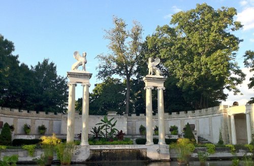
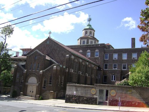
28 places in town are on the National Register, among them the Philipse Manor Hall, a National Historic Landmark, and four historic districts with 121 buildings between them. Below: 6 old photos and papers, maps from 1886 on, and the census since 1860.
Founding year: Wikidata. First post office: 1796.The full story ↓
History grade
What drives Yonkers’ History grade
On its age, its old homes and the National Register, Yonkers is more historic than 93% of U.S. towns, #189 of 758 in New York. All 3 inputs are above most U.S. towns; its age ranks highest and its National Register listings lowest.
A
HistoryA character grade: shown, never part of Yonkers’ overall grade.
Among the 400 U.S. cities of 100,000 or more, Yonkers ranks #58 on History.
New York towns list more on the Register than most of the country (a typical New York town has 12.3 per 10,000 residents, the U.S. 2.4), so Yonkers’ 7.3 sits near the middle of its state (41% of New York towns have fewer) while its 153 historic buildings outnumber those of 92% of U.S. towns.
NoteThe founding year comes from Wikidata alone; no second source gives 1646.
How sure. Graded on any two of the three inputs instead, the letter would range from A− to A+. The pre-1940 share (±1.4 points) is firm at this size.
Founding year: Wikidata (other dates in Quick answers). Homes: Census ACS 2020–24. National Register: National Park Service, May 2026 list; each listing counted once (boundary changes and added documentation belong to their listing), and a historic district counts its contributing buildings. How TownRatings grades history →
What stands out about Yonkers’ past
Read from the archive, the National Register and the record. The page puts what stands out first.
Central TheatrebuildingEvangelical Lutheran Church of the RedeemerchurchFirst Unitarian Congregational ChurchchurchHalsted SchoolschoolHamilton TheatrebuildingHawthorne High SchoolschoolHunt's BridgebridgeKent CinemabuildingKimball TheatrebuildingMargaret M Hughes ManorbuildingMorsemere Methodist Episcopal ChurchchurchNorth Station Yonkers Post Officepost officeOur Lady of Mount Carmel-Saint Anthony SchoolschoolPark Hill TheatrebuildingProctor's PalacebuildingPublic School Number 10schoolSaunders SchoolschoolStrand Theatrebuilding
5cemeteries and burying grounds inside Yonkers
OaklandSaint JohnsSaint JosephSaint MarysSherwood Park
US Post Offices dataset (Blevins & Helbock, CC0). Places and cemeteries from the USGS Geographic Names Information System (2021).
The indigenous Native American village of Nappeckamack was located near the Neperah stream (now the Saw Mill River, also known as Nepperhan Creek), which flowed into the Shatemuck (Hudson River). The land on which the city is built was once part of Colen Donck, a 24,000-acre (97-square-kilometer) Dutch land grant. It ran 12 miles (19 km) north from the present-day Manhattan–Bronx border at Marble Hill, and from the Hudson River east to the Bronx River.
Passages that mention Yonkers, cut from the printed page as they were published.
History of Westchester county, New York, including Morrisania, Kings Bridge, and West Farms, which have been annexed to New York city1886 · page 756Read the page →
Read the text
By act of March 7, 1788, a new town waa erected* containing part of Phillipsburgh, Mile Square and the old precinct of Yonkers, under the name of Yonkers. In November, 1872, the supervisors of Westchester County erected a township consisting of all of the town of Yonkers lying south of the southerly line of the city of Yonkers, to be called King's Bridge. Its first and only annual meeting was held
Text read by machine from the scan; it may contain errors.
History of Westchester county, New York, including Morrisania, Kings Bridge, and West Farms, which have been annexed to New York city1886 · page 763Read the page →
Read the text
The will of Augustus Van Cortlandt, dated December, 1823, contains the following clause : " Whereas, the greatest part of the lands and real estate which I occupy and hold in the town of Yonkers was derived to me by inheritance from my ancestors; and Whereas, I have purchased some tracts of land, also lying in the town of Yonkers, which I at present possess, it is my desire that the same remain entire and pass to
Text read by machine from the scan; it may contain errors.
Scans and text from the Internet Archive. Books published in 1930 or earlier, which are in the public domain.
By decade
Yonkers, decade by decade
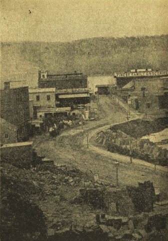
4 decades in the archive, from the 1820s to the 1860s. Scroll each row; tap a photo for its story.
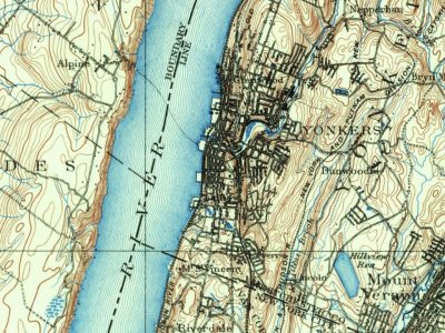
Every edition of the U.S. Geological Survey’s map of Yonkers. Tap a year, or press play to watch the town change.
1897Harlem sheet · 1:62,500
U.S. Geological Survey historical topographic maps (public domain), via Esri’s collection of the scans. The red ring marks the center of Yonkers.
Every building
Yonkers, building by building, 1886–1917
Fire insurance maps drew every building, what it was made of and what it was used for, so insurers could price the risk of fire. Pick a year, then a sheet.
In 1646, according to Wikidata. Yonkers’ post office opened in 1796, and the census of 1860 counted 8,218 people here.
How does Yonkers rank for history?
Yonkers is more historic than 93% of U.S. towns, #189 of 758 in New York. The History grade combines the town’s founding era, the share of homes built before 1940 and its National Register listings. It’s a character grade, so it isn’t part of the overall grade. How it works.
What is on the National Register in Yonkers?
28 listings: 23 buildings, among them the Philipse Manor Hall (a National Historic Landmark since 1961), 4 historic districts with 121 contributing buildings, and 1 structure. 153 historic buildings in all.
How old are the homes in Yonkers?
27% of Yonkers’ homes were built before 1940 (Census estimate, ±1.4 points), against a typical 27% for a New York town; the median home was built in 1958.
Founding dates: Wikidata, Wikipedia, the U.S. post office records of Blevins & Helbock (CC0) and the Census. Homes by year built: Census ACS 2020–24. National Register of Historic Places: National Park Service (list of May 22, 2026). Old photos, postcards and papers: Wikimedia Commons, the Library of Congress and other public archives, credited on each item’s page. Maps: U.S. Geological Survey historical topographic maps (via Esri) and Sanborn fire-insurance maps (Library of Congress). History text and census tables: Wikipedia (CC BY-SA 4.0). Places that used to be: USGS Geographic Names Information System (2021).
From Wikimedia Commons (6), the National Register of Historic Places (28), Wikipedia, Wikidata and Wikipedia for famous people, U.S. Geological Survey historical maps, U.S. Census counts (via Wikipedia), the US Post Offices dataset (Blevins & Helbock), the USGS Geographic Names Information System, Sanborn fire insurance maps (Library of Congress) and old county and town histories (Internet Archive). Archive images are copied here with their credits and licenses, shown on each photo’s page. Refreshed monthly.

 ★ Landmark






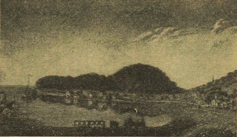 1837
 1859


