Westfield dates to 1802, and 48% of its homes were built before 1940
Among the most historic 1% of U.S. towns · #15 of 758 in New York. What drives it
20 places in town are on the National Register, among them two historic districts with 116 buildings between them. Below: 9 old photos and papers, maps from 1886 on, and the census since 1830.
Founding year: Wikidata. First post office: 1818.The full story ↓
History grade
What drives Westfield’s History grade
On its age, its old homes and the National Register, Westfield is among the most historic 1% of U.S. towns, #15 of 758 in New York. All 2 inputs put Westfield near the top nationally; its share of homes from before 1940 ranks highest.
A+
HistoryA character grade: shown, never part of Westfield’s overall grade.
New York towns list more on the Register than most of the country (a typical New York town has 12.3 per 10,000 residents, the U.S. 2.4), so Westfield’s 320 sits above most of its state (87% of New York towns have fewer) while its 143 historic buildings outnumber those of 91% of U.S. towns.
How sure. Graded on two of the three inputs, so a change in either one moves the letter more than it would with three. The pre-1940 share is a Census survey estimate (±10.5 points). Two sources give 1802.
Founding year: Wikidata (other dates in Quick answers). Homes: Census ACS 2020–24. National Register: National Park Service, May 2026 list; each listing counted once (boundary changes and added documentation belong to their listing), and a historic district counts its contributing buildings. How TownRatings grades history →
What stands out about Westfield’s past
Read from the archive, the National Register and the record. The page puts what stands out first.
The area was first settled in 1802 by James McMahan, formerly of Northumberland County, Pennsylvania. McMahan established a mill near the mouth of Chautauqua Creek, where it empties into Lake Erie. The mill was later dismantled in advance of the War of 1812 to prevent it from falling into the hands of the British. Today some of the millstones from McMahan's mill rest outside the Patterson Library in Westfield village.
The town of Westfield was established in 1828 from parts of the towns of Portland and Ripley.
The Barcelona Lighthouse was constructed in 1829 to overlook Barcelona Harbor and aided sailors on Lake Erie until being deactivated in 1859. It was the first lighthouse in the world to be powered by natural gas.
Passages that mention Westfield, cut from the printed page as they were published.
History of Chautauqua County, New York, and its people1921 · page 221Read the page →
Read the text
continue. An act, passed March 1, 1816, erected the town of Ripley as at present constituted, and in addition took from Portland all of the present town of Westfield lying west of Chautauqua creek. Friction arose between the people of the village of Westfield and Portland, which finally resulted in an act erecting the town of Westfield, passed March 19, 1829.
Text read by machine from the scan; it may contain errors.
History of Chautauqua County, New York, and its people1921Read the page →
Read the text
James McMahan, a Pennsylvanian, was destined to play an important part in the early development of Westfield. He first visited the region in 1795 and in 1801, in company with Andrew Smith, he visited the lake region and made a contract for his brother John to buy township 4, in range 14, which included all the village of Westfield and parts of the towns of
Text read by machine from the scan; it may contain errors.
Scans and text from the Internet Archive. Books published in 1930 or earlier, which are in the public domain.
Timeline
Westfield, 1802 to 1991
Woven from the archive, old maps, post office records, the National Register and the people born here.
Every edition of the U.S. Geological Survey’s map of Westfield. Tap a year, or press play to watch the town change.
1899Westfield sheet · 1:62,500
U.S. Geological Survey historical topographic maps (public domain), via Esri’s collection of the scans. The red ring marks the center of Westfield.
Every building
Westfield, building by building, 1886–1912
Fire insurance maps drew every building, what it was made of and what it was used for, so insurers could price the risk of fire. Pick a year, then a sheet.
In 1802, according to Wikidata. Westfield’s post office opened in 1818, and the census of 1830 counted 2,476 people here.
How does Westfield rank for history?
Westfield is among the most historic 1% of U.S. towns, #15 of 758 in New York. The History grade combines the town’s founding era, the share of homes built before 1940 and its National Register listings. It’s a character grade, so it isn’t part of the overall grade. How it works.
What is on the National Register in Westfield?
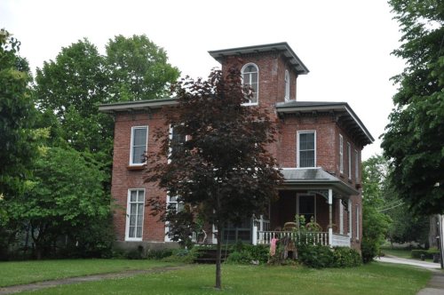
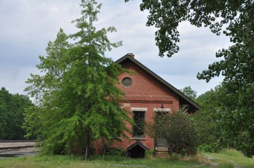
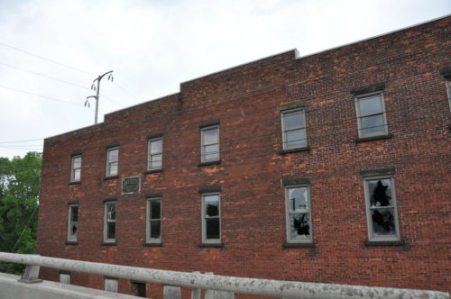
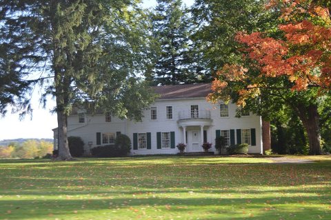
20 listings: 17 buildings, among them the Barcelona Lighthouse and Keeper's Cottage (listed 1972, the first), 2 historic districts, the East Main Street Historic District and the French Portage Road Historic District, with 116 contributing buildings, and 1 structure. 143 historic buildings in all.
How old are the homes in Westfield?
48% of Westfield’s homes were built before 1940 (Census estimate, ±10.5 points), against a typical 27% for a New York town; the median home was built in 1948.
Founding dates: Wikidata, Wikipedia, the U.S. post office records of Blevins & Helbock (CC0) and the Census. Homes by year built: Census ACS 2020–24. National Register of Historic Places: National Park Service (list of May 22, 2026). Old photos, postcards and papers: Wikimedia Commons, the Library of Congress and other public archives, credited on each item’s page. Maps: U.S. Geological Survey historical topographic maps (via Esri) and Sanborn fire-insurance maps (Library of Congress). History text and census tables: Wikipedia (CC BY-SA 4.0). Places that used to be: USGS Geographic Names Information System (2021).
From Wikimedia Commons (17), Wikidata (1), the National Register of Historic Places (20), Wikipedia, Wikidata and Wikipedia for famous people, U.S. Geological Survey historical maps, U.S. Census counts (via Wikipedia), the US Post Offices dataset (Blevins & Helbock), the USGS Geographic Names Information System, Sanborn fire insurance maps (Library of Congress) and old county and town histories (Internet Archive). Archive images are copied here with their credits and licenses, shown on each photo’s page. Refreshed monthly.








 1867
 1867
 1867
 1867
 1867
 1992
 2014
 2012
 2006
 2006
 2006
 2006
 2006
 2006


