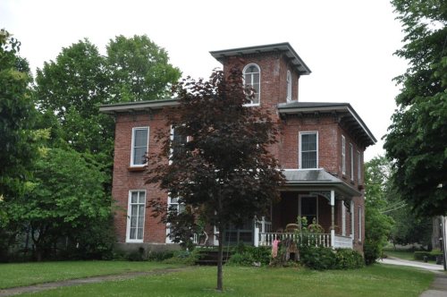
224 years in pictures
Census counts: 2,476 in 1830, 4,545 in 2020. The archive holds 18 old photos and papers going back to 1867 and 2 maps from 1899 on.
20 places on the National Register of Historic Places.
- 1802Westfield is settled
Each edition grades its towns against each other only.

Incomes are its weak spot: the median household income is $51K, and 13% of residents live below the poverty line. Overall, Westfield earns a C+, better than 39% of U.S. towns. The ranking puts it 477th of 745 in New York. Its strongest is hazard risk (A). Add cost of living to its strengths (B+): a typical home costs about $114K, 2 years of the Jamestown area’s $58K median household income. Its National Register listings include Barcelona Lighthouse and Keeper's Cottage and L. Bliss House. History is its standout character grade: an A+, better than 99% of U.S. towns, with 20 places on the National Register.
Figures: FEMA National Risk Index · home values, Zillow · incomes, Census ACS, 2020–24 · National Register of Historic Places.
Where Westfield beats most towns.
Barcelona Lighthouse and Keeper's CottageCensus counts: 2,476 in 1830, 4,545 in 2020. The archive holds 18 old photos and papers going back to 1867 and 2 maps from 1899 on.
20 places on the National Register of Historic Places.
Each subject compared with towns across the country (schools within New York), ordered by how far Westfield is from typical.
How TownRatings grades towns →
Who provides power, water and the rest in Westfield, and how to reach them.
EPA SDWIS (Oct 9, 2026) · HIFLD + EIA-861 2025 · Census 2020 ZCTAs · NCES 2024–25 · registration: vote.gov, updated Aug 3, 2026.
Ordered by what stands out in Westfield.
Westfield gets more snow than nearly all U.S. towns and is healthier than towns with similar incomes, but it has household incomes well below the New York norm.
Storm and flood damage is expected to run lower than in 90% of U.S. communities. FEMA puts nearly three quarters of Westfield’s expected hazard losses down to inland flooding, and 8% to tornadoes. Federal disaster aid has reached households in Westfield after 6 declared disasters, most recently in 2014.
FEMA disaster declarations and aid · FEMA National Risk Index · OpenFEMA
Two of its 3 schools are below, each with the reason it’s listed. Its public schools are run by the Westfield Central School District.
| School | Level | Students | Letter |
|---|---|---|---|
| Westfield Elementary SchoolLargest public elementary schoolGrades PK–5 | Grades PK–5 | 288 | C |
| Westfield High SchoolLargest public high schoolGrades 6–12 | Grades 6–12 | 203 | A+ |
NCES · EDFacts · graded within NY on state tests and graduation
The average commute for its 1,753 working residents takes 14.8 minutes, against 32.6 across New York.
One in 4 of Westfield’s working residents works locally. The mean commuting time for Westfield comes to 15 minutes, below both the New York town median (25 minutes) and the median of U.S. towns (25 minutes). Employers in Westfield shed 149 jobs between 2013 and 2023, to 1,169. The top destinations are Chautauqua (10%), Portland (9%) and Dunkirk (4%).
| Westfield | New York towns | U.S. towns | |
|---|---|---|---|
| Average trip to work | 15 minutes | 25 minutes | 25 minutes |
| Working residents who work in town | 26% | 10% | 8% |
| Median household income | $51,000 | $82,000 | $80,000 |
| Below the poverty line | 13% | 9.5% | 9.6% |
Census LEHD 2023 · ACS
Against the 6,110 U.S. towns with household incomes like Westfield’s, it is healthier than 60%, so its C isn’t only a matter of income.
The share of adults in Westfield who smoke cigarettes is 17%, above both New York’s towns (13%) and U.S. towns (14%). For adults in the town, the share who have obesity is 37%. Add to that, only 10 of the 755 New York towns we compare have a higher share of adults who have diabetes than Westfield. Against the New York average, Westfield comes out ahead on 1 CDC measures out of 32, and behind on 14.
| Westfield | New York towns | U.S. towns | |
|---|---|---|---|
| Frequent physical distress (CDC PLACES) | 17% | 14% | 14% |
| High blood pressure (CDC PLACES) | 41% | 34% | 35% |
| Diabetes (CDC PLACES) | 14% | 11% | 12% |
| Smoke cigarettes (CDC PLACES) | 17% | 13% | 14% |
| What stands out | Westfield | NY |
|---|---|---|
| More adults treating high blood pressure | 80.6% | 77.2% |
| More adults with COPD | 10.5% | 6% |
CDC PLACES 2025 · modeled estimates for adults · CMS · HRSA
The Sherman weather station, 8 miles away, records that 225 inches of snow fall in a normal winter, more than in 100% of U.S. towns.
Westfield’s July high is 79°F.
NOAA U.S. Climate Normals, 1991–2020
Count the trails in 5 parks and preserves and they come to 2.4 miles. Westfield’s density of trails comes in at 0.1 miles per square mile. Parks and preserves in the town: 5, covering 29 acres.
| Westfield | New York towns | U.S. towns | |
|---|---|---|---|
| Miles of trail per square mile | 0.1 miles per square mile | 0.4 | 0.4 |
| Conserved land | 1.7% | 5.2% | 4.3% |
| Biggest places to walk | Trails | Acres |
|---|---|---|
| 1. Ottoway Park | — | 15 |
| 2. Welch Field Park | — | 5 |
| 3. Chautauqua Gorge State Forest | — | 4 |
Trails & parks © OpenStreetMap contributors · Conserved land: USGS PAD-US
None within 15 miles of Westfield; the nearest are
About 1 of every 100 Westfield residents are enrolled in college, against 7 across New York.
20 places in Westfield on the National Register of Historic Places.
9 notable people were born in Westfield.


Town in New York, United States
Westfield is a town in the western part of Chautauqua County, New York, United States. The population was 4,513 at the 2020 census. Westfield is also the name of a village within the town, containing 65% of the town's population. This unique town is accompanied by vineyards, gorges and historical buildings.
From Wikipedia, licensed CC BY-SA 4.0 · facts via Wikidata (CC0)
4 towns share a border with Westfield.
| Town | NY rank | Overall | Cost | Safety | Schools | Health |
|---|---|---|---|---|---|---|
| Westfield | #477 | C+ | B+ | — | B− | C |
| Chautauqua | #334 | B | B | — | A− | B− |
| Portland | #672 | D | B | — | C− | C+ |
| Ripley | — | — | A− | — | B− | C |
| Sherman | — | — | A− | — | B | C+ |
Ripley and Sherman have fewer than 2,500 residents, so they get subject grades but no overall grade. Westfield, Chautauqua, Portland, Ripley and Sherman report no FBI crime data of their own. Compare Westfield with a neighbor →
Short answers, built from the data on this page.
Westfield grades C+ overall, better than 39% of U.S. towns and #477 of 745 in New York. It grades C for health and B− for schools. Jobs & income is its weak spot, with a D.
Not for the area. Cost of living, which also weighs rents, property taxes and how many households pay 30% or more of their income for housing, grades B+.
9 notable people were born here, including John Wrench and Alexander Wilson.