194 years in pictures
Census counts: 1,899 in 1840, 1,618 in 2020. The archive holds 1 old photo or paper going back to 1867 and 4 maps from 1905 on.
- 1832Sherman is settled
Each edition grades its towns against each other only.

Sherman’s best subject grades are an A− for cost of living and a B+ for the outdoors; its weakest is a D for incomes. Only 99 of New York’s 1,216 towns score lower on incomes. 28% of residents are under 18 in Sherman, above both the New York town median (20%) and the median of U.S. towns (22%). The biggest place to walk is North Harmony State Forest, 769 acres with 1.2 miles of trail. Sherman has fewer than 2,500 residents, so it gets subject grades but no overall grade.
Where Sherman beats most towns.
Where Sherman’s working residents go each day. Line width shows the share.
Census LEHD 2023
Each subject compared with towns across the country (schools within New York), ordered by how far Sherman is from typical.
How TownRatings grades towns →
Census counts: 1,899 in 1840, 1,618 in 2020. The archive holds 1 old photo or paper going back to 1867 and 4 maps from 1905 on.
Who provides power, water and the rest in Sherman, and how to reach them.
EPA SDWIS (Oct 9, 2026) · HIFLD + EIA-861 2025 · Census 2020 ZCTAs · NCES 2024–25 · registration: vote.gov, updated Aug 3, 2026.
Ordered by what stands out in Sherman.
Only nearly a tenth of working residents stay in Sherman for work; the rest commute out. In Sherman, 15% of residents live below the poverty line. Employers in Sherman added 43 jobs between 2013 and 2023, to 311. The town’s typical household income stands at $52,000.
| Sherman | New York towns | U.S. towns | |
|---|---|---|---|
| Median household income | $52,000 | $82,000 | $80,000 |
| Below the poverty line | 15% | 9.5% | 9.6% |
| Average trip to work | 26 minutes | 25 minutes | 25 minutes |
Census LEHD 2023 · ACS
The Sherman Central School District runs its public schools. Two of its 4 schools are shown below, with the reason for each. Public school enrollment in the town: 414 students across 2 schools.
| School | Level | Students | Letter |
|---|---|---|---|
| Sherman Elementary SchoolLargest public elementary schoolGrades PK–6 | Grades PK–6 | 234 | B |
| Sherman High SchoolLargest public high schoolGrades 7–12 | Grades 7–12 | 180 | B+ |
NCES · EDFacts · graded within NY on state tests and graduation
FEMA puts 77% of Sherman’s expected hazard losses down to inland flooding, and 8% to tornadoes. Federal disaster aid has reached households in Sherman after 5 declared disasters, most recently in 2014. The FEMA risk score in the town is 27 of 100.
FEMA disaster declarations and aid · FEMA National Risk Index · OpenFEMA
The range runs from 15° on a January night to 78° on a July afternoon, with about 225 inches of snow a winter.
NOAA U.S. Climate Normals, 1991–2020
Among adults in Sherman, 17% binge drink. Two figures for adults here: 17% smoke cigarettes, 40% sleep under 7 hours.
| Sherman | New York towns | U.S. towns | |
|---|---|---|---|
| Frequent physical distress (CDC PLACES) | 16% | 14% | 14% |
| Smoke cigarettes (CDC PLACES) | 17% | 13% | 14% |
| Sleep under 7 hours (CDC PLACES) | 40% | 37% | 36% |
| Frequent mental distress (CDC PLACES) | 18% | 16% | 17% |
| What stands out | Sherman | NY |
|---|---|---|
| More adults with COPD | 9.3% | 6% |
| More smokers | 16.6% | 11.3% |
| More adults with heart disease | 7.9% | 6.1% |
CDC PLACES 2025 · modeled estimates for adults · CMS · HRSA
In 3 parks and preserves, walkers have 13 miles of trail. Parks and preserves in Sherman: 3, covering 1,452 acres.
| Sherman | New York towns | U.S. towns | |
|---|---|---|---|
| Conserved land | 6.4% | 5.2% | 4.3% |
| Miles of trail per square mile | 0.4 miles per square mile | 0.4 | 0.4 |
| Biggest places to walk | Trails | Acres |
|---|---|---|
| 1. North Harmony State Forest | 1.2 mi | 769 |
| 2. Alder Bottom Wildlife Management Area | — | 636 |
| 3. Mount Pleasant State Forest | — | 47 |
Trails & parks © OpenStreetMap contributors · Conserved land: USGS PAD-US
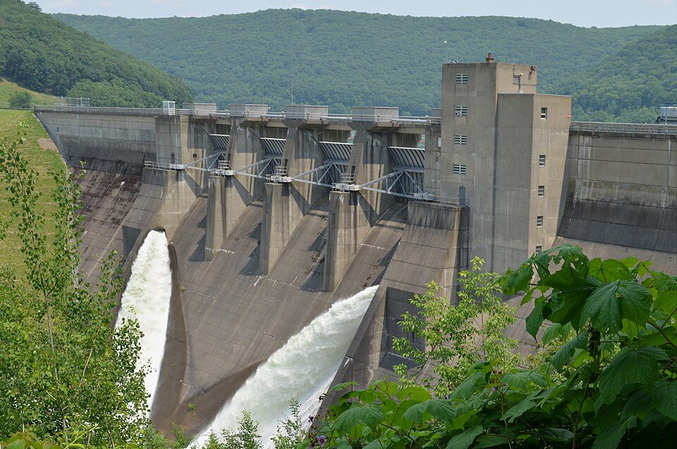
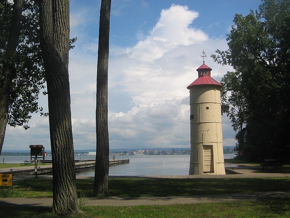
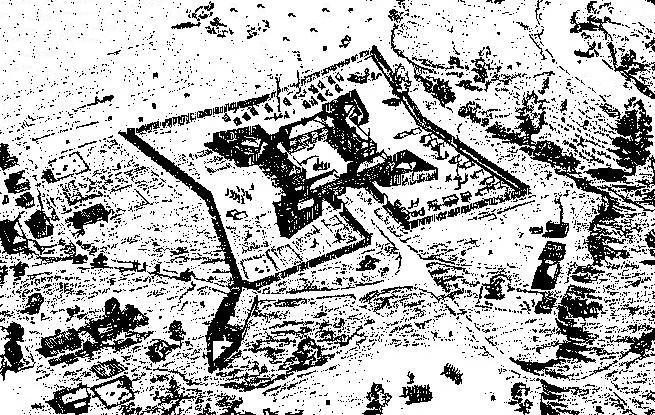
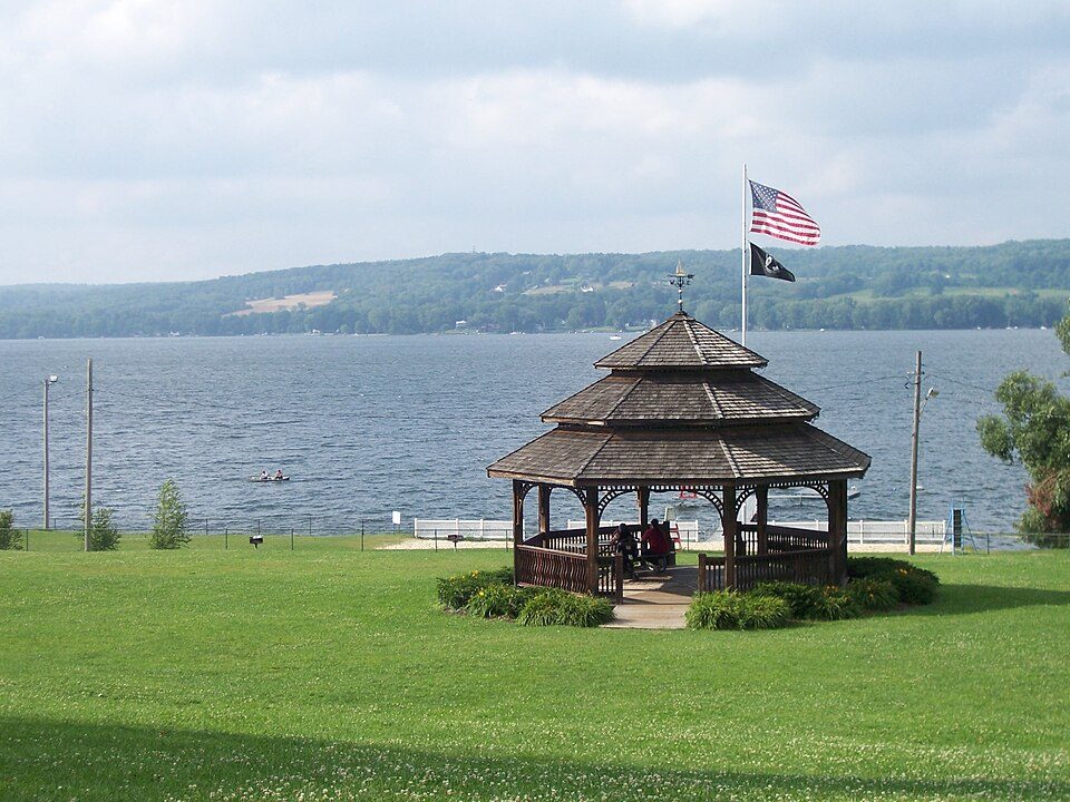
Museums, parks, gardens and other places to visit around Sherman. Close and well known come first.
10 mi LakeChautauqua Lake
36 mi DamKinzua Dam
27 mi State parkPresque Isle State Park
25 mi LandmarkFort Le Boeuf30 mi Theme parkWaldameer Park
18 mi MuseumLucille Ball-Desi Arnaz CenterChautauqua Lake: Banderas, Public domain · Kinzua Dam: Niagara, CC BY-SA 3.0 · Presque Isle State Park: Ruhrfisch, CC BY-SA 3.0 · Fort Le Boeuf: Charles M. Stotz ?, Public domain · Lucille Ball-Desi Arnaz Center: G. Edward Johnson, CC BY 4.0
None within 15 miles of Sherman; the nearest are
About 4 of every 100 Sherman residents are enrolled in college, against 7 across New York.
5 towns share a border with Sherman.
| Town | NY rank | Overall | Cost | Safety | Schools | Health |
|---|---|---|---|---|---|---|
| Sherman | — | — | A− | — | B | C+ |
| Mina | — | — | — | — | — | — |
| North Harmony | — | — | B− | — | A− | B |
| Westfield | #477 | C+ | B+ | — | B− | C |
| Clymer | — | — | A− | — | B− | C+ |
| Chautauqua | #334 | B | B | — | A− | B− |
Sherman, North Harmony and Clymer have fewer than 2,500 residents, so they get subject grades but no overall grade. Sherman, North Harmony, Westfield, Clymer and Chautauqua report no FBI crime data of their own. Mina isn’t graded (fewer than 1,000 residents, or not enough data). Compare Sherman with a neighbor →
Short answers, built from the data on this page.
Not for the area. Cost of living, which also weighs rents, property taxes and how many households pay 30% or more of their income for housing, grades A−.