The Tioga post office opened in 1837, the earliest record of the town by name. Three smaller post offices, Girl's Flatts (1837), Halsey Valley (1844) and Straits Corners (1854), opened inside today’s town and later closed.
First census: 1,816 in 18202020 census: 4,440189 years
How historic is Tioga?
A−
More historic than 80% of U.S. towns, on its age, its old homes and the National Register.
Founding year: the first Tioga post office (Blevins & Helbock, CC0).The full story ↓
History grade
What drives Tioga’s History grade
On its age, its old homes and the National Register, Tioga is more historic than 80% of U.S. towns, #421 of 758 in New York. All 3 inputs are above most U.S. towns; its age ranks highest and its National Register listings lowest.
A−
HistoryA character grade: shown, never part of Tioga’s overall grade.
New York towns list more on the Register than most of the country (a typical New York town has 12.3 per 10,000 residents, the U.S. 2.4), so Tioga’s 16.1 sits near the middle of its state (53% of New York towns have fewer) while its 7 historic buildings outnumber those of 73% of U.S. towns.
How sure. Graded on any two of the three inputs instead, the letter would range from B+ to A−. The pre-1940 share is a Census survey estimate (±6.7 points). The founding year is the first post office, not a stated founding date.
Founding year: the first post office (other dates in Quick answers). Homes: Census ACS 2020–24. National Register: National Park Service, May 2026 list; each listing counted once (boundary changes and added documentation belong to their listing), and a historic district counts its contributing buildings. How TownRatings grades history →
What stands out about Tioga’s past
Read from the archive, the National Register and the record. The page puts what stands out first.
Lost post offices, old corners, places now gone and burying grounds
Tioga had its own post office from 1837 to 1846. Three other post offices opened and closed inside today’s town.
Smithsboro
1807–today
Girl's Flatts
1837–1844
Tioga
1837–1846
Tioga Centre
1838–today
Halsey Valley
1844–1958
Straits Corners
1854–1954
18001910today
Hamlets and corners on the map
Airways Mobile Home ParkCatlin HillGermany HillGlenmary Mobile Home ParkGoodrichHalsey ValleyHorton CrossingMaple Shade Trailer ParkMountain View Mobile Home ParkOwego HeightsOwego Heights Mobile Home ParkPebble Hill Mobile Home ParkPine Tree Mobile Home ParkSmithboroStraits CornersTioga Center
For thousands of years, this area of New York had been settled by distinct cultures of indigenous peoples. The most recent prehistoric peoples were the Owasco, who appeared to migrate from southern areas and displaced the Point Peninsula complex peoples. However, a 2011 paper by archaeologist Dr. John P. Hart argues there was no definable Owasco culture. They lived in isolated villages and had frequent warfare. Under pressure of warfare, they began to consolidate into larger tribes and confederacies.
Passages that mention Tioga, cut from the printed page as they were published.
Historical gazetteer of Tioga County, New York, 1785-18881887 · page 201Read the page →
Read the text
The territory within this town has changed its name so often as to perplex the person who attempts to write its history. From i6 Feb., 1791, till 14 March, 1800, a part of the town of Union, in the county of Tioga, and bearing the local name of Brown's Settlement during that time. From 14 March, 1800, till 12 Feb., 1808, a part of the town of Tioga, at first in the county of Tioga, but after 28 March, 1806, a part of the county of Broome, taking also, during that time, as its ecclesiastical name, "the Society
Text read by machine from the scan; it may contain errors.
An outline history of Tioga and Bradford counties in Pennsylvania, Chemung, Steuben, Tioga, Tompkins and Schuyler in New York1885 · page 220Read the page →
Read the text
town of Westville, taken from the town of Berkshire was created, and by an act of the legislature, session 47, chapter 109, passed March 24, 1824, the name Westville was changed to Newark, and in 1862, again changed to Newark Valley. The town "is situated in the central eastern portion of Tioga county, adjoining the Broome county line. It is bounded on the north by the town of Berkshire, in Tioga county, on the east by Broome county, on the south by Broome county, and the town of Owego, in Tioga county, on the west by the town of Candor, in Tioga county. The east branch of
Text read by machine from the scan; it may contain errors.
An outline history of Tioga and Bradford counties in Pennsylvania, Chemung, Steuben, Tioga, Tompkins and Schuyler in New York1885 · page 20Read the page →
Read the text
Covington township was formed from the township of Tioga, and originally contained the territory now chiefly composed of the township of Bloss and Blossburg Borough, Sullivan and Mainesburg Borough, Ward and the borough of Fall Brook, Union, Liberty and Morris. The earliest settler in the township was Aaron Bloss, who located in the township in the year 1801, and subsequently removed and founded Blossburg, five miles further up the Tioga river in the year 1806. The next early settlers were David Clemmons Hovey, Washburne, Mallory, Sackett, Levi Prentiss, John Patten, Tilley
Text read by machine from the scan; it may contain errors.
Historical gazetteer of Tioga County, New York, 1785-18881887 · page 317Read the page →
Read the text
On the I4lh of March, i8oo,' the present town of Owego was organized from Union and named Tioga, and ,when Broome •county was organized on March 22, 1806, the town became apart •of her territory. The disadvantages of having a town of Owego •on the west side of the Owego creek, and a village of Owego in the town of Tioga on the east side of the creek were such that in the revision of the statutes, in 1813, the names of the towns •of Owego arid Tioga were exchanged, the one for the other, as
Text read by machine from the scan; it may contain errors.
Scans and text from the Internet Archive. Books published in 1930 or earlier, which are in the public domain.
Timeline
Tioga, 1807 to 2010
Woven from the archive, old maps, post office records, the National Register and the people born here.
The Tioga post office opened in 1837, the earliest record of the town by name (U.S. post office records).
How does Tioga rank for history?
Tioga is more historic than 80% of U.S. towns, #421 of 758 in New York. The History grade combines the town’s founding era, the share of homes built before 1940 and its National Register listings. It’s a character grade, so it isn’t part of the overall grade. How it works.
What is on the National Register in Tioga?
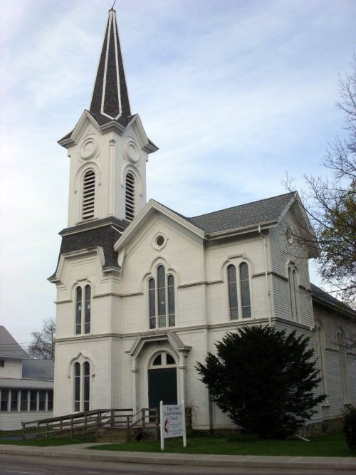
4 listings: 4 buildings, among them the First Methodist Episcopal Church of Tioga Center (listed 2002, the first). 7 historic buildings in all.
How old are the homes in Tioga?
19% of Tioga’s homes were built before 1940 (Census estimate, ±6.7 points), against a typical 27% for a New York town; the median home was built in 1977.
Founding dates: Wikidata, Wikipedia, the U.S. post office records of Blevins & Helbock (CC0) and the Census. Homes by year built: Census ACS 2020–24. National Register of Historic Places: National Park Service (list of May 22, 2026). Old photos, postcards and papers: Wikimedia Commons, the Library of Congress and other public archives, credited on each item’s page. Maps: U.S. Geological Survey historical topographic maps (via Esri) and Sanborn fire-insurance maps (Library of Congress). History text and census tables: Wikipedia (CC BY-SA 4.0). Places that used to be: USGS Geographic Names Information System (2021).
From the Library of Congress (5), the National Register of Historic Places (4), Wikipedia, U.S. Geological Survey historical maps, U.S. Census counts (via Wikipedia), the US Post Offices dataset (Blevins & Helbock), the USGS Geographic Names Information System and old county and town histories (Internet Archive). Archive images are copied here with their credits and licenses, shown on each photo’s page. Refreshed monthly.
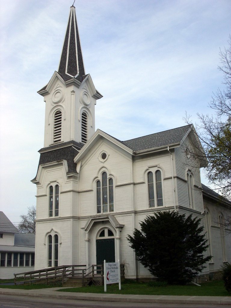


 2018
 2018
 2018
 2018
 2018