More historic than 76% of U.S. towns · #469 of 758 in New York. What drives it
5 places in town are on the National Register, among them two historic districts with 63 buildings between them. Below: maps from 1895 on and the census since 1820.
On its age, its old homes and the National Register, Sullivan is more historic than 76% of U.S. towns, #469 of 758 in New York. All 2 inputs are above most U.S. towns; its National Register listings ranks highest and its share of homes from before 1940 lowest.
A−
HistoryA character grade: shown, never part of Sullivan’s overall grade.
New York towns list more on the Register than most of the country (a typical New York town has 12.3 per 10,000 residents, the U.S. 2.4), so Sullivan’s 45.6 sits above most of its state (67% of New York towns have fewer) while its 67 historic buildings outnumber those of 87% of U.S. towns.
How sure. Graded on two of the three inputs, so a change in either one moves the letter more than it would with three. The pre-1940 share (±2.8 points) is firm at this size.
Founding year: our sources. Homes: Census ACS 2020–24. National Register: National Park Service, May 2026 list; each listing counted once (boundary changes and added documentation belong to their listing), and a historic district counts its contributing buildings. How TownRatings grades history →
What stands out about Sullivan’s past
Read from the archive, the National Register and the record. The page puts what stands out first.
Lost post offices, old corners, places now gone and burying grounds
Sullivan had its own post office from 1798 to 1903. Four other post offices opened and closed inside today’s town.
Sullivan
1798–1903
Canasarga
1816–1823
Chittenango
1823–today
Bridgeport
1828–today
Lakeport
1849–1903
East Boston
1860–1909
Chittenango Station
1869–1968
17901910today
Hamlets and corners on the map
BolivarBridgeportChittenangoEast BostonEaton CornersEdgebrook Mobile Home ParkFyler SettlementGees CornerLakeportMohawk Manor Trailer ParkNorth ChittenangoOneida Lake Beach WestOniontownShady Lane Manufactured Housing CommunitySulphur SpringsTall Pines VillageWeaver CornerWillow Run Mobile Home Park
Gone or out of use
Black Creek SchoolschoolBushnell SchoolschoolLakeview AirportairportLakewood SchoolschoolPerryville Quarrymine
Settlement began around 1790. The town was established in 1803 from the town of Cazenovia. In 1809, the town was partitioned to form the town of Lenox.
The Chittenango Landing Dry Dock Complex was listed on the National Register of Historic Places in 1992.
Passages that mention Sullivan, cut from the printed page as they were published.
A history of Sullivan County, Indiana, closing of the first century's history of the county, and showing the growth of its people, institutions, industries and wealth1909 · page 10Read the page →
Read the text
In the boundaries of this "Old Purchase," as it was called, were planted the first settlements of Sullivan county. It is probable that in 1803. at the time of the treaty, some of the lands south of the Indian boundary were in the nominal possession of certain individuals who claimed them by right of one of the methods above described. So far as can be learned there was no actual settlement in Sullivan county previous to the year 1803. The family of James Ledgerwood came to this vicinity in
Text read by machine from the scan; it may contain errors.
A history of Sullivan County, Indiana, closing of the first century's history of the county, and showing the growth of its people, institutions, industries and wealth1909 · page 77Read the page →
Read the text
finest types of its citizenship, was born near Greenville, Tennessee, January 27, 181 1, the oldest child of Adam and Margaret Wilson. Both his grandfathers served in the Revolutionary war. The family came to Sullivan county in 1832, settling at first near Carlisle and later in Cass township. Harvey Wilson assisted in laying out the town of Sullivan. He was a teacher in one of the early log school houses of the county.
Text read by machine from the scan; it may contain errors.
Journals of the military expedition of Major General John Sullivan against the Six nations of Indians in 17791887 · page 426Read the page →
Read the text
mischief which time and circumstances will permit." And in the order to General Sullivan, Washington said : " The immediate objects are the total destruction of the hostile tribes of the Six Nations, and the devastation of their settlements, and the capture of as many prisoners of every age and sex as possible." Sullivan was directed " to lay waste all the settlements around, so that the country may not only be overrun but destroyed." Writing to the President of Congress, Washington used these words : " The council are fully sensible of the importance of success in the present expedition, and the fatal mischiefs which would attend a defeat. We should perhaps lose an army, and our frontiers,
Text read by machine from the scan; it may contain errors.
Scans and text from the Internet Archive. Books published in 1930 or earlier, which are in the public domain.
Timeline
Sullivan, 1798 to 2010
Woven from the archive, old maps, post office records, the National Register and the people born here.
Sullivan is more historic than 76% of U.S. towns, #469 of 758 in New York. The History grade combines the town’s founding era, the share of homes built before 1940 and its National Register listings. It’s a character grade, so it isn’t part of the overall grade. How it works.
What is on the National Register in Sullivan?
5 listings: 3 buildings and 2 historic districts, the Rutger-Steuben Park Historic District and the Chittenango Landing Dry Dock Complex, with 63 contributing buildings. 67 historic buildings in all.
How old are the homes in Sullivan?
13% of Sullivan’s homes were built before 1940 (Census estimate, ±2.8 points), against a typical 27% for a New York town; the median home was built in 1974.
Founding dates: Wikidata, Wikipedia, the U.S. post office records of Blevins & Helbock (CC0) and the Census. Homes by year built: Census ACS 2020–24. National Register of Historic Places: National Park Service (list of May 22, 2026). Old photos, postcards and papers: Wikimedia Commons, the Library of Congress and other public archives, credited on each item’s page. Maps: U.S. Geological Survey historical topographic maps (via Esri) and Sanborn fire-insurance maps (Library of Congress). History text and census tables: Wikipedia (CC BY-SA 4.0). Places that used to be: USGS Geographic Names Information System (2021).
From Wikimedia Commons (26), the National Register of Historic Places (5), Wikipedia, Wikidata and Wikipedia for famous people, U.S. Geological Survey historical maps, U.S. Census counts (via Wikipedia), the US Post Offices dataset (Blevins & Helbock), the USGS Geographic Names Information System and old county and town histories (Internet Archive). Archive images are copied here with their credits and licenses, shown on each photo’s page. Refreshed monthly.


 2015
 2012
 2012
 2012
 2012
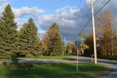 2012
 2012
 2012
 2012
 2012
 2012
 2012
 2012
 2012
 2012
 2012
 2012
 2012
 2012
 2012
 2012
 2012
 2012
 2012
 2012
 2012


