
Shelter Island HeightsNY
This town of 1,230 people was settled in 1886.
Is Shelter Island Heights a good place to live?
71% of adults 25 and older hold a bachelor’s degree or more in Shelter Island Heights, above both New York’s towns (32%) and U.S. towns (29%). Of the 759 New York towns we compare, none has a higher median age than Shelter Island Heights. We don’t grade Shelter Island Heights yet; the figures below are still real.
Shelter Island Heights has grown 53% from 2010 to 2020
1,048 counted in 2010 and 1,601 in 2020.
U.S. Census 2010 & 2020 counts
Moving to Shelter Island Heights: who provides what
Shelter Island Heights is unincorporated, so Suffolk County and regional agencies provide most services.
EPA SDWIS (Oct 9, 2026) · HIFLD + EIA-861 2025 · Census 2020 ZCTAs · NCES 2024–25 · registration: vote.gov, updated Aug 3, 2026.
The data
Ordered by what stands out in Shelter Island Heights.
Natural hazards: very low risk in Shelter Island Heights, mostly inland flooding
FEMA puts 54% of Shelter Island Heights’s expected hazard losses down to inland flooding, and 18% to hurricanes. Compared with 96% of U.S. communities, expected storm and flood damage in the town is lower.
FEMA National Risk Index · OpenFEMA
About one in three of Shelter Island Heights’ working residents commute to Shelter Island
Jobs based in Shelter Island Heights grew to 350 in 2024, 71 more than in 2014. Just 14% of the town’s working residents have a job in town. Shelter Island Heights’ mean commuting time is 17 minutes. Half of commuters travel less than 34 miles.
| Shelter Island Heights | Typical New York town | Typical U.S. town | |
|---|---|---|---|
| Average trip to work | 17 minutes | 25 minutes | 25 minutes |
| Below the poverty line | 15% | 9.5% | 9.6% |
| Working residents who work in town | 14% | 10% | 7.9% |
Where working residents work
Census LEHD 2024 · ACS
Four seasons and pleasant summers: that is Shelter Island Heights’ year
Shelter Island Heights’ typical July afternoon high works out to 81°F.
Typical low → high °F
NOAA U.S. Climate Normals, 1991–2020
A smaller share of adults in Shelter Island Heights binge drink than in the typical New York or U.S. town
Only 2 of the 756 New York towns we compare have a higher share of adults who had a checkup this year than Shelter Island Heights. Shelter Island Heights: 16% of adults have been diagnosed with depression. Also worth knowing: across all 32 CDC measures, Shelter Island Heights beats New York on 13 and trails on 7.
| Shelter Island Heights | Typical New York town | Typical U.S. town | |
|---|---|---|---|
| Feel lonely (CDC PLACES) | 26% | 32% | 33% |
| Depression (CDC PLACES) | 16% | 21% | 23% |
| Yearly checkup (CDC PLACES) | 86% | 81% | 79% |
| Frequent mental distress (CDC PLACES) | 13% | 16% | 17% |
| What stands out | Shelter Island Heights | NY |
|---|---|---|
| Fewer adults facing housing insecurity | 7.7% | 14.5% |
| Fewer adults facing food insecurity | 9.8% | 17.2% |
| More adults who have had cancer | 13.4% | 7.7% |
CDC PLACES 2025 · modeled estimates for adults · CMS · HRSA
Open space protected for good: 1.3% of Shelter Island Heights
4.3 miles of trail. The density of trails for Shelter Island Heights is 0.3 miles per square mile.
| Shelter Island Heights | Typical New York town | Typical U.S. town | |
|---|---|---|---|
| Conserved land | 1.3% | 5.2% | 4.3% |
| Miles of trail per square mile | 0.3 miles per square mile | 0.4 | 0.4 |
Trails & parks © OpenStreetMap contributors · Conserved land: USGS PAD-US
Zillow Home Value Index · Redfin Data Center
Yale Bowl and 47 more within 40 miles
Museums, parks, gardens and other places to visit around Shelter Island Heights. Close and well known come first.
 36 mi Stadium & arenaYale Bowl
 33 mi Stadium & arenaMohegan Sun Arena
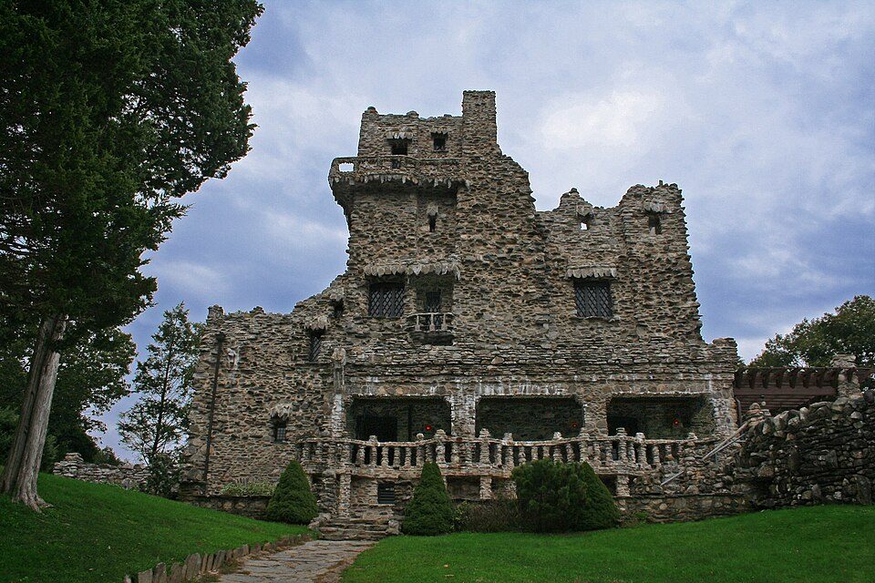 26 mi State parkGillette Castle State Park
 26 mi State parkCamp Hero State Park
 26 mi LighthouseMontauk Point Light
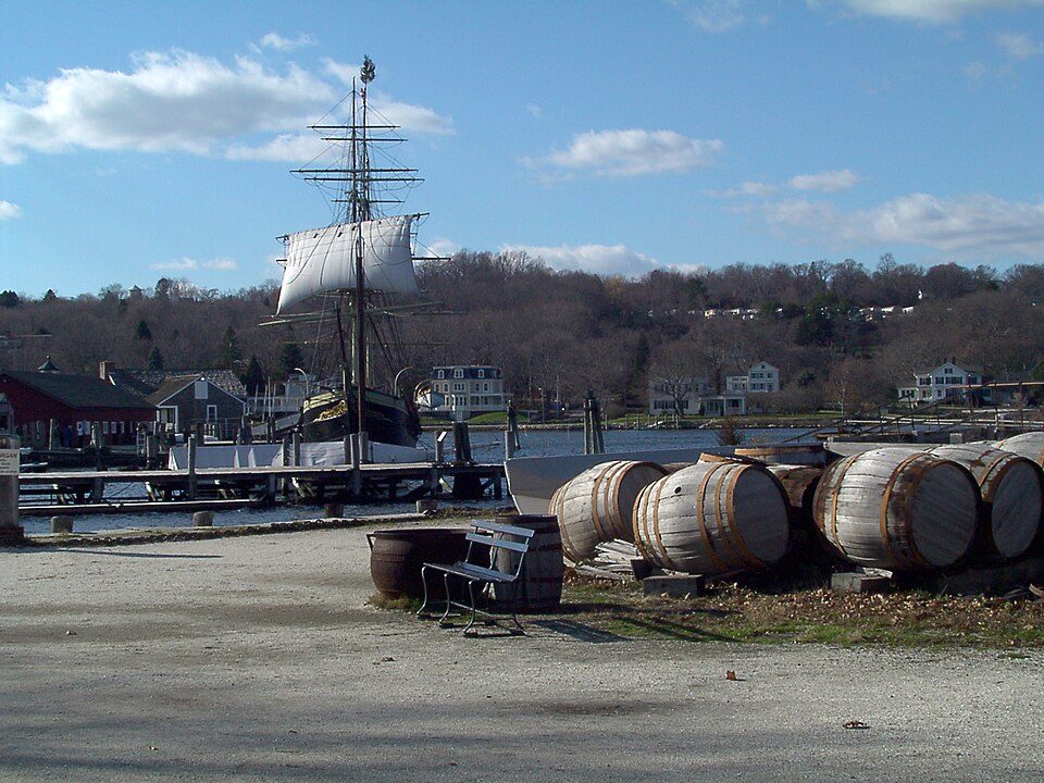 30 mi MuseumMystic Seaport
Photo credits
Yale Bowl: Kenneth Zirkel, CC BY-SA 4.0 · Mohegan Sun Arena: Bbjeter, CC BY-SA 3.0 · Gillette Castle State Park: Original uploader was Kevinpepin at en.wikipedia, Public domain · Camp Hero State Park: Transpoman, CC BY-SA 3.0 · Montauk Point Light: Wolfgang Wander, CC BY-SA 3.0 · Mystic Seaport: Joethon, Public domain


Everything we know about Shelter Island Heights
Colleges nearby
None within 15 miles of Shelter Island Heights; the nearest are
About 2 of every 100 Shelter Island Heights residents are enrolled in college, against 7 across New York.
Shelter Island Heights lives by the ocean
Coastal flooding makes up 16% of the storm damage FEMA expects here.
FEMA National Risk Index · OpenFEMA · OpenStreetMap
Shelter Island Heights’s neighbors
6 towns share a border with Shelter Island Heights.
| Town | NY rank | Overall | Cost | Safety | Schools | Health |
|---|---|---|---|---|---|---|
| Shelter Island Heights | — | — | — | — | — | — |
| Dering Harbor | — | — | — | — | — | — |
| Shelter Island | #274 | B+ | C− | A− | C+ | A− |
| Southold | #204 | B+ | D− | B+ | B+ | A |
| East Hampton | #273 | B+ | D− | — | B+ | A |
| Greenport West | — | — | — | — | — | — |
| East Marion | — | — | — | — | — | — |
East Hampton reports no FBI crime data of its own. Shelter Island Heights, Dering Harbor, Greenport West and East Marion aren’t graded (fewer than 1,000 residents, or not enough data). Compare Shelter Island Heights with a neighbor →
Questions about Shelter Island Heights
Short answers, built from the data on this page.
Is Shelter Island Heights, NY a good place to live?
We don’t grade Shelter Island Heights yet; the figures below are still real.