
Camp Hero State Park
Camp Hero State Park is a 3.05-square-kilometre (1.18 sq mi) state park located on Montauk Point, New York.

A state park inside East Hampton
You can stay in East Hampton
Camp Hero State Park is inside East Hampton, which has 97 places to stay, so you won’t need a base farther out. Where to stay ↓
Best months: May, Jun, Jul, Aug, Sep and Oct
May, June, July, August, September and October are the mild months, with highs of 64–81°. When to go ↓
Written from NOAA 1991–2020 normals, Overture places to stay, Census town figures, Wikidata and Wikipedia.
Weather, month by month
Typical highs and lows in East Hampton. Green months are the mild ones.
Camp Hero State Park
Camp Hero State Park is a 3.05-square-kilometre (1.18 sq mi) state park located on Montauk Point, New York. The park occupies a portion of the former Montauk Air Force Station.
- Type
- State park
- Run by
- New York State Office of Parks, Recreation and Historic Preservation
- Wikipedia readers
- 22K a year
Where to stay near Camp Hero State Park
The closest towns with hotels, motels or campgrounds are East Hampton (97) and New Shoreham (40).
Compare 8 towns
| Town | From Camp Hero | Drive | Places to stay | People | Typical home | Safety |
|---|---|---|---|---|---|---|
| East Hampton 47% vacation homes | in town | — | 97 53 hotels · 12 motels · 20 inns & B&Bs · 8 lodges & cabins · 4 campgrounds | 29,400 | $1,179K | — |
| New Shoreham 75% vacation homes | 18 mi northeast | 25 min | 40 15 hotels · 23 inns & B&Bs · 1 lodge or cabins · 1 hostel | 1,408 | $1,301K | — |
| Westerly | 18 mi north | 25 min | 37 16 hotels · 6 motels · 12 inns & B&Bs · 1 lodge or cabins · 2 RV parks | 23,139 | $467K | B+ |
| Stonington | 21 mi north | 30 min | 34 13 hotels · 1 motel · 15 inns & B&Bs · 1 lodge or cabins · 4 campgrounds | 18,832 | $483K | — |
| Southold 30% vacation homes | 24 mi west | 35 min | 50 18 hotels · 3 motels · 21 inns & B&Bs · 3 lodges & cabins · 5 campgrounds | 24,260 | $859K | B+ |
| Groton | 21 mi northwest | 30 min | 30 19 hotels · 4 motels · 7 inns & B&Bs | 39,138 | $340K | B+ |
| Charlestown 33% vacation homes | 23 mi northeast | 35 min | 18 3 hotels · 3 motels · 2 inns & B&Bs · 6 lodges & cabins · 4 campgrounds | 8,002 | $526K | A− |
| East Hampton 63% vacation homes | 19 mi southwest | 30 min | 10 3 hotels · 6 inns & B&Bs · 1 lodge or cabins | 1,552 | $2,000K | — |
Day trip from
Straight-line miles.
Getting there
Nearest airports with airline service
Also near Camp Hero
Other well-known places within 68 miles. Numbered ones are on the map above.
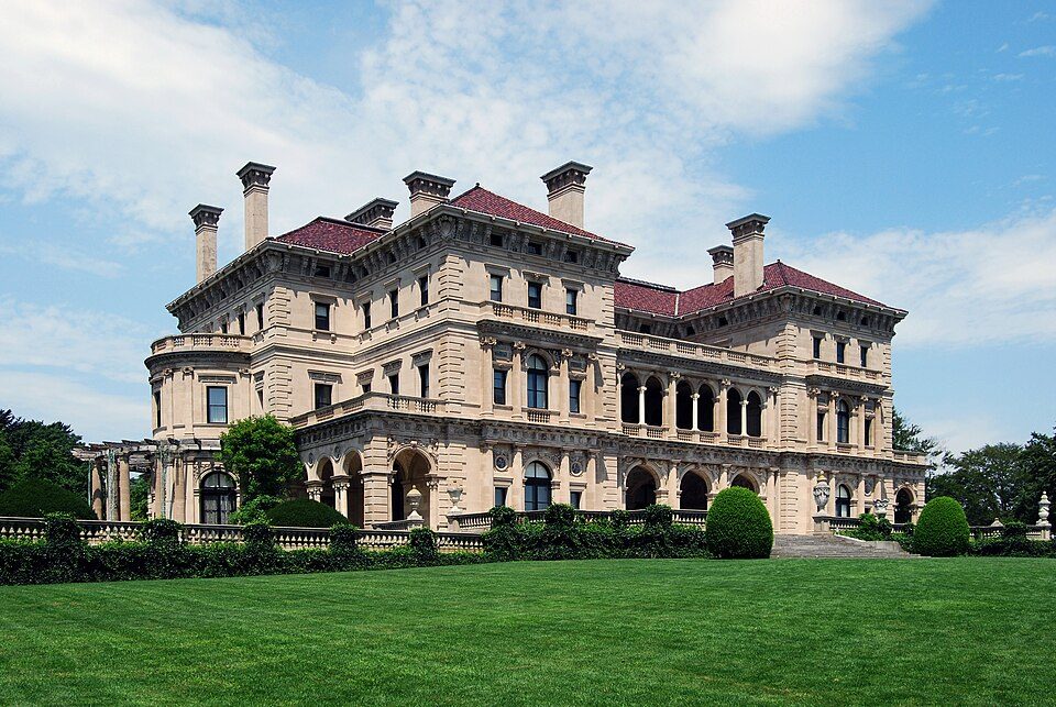 Big draw41 mi MuseumThe Breakers
 Big draw67 mi LakeLake Chaubunagungamaug
 1in town LighthouseMontauk Point Light
 46 mi Ancient siteHMS Endeavour
 57 mi MuseumUSS Massachusetts
 40 mi MuseumMarble House
 32 mi Stadium & arenaMohegan Sun Arena
 41 mi MuseumThe Elms
Photo credits
The Breakers: UpstateNYer, CC BY-SA 3.0 · Lake Chaubunagungamaug: Bree from Worcester, MA, USA, CC BY-SA 2.0 · Montauk Point Light: Wolfgang Wander, CC BY-SA 3.0 · HMS Endeavour: Samuel Atkins (c.1760-1810), Public domain · USS Massachusetts: USN, Public domain · Marble House: [email protected], Public domain · Mohegan Sun Arena: Bbjeter, CC BY-SA 3.0 · The Elms: The original uploader was Daderot at English Wikipedia., CC BY-SA 3.0


Visiting Camp Hero
Is Camp Hero State Park in East Hampton?
Yes. It’s inside East Hampton, NY.
When is the best time to visit Camp Hero State Park?
May, June, July, August, September and October, with highs of 64–81°.
How far is Camp Hero State Park from Brookhaven and Islip?
About 59 miles west of Brookhaven and about 74 miles west of Islip, as the crow flies.
What is the closest airport to Camp Hero State Park?
Westerly State (WST), about 20 miles away. The nearest big hub is Rhode Island T. F. Green (PVD), about 51 miles.
Where should I stay near Camp Hero State Park?
East Hampton (in town, 97 places to stay), New Shoreham (18 mi, 40 places to stay) and Westerly (18 mi, 37 places to stay).
Tips from people in East Hampton
No tips yet. Ask, or answer, in East Hampton’s Town Square.
Sources: National Park Service · ski areas © OpenSkiMap / OpenStreetMap contributors · Wikidata · Wikipedia readership · NOAA climate normals · U.S. Census.