Sandy Creek dates to 1803, and 27% of its homes were built before 1940
More historic than 91% of U.S. towns · #253 of 758 in New York. What drives it
14 places in town are on the National Register, among them a historic district with 14 buildings. Below: 3 old photos and papers, maps from 1885 on, and the census since 1830.
Founding year: Wikipedia. First post office: 1817.The full story ↓
History grade
What drives Sandy Creek’s History grade
On its age, its old homes and the National Register, Sandy Creek is more historic than 91% of U.S. towns, #253 of 758 in New York. All 3 inputs are above most U.S. towns; its share of homes from before 1940 ranks highest and its age lowest.
A
HistoryA character grade: shown, never part of Sandy Creek’s overall grade.
New York towns list more on the Register than most of the country (a typical New York town has 12.3 per 10,000 residents, the U.S. 2.4), so Sandy Creek’s 84.1 sits above most of its state (73% of New York towns have fewer) while its 32 historic buildings outnumber those of 82% of U.S. towns.
How sure. Graded on any two of the three inputs instead, the letter would range from A− to A. The pre-1940 share is a Census survey estimate (±5.7 points). Two sources give 1803.
Founding year: Wikipedia (other dates in Quick answers). Homes: Census ACS 2020–24. National Register: National Park Service, May 2026 list; each listing counted once (boundary changes and added documentation belong to their listing), and a historic district counts its contributing buildings. How TownRatings grades history →
What stands out about Sandy Creek’s past
Read from the archive, the National Register and the record. The page puts what stands out first.
Champlain passed through the town in 1615, leading a war party of Hurons (Wendat) and soldiers.
The town was first settled around 1803, near Lacona. Sandy Creek was formed from the Town of Richland in 1825.
In 1835, Sandy Creek resident Thomas Meacham decided to make the world's largest cheese as a gift to president Andrew Jackson. His finished product was 4 feet in diameter, 2 feet thick, and weighed nearly 1400 pounds. The cheese was delivered and sat in the White House until February 22, 1836, when the president invited the public to come to the White House and eat the cheese. This event was made famous in an episode of the television show The West Wing.
The Holyoke Cottage was listed on the National Register of Historic Places in 1988.
town of Sandy Creek. It was then Willianistown, that town having been set off from Mexico on tlie 24th of March, 1804, with boundaries which included tlio whole northeastern part of what is now Oswogo County, excojiling the town of Redfield.
Text read by machine from the scan; it may contain errors.
increased in numbers as the country settled ; but it was not legally incorporated until 1830. The following year the present commodious church edifice was erected on what is now Railroad street, in the village of Sandy Creek. Rev. Elisha Wheeler was the pastor at that time, but we have been unable to obtain the names of his successors.
Text read by machine from the scan; it may contain errors.
Scans and text from the Internet Archive. Books published in 1930 or earlier, which are in the public domain.
Timeline
Sandy Creek, 1803 to 2010
Woven from the archive, old maps, post office records, the National Register and the people born here.
Fire insurance maps drew every building, what it was made of and what it was used for, so insurers could price the risk of fire. Pick a year, then a sheet.
1885Sheet 1 of 1
Edition
Sheets
BrickWoodStone
Sanborn Map Company, via the Library of Congress. Editions published in 1930 or earlier, which are in the public domain.
Then & now
Stand where they stood
No then-and-now pairs yet. Take a photo from the same spot as an old one and they appear here side by side.
Retake this viewEast Boylston (Village); East Boylston Business Directory.; West Amboy Business Directory.; Sandy Creek Business Direct…, 1867
Find the spot, match the angle, and add your photo. It becomes the first then-and-now pair on Sandy Creek’s page.
Sandy Creek’s post office has been open since 1817.
Sandy Creek
1817–today
Lacona
1870–today
18101920today
Hamlets and corners on the map
Community ParkGreen Haven Mobile Home CommunityLaconaSandy PondThe Elms
Gone or out of use
Kidder FieldairportSchool Number 1schoolSchool Number 10schoolSchool Number 11schoolSchool Number 12schoolSchool Number 13schoolSchool Number 2schoolSchool Number 4schoolSchool Number 5schoolSchool Number 6schoolSchool Number 7schoolSchool Number 8school
6cemeteries and burying grounds inside Sandy Creek
BarnardBoylston Sandy Creek WesleyanNoyesScriptureStevensWoodlawn
US Post Offices dataset (Blevins & Helbock, CC0). Places and cemeteries from the USGS Geographic Names Information System (2021).
Stories next door
History across the town line
Each neighbor’s History grade, on the same three inputs.
In 1803, according to Wikipedia’s history of the town. Sandy Creek’s post office opened in 1817, and the census of 1830 counted 1,839 people here.
How does Sandy Creek rank for history?
Sandy Creek is more historic than 91% of U.S. towns, #253 of 758 in New York. The History grade combines the town’s founding era, the share of homes built before 1940 and its National Register listings. It’s a character grade, so it isn’t part of the overall grade. How it works.
What is on the National Register in Sandy Creek?
14 listings: 12 buildings, among them the First Baptist Church (listed 1988, the first), 1 historic district, the Sandy Creek Historic District, with 14 contributing buildings, and 1 structure. 32 historic buildings in all.
How old are the homes in Sandy Creek?
27% of Sandy Creek’s homes were built before 1940 (Census estimate, ±5.7 points), against a typical 27% for a New York town; the median home was built in 1980.
Founding dates: Wikidata, Wikipedia, the U.S. post office records of Blevins & Helbock (CC0) and the Census. Homes by year built: Census ACS 2020–24. National Register of Historic Places: National Park Service (list of May 22, 2026). Old photos, postcards and papers: Wikimedia Commons, the Library of Congress and other public archives, credited on each item’s page. Maps: U.S. Geological Survey historical topographic maps (via Esri) and Sanborn fire-insurance maps (Library of Congress). History text and census tables: Wikipedia (CC BY-SA 4.0). Places that used to be: USGS Geographic Names Information System (2021).
From Wikimedia Commons (3), the National Register of Historic Places (14), Wikipedia, Wikidata and Wikipedia for famous people, U.S. Geological Survey historical maps, U.S. Census counts (via Wikipedia), the US Post Offices dataset (Blevins & Helbock), the USGS Geographic Names Information System, Sanborn fire insurance maps (Library of Congress) and old county and town histories (Internet Archive). Archive images are copied here with their credits and licenses, shown on each photo’s page. Refreshed monthly.




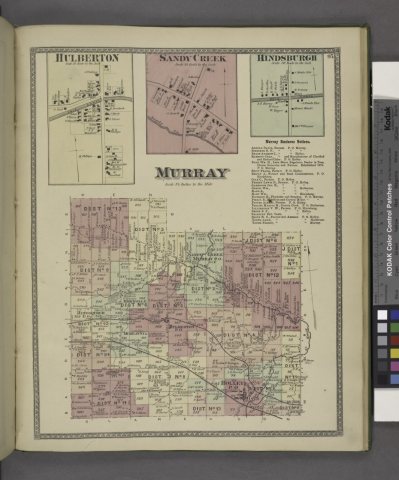

 1867

