Rensselaer dates to 1630, and 41% of its homes were built before 1940
More historic than 96% of U.S. towns · #124 of 758 in New York. What drives it
9 places in town are on the National Register, among them the Fort Crailo, a National Historic Landmark, and a historic district with 4 buildings. Below: 10 old photos and papers, maps from 1893 on, and the census since 1880.
Founding year: Wikidata. First post office: 1814.The full story ↓
History grade
What drives Rensselaer’s History grade
On its age, its old homes and the National Register, Rensselaer is more historic than 96% of U.S. towns, #124 of 758 in New York. All 3 inputs are above most U.S. towns; its age ranks highest and its National Register listings lowest.
A+
HistoryA character grade: shown, never part of Rensselaer’s overall grade.
New York towns list more on the Register than most of the country (a typical New York town has 12.3 per 10,000 residents, the U.S. 2.4), so Rensselaer’s 12.9 sits near the middle of its state (50% of New York towns have fewer) while its 12 historic buildings outnumber those of 77% of U.S. towns.
How sure. Graded on any two of the three inputs instead, the letter would range from A to A+. The pre-1940 share is a Census survey estimate (±5.9 points). Two sources give 1630.
Founding year: Wikidata (other dates in Quick answers). Homes: Census ACS 2020–24. National Register: National Park Service, May 2026 list; each listing counted once (boundary changes and added documentation belong to their listing), and a historic district counts its contributing buildings. How TownRatings grades history →
What stands out about Rensselaer’s past
Read from the archive, the National Register and the record. The page puts what stands out first.
The natives of the area called it Petuquapoern and Juscum catick, and the Dutch claimed the land in 1609 based on Henry Hudson's exploration of the Hudson River on board the Dutch ship, Halve Maen. Later the area was called "De Laet's Burg" in honor of one of the directors of the Dutch West India Co. Settlement occurred at least as early as 1628. By 1642, there was a brewery and many farms, also a ferry was established by Hendrick Albertsen running from the mouth of Beaver Creek in Beverwyck (Albany) to the future Rensselaer. Greenbush (originally t'Greyn Bos in Dutch) was the earliest settlement from Dutch times. The hamlet of East Albany was part of the village of Greenbush. The second hamlet that was incorporated was Bath (also Bath-on-Hudson), which was laid out in 1795 and incorporated as a village prior to 1874.
Passages that mention Rensselaer, cut from the printed page as they were published.
History of Rensselaer Co., New York1880 · page 191Read the page →
Read the text
This town, which was named in honor of Stephen Van Rensselaer, was formed from Rensselaerswyck, on March 29, 1784. Petersburgh was taken off in 1791, and parts of Berlin and Nassau in 1806. It forms the southeast comer of the county, and is bounded on the north by the town of Berlin, in the same county ; on the south by the town of New Lebanon, in Columbia County ; on the east by the State of Massachusetts ; and on the west by the
Text read by machine from the scan; it may contain errors.
History of Rensselaer Co., New York1880 · page 57Read the page →
Read the text
ill that part of the territory of the State of New Yrork iiirth of the counties of Ulster and Dutchess, except Washington County, which was taken from Albany County, March 12, 1772. Rensselaer County was named in honor if the Van Rensselaer family, and was set off from Albany bounty, Feb. 17, 1791.
Text read by machine from the scan; it may contain errors.
History of Rensselaer Polytechnic Institute, 1824-19141914 · page 67Read the page →
Read the text
1832, which gave the trustees power, after October 23, 1832, if the patron consented, to remove to the site of the Greenbush and Schodack Academy, in the town of Greenbush, in Rensselaer county, and to unite with this academy if its trustees consented. In this case the united institution was to be called the Rensselaer Institute. If, however, the patron or the trustees of the academy objected, the trus-
Text read by machine from the scan; it may contain errors.
Scans and text from the Internet Archive. Books published in 1930 or earlier, which are in the public domain.
By decade
Rensselaer, decade by decade
6 decades in the archive, from the 1900s to the 1980s. Scroll each row; tap a photo for its story.
Nothing in the archives for these yearsWeddings on Main Street, storms, parades, school pictures, the old store. If it’s in your family album, it belongs here.
In 1630, according to Wikidata. Rensselaer’s post office opened in 1814, and the census of 1880 counted 3,295 people here.
How does Rensselaer rank for history?
Rensselaer is more historic than 96% of U.S. towns, #124 of 758 in New York. The History grade combines the town’s founding era, the share of homes built before 1940 and its National Register listings. It’s a character grade, so it isn’t part of the overall grade. How it works.
What is on the National Register in Rensselaer?
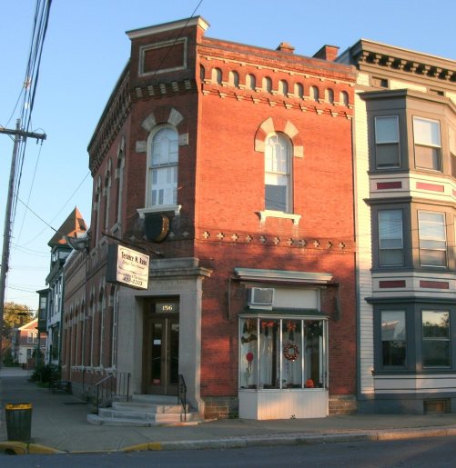
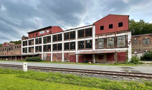
9 listings: 8 buildings, among them the Fort Crailo (a National Historic Landmark since 1961), and 1 historic district, the William Barnet & Son Shoddy Mill, with 4 contributing buildings. 12 historic buildings in all.
How old are the homes in Rensselaer?
41% of Rensselaer’s homes were built before 1940 (Census estimate, ±5.9 points), against a typical 27% for a New York town; the median home was built in 1960.
Founding dates: Wikidata, Wikipedia, the U.S. post office records of Blevins & Helbock (CC0) and the Census. Homes by year built: Census ACS 2020–24. National Register of Historic Places: National Park Service (list of May 22, 2026). Old photos, postcards and papers: Wikimedia Commons, the Library of Congress and other public archives, credited on each item’s page. Maps: U.S. Geological Survey historical topographic maps (via Esri) and Sanborn fire-insurance maps (Library of Congress). History text and census tables: Wikipedia (CC BY-SA 4.0). Places that used to be: USGS Geographic Names Information System (2021).
From Wikimedia Commons (5), the Library of Congress (5), Wikidata (1), the National Register of Historic Places (9), Wikipedia, Wikidata and Wikipedia for famous people, U.S. Geological Survey historical maps, U.S. Census counts (via Wikipedia), the US Post Offices dataset (Blevins & Helbock), the USGS Geographic Names Information System, Sanborn fire insurance maps (Library of Congress) and old county and town histories (Internet Archive). Archive images are copied here with their credits and licenses, shown on each photo’s page. Refreshed monthly.


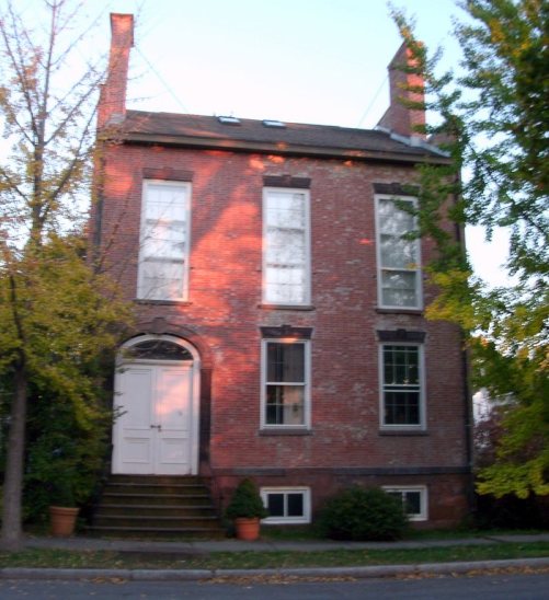


 ★ Landmark





 1906
 1908
 1933
 1933


