
View of, 1850
Patchogue’s story
224 years in pictures
Census counts: 2,503 in 1880, 12,408 in 2020. The archive holds 12 old photos and papers going back to 1834 and 5 maps from 1902 on.
- 1802Patchogue is settled
Each edition grades its towns against each other only.

Homes are expensive, about $603K for a typical one and 6.1 times the New York metro’s $99K median household income. Overall it grades B−, 410th of 745 graded towns in New York. It is healthier than 81% of U.S. towns and the median household earns $107K. Patchogue’s midpoint rent is $2,263 a month, where New York’s towns sit at $1,098 a month and U.S. towns at $1,185 a month. Patchogue is easier to get around on foot or by transit than 94% of U.S. towns. Patchogue's civic life (library use, community groups, volunteering) trails 83% of U.S. towns.
Where Patchogue beats most towns.
Coastal flooding makes up 10% of the storm damage FEMA expects here.
FEMA National Risk Index · OpenFEMA · OpenStreetMap
Each subject compared with towns across the country (schools within New York), ordered by how far Patchogue is from typical.
Its grades run from A for walkability (better than 94% of comparable towns) to D− for cost of living (better than 3%), so the B− overall blends very different results.
How TownRatings grades towns →
Census counts: 2,503 in 1880, 12,408 in 2020. The archive holds 12 old photos and papers going back to 1834 and 5 maps from 1902 on.
Museums, parks, gardens and other places to visit around Patchogue. Close and well known come first.
 30 mi Stadium & arenaNassau Veterans Memorial Coliseum
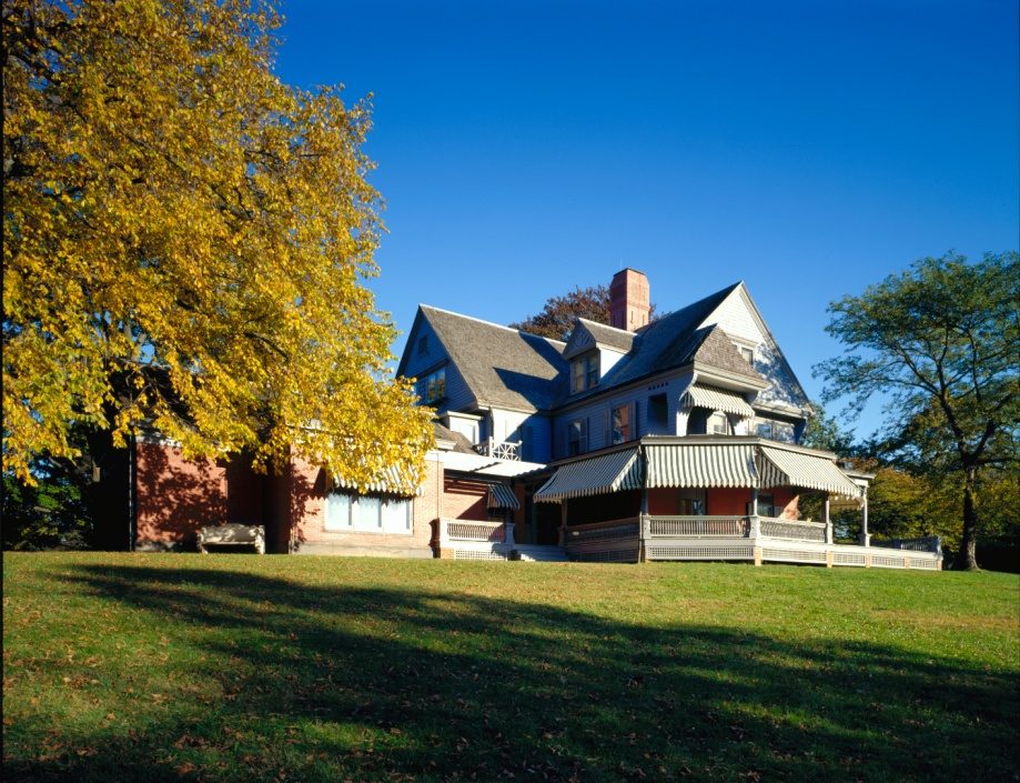 26 mi National Historic SiteSagamore Hill National Historic Site122K visitors a year
 38 mi Stadium & arenaYale Bowl
 28 mi State parkJones Beach State Park
 37 mi MuseumGlass House
 38 mi LandmarkOhel
Nassau Veterans Memorial Coliseum: iMatthew // talk //, Public domain · Sagamore Hill National Historic Site: Unknown, Public domain · Yale Bowl: Kenneth Zirkel, CC BY-SA 4.0 · Jones Beach State Park: Bjoertvedt, CC BY-SA 3.0 · Glass House: Carol M. Highsmith, Public domain · Ohel: משתמש:אבגד, CC BY-SA 2.5
Who provides power, water and the rest in Patchogue, and how to reach them.
EPA SDWIS (Oct 9, 2026) · HIFLD + EIA-861 2025 · Census 2020 ZCTAs · NCES 2024–25 · registration: vote.gov, updated Aug 3, 2026.
Ordered by what stands out in Patchogue.
Patchogue trades workers with Brookhaven and other neighbors, but it has homes that cost more against local pay than most of New York and has a long record of flood insurance claims.
30% of adults have high blood pressure in Patchogue. Of 32 CDC measures, Patchogue beats the New York average on 8 and trails it on 1.
| Patchogue | New York towns | U.S. towns | |
|---|---|---|---|
| Depression (CDC PLACES) | 17% | 21% | 23% |
| High blood pressure (CDC PLACES) | 30% | 34% | 35% |
| Sleep under 7 hours (CDC PLACES) | 40% | 37% | 36% |
| Smoke cigarettes (CDC PLACES) | 11% | 13% | 14% |
| What stands out | Patchogue | NY |
|---|---|---|
| Fewer adults with diabetes | 9.4% | 11.5% |
| Fewer adults facing food insecurity | 14.1% | 17.2% |
| Fewer adults treating high blood pressure | 74.4% | 77.2% |
CDC PLACES 2025 · modeled estimates for adults · CMS · HRSA
312 flood insurance claims have been filed here, and 41 properties have flooded more than once.
Patchogue’s FEMA hazard score stands at 15 of 100. Since 1978, Patchogue has seen 312 flood insurance claims paid out. FEMA puts 57% of the town’s expected hazard losses down to inland flooding, and 12% to hurricanes. Also worth knowing: households in the town have drawn federal disaster aid in 8 declared disasters, most recently in 2021.
FEMA flood insurance claims · FEMA disaster declarations and aid · FEMA National Risk Index · OpenFEMA
A winter brings about 32 inches of snow, with January nights at 25° and July afternoons at 82°.
NOAA U.S. Climate Normals, 1991–2020
Patchogue has about as many jobs (5,765) as working residents, but only 405 people both live and work here.
Commuting out is the norm in Patchogue: 7% of working residents work locally. The average trip to work for Patchogue comes to 32 minutes. Half of commuters travel less than 13 miles. The top destinations are Brookhaven (30%), Islip (21%) and New York (16%).
| Patchogue | New York towns | U.S. towns | |
|---|---|---|---|
| Average trip to work | 32 minutes | 25 minutes | 25 minutes |
| Median household income | $107,000 | $82,000 | $80,000 |
| Work from home | 8.4% | 12% | 11% |
| Working residents who work in town | 7.3% | 10% | 8% |
Census LEHD 2023 · ACS
At 6.1 years of the New York metro’s $99K median household income, the typical home (about $603K) costs more against local pay than in 82% of New York towns; that ratio is one input to that grade.
In the year to September 2026, typical home values climbed 4.8%. Among households in Patchogue, 55% own their home. 56% of the homes sold in Patchogue went for more than their asking price.
Census ACS, 2020–24 · Zillow Home Value Index · Redfin Data Center
A bachelor’s degree or higher: 35% of adults 25 and older, vs 40% across New York. Adults 35 to 64 are 43% of residents (39% statewide); children under 18 are 16% of residents (21% statewide). In Patchogue, 14% of residents are 65 or older.
| Patchogue | New York towns | U.S. towns | |
|---|---|---|---|
| Under 18 | 16% | 20% | 22% |
| Aged 65 or older | 14% | 20% | 18% |
| Median age | 39.5 years | 43 years | 40.5 years |
| Bachelor’s degree or more, 25+ | 35% | 32% | 29% |
49% women, 51% men
That’s an even split within the survey’s margin of ±2.6 points. Across New York, 51.2% of residents are women.
| Patchogue | NY | U.S. | |
|---|---|---|---|
| Under 10 | 9% | 11% | 11.6% |
| 10 to 17 | 6.9% | 9.5% | 10.3% |
| 18 to 24 | 5.8% | 8.9% | 9.1% |
| 25 to 34 | 21.1% | 14.2% | 13.7% |
| 35 to 44 | 15.6% | 13% | 13.2% |
| 45 to 54 | 13.2% | 12.2% | 12.2% |
| 55 to 64 | 14.4% | 13.3% | 12.7% |
| 65 to 74 | 8.9% | 10.3% | 10.2% |
| 75 and older | 5.1% | 7.6% | 7% |
| No diploma | 11% | 12% | 10.4% |
| High school | 20.2% | 24.3% | 26% |
| Some college | 21.3% | 14.6% | 19.1% |
| Associate’s | 12.3% | 8.8% | 8.8% |
| Bachelor’s | 18.2% | 22.4% | 21.6% |
| Graduate | 16.9% | 17.9% | 14.1% |
U.S. Census Bureau · ACS 2020-2024 5-year estimates
Trails total 0.9 miles in 5 parks and preserves. Parks and preserves in Patchogue: 5, covering 32 acres.
| Patchogue | New York towns | U.S. towns | |
|---|---|---|---|
| Conserved land | 3.4% | 5.2% | 4.3% |
| Miles of trail per square mile | 0.4 miles per square mile | 0.4 | 0.4 |
| Biggest places to walk | Trails | Acres |
|---|---|---|
| 1. Shorefront Park | 0.6 mi | 11 |
| 2. Rider Avenue Park | — | 17 |
| 3. Four Sisters Park | — | 2 |
Trails & parks © OpenStreetMap contributors · Conserved land: USGS PAD-US
2 within 15 miles of the center of Patchogue
About 5 of every 100 Patchogue residents are enrolled in college, against 7 across New York.
14 notable people were born in Patchogue.


Village in New York, United States
Patchogue ( PATCH-og) is a village located within the Town of Brookhaven in Suffolk County, on the South Shore of Long Island, in New York, United States. The population was 12,408 at the time of the 2020 census. The Incorporated Village of Patchogue is located approximately 60 miles (100 km) east of Manhattan, along the shore of Patchogue Bay – itself part of the Great South Bay.
From Wikipedia, licensed CC BY-SA 4.0 · facts via Wikidata (CC0)
3 towns share a border with Patchogue.
| Town | NY rank | Overall | Cost | Safety | Schools | Health |
|---|---|---|---|---|---|---|
| Patchogue | #410 | B− | D− | — | C | A− |
| Blue Point | — | — | — | — | — | — |
| North Patchogue | — | — | — | — | — | — |
| East Patchogue | — | — | — | — | — | — |
Patchogue reports no FBI crime data of its own. Blue Point, North Patchogue and East Patchogue aren’t graded (fewer than 1,000 residents, or not enough data). Compare Patchogue with a neighbor →
Short answers, built from the data on this page.
Patchogue grades B− overall, better than 47% of U.S. towns and #410 of 745 in New York. It grades A− for health and C for schools. Cost of living is its weak spot, with a D−.
Yes. Cost of living, which also weighs rents, property taxes and how many households pay 30% or more of their income for housing, grades D−.
14 notable people were born here, including Kevin Connolly and Leila Kenzle.


