Oneida’s post office opened in 1847, and 45% of its homes were built before 1940
More historic than 97% of U.S. towns · #69 of 758 in New York. What drives it
9 places in town are on the National Register, among them the Oneida Community Mansion House, a National Historic Landmark, and two historic districts with 258 buildings between them. Below: 6 old photos and papers, maps from 1895 on, and the census since 1870.
The Oneida post office opened in 1847, the earliest record of the town by name. Wikidata gives 1901. Two smaller post offices, Bennet's Corners (1830) and Kenwood (1889), opened inside today’s city and later closed.
First census: 3,262 in 18702020 census: 10,329179 years
How historic is Oneida?
A+
More historic than 97% of U.S. towns, on its age, its old homes and the National Register.
Founding year: the first Oneida post office (Blevins & Helbock, CC0). Wikidata: 1901.The full story ↓
History grade
What drives Oneida’s History grade
On its age, its old homes and the National Register, Oneida is more historic than 97% of U.S. towns, #69 of 758 in New York. All 3 inputs are above most U.S. towns; its share of homes from before 1940 ranks highest and its age lowest.
A+
HistoryA character grade: shown, never part of Oneida’s overall grade.
New York towns list more on the Register than most of the country (a typical New York town has 12.3 per 10,000 residents, the U.S. 2.4), so Oneida’s 263 sits above most of its state (85% of New York towns have fewer) while its 268 historic buildings outnumber those of 95% of U.S. towns.
How sure. Graded on any two of the three inputs instead, the letter would range from A to A+. The pre-1940 share is a Census survey estimate (±4.5 points). The founding year is the first post office, not a stated founding date; Wikidata gives 1901.
Founding year: the first post office (other dates in Quick answers). Homes: Census ACS 2020–24. National Register: National Park Service, May 2026 list; each listing counted once (boundary changes and added documentation belong to their listing), and a historic district counts its contributing buildings. How TownRatings grades history →
What stands out about Oneida’s past
Read from the archive, the National Register and the record. The page puts what stands out first.
In the post-Revolutionary period, central and western New York were settled by many migrants from New England. With development of the Erie Canal in the early 19th century, the movement of people expanded towards the Midwest as trade and commerce increased. Oneida's development began to pick up as new trade routes were opened, especially in the period initially following construction of the Oneida Lake canal and feeder and an associated railroad stop, tying it into major trade networks of the day.
Passages that mention Oneida, cut from the printed page as they were published.
History of Oneida County, New York1878 · page 573Read the page →
Read the text
Turkey Street is a name given to a portion of the old Seneca turnpike, east of the village of Oneida Castle. This name was applied from the fact that a number of the first settlers went to the Oneida Castle in the night and stole several turkeys from the Indians. They were found out, and the locality in which they lived was given the above appropriate title. Originally its eastern boundary was a large hemlock -tree standing on the south side of the
Text read by machine from the scan; it may contain errors.
History of Oneida County, New York1878 · page 409Read the page →
Read the text
This is the southwest corner town of Oneida County, and has an area of 16,763 acres. It includes portions of Peter Smith's tract and New Stockbridge, — a reservation belonging to the Stockbridge Indians. The town lies on both sides of the Skanandoa Creek, the land on either side rising to a height of several hundred feet above the stream.
Text read by machine from the scan; it may contain errors.
Annals and recollections of Oneida County1851 · page 840Read the page →
Read the text
According to the tradition of Cusick, the Oneidas first settled upon one of the head-waters of the Susquchannah, called Kaw-nah-taw-te-ruh (variously spelled), about ten miles south of Oneida Castle. The •• earliest recollected residence" of tlic Oneidas was upon the southern shore of Oneida Lake, near the moutli of tlie Oneida Creek. Here they constructed fortifications, remains of which have been found since tlucountry was settled by whites. From the last named place
Text read by machine from the scan; it may contain errors.
Scans and text from the Internet Archive. Books published in 1930 or earlier, which are in the public domain.
Timeline
Oneida, 1830 to 1993
Woven from the archive, old maps, post office records, the National Register and the people born here.
Nothing in the archives for these yearsWeddings on Main Street, storms, parades, school pictures, the old store. If it’s in your family album, it belongs here.
Nothing in the archives for these yearsWeddings on Main Street, storms, parades, school pictures, the old store. If it’s in your family album, it belongs here.
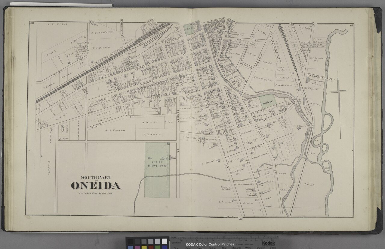
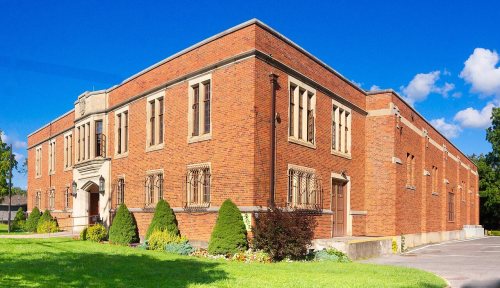
Fire insurance maps drew every building, what it was made of and what it was used for, so insurers could price the risk of fire. Pick a year, then a sheet.
The Oneida post office opened in 1847, the earliest record of the town by name (U.S. post office records). Wikidata gives 1901.
How does Oneida rank for history?
Oneida is more historic than 97% of U.S. towns, #69 of 758 in New York. The History grade combines the town’s founding era, the share of homes built before 1940 and its National Register listings. It’s a character grade, so it isn’t part of the overall grade. How it works.
What is on the National Register in Oneida?
9 listings: 6 buildings, among them the Oneida Community Mansion House (a National Historic Landmark since 1965), 2 historic districts, the Main-Broad-Grove Streets Historic District and the Oneida Downtown Commercial Historic District, with 258 contributing buildings, and 1 site. 268 historic buildings in all.
How old are the homes in Oneida?
45% of Oneida’s homes were built before 1940 (Census estimate, ±4.5 points), against a typical 27% for a New York town; the median home was built in 1946.
Founding dates: Wikidata, Wikipedia, the U.S. post office records of Blevins & Helbock (CC0) and the Census. Homes by year built: Census ACS 2020–24. National Register of Historic Places: National Park Service (list of May 22, 2026). Old photos, postcards and papers: Wikimedia Commons, the Library of Congress and other public archives, credited on each item’s page. Maps: U.S. Geological Survey historical topographic maps (via Esri) and Sanborn fire-insurance maps (Library of Congress). History text and census tables: Wikipedia (CC BY-SA 4.0). Places that used to be: USGS Geographic Names Information System (2021).
From Wikimedia Commons (6), the National Register of Historic Places (9), Wikipedia, Wikidata and Wikipedia for famous people, U.S. Geological Survey historical maps, U.S. Census counts (via Wikipedia), the US Post Offices dataset (Blevins & Helbock), the USGS Geographic Names Information System, Sanborn fire insurance maps (Library of Congress) and old county and town histories (Internet Archive). Archive images are copied here with their credits and licenses, shown on each photo’s page. Refreshed monthly.




 ★ Landmark


 1875
 1875
 1927


