Newburgh dates to 1709, and 51% of its homes were built before 1940
Among the most historic 1% of U.S. towns · #2 of 758 in New York. What drives it
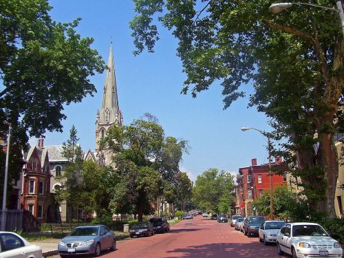
10 places in town are on the National Register, among them 2 National Historic Landmarks and three historic districts with 2,468 buildings between them. Below: 12 old photos and papers, maps from 1884 on, and the census since 1860.
Founding year: Wikidata. First post office: 1795.The full story ↓
History grade
What drives Newburgh’s History grade
On its age, its old homes and the National Register, Newburgh is among the most historic 1% of U.S. towns, #2 of 758 in New York. All 3 inputs put Newburgh near the top nationally; its share of homes from before 1940 ranks highest.
A+
HistoryA character grade: shown, never part of Newburgh’s overall grade.
New York towns list more on the Register than most of the country (a typical New York town has 12.3 per 10,000 residents, the U.S. 2.4), so Newburgh’s 868 sits above most of its state (95% of New York towns have fewer) while its 2,475 historic buildings outnumber those of 100% of U.S. towns.
NoteThe founding year comes from Wikidata alone; no second source gives 1709.
How sure. Graded on any two of the three inputs instead, the letter would still be A+. The pre-1940 share is a Census survey estimate (±4.2 points).
Founding year: Wikidata (other dates in Quick answers). Homes: Census ACS 2020–24. National Register: National Park Service, May 2026 list; each listing counted once (boundary changes and added documentation belong to their listing), and a historic district counts its contributing buildings. How TownRatings grades history →
What stands out about Newburgh’s past
Read from the archive, the National Register and the record. The page puts what stands out first.
At the time of European contact the area of Newburgh was occupied by the Waoranek, a branch of the Lenape. The area that became Newburgh was first explored by Europeans when Henry Hudson stopped by during his 1609 expedition up the river that now bears his name. His navigator, Robert Juet, is said to have called the site "a pleasant place to build a town", although some later historians believe he may actually have been referring to the area where Cornwall-on-Hudson now stands.
Passages that mention Newburgh, cut from the printed page as they were published.
History of Orange County, New York1881 · page 266Read the page →
Read the text
X Old Town of Newburgh Plot. The peculiar angles in all of the principal streets arose from this fact : Colden and his associates, in laying out the Old Town of Newburgh Plot, commenced their streets on the natural plateaus. The trustees of the Glebe laid out their streets parallel with the river. When Smith came to open his land. Water Street was placed nearer the river, and a corresponding division carried back in Smith and Montgomery Streets. When the road commissioners took the duty in hand of joining together the streets thus dedicated in the three distlDCt
Text read by machine from the scan; it may contain errors.
Scans and text from the Internet Archive. Books published in 1930 or earlier, which are in the public domain.
Timeline
Newburgh, 1709 to 2001
Woven from the archive, old maps, post office records, the National Register and the people born here.
Every edition of the U.S. Geological Survey’s map of Newburgh. Tap a year, or press play to watch the town change.
1903Newburgh sheet · 1:62,500
U.S. Geological Survey historical topographic maps (public domain), via Esri’s collection of the scans. The red ring marks the center of Newburgh.
Every building
Newburgh, building by building, 1884–1913
Fire insurance maps drew every building, what it was made of and what it was used for, so insurers could price the risk of fire. Pick a year, then a sheet.
Old hamlets and crossroads still carry their names on the map.
Hamlets and corners on the map
Varick Homes
Gone or out of use
Academy TheatrebuildingBroadway TheatrebuildingCameo TheatrebuildingOdell Memorial Tuberculosis SanitariumhospitalPark TheatrebuildingRitz Theaterbuilding
4cemeteries and burying grounds inside Newburgh
Old TownSaint GeorgesSaint Patrick'sTemple Beth Jacob
US Post Offices dataset (Blevins & Helbock, CC0). Places and cemeteries from the USGS Geographic Names Information System (2021).
Help out
Finish Newburgh’s story
Most archives stop around 1920. The photos from after that are in family albums, not libraries.
Decades since 1900 with photos
00s10s20s30s40s50s60s70s80s90s
0 of 10 decades. The empty ones are waiting for someone’s album.
In 1709, according to Wikidata. Newburgh’s post office opened in 1795, and the census of 1860 counted 12,578 people here.
How does Newburgh rank for history?
Newburgh is among the most historic 1% of U.S. towns, #2 of 758 in New York. The History grade combines the town’s founding era, the share of homes built before 1940 and its National Register listings. It’s a character grade, so it isn’t part of the overall grade. How it works.
What is on the National Register in Newburgh?
10 listings, 2 of them National Historic Landmarks: 6 buildings, among them the Washington's Headquarters (a National Historic Landmark since 1961), 3 historic districts, the Montgomery-Grand-Liberty Streets Historic District, the East End Historic District and the Old Town Cemetery and Palatine Church Site, with 2,468 contributing buildings, and 1 site. 2,475 historic buildings in all.
How old are the homes in Newburgh?
51% of Newburgh’s homes were built before 1940 (Census estimate, ±4.2 points), against a typical 27% for a New York town; the median home was built in 1938.
Founding dates: Wikidata, Wikipedia, the U.S. post office records of Blevins & Helbock (CC0) and the Census. Homes by year built: Census ACS 2020–24. National Register of Historic Places: National Park Service (list of May 22, 2026). Old photos, postcards and papers: Wikimedia Commons, the Library of Congress and other public archives, credited on each item’s page. Maps: U.S. Geological Survey historical topographic maps (via Esri) and Sanborn fire-insurance maps (Library of Congress). History text and census tables: Wikipedia (CC BY-SA 4.0). Places that used to be: USGS Geographic Names Information System (2021).
From Wikimedia Commons (9), the Library of Congress (3), the National Register of Historic Places (10), Wikipedia, Wikidata and Wikipedia for famous people, U.S. Geological Survey historical maps, U.S. Census counts (via Wikipedia), the US Post Offices dataset (Blevins & Helbock), the USGS Geographic Names Information System, Sanborn fire insurance maps (Library of Congress) and old county and town histories (Internet Archive). Archive images are copied here with their credits and licenses, shown on each photo’s page. Refreshed monthly.


 ★ Landmark
 ★ Landmark



 c. 1852
 1857
 1859
 c. 1860
 c. 1860
 c. 1860
 c. 1860
 c. 1860


