Guest, Sign inJoin

Post to Mattituck

We’ll email a one-tap link to publish your post. No password, and nothing is public until you click it.
Already a member? Sign in
–Not graded
History · Mattituck

Mattituck’s post office opened in 1802, and 20% of its homes were built before 1940

3 places in town are on the National Register. Below: 3 old photos and papers from 1873 on and old-book passages.

1802first post office
3on the National Register
20%homes built before 1940
3old photos & papers
5famous people
Photo: Copyright Lise Visser 2006 (Wildflowers00 at English Wikipedia) · CC BY-SA 3.0
Quick answers

How Mattituck began

When was Mattituck founded?

1802

The Mattituck post office opened in 1802, the earliest record of the town by name.

2020 census: 4,322224 years
Founding year: the first Mattituck post office (Blevins & Helbock, CC0).The full story ↓

What stands out about Mattituck’s past

Read from the archive, the National Register and the record. The page puts what stands out first.

★ What stands out · Help out

Start Mattituck’s collection

The first neighbors to add old photos shape how Mattituck’s history is told.

Decades since 1900 with photos
00s10s20s30s40s50s60s70s80s90s
1 of 10 decades. The empty ones are waiting for someone’s album.
Timeline

Mattituck, 1801 to 1952

Woven from the archive, old maps, post office records, the National Register and the people born here.

  1. 19th century
  2. 1801Born hereHerman D. Aldrich is born here
  3. 1810Born hereJames Aldrich is born here
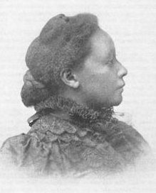
  4. 1859Born hereJosephine Silone Yates is born here
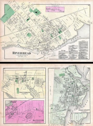
  5. 1873In the archive1873 Beers Map of Riverhead, Long Island, New York (Southhampton) - Geographicus - Riverh…
  6. 20th century
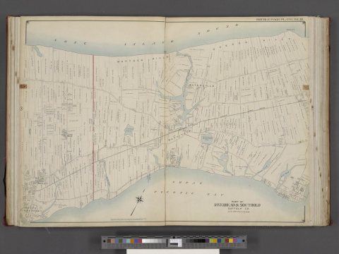
  7. 1902In the archiveSuffolk County, V. 2, Double Page Plate No. 10 (Map bounded by Long Island Sound, New Suf…
  8. 1952Born hereGreg Sacks is born here
The story

How Mattituck came to be

From Wikipedia’s history of Mattituck.

Read it all →

Mattituck is believed to have derived its name from the Algonquian name for "Great Creek". Mattituck Creek has been dredged and is used extensively by pleasure craft on the Long Island Sound (the Mattituck Inlet is the entrance into Mattituck Creek, and the whole waterway is now popularly referred to as Mattituck Inlet).

It is only one of two harbors (the other being Mt. Sinai harbor) on the north side of Long Island on the Sound east of Port Jefferson.

Text from Wikipedia, licensed CC BY-SA 4.0.

From the old history books

What they wrote about Mattituck in 1906

Passages that mention Mattituck, cut from the printed page as they were published.

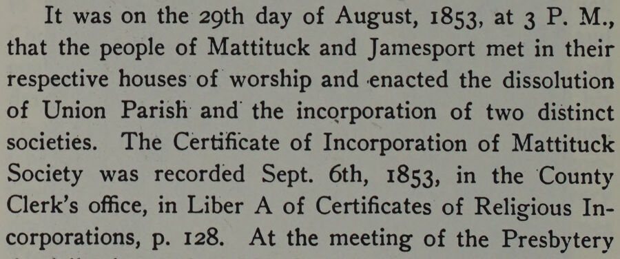
It was on the 29th day of August, 1853, at 3 P. M., that the people of Mattituck and Jamesport met in their respective houses of worship and enacted the dissolution of Union Parish and the incorporation of two distinct societies. The Certificate of Incorporation of Mattituck Society was recorded Se…
a history of mattituck long island new york1906 · page 176Read the page →
Read the text

It was on the 29th day of August, 1853, at 3 P. M., that the people of Mattituck and Jamesport met in their respective houses of worship and enacted the dissolution of Union Parish and the incorporation of two distinct societies. The Certificate of Incorporation of Mattituck Society was recorded Sept. 6th, 1853, in the County Clerk’s office, in Liber A of Certificates of Religious Incorporations, p. 128. At the meeting of the Presbytery

Text read by machine from the scan; it may contain errors.
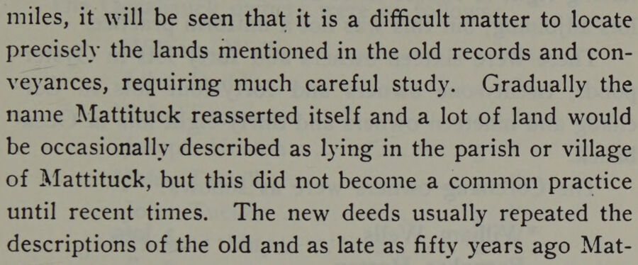
miles, it will be seen that it is a difficult matter to locate precisely the lands mentioned in the old records and conveyances, requiring much careful study. Gradually the name Mattituck reasserted itself and a lot of land would be occasionally described as lying in the parish or village of Mattit…
a history of mattituck long island new york1906 · page 29Read the page →
Read the text

miles, it will be seen that it is a difficult matter to locate precisely the lands mentioned in the old records and conveyances, requiring much careful study. Gradually the name Mattituck reasserted itself and a lot of land would be occasionally described as lying in the parish or village of Mattituck, but this did not become a common practice until recent times. The new deeds usually repeated the descriptions of the old and as late as fifty years ago Mat-

Text read by machine from the scan; it may contain errors.

Scans and text from the Internet Archive. Books published in 1930 or earlier, which are in the public domain.

By decade

Mattituck, decade by decade

2 decades in the archive, from the 1870s to the 1900s. Scroll each row; tap a photo for its story.

1910s–1990snothing yet
Nothing in the archives for these yearsWeddings on Main Street, storms, parades, school pictures, the old store. If it’s in your family album, it belongs here.
Add from your album
On the National Register

3 historic places in Mattituck

The country’s official list of buildings and places worth saving.

places listed
3
National Historic Landmarks
0
none yet
historic buildings protected
5
each building in a district counts

National Park Service, National Register of Historic Places. Photos from Wikimedia Commons, credited on each place’s page.

Famous people

5 famous people were born in Mattituck

Writers, athletes, leaders and more, ranked by how widely they’re known.

See all →
Stories next door

History across the town line

Each neighbor’s History grade, on the same three inputs.

Questions about Mattituck’s history

What year was Mattituck founded?

The Mattituck post office opened in 1802, the earliest record of the town by name (U.S. post office records).

Memory lane

What the archives can’t tell you, neighbors can.

Town Square →
Start a conversation
Sources

Where this page comes from

Founding dates: Wikidata, Wikipedia, the U.S. post office records of Blevins & Helbock (CC0) and the Census. Homes by year built: Census ACS 2020–24. National Register of Historic Places: National Park Service (list of May 22, 2026). Old photos, postcards and papers: Wikimedia Commons, the Library of Congress and other public archives, credited on each item’s page. Maps: U.S. Geological Survey historical topographic maps (via Esri) and Sanborn fire-insurance maps (Library of Congress). History text and census tables: Wikipedia (CC BY-SA 4.0). Places that used to be: USGS Geographic Names Information System (2021). How TownRatings grades history →

From Wikimedia Commons (6), Wikipedia, Wikidata and Wikipedia for famous people and old county and town histories (Internet Archive). Archive images are copied here with their credits and licenses, shown on each photo’s page. Refreshed monthly.