Riverhead’s post office opened in 1855, and 11% of its homes were built before 1940
More historic than 61% of U.S. towns · #591 of 758 in New York. What drives it
14 places in town are on the National Register, among them three historic districts with 270 buildings between them. Below: 10 old photos and papers, maps from 1885 on, and the census since 1800.
The Riverhead post office opened in 1855, the earliest record of the town by name. Eight smaller post offices, Suffolk (1794), Aquebogue (1828) and Baiting Hollow (1838), opened inside today’s town and later closed.
First census: 1,498 in 18002020 census: 35,902171 years
How historic is Riverhead?
B
More historic than 61% of U.S. towns, on its age, its old homes and the National Register.
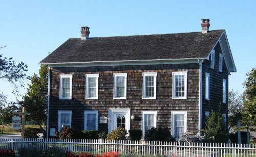
Founding year: the first Riverhead post office (Blevins & Helbock, CC0).The full story ↓
History grade
What drives Riverhead’s History grade
On its age, its old homes and the National Register, Riverhead is more historic than 61% of U.S. towns, #591 of 758 in New York. Its National Register listings hold the grade up; its age pulls it down.
B
HistoryA character grade: shown, never part of Riverhead’s overall grade.
New York towns list more on the Register than most of the country (a typical New York town has 12.3 per 10,000 residents, the U.S. 2.4), so Riverhead’s 83.4 sits above most of its state (73% of New York towns have fewer) while its 300 historic buildings outnumber those of 95% of U.S. towns.
How sure. Graded on any two of the three inputs instead, the letter would range from C+ to B+. The pre-1940 share (±2.2 points) is firm at this size. The founding year is the first post office, not a stated founding date.
Founding year: the first post office (other dates in Quick answers). Homes: Census ACS 2020–24. National Register: National Park Service, May 2026 list; each listing counted once (boundary changes and added documentation belong to their listing), and a historic district counts its contributing buildings. How TownRatings grades history →
What stands out about Riverhead’s past
Read from the archive, the National Register and the record. The page puts what stands out first.
National Park Service, National Register of Historic Places. Photos from Wikimedia Commons, credited on each place’s page.
Places that used to be
Lost post offices, old corners, places now gone and burying grounds
Riverhead’s post office has been open since 1855. Eight other post offices opened and closed inside today’s town.
Suffolk
1794–1874
Wading River
1825–today
Aquebogue
1828–1842
Baiting Hollow
1838–1912
Success
1838–1880
Jamesport
1842–today
Fresh Pond
1852–1901
Riverhead
1855–today
Suffolk Station
1857–1859
Calverton
1868–today
17901910today
Hamlets and corners on the map
AquebogueBaiting HollowCalvertonCentervilleFoxwood VillageGlenwood VillageJamesportLakewood ParkMillbrook Mobile Home ParkNorthvilleOakland Ridge Mobile Home ParkRamblewood Mobile Home ParkReeves ParkRiverhaven ParkSouth JamesportSweyzeThurms Mobile HomesWading RiverWildwoodWoodcliff Park
AquebogueBaiting HollowCalverton NationalJamesportOliver's HillRiverheadSaint John the EvangelistSound AvenueWading RiverWells
US Post Offices dataset (Blevins & Helbock, CC0). Places and cemeteries from the USGS Geographic Names Information System (2021).
Every building
Riverhead, building by building, 1885–1920
Fire insurance maps drew every building, what it was made of and what it was used for, so insurers could price the risk of fire. Pick a year, then a sheet.
European colonists purchased the "Southold land" from the local Algonquian-speaking Native Americans and Shinnecock Indian Nation in 1649. An additional portion was purchased from Col. William Smith and divided among settlers in 1742.
Since 1727, the eponymous hamlet within the Town of Riverhead has been the county seat of Suffolk County – although most county offices have been in Hauppauge further west since the 1960s; this has spurred efforts by the five easternmost towns in Suffolk County – East Hampton, Riverhead, Southamton, Southold, and Shelter Island – to secede from the county to form Peconic County.
The whole section lying west of the east line of the present town of Riverhead was called Aqueboke, or Aquebouk. There seem to have been at least four divisions of land made at different times within this territory, though the records of those divisions have for the most part been lost. The first and second divisions were probably in the eastern "part of the present town of Riverhead. An existing record of the third division
Text read by machine from the scan; it may contain errors.
...History of Suffolk county, New York1882 · page 47Read the page →
Read the text
The principal part of the present village of Wading River lies within the town of Riverhead. The initial step toward establishing a settlement here was taken by Brookhaven in a public town meeting November 17th 1671. It was at that time voted that a village of eight families or men should be located there "or thereabouts," and it is probable that most of them were established "thereabouts," i. e. in the section now called Woodville.
Text read by machine from the scan; it may contain errors.
Scans and text from the Internet Archive. Books published in 1930 or earlier, which are in the public domain.
Timeline
Riverhead, 1750 to 1974
Woven from the archive, old maps, post office records, the National Register and the people born here.
Nothing in the archives for these yearsWeddings on Main Street, storms, parades, school pictures, the old store. If it’s in your family album, it belongs here.
The Riverhead post office opened in 1855, the earliest record of the town by name (U.S. post office records).
How does Riverhead rank for history?
Riverhead is more historic than 61% of U.S. towns, #591 of 758 in New York. The History grade combines the town’s founding era, the share of homes built before 1940 and its National Register listings. It’s a character grade, so it isn’t part of the overall grade. How it works.
What is on the National Register in Riverhead?
14 listings: 11 buildings, among them the Vail-Leavitt Music Hall (listed 1983, the first), and 3 historic districts, the Riverhead Main Street Historic District, the Daniel and Henry P. Tuthill Farm and the Second and Ostrander Historic District, with 270 contributing buildings. 300 historic buildings in all.
How old are the homes in Riverhead?
11% of Riverhead’s homes were built before 1940 (Census estimate, ±2.2 points), against a typical 27% for a New York town; the median home was built in 1984.
Founding dates: Wikidata, Wikipedia, the U.S. post office records of Blevins & Helbock (CC0) and the Census. Homes by year built: Census ACS 2020–24. National Register of Historic Places: National Park Service (list of May 22, 2026). Old photos, postcards and papers: Wikimedia Commons, the Library of Congress and other public archives, credited on each item’s page. Maps: U.S. Geological Survey historical topographic maps (via Esri) and Sanborn fire-insurance maps (Library of Congress). History text and census tables: Wikipedia (CC BY-SA 4.0). Places that used to be: USGS Geographic Names Information System (2021).
From Wikimedia Commons (10), Wikidata (2), the National Register of Historic Places (14), Wikipedia, Wikidata and Wikipedia for famous people, U.S. Geological Survey historical maps, U.S. Census counts (via Wikipedia), the US Post Offices dataset (Blevins & Helbock), the USGS Geographic Names Information System, Sanborn fire insurance maps (Library of Congress) and old county and town histories (Internet Archive). Archive images are copied here with their credits and licenses, shown on each photo’s page. Refreshed monthly.




 1834
 1834
 1902
 1903
 1906


