Long Lake dates to 1833, and 24% of its homes were built before 1940
9 places in town are on the National Register, among them 3 National Historic Landmarks and two historic districts with 27 buildings between them. Below: 6 old photos and papers, maps from 1903 on, and the census since 1840.
US Post Offices dataset (Blevins & Helbock, CC0). Places and cemeteries from the USGS Geographic Names Information System (2021).
On the National Register
9 listings protect 109 historic buildings
The country’s official list of buildings and places worth saving. 3 are National Historic Landmarks, the highest tier. Boundary changes and added documentation are counted with their listing.
The town was settled circa 1833 by Joel Plumley, a native of Vermont.
The town of Long Lake was formed in 1837 from sections of the towns of Arietta, Morehouse, Lake Pleasant, and Wells. In 1861, the town was increased by additions from Arietta, Lake Pleasant, and Morehouse.
Nothing in the archives for these yearsWeddings on Main Street, storms, parades, school pictures, the old store. If it’s in your family album, it belongs here.
In 1833, according to Wikipedia’s history of the town. Long Lake’s post office opened in 1837, and the census of 1840 counted 59 people here.
What is on the National Register in Long Lake?
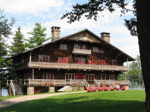
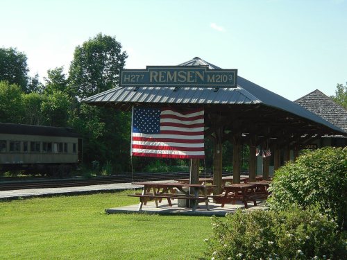
9 listings, 3 of them National Historic Landmarks: 8 buildings, among them the Sagamore (a National Historic Landmark since 2000), and 2 historic districts, the New York Central Railroad Adirondack Division Historic District and the Whelan Camp, with 27 contributing buildings. 109 historic buildings in all.
Founding dates: Wikidata, Wikipedia, the U.S. post office records of Blevins & Helbock (CC0) and the Census. Homes by year built: Census ACS 2020–24. National Register of Historic Places: National Park Service (list of May 22, 2026). Old photos, postcards and papers: Wikimedia Commons, the Library of Congress and other public archives, credited on each item’s page. Maps: U.S. Geological Survey historical topographic maps (via Esri) and Sanborn fire-insurance maps (Library of Congress). History text and census tables: Wikipedia (CC BY-SA 4.0). Places that used to be: USGS Geographic Names Information System (2021). How TownRatings grades history →
From Wikimedia Commons (6), the National Register of Historic Places (10), Wikipedia, U.S. Geological Survey historical maps, U.S. Census counts (via Wikipedia), the US Post Offices dataset (Blevins & Helbock) and the USGS Geographic Names Information System. Archive images are copied here with their credits and licenses, shown on each photo’s page. Refreshed monthly.


 ★ Landmark
 ★ Landmark
 ★ Landmark



 1875
 1888
 1898