Guest, Sign inJoin

Post to Lewis

We’ll email a one-tap link to publish your post. No password, and nothing is public until you click it.
Already a member? Sign in
Lewis
New York›Essex County

LewisNY

A town of 1,239, established in 1805.

6 bordering townsMap →
First Congregational Church and Cemetery · Photo: Magicpiano · CC BY-SA 4.0
Photo of Lewis

Lewis, NY · First Congregational Church and Cemetery · Photo: Magicpiano · CC BY-SA 4.0

Is Lewis a good place to live?

Lewis’ best subject grades are an A− for the outdoors and history; its weakest is a D− for walkability. Only 46 of New York’s 1,216 towns score lower on walkability. Homes are within reach, about $181K for a typical one, or 2.5 years of the county’s $72K median household income. 23% of the land in Lewis is conserved, above both the New York town median (5.2%) and the median of U.S. towns (4.3%). The biggest place to walk is Jay Mountain Wilderness, 5,378 acres with 2.2 miles of trail. Lewis has fewer than 2,500 residents, so it gets subject grades but no overall grade.

What makes Lewis stand out

Where Lewis beats most towns.

Small town

1,239 people, and everyone knows the way

In a town this size, neighbors are the best guide. Ask them anything.

Nearby towns
ElizabethtownChesterfieldJayWillsboroEssexWestportElizabethtownChesterfieldJayWillsboroEssexWestportLewis

How Lewis grades

Each subject compared with towns across the country (schools within New York), ordered by how far Lewis is from typical.

How grading works

Character Graded, but not part of the overall grade.
Described, not graded Taste, not quality: snow or an older crowd is neither good nor bad.

How TownRatings grades towns →

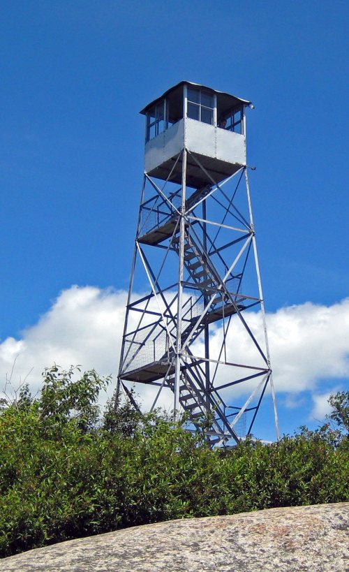
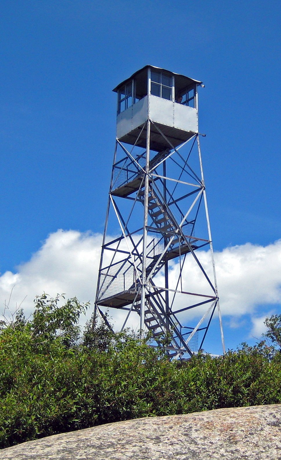
Poke-O-Moonshine Mountain Fire Observation Station
Poke-O-Moonshine Mountain Fire Observation Station · National Register of Historic Places
Lewis’s story

221 years in pictures

Census counts: 779 in 1820, a peak of 2,058 in 1850, 1,293 in 2020. The archive holds 5 maps from 1895 on.

2 places on the National Register of Historic Places.

  • 1805Lewis is established
Explore the history →
Getting set up

Moving to Lewis: who provides what

Who provides power, water and the rest in Lewis, and how to reach them.

The full setup list →
PowerNew York State Elec & Gas22.6¢/kWh · EIA 2025HIFLD · EIA
WaterLewis WD water system1 health-based violation in 5 years · EPAEPA
Internet5 providers84% of addresses get 100/20 MbpsFCC
Trash & dumpNot on file yetWe don’t have Lewis’ trash rules yet
SchoolsBoquet Valley Central School District at Elizabethtown-Lewis-WestportWhich school depends on your addressNCES
Register to voteOnlineIn New York you can register online until 10 days before Election Day, in person until 10 days before Election Day, or by mail (postmarked 15 days before and received 10 days before).vote.gov
Who runs elections hereEssex County Board of ElectionsEssex County; contacts on the Handbook page.FVAP, Mar 2023
ZIP codes12950, 12932, 1299312950 57% · 12932 24% · 12993 19%Census 2020

EPA SDWIS (Oct 9, 2026) · HIFLD + EIA-861 2025 · Census 2020 ZCTAs · NCES 2024–25 · registration: vote.gov, updated Aug 3, 2026.

The data

Ordered by what stands out in Lewis.

Work & commuteJobs & income grade B−

Most of Lewis’ workers commute out: the town has 0.1 jobs for each of them

Most working residents leave Lewis for work: only 4% work in town. 3.2% of residents live below the poverty line in Lewis, against 9.5% in New York’s towns and 9.6% across U.S. towns. The top destinations are Elizabethtown (21%), Essex (7%) and Plattsburgh (6%).

4%work in town
LewisNew York townsU.S. towns
Below the poverty line3.2%9.5%9.6%
Working residents who work in town3.5%10%8%

Where working residents work

In Lewis4%
Elizabethtown21%
Essex7%
Plattsburgh6%
Plattsburgh6%
19 mi
median commute distance
73
jobs based in Lewis
A commuter town
jobs vs. working residents
D−
Walkability grade: more walkable than 5% of U.S. towns

Census LEHD 2023 · ACS

OutdoorsA−

Lewis earns an A− for the outdoors

61 miles of trail in 6 parks and preserves. The trail density in Lewis is 0.7 miles per square mile.

22.9%conserved
22.9%
conserved · 12,381 of 54,040 acres
61 mi
of trails · 0.7 per sq mi
Biggest places to walkTrailsAcres
1. Twin Valleys Outdoor Education Center4.2 mi363
2. Jay Mountain Wilderness2.2 mi5,378
3. Taylor Pond Wild Forest1.6 mi1,054

Trails & parks © OpenStreetMap contributors · Conserved land: USGS PAD-US

HealthB+

Residents of Lewis are healthier than 71% of U.S. towns

Lewis beats the New York average on 7 of 32 CDC measures and trails it on 4. 34% of adults sleep under 7 hours in Lewis.

71%healthier than U.S. townsB+Health Grade
LewisNew York townsU.S. towns
Sleep under 7 hours (CDC PLACES)34%37%36%
Frequent mental distress (CDC PLACES)15%16%17%
Depression (CDC PLACES)21%21%23%
Binge drink (CDC PLACES)17%17%16%
32 measures vs. New York
7 better21 too close to call4 worse
What stands outLewisNY
Fewer adults facing food insecurity10.9%17.2%
Fewer adults facing housing insecurity9.6%14.5%
More adults who have had cancer10.5%7.7%
Elizabethtown Community Hospital
7.2 mi away · emergency room
2 of 3
care shortages: dental, mental health

CDC PLACES 2025 · modeled estimates for adults · CMS · HRSA

Climate

In Lewis, expect snowy winters and pleasant summers

Lewis has cold, snowy winters and pleasant summers. Lewis’ July high is 80°F.

64″snow a winter

Typical low → high °F

Winter12–31°
Spring32–54°
Summer56–78°
Fall38–57°
Oct 14
typical first frost
May 2
typical last frost
+1.7°
vs. the 20th-century average

NOAA U.S. Climate Normals, 1991–2020

Natural hazardsHazard risk grade C

Lewis faces a high natural-hazard risk, led by inland flooding

Expected storm and flood damage is higher than in 60% of U.S. communities. Since 1996, 3 flood insurance claims have been paid out in Lewis.

60risk score of 100
FEMA risk score
60High riskLowerHigher
Inland floodingAvalanches
3
paid flood claims since 1996
3
federal disasters paid out here

FEMA flood insurance claims · FEMA National Risk Index · OpenFEMA

Nearby attractions

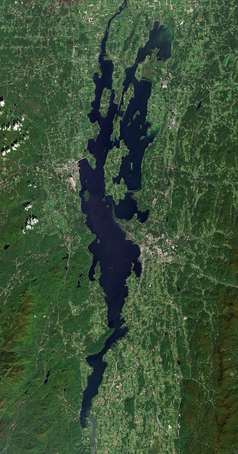
Lake Champlain and 19 more within 40 miles

Museums, parks, gardens and other places to visit around Lewis. Close and well known come first.

All 38 attractions →
Sources: National Park Service · ski areas © OpenSkiMap / OpenStreetMap contributors · Wikidata · Wikipedia readership · photos via Wikimedia Commons
Photo credits

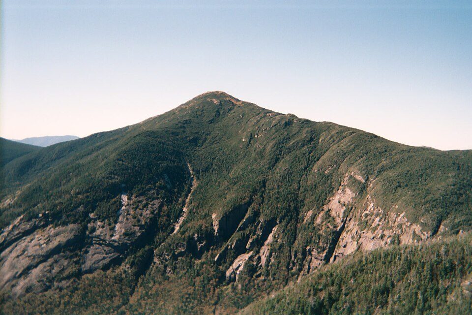
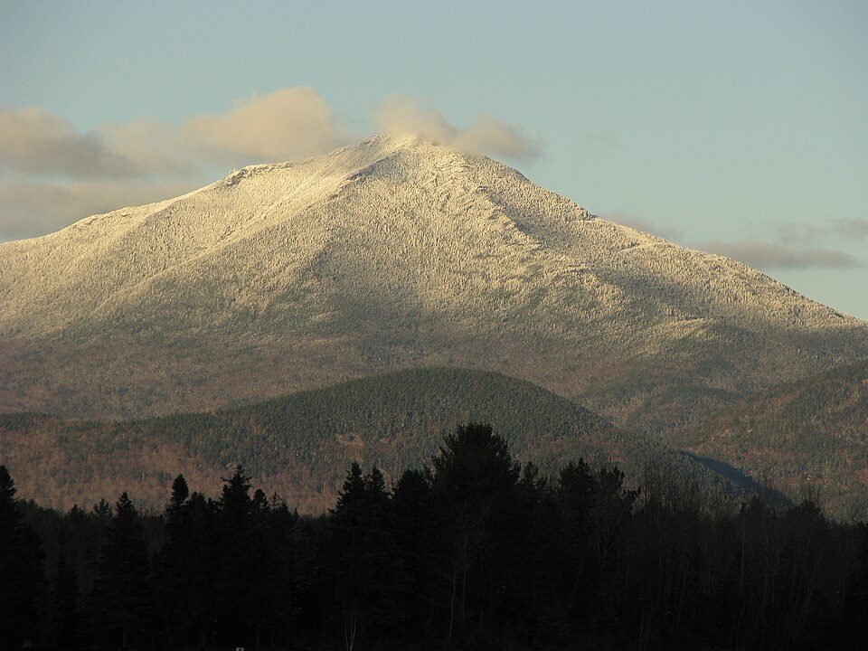
Lake Champlain: Copernicus Sentinel-2, ESA, CC BY-SA 3.0 igo · Fort Ticonderoga: Mwanner, CC BY-SA 3.0 · Mount Marcy: Daniel Tripp, Public domain · Whiteface Mountain: Mwanner, CC BY-SA 3.0 · Lake Tear of the Clouds: TheKilimanjaro, CC BY-SA 4.0 · Ausable Chasm: Alan Prusila / Alanp35 at en.wikipedia, CC BY-SA 3.0

Keep exploring

Everything we know about Lewis

19pages on Lewis
After high school

Colleges nearby

None within 15 miles of Lewis; the nearest are

A commuter town

96% of working residents leave Lewis for work

Where Lewis’s working residents go each day. Line width shows the share.

21% → Elizabethtown Elizabethtown 21% 7% → Essex Essex 7% 6% → Plattsburgh Plattsburgh 6% 6% → Plattsburgh Plattsburgh 6% 5% → Willsboro Willsboro 5% 4% → Keene Keene 4% Lewis · 4% stay
73jobs based in Lewis
4%of working residents work in town
19 mimedian commute distance

Census LEHD 2023

Landmarks

2 places in Lewis on the National Register of Historic Places.

All landmarks →

About Lewis

Town in Essex County, New York, US

There is another Town of Lewis in Lewis County, New York. Lewis is a town in Essex County, New York, United States. The population was 1,382 at the 2010 census. The town is named after Morgan Lewis, the governor of New York at the time the town was established. The town is in the northeastern quadrant of the county. It is 30 miles (48 km) southwest of Burlington, Vermont, 32 miles (51 km) south of Plattsburgh, 94 miles (151 km) south of Montreal, Quebec, and 131 miles (211 km) north of Albany.

From Wikipedia, licensed CC BY-SA 4.0 · facts via Wikidata (CC0)

Area
85 sq mi
Elevation
679 ft
ZIP code
12950
Area code
518

Questions about Lewis

Short answers, built from the data on this page.

Is Lewis, NY expensive?

Not for the area. Cost of living, which also weighs rents, property taxes and how many households pay 30% or more of their income for housing, grades B+.