Hauppauge’s post office opened in 1856, and 1 of its places is on the National Register
Most of Hauppauge was built recently: 1% of its homes predate 1940 and the median home dates from 1969. Below: 3 old photos and papers, maps from 1902 on, and the census since 2000.
The first house in greater Hauppauge, according to historian Simeon Wood, dates as far back as 1731, located on what would be the Arbuckle Estate, and later the southeast corner of the Hauppauge Industrial Park, near the intersection of Motor Parkway and Old Willets Path. The settlement of Hauppauge proper commenced with the family of Thomas Wheeler prior to 1753, at the present-day location of the BP gas station between Townline and Wheeler Road. The locale would take the Wheelers' name as its own until the 1860s when the name Hauppauge was restored. On March 13, 1806, "a meeting of the male members of the Methodist Society of the 'Haupogues' was convened at the School House agreeable to public notice for the express purpose of Incorporating and Electing Trustees for said Society." The first trustees elected at the meeting presided by Timothy Wheeler and Issac Wheeler were Issac Nichol…
Passages that mention Hauppauge, cut from the printed page as they were published.
A history of Hauppauge, Long Island, N. Y., together with genealogies of the following families1920 · page 17Read the page →
Read the text
It was not always so. That part south of the road from Hauppauge to Commack was the W inne-Commack patent granted to Charles Congreve by Queen Anne in 1703. The road from Hauppauge to Commack was laid out on the line between the two patents* in 1789.
Text read by machine from the scan; it may contain errors.
A history of Hauppauge, Long Island, N. Y., together with genealogies of the following families1920 · page 76Read the page →
Read the text
Nearly 170 years have elapsed since the first house was built in Hauppauge, and 100 years since the foundation of the Church was laid. From the retrospect, conditions have changed.
Text read by machine from the scan; it may contain errors.
...History of Suffolk county, New York1882 · page 39Read the page →
Read the text
Hauppauge Neck as owned by the Smiths was only that portion of it which lay in Smithtown. The neck ran across the town of Islip and was the tract included in Gibbs's patent of 1692. The road which is the boundary line between Smithtown and Islip separated the Smith estates from the settlement on the Islip side of the road, which was composed of a number of families mostly of the name of Wheeler. The settlement was
Text read by machine from the scan; it may contain errors.
...History of Suffolk county, New York1882 · page 48Read the page →
Read the text
The Methodist Episcopal church here was a part of the old Suffolk circuit as early as 1820. Later it was a preaching station in the Smithtown circuit, in which connection it continued until 1879, when it, with Hauppauge and St. James, was set off from that circuit. The classbook of 1825 shows 31 names, with Caleb Newton as leader. Meetings were then held in the old " Pond school-house." The church was built in 1852, on land
Text read by machine from the scan; it may contain errors.
Scans and text from the Internet Archive. Books published in 1930 or earlier, which are in the public domain.
Timeline
Hauppauge, 1902 to 2006
Woven from the archive, old maps, post office records, the National Register and the people born here.
Nothing in the archives for these yearsWeddings on Main Street, storms, parades, school pictures, the old store. If it’s in your family album, it belongs here.
Founding dates: Wikidata, Wikipedia, the U.S. post office records of Blevins & Helbock (CC0) and the Census. Homes by year built: Census ACS 2020–24. National Register of Historic Places: National Park Service (list of May 22, 2026). Old photos, postcards and papers: Wikimedia Commons, the Library of Congress and other public archives, credited on each item’s page. Maps: U.S. Geological Survey historical topographic maps (via Esri) and Sanborn fire-insurance maps (Library of Congress). History text and census tables: Wikipedia (CC BY-SA 4.0). Places that used to be: USGS Geographic Names Information System (2021). How TownRatings grades history →
From Wikimedia Commons (6), Wikipedia, Wikidata and Wikipedia for famous people, U.S. Geological Survey historical maps, U.S. Census counts (via Wikipedia) and old county and town histories (Internet Archive). Archive images are copied here with their credits and licenses, shown on each photo’s page. Refreshed monthly.
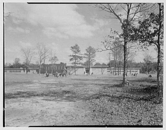


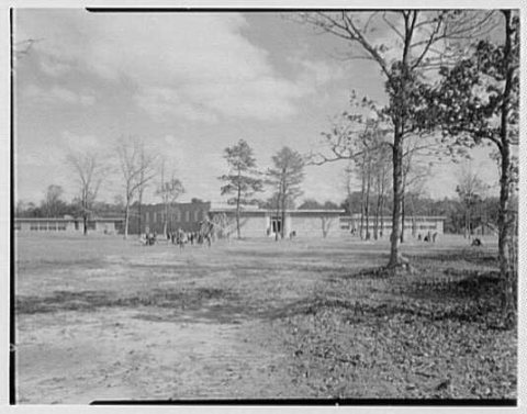

 1956
 1956
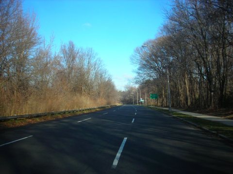 2006
 2006
 2006
