The origin of Fire Island's name is uncertain. It is believed its Native American name was Sictem Hackey ("Land of the Secatogues"). The Secatogues were a tribe in the area of the current town of Islip. It was part of what was also called the "Seal Islands".
Historian Richard Bayles suggests that the name derives from a misinterpretation or corruption of the Dutch word vijf ("five"), or in another version vier ("four"), referring to the number of islands near the Fire Island inlet, a view echoed by Robert Caro, who suggests in The Power Broker that the island was named to reflect four inlets that have since disappeared. At times histories have referred to it in the plural, as "Fire Islands", because of the inlet breaks.
machinery. The next spring, with his accustomed energy, Mr. Sammis replaced the wrecked boat with a better one. To further add to the comfort of visitors to Fire Island he has built a street railroad from the depot in the village of Babylon to the steamboat landing.
Text read by machine from the scan; it may contain errors.
Fire Island Inlet separates this beach from Fire Islands and the other Islip islands, the largest of which is Captree Island. Since 1700 very little change has occurred in the Fire Islands. Fire Island Inlet, however, has been gradually working westward, and the Islip islands and the west beaches have undergone slight changes.
Text read by machine from the scan; it may contain errors.
Scans and text from the Internet Archive. Books published in 1930 or earlier, which are in the public domain.
By decade
Fire Island, decade by decade
2 decades in the archive, from the 1890s to the 1900s. Scroll each row; tap a photo for its story.
Nothing in the archives for these yearsWeddings on Main Street, storms, parades, school pictures, the old store. If it’s in your family album, it belongs here.
Founding dates: Wikidata, Wikipedia, the U.S. post office records of Blevins & Helbock (CC0) and the Census. Homes by year built: Census ACS 2020–24. National Register of Historic Places: National Park Service (list of May 22, 2026). Old photos, postcards and papers: Wikimedia Commons, the Library of Congress and other public archives, credited on each item’s page. Maps: U.S. Geological Survey historical topographic maps (via Esri) and Sanborn fire-insurance maps (Library of Congress). History text and census tables: Wikipedia (CC BY-SA 4.0). Places that used to be: USGS Geographic Names Information System (2021). How TownRatings grades history →
From Wikimedia Commons (6), Wikipedia and old county and town histories (Internet Archive). Archive images are copied here with their credits and licenses, shown on each photo’s page. Refreshed monthly.


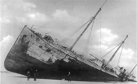 1893
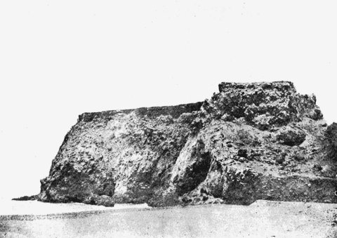 1906
 1906
 1906
 1908
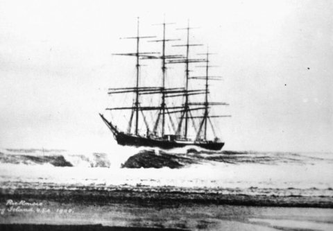 1908