Fire IslandNY
A town of 352, settled in 1857.
Is Fire Island a good place to live?
Fire Island’s typical journey to work is 39 minutes, where New York’s towns sit at 25 minutes and U.S. towns at 25 minutes. 28% of the land in Fire Island is conserved, where New York’s towns sit at 5.2% and U.S. towns at 4.3%. The biggest place to walk is Fire Island National Seashore, 12,246 acres with 46.2 miles of trail. Fire Island has fewer than 1,000 residents, too few for fair grades; the figures below are still real.
Fire Island lives by the ocean
Coastal flooding makes up 73% of the storm damage FEMA expects here.
FEMA National Risk Index · OpenFEMA · OpenStreetMap
Citi Field and 142 more within 40 miles
Museums, parks, gardens and other places to visit around Fire Island. Close and well known come first.
 Big draw35 mi Stadium & arenaCiti Field
 Big draw35 mi Stadium & arenaEtihad Park
 34 mi City parkFlushing Meadows–Corona Park
 21 mi Stadium & arenaNassau Veterans Memorial Coliseum
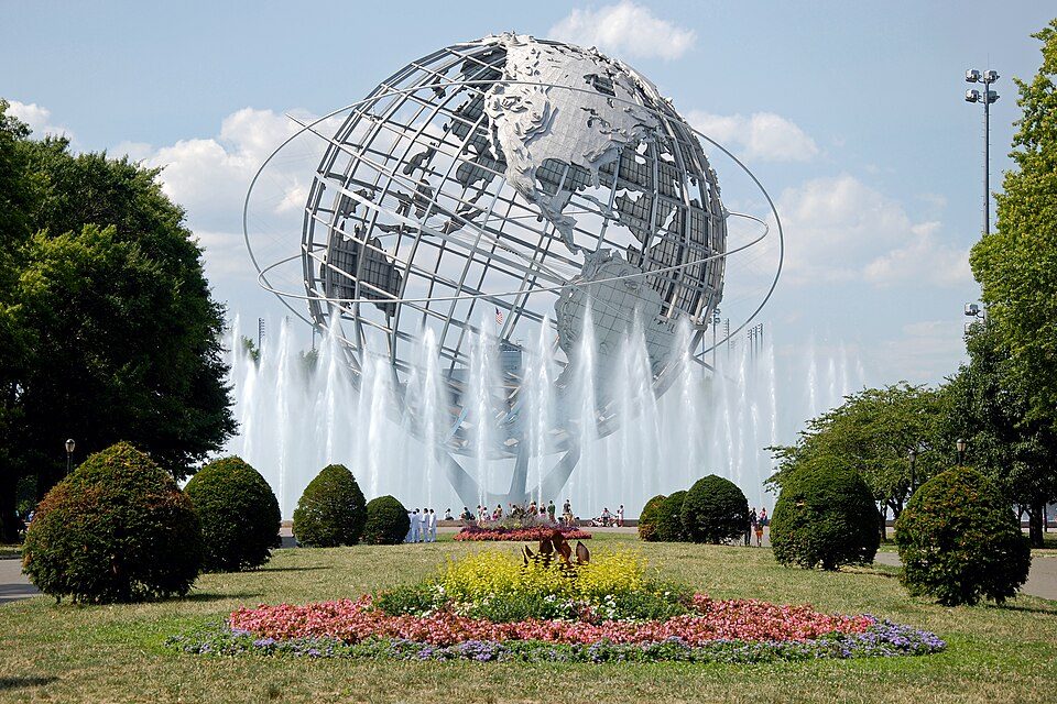
 34 mi LandmarkUnisphere
 38 mi Zoo & aquariumBronx Zoo
Photo credits
Citi Field: Chris6d, CC BY-SA 4.0 · Etihad Park: Bananza76, CC0 · Flushing Meadows–Corona Park: Flapane, Public domain · Nassau Veterans Memorial Coliseum: iMatthew // talk //, Public domain · Unisphere: Beyond My Ken, CC BY-SA 4.0 · Bronx Zoo: Stavenn, CC BY-SA 3.0


Moving to Fire Island: who provides what
Fire Island is unincorporated, so Suffolk County and regional agencies provide most services.
EPA SDWIS (Oct 9, 2026) · HIFLD + EIA-861 2025 · Census 2020 ZCTAs · NCES 2024–25 · registration: vote.gov, updated Aug 3, 2026.
The data
Ordered by what stands out in Fire Island.
In Fire Island, the FEMA risk score runs higher than in the typical New York or U.S. town
FEMA puts 73% of Fire Island’s expected hazard losses down to coastal flooding, and 22% to inland flooding. The national flood insurance program has paid 3,079 claims locally since 1978. Expected storm and flood damage is higher than in 88% of U.S. communities.
FEMA flood insurance claims · FEMA National Risk Index · OpenFEMA
Nearly a quarter of Fire Island is conserved land
In 6 parks and preserves, walkers have 69 miles of trail. The trail density in Fire Island is 1.8 miles per square mile.
| Biggest places to walk | Trails | Acres |
|---|---|---|
| 1. Fire Island National Seashore | 46.2 mi | 12,246 |
| 2. Smith Point County Park | 7 mi | 1,139 |
| 3. Robert Moses State Park (Long Island) | 5 mi | 745 |
Trails & parks © OpenStreetMap contributors · Conserved land: USGS PAD-US
Fire Island: four seasons and pleasant summers
Expect July afternoons of 83° and January nights of 26°, with about 32 inches of snow a winter.
Typical low → high °F
NOAA U.S. Climate Normals, 1991–2020
Fire Island stands out in New York and nationally, with fewer of its working residents who work locally
The top destinations are Islip (28%), New York (19%) and Brookhaven (13%). Jobs based in Fire Island fell to 267 in 2023, 148 fewer than in 2013. 6.6% of Fire Island residents live below the poverty line.
| Fire Island | New York towns | U.S. towns | |
|---|---|---|---|
| Working residents who work in town | 2% | 10% | 8% |
| Below the poverty line | 6.6% | 9.5% | 9.6% |
Where working residents work
Census LEHD 2023 · ACS
How healthy Fire Island is
Just over two in five adults in Fire Island have high blood pressure; 29% feel lonely. This New York town does better than the New York average on 7 of 32 CDC measures and worse on 13. The share of adults in Fire Island who have diabetes: 14%.
| Fire Island | New York towns | U.S. towns | |
|---|---|---|---|
| Depression (CDC PLACES) | 16% | 21% | 23% |
| High blood pressure (CDC PLACES) | 41% | 34% | 35% |
| Feel lonely (CDC PLACES) | 29% | 32% | 33% |
| Diabetes (CDC PLACES) | 14% | 11% | 12% |
| What stands out | Fire Island | NY |
|---|---|---|
| Fewer older adults who have lost all their teeth | 10.2% | 12.8% |
| Fewer lonely adults | 28.5% | 34.2% |
| More adults with COPD | 9.4% | 6% |
CDC PLACES 2025 · modeled estimates for adults · CMS · HRSA
The median home in Fire Island sells for about $1.7M
For Fire Island, the going rate for rent is $1,328 a month. In Fire Island, 80% of households live in a home they own.
| Fire Island | New York towns | U.S. towns | |
|---|---|---|---|
| Households that own their home | 80% | 75% | 73% |
| Median rent | $1,328 a month | $1,101 a month | $1,185 a month |
Census ACS, 2020–24 · Zillow Home Value Index · Redfin Data Center
Everything we know about Fire Island
Colleges nearby
2 within 15 miles of the center of Fire Island
College town 15 of every 100 Fire Island residents are enrolled in college, against 7 across New York.
352 people, and everyone knows the way
In a town this size, neighbors are the best guide. Ask them anything.
About Fire Island
Island in New York
Fire Island is the large center island of the outer barrier islands parallel to the South Shore of Long Island in the U.S. state of New York. In 2012, Hurricane Sandy once again divided Fire Island into two islands. Together, these two islands are about 31 miles (50 km) long and vary between 520 and 1,310 feet (160 and 400 m) wide. The land area of Fire Island is 9.6 square miles (24.9 km2). The majority of the island's land is protected by Fire Island National Seashore, established in 1964 after local resistance to proposed overdevelopment and highway construction. As of 2024, life for Fire Island visitors and residents was defined by restrictions on personal automobile use meant to preser…
From Wikipedia, licensed CC BY-SA 4.0 · facts via Wikidata (CC0)
- Area
- 38 sq mi
Questions about Fire Island
Short answers, built from the data on this page.
Is Fire Island, NY a good place to live?
Fire Island has fewer than 1,000 residents, too few for fair grades; the figures below are still real.