
Saltaire; Gilgo Beach; Atlantique; Stay - A - While Beach, 1915
Saltaire’s story
116 years in pictures
The archive holds 12 old photos and papers going back to 1915.
- 1910Saltaire is founded
Each edition grades its towns against each other only.

A town of 111, founded in 1910.
21% of the land in Saltaire is conserved, above both New York’s towns (5.2%) and U.S. towns (4.3%). The biggest park or preserve is Fire Island National Seashore, at 181 acres. Saltaire has fewer than 1,000 residents, too few for fair grades; the figures below are still real.
Coastal flooding makes up 79% of the storm damage FEMA expects here.
FEMA National Risk Index · OpenFEMA · OpenStreetMap
The archive holds 12 old photos and papers going back to 1915.
Museums, parks, gardens and other places to visit around Saltaire. Close and well known come first.
 Big draw35 mi Stadium & arenaCiti Field
 Big draw35 mi Stadium & arenaEtihad Park
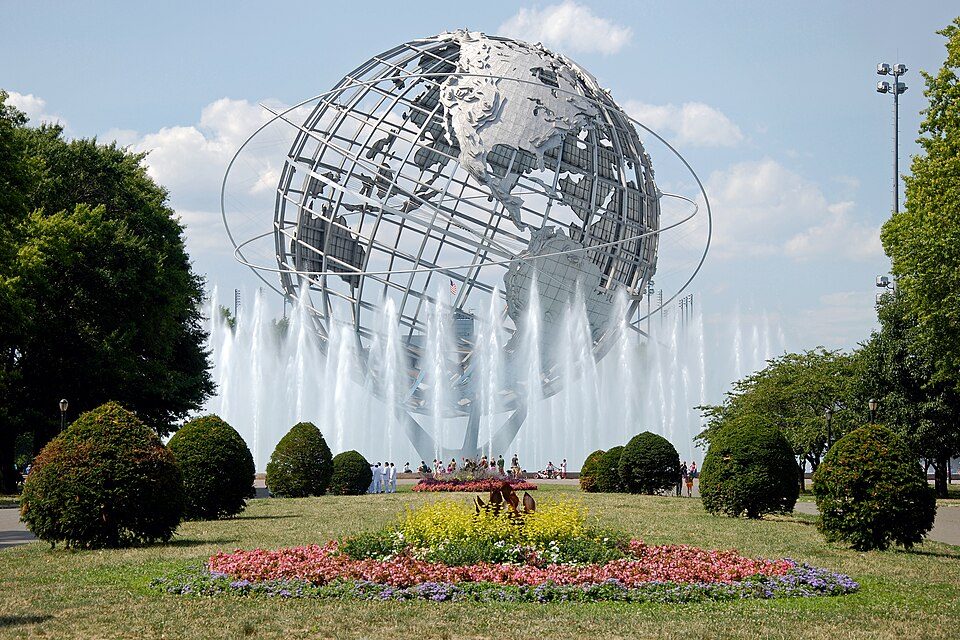 35 mi City parkFlushing Meadows–Corona Park
 22 mi Stadium & arenaNassau Veterans Memorial Coliseum
 35 mi LandmarkUnisphere
 39 mi Zoo & aquariumBronx Zoo
Citi Field: Chris6d, CC BY-SA 4.0 · Etihad Park: Bananza76, CC0 · Flushing Meadows–Corona Park: Flapane, Public domain · Nassau Veterans Memorial Coliseum: iMatthew // talk //, Public domain · Unisphere: Beyond My Ken, CC BY-SA 4.0 · Bronx Zoo: Stavenn, CC BY-SA 3.0
Who provides power, water and the rest in Saltaire, and how to reach them.
EPA SDWIS (Oct 9, 2026) · HIFLD + EIA-861 2025 · Census 2020 ZCTAs · NCES 2024–25 · registration: vote.gov, updated Aug 3, 2026.
Ordered by what stands out in Saltaire.
Nearly four fifths of Saltaire’s expected losses from natural hazards come from coastal flooding, followed by inland flooding at 17%. Since 1978, 330 flood insurance claims have been paid out locally. Federal aid has come to Saltaire households in 8 declared disasters; the latest was in 2020.
FEMA flood insurance claims · FEMA disaster declarations and aid · FEMA National Risk Index · OpenFEMA
0.3 miles of trail wind through 1 park or preserve.
| Biggest places to walk | Trails | Acres |
|---|---|---|
| 1. Fire Island National Seashore | 0.3 mi | 181 |
Trails & parks © OpenStreetMap contributors · Conserved land: USGS PAD-US
A winter brings about 32 inches of snow, with January nights at 26° and July afternoons at 83°.
NOAA U.S. Climate Normals, 1991–2020
Saltaire: 32% of adults have obesity. The share of adults in Saltaire who have been diagnosed with depression is 18%, below both the New York town median (21%) and the median of U.S. towns (23%). CDC measures, 32 in all: Saltaire beats New York on 8 and trails on 9.
| Saltaire | New York towns | U.S. towns | |
|---|---|---|---|
| Binge drink (CDC PLACES) | 14% | 17% | 16% |
| High blood pressure (CDC PLACES) | 40% | 34% | 35% |
| Diabetes (CDC PLACES) | 14% | 11% | 12% |
| Feel lonely (CDC PLACES) | 29% | 32% | 33% |
| What stands out | Saltaire | NY |
|---|---|---|
| Fewer adults facing housing insecurity | 11% | 14.5% |
| Fewer older adults who have lost all their teeth | 10% | 12.8% |
| More adults with COPD | 10.3% | 6% |
CDC PLACES 2025 · modeled estimates for adults · CMS · HRSA
2 within 15 miles of the center of Saltaire
About 0 of every 100 Saltaire residents are enrolled in college, against 7 across New York.
In a town this size, neighbors are the best guide. Ask them anything.
Village in New York, United States
Saltaire is a village on Fire Island in the Town of Islip, in Suffolk County, New York, United States. The year-round population was 113 at the time of the 2020 census, although the population of the village – being a summer beach community – increases many times over in the summer.
From Wikipedia, licensed CC BY-SA 4.0 · facts via Wikidata (CC0)
Short answers, built from the data on this page.
Saltaire has fewer than 1,000 residents, too few for fair grades; the figures below are still real.


