East WorcesterNY
A town settled in 1831, now home to 270 people.
Is East Worcester a good place to live?
27% of residents live below the poverty line in East Worcester, above both the New York town median (9.5%) and the median of U.S. towns (9.6%). Among 759 New York towns, just 8 have a lower July high than East Worcester. The biggest park or preserve is Decatur State Forest, at 63 acres. East Worcester has fewer than 1,000 residents, too few for fair grades; the figures below are still real.
270 people, and everyone knows the way
In a town this size, neighbors are the best guide. Ask them anything.
The data
Ordered by what stands out in East Worcester.
The FEMA risk score in East Worcester is higher than in the typical New York or U.S. town
84% of East Worcester’s expected losses from natural hazards come from inland flooding, followed by cold waves at 9%.
FEMA National Risk Index · OpenFEMA
With 0.3 jobs for every working resident, most of East Worcester’s workers commute out
The top destinations are Worcester (10%), Oneonta (8%) and Cobleskill (6%). The median commute is under 24 miles.
Where working residents work
Census LEHD 2024 · ACS
Snowy winters and pleasant summers: that is East Worcester’s year
In East Worcester, the January low is 11°F.
Typical low → high °F
NOAA U.S. Climate Normals, 1991–2020
East Worcester stands out in New York and nationally: a larger share of its adults have high blood pressure
Among adults in East Worcester, 82% had a checkup this year. Against the New York average, East Worcester comes out ahead on 10 CDC measures out of 32, and behind on 9. 29% of adults in East Worcester feel lonely; 14% have diabetes.
| East Worcester | Typical New York town | Typical U.S. town | |
|---|---|---|---|
| High blood pressure (CDC PLACES) | 41% | 34% | 35% |
| Feel lonely (CDC PLACES) | 29% | 32% | 33% |
| Diabetes (CDC PLACES) | 14% | 11% | 12% |
| Frequent physical distress (CDC PLACES) | 16% | 14% | 14% |
| What stands out | East Worcester | NY |
|---|---|---|
| Fewer uninsured adults | 4.6% | 7.9% |
| Fewer adults facing housing insecurity | 9.3% | 14.5% |
| More adults who have had cancer | 12.2% | 7.7% |
CDC PLACES 2025 · modeled estimates for adults · CMS · HRSA
| Biggest places to walk | Trails | Acres |
|---|---|---|
| 1. Decatur State Forest | — | 63 |
Trails & parks © OpenStreetMap contributors · Conserved land: USGS PAD-US
Homes in East Worcester sell for about $150K
For households in East Worcester, the share who are owner-occupiers is 92%.
Census ACS, 2020–24 · Zillow Home Value Index · Redfin Data Center
Everything we know about East Worcester
National Baseball Hall of Fame and Museum and 13 more within 40 miles
Museums, parks, gardens and other places to visit around East Worcester. Close and well known come first.
 Big draw14 mi MuseumNational Baseball Hall of Fame and Museum315K visitors a year15 mi CaveHowe Caverns32 mi LandmarkFort Dayton
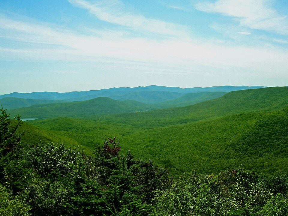 39 mi Park & preserveCatskill Park
 38 mi Ski areaHunter Mountain62 runs · 1,532 ft vertical
 14 mi MuseumFenimore Art Museum
Photo credits
National Baseball Hall of Fame and Museum: Beyond My Ken, CC BY-SA 4.0 · Catskill Park: The original uploader was Daniel Case at English Wikipedia., CC BY-SA 3.0 · Hunter Mountain: The original uploader was Daniel Case at English Wikipedia., CC BY-SA 3.0 · Fenimore Art Museum: Ser Amantio di Nicolao, CC BY-SA 3.0


Moving to East Worcester: who provides what
East Worcester is unincorporated, so Otsego County and regional agencies provide most services.
EPA SDWIS (Oct 9, 2026) · HIFLD + EIA-861 2025 · Census 2020 ZCTAs · NCES 2024–25 · registration: vote.gov, updated Aug 3, 2026.
100% of working residents leave East Worcester for work
Where East Worcester’s working residents go each day. Line width shows the share.
Census LEHD 2024
Colleges nearby
1 within 15 miles of the center of East Worcester
About 0 of every 100 East Worcester residents are enrolled in college, against 7 across New York.
About East Worcester
Census-designated place in New York, United States
East Worcester is a hamlet and census-designated place (CDP) in the town of Worcester in Otsego County, New York, United States. It was first listed as a CDP prior to the 2020 census. As of the 2020 census, East Worcester had a population of 327. East Worcester is in eastern Otsego County, in the northeast part of the town of Worcester. It is bordered to the north by the town of Decatur and to the southeast by Interstate 88. New York State Route 7 is East Worcester's Main Street. Access to I-88 is either from Exit 19 in Worcester hamlet, 4 miles (6 km) to the southwest along Route 7, or from Exit 20 in Richmondville, 7 miles (11 km) to the east, also via Route 7. East Worcester is in the va…
From Wikipedia, licensed CC BY-SA 4.0 · facts via Wikidata (CC0)
- Area
- 2.5 sq mi
- Elevation
- 1,516 ft
- ZIP code
- 12064
Questions about East Worcester
Short answers, built from the data on this page.
Is East Worcester, NY a good place to live?
East Worcester has fewer than 1,000 residents, too few for fair grades; the figures below are still real.
Say something about East Worcester.
Ask a question, answer one, post a photo or an event. Free, and the parts only a neighbor would know are the parts worth reading.