East Hampton’s post office opened in 1816, and 13% of its homes were built before 1940
More historic than 88% of U.S. towns · #291 of 758 in New York. What drives it
33 places in town are on the National Register, among them 3 National Historic Landmarks and ten historic districts with 1,455 buildings between them. Below: 7 old photos and papers, maps from 1904 on, and the census since 1790.
From East Hampton’s archive · credits on each photo
Quick answers
How East Hampton began
When was East Hampton founded?
1816
The East Hampton post office opened in 1816, the earliest record of the town by name. Three smaller post offices, Fireplace (1802), Springs (1849) and Promised Land (1879), opened inside today’s town and later closed.
First census: 1,497 in 17902020 census: 28,385210 years
How historic is East Hampton?
A
More historic than 88% of U.S. towns, on its age, its old homes and the National Register.
Founding year: the first East Hampton post office (Blevins & Helbock, CC0).The full story ↓
History grade
What drives East Hampton’s History grade
On its age, its old homes and the National Register, East Hampton is more historic than 88% of U.S. towns, #291 of 758 in New York. All 3 inputs are above most U.S. towns; its National Register listings ranks highest and its share of homes from before 1940 lowest.
A
HistoryA character grade: shown, never part of East Hampton’s overall grade.
New York towns list more on the Register than most of the country (a typical New York town has 12.3 per 10,000 residents, the U.S. 2.4), so East Hampton’s 517 sits above most of its state (92% of New York towns have fewer) while its 1,483 historic buildings outnumber those of 99% of U.S. towns.
How sure. Graded on any two of the three inputs instead, the letter would range from B+ to A. The pre-1940 share (±2.3 points) is firm at this size. The founding year is the first post office, not a stated founding date.
Founding year: the first post office (other dates in Quick answers). Homes: Census ACS 2020–24. National Register: National Park Service, May 2026 list; each listing counted once (boundary changes and added documentation belong to their listing), and a historic district counts its contributing buildings. How TownRatings grades history →
What stands out about East Hampton’s past
Read from the archive, the National Register and the record. The page puts what stands out first.
The country’s official list of buildings and places worth saving. 3 are National Historic Landmarks, the highest tier. Boundary changes and added documentation are counted with their listing.
Amagansett Life Saving StationlocaleBattery Edmund SmithmilitaryCamp HeromilitaryDitch Plain Life Saving StationlocaleFireplace Lodge Girls CamplocaleFort TylermilitaryGardiners Point Island LighthousebuildingGeorgica Life Saving StationlocaleHither Plain Life Saving StationlocaleMontauk Air Force StationmilitaryNapeague Coast Guard Stationmilitary
19cemeteries and burying grounds inside East Hampton
Cedar LawnEast EndEdwardsFort HillGardiners IslandGreen RiverJerichoJohn Parsons FamilyLily HillMost Holy Trinity Roman CatholicNorth EndOak GroveRichard KingRound SwampSaint David African Methodist Episcopal ZionSaint Luke's Memorial GardenSouth EndSprings Community Presbyterian ChurchWainscott
See all 19
Cedar Lawn Cemetery · East End Cemetery · Edwards Cemetery · Fort Hill Cemetery · Gardiners Island Cemetery · Green River Cemetery · Jericho Cemetery · John Parsons Family Cemetery · Lily Hill Cemetery · Most Holy Trinity Roman Catholic Cemetery · North End Cemetery · Oak Grove Cemetery · Richard King Cemetery · Round Swamp Cemetery · Saint David African Methodist Episcopal Zion Cemetery · Saint Luke's Memorial Garden · South End Cemetery · Springs Community Presbyterian Church Cemetery · Wainscott Cemetery
US Post Offices dataset (Blevins & Helbock, CC0). Places and cemeteries from the USGS Geographic Names Information System (2021).
This area had been inhabited for thousands of years by wandering tribes of indigenous peoples. At the time of European contact, East Hampton was home to the Pequot people, part of the culture that also occupied territory on the northern side of Long Island Sound, in what is now Connecticut of southern New England. They belong to the large Algonquian-speaking language family. Bands on Long Island were identified by their geographic locations. The historical people known to the colonists as the Montaukett, who were Pequot, controlled most of the territory at the east end of Long Island.
Passages that mention East Hampton, cut from the printed page as they were published.
History of the Davis family. Being an account of the descendants of John Davis, a native of England, who died in East Hampton, Long Island, in 1705. With notices of individuals and families connected with them. Brought down to 1886-71888Read the page →
Read the text
The following last will and testament we copy from the Records in the Surrogate's oflHce of the City and County of IS'. Y., Liber twenty-five, page two-hundred and ninety-two: In the name of God, Amen, I, John Davis, of the town of East Hampton, in the county of Suffolk, and province of New Yorl<, yooman, being aged and attended with many infirmiiies, but of sound and perfect mind and memory, and calling to mind the uncertainty of this transitory life, do make and ordain this my last will and testament, in the following form and manner : That is to say principally and iirst of all, I recommend my soul to God who gave it,
Text read by machine from the scan; it may contain errors.
...History of Suffolk county, New York1882 · page 10Read the page →
Read the text
vicinity, was laid out the same year. The 30-acre division at Mecox was made in 1677. The Great North and Great South divisions were the large extent of woodland lying between the East Hampton line and the Shinecock Hills, laid out in 1738. The Little South division consisted of small parcels of land lying at different places, from the East Hampton line to the Shinecock Hills, laid out in 1763. The Sag Harbor little division was laid
Text read by machine from the scan; it may contain errors.
...History of Suffolk county, New York1882 · page 11Read the page →
Read the text
The town of East Hampton is now divided into six school districts, which, with their respective numbers of pupils, are as follows: i. East Hampton (Hook District), 55 ; 2, Wainscott, 25; 3, Amagansett, 95; 4, Springs, 94; 5, East Hampton, 78; 6, Northwest, 10.
Text read by machine from the scan; it may contain errors.
Scans and text from the Internet Archive. Books published in 1930 or earlier, which are in the public domain.
Timeline
East Hampton, 1725 to 2012
Woven from the archive, old maps, post office records, the National Register and the people born here.
Nothing in the archives for these yearsWeddings on Main Street, storms, parades, school pictures, the old store. If it’s in your family album, it belongs here.
The East Hampton post office opened in 1816, the earliest record of the town by name (U.S. post office records).
How does East Hampton rank for history?
East Hampton is more historic than 88% of U.S. towns, #291 of 758 in New York. The History grade combines the town’s founding era, the share of homes built before 1940 and its National Register listings. It’s a character grade, so it isn’t part of the overall grade. How it works.
What is on the National Register in East Hampton?
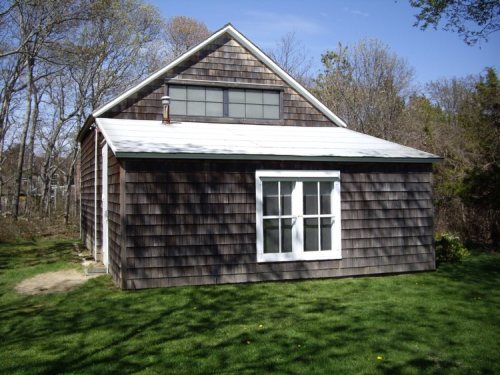
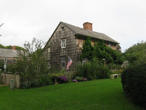
33 listings, 3 of them National Historic Landmarks: 20 buildings, among them the Thomas Moran House (a National Historic Landmark since 1965), 12 historic districts with 1,455 contributing buildings, 1 site, and 1 structure. 1,483 historic buildings in all.
How old are the homes in East Hampton?
13% of East Hampton’s homes were built before 1940 (Census estimate, ±2.3 points), against a typical 27% for a New York town; the median home was built in 1980.
Founding dates: Wikidata, Wikipedia, the U.S. post office records of Blevins & Helbock (CC0) and the Census. Homes by year built: Census ACS 2020–24. National Register of Historic Places: National Park Service (list of May 22, 2026). Old photos, postcards and papers: Wikimedia Commons, the Library of Congress and other public archives, credited on each item’s page. Maps: U.S. Geological Survey historical topographic maps (via Esri) and Sanborn fire-insurance maps (Library of Congress). History text and census tables: Wikipedia (CC BY-SA 4.0). Places that used to be: USGS Geographic Names Information System (2021).
From the Library of Congress (7), Wikidata (5), the National Register of Historic Places (34), Wikipedia, Wikidata and Wikipedia for famous people, U.S. Geological Survey historical maps, U.S. Census counts (via Wikipedia), the US Post Offices dataset (Blevins & Helbock), the USGS Geographic Names Information System and old county and town histories (Internet Archive). Archive images are copied here with their credits and licenses, shown on each photo’s page. Refreshed monthly.


 ★ Landmark
 ★ Landmark
 ★ Landmark


 1913
 1913
 1913
 1913
 1913
 1914


