Dryden dates to 1803, and 14% of its homes were built before 1940
More historic than 83% of U.S. towns · #383 of 758 in New York. What drives it
11 places in town are on the National Register, among them a historic district with 61 buildings. Below: 2 old photos and papers, maps from 1887 on, and the census since 1820.
Founding year: Wikidata; Wikipedia’s history section gives the same year. First post office: 1817.The full story ↓
History grade
What drives Dryden’s History grade
On its age, its old homes and the National Register, Dryden is more historic than 83% of U.S. towns, #383 of 758 in New York. All 3 inputs are above most U.S. towns; its National Register listings ranks highest and its share of homes from before 1940 lowest.
A−
HistoryA character grade: shown, never part of Dryden’s overall grade.
New York towns list more on the Register than most of the country (a typical New York town has 12.3 per 10,000 residents, the U.S. 2.4), so Dryden’s 55.9 sits above most of its state (70% of New York towns have fewer) while its 76 historic buildings outnumber those of 88% of U.S. towns.
How sure. Graded on any two of the three inputs instead, the letter would range from B+ to A−. The pre-1940 share (±2.8 points) is firm at this size. Two sources give 1803.
Founding year: Wikidata (other dates in Quick answers). Homes: Census ACS 2020–24. National Register: National Park Service, May 2026 list; each listing counted once (boundary changes and added documentation belong to their listing), and a historic district counts its contributing buildings. How TownRatings grades history →
What stands out about Dryden’s past
Read from the archive, the National Register and the record. The page puts what stands out first.
Lost post offices, old corners, places now gone and burying grounds
Dryden’s post office has been open since 1817. Four other post offices opened and closed inside today’s town.
Dryden
1817–today
Etna
1823–today
West Dryden
1828–1902
Varna
1830–1918
Freeville
1864–today
Ellis Hollow
1879–1879
Ellis
1883–1902
18101920today
Hamlets and corners on the map
Beacon View Village Mobile Home ParkBethel GroveCongers Mobile Home ParkCountry Acres Mobile Home ParkCountry Manor EstatesEllisEtnaFall Creek ParkeFreevilleHibbards CornerHillside Acres Mobile Home ParkLacy CornersPerutonPleasant View Mobile Home ParkRed MillsVarnaWest DrydenWillow Glen
Gone or out of use
Dryden Drive-InlocaleFinger Lakes QuarrymineKeech AirportairportSchool Number 17schoolSchool Number 21schoolSchool Number 27school
5cemeteries and burying grounds inside Dryden
Ellis HollowEtnaGee TownSaint PatricksWillow Glen
US Post Offices dataset (Blevins & Helbock, CC0). Places and cemeteries from the USGS Geographic Names Information System (2021).
Help out
Start Dryden’s collection
The first neighbors to add old photos shape how Dryden’s history is told.
Decades since 1900 with photos
00s10s20s30s40s50s60s70s80s90s
0 of 10 decades. The empty ones are waiting for someone’s album.
The region was part of the Central New York Military Tract, land given as compensation to soldiers of the American Revolution. Robert Harpur, a Clerk in the office of the New York State Surveyor General who named numerous New York townships in 1790 based on his own classical studies, named Dryden for John Dryden (1631–1700), the English poet and a translator of the classics (including the works of Virgil, with the town of Virgil being the next town east of Dryden). Dryden was also the translator of Plutarch's work Lives of the Noble Greeks and Romans, which Harpur likely sourced for many of the names in the Military Tract.
Passages that mention Dryden, cut from the printed page as they were published.
Landmarks of Tompkins county, New York1894 · page 149Read the page →
Read the text
Cole, George, was born in the town of Dryden, August 5, 1845, and was educated in the common schools, and finishedunder Prof. Jackson Graves at Dryden Academy. After leaving school he returned to the farm of his father, Joseph Cole, who was one of the earliest residents of the town of Dryden, settling on the south hill about 1830.
Text read by machine from the scan; it may contain errors.
Landmarks of Tompkins county, New York1894 · page 107Read the page →
Read the text
Wheeler, D. T., was born in the town of Dryden, November 24, 1855, and was educated in the Dryden Union School, and afterwards took a course of instruction in Lowell's Business College at Binghamton. After leaving school he went to work in the mercantile trade, and in 1889 went into business for himself, and now carries the largest line of dry goods and general merchandise in the town of Dryden. At the age of twenty-two he married Miss Carrie Gaston, daughter of Edmund Gaston, of the town of Dryden, and they are the parents of two children, one daughter, Georgia, and one son, Meritt. He takes the Republican side in politics, also an active interest
Text read by machine from the scan; it may contain errors.
Scans and text from the Internet Archive. Books published in 1930 or earlier, which are in the public domain.
Timeline
Dryden, 1803 to 2010
Woven from the archive, old maps, post office records, the National Register and the people born here.
Every edition of the U.S. Geological Survey’s map of Dryden. Tap a year, or press play to watch the town change.
1900Dryden sheet · 1:62,500
U.S. Geological Survey historical topographic maps (public domain), via Esri’s collection of the scans. The red ring marks the center of Dryden.
Every building
Dryden, building by building, 1887–1910
Fire insurance maps drew every building, what it was made of and what it was used for, so insurers could price the risk of fire. Pick a year, then a sheet.
In 1803, according to Wikidata and Wikipedia’s history of the town. Dryden’s post office opened in 1817, and the census of 1820 counted 3,951 people here.
How does Dryden rank for history?
Dryden is more historic than 83% of U.S. towns, #383 of 758 in New York. The History grade combines the town’s founding era, the share of homes built before 1940 and its National Register listings. It’s a character grade, so it isn’t part of the overall grade. How it works.
What is on the National Register in Dryden?
11 listings: 10 buildings, among them the Jennings-Marvin House (listed 1984, the first), and 1 historic district, the Dryden Historic District, with 61 contributing buildings. 76 historic buildings in all.
How old are the homes in Dryden?
14% of Dryden’s homes were built before 1940 (Census estimate, ±2.8 points), against a typical 27% for a New York town; the median home was built in 1979.
Founding dates: Wikidata, Wikipedia, the U.S. post office records of Blevins & Helbock (CC0) and the Census. Homes by year built: Census ACS 2020–24. National Register of Historic Places: National Park Service (list of May 22, 2026). Old photos, postcards and papers: Wikimedia Commons, the Library of Congress and other public archives, credited on each item’s page. Maps: U.S. Geological Survey historical topographic maps (via Esri) and Sanborn fire-insurance maps (Library of Congress). History text and census tables: Wikipedia (CC BY-SA 4.0). Places that used to be: USGS Geographic Names Information System (2021).
From Wikimedia Commons (12), the National Register of Historic Places (11), Wikipedia, U.S. Geological Survey historical maps, U.S. Census counts (via Wikipedia), the US Post Offices dataset (Blevins & Helbock), the USGS Geographic Names Information System, Sanborn fire insurance maps (Library of Congress) and old county and town histories (Internet Archive). Archive images are copied here with their credits and licenses, shown on each photo’s page. Refreshed monthly.


 1866
 2009
 2009
 2009
 2008
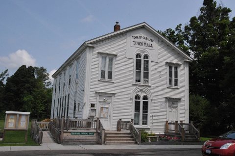 2008
 2006
 2005
 2005
 2005
 2005


