Guest, Sign inJoin

Post to Catharine

We’ll email a one-tap link to publish your post. No password, and nothing is public until you click it.
Already a member? Sign in
AHistory
History · Catharine

46% of Catharine’s homes were built before 1940

More historic than 89% of U.S. towns. What drives it

Its Register listings are the Lattin-Crandall Octagon Barn and the Lawrence Memorial Chapel and Cemetery. Below: 2 old photos and papers, maps from 1898 on, and the census since 1820.

2on the National Register
46%homes built before 1940
2old photos & papers
1famous people
Quick answers

About Catharine’s history

How historic is Catharine?

A

More historic than 89% of U.S. towns, on its age, its old homes and the National Register.

What drives the grade ↓
History grade

What drives Catharine’s History grade

On its age, its old homes and the National Register, Catharine is more historic than 89% of U.S. towns. All 2 inputs are above most U.S. towns; its share of homes from before 1940 ranks highest and its National Register listings lowest.

A
HistoryA character grade: shown, never part of Catharine’s overall grade.
All U.S. towns we grade (21,289)Ahead of 89%
NewerOlder

New York towns list more on the Register than most of the country (a typical New York town has 12.3 per 10,000 residents, the U.S. 2.4), so Catharine’s 14.6 sits near the middle of its state (52% of New York towns have fewer) while its 2 listings outnumber those of 60% of U.S. towns.

How sure. Graded on two of the three inputs, so a change in either one moves the letter more than it would with three. The pre-1940 share is a Census survey estimate (±7.8 points).

Founding year: our sources. Homes: Census ACS 2020–24. National Register: National Park Service, May 2026 list; each listing counted once (boundary changes and added documentation belong to their listing), and a historic district counts its contributing buildings. How TownRatings grades history →

What stands out about Catharine’s past

Read from the archive, the National Register and the record. The page puts what stands out first.

★ What stands out · Help out

Start Catharine’s collection

The first neighbors to add old photos shape how Catharine’s history is told.

Decades since 1900 with photos
00s10s20s30s40s50s60s70s80s90s
0 of 10 decades. The empty ones are waiting for someone’s album.
Places that used to be

Lost post offices, old corners and burying grounds

Three other post offices opened and closed inside today’s town.

Catherine
1829–1911
Cayutaville
1846–1902
Alpine
1852–today
Odessa
1855–today
Lawrence
1865–1893
18201920today
Hamlets and corners on the map
AlpineCayutavilleOdessaWildwood Mobile Home Park
3cemeteries and burying grounds inside Catharine
Laurel HillLawrenceNorth Settlement

US Post Offices dataset (Blevins & Helbock, CC0). Places and cemeteries from the USGS Geographic Names Information System (2021).

On the map

Catharine on the map, 1898 to 1978

Every edition of the U.S. Geological Survey’s map of Catharine. Tap a year, or press play to watch the town change.

Catharine on the 1898 USGS mapCatharine on the 1901 USGS mapCatharine on the 1950 USGS mapCatharine on the 1961 USGS mapCatharine on the 1978 USGS map1898Watkins Glen sheet · 1:62,500

U.S. Geological Survey historical topographic maps (public domain), via Esri’s collection of the scans. The red ring marks the center of Catharine.

The story

How Catharine came to be

From Wikipedia’s history of Catharine.

Read it all →

A Seneca village informally known as Catharine's Town was located near the falls. It was destroyed by colonial forces during the Sullivan Expedition of 1779, one of more than 40 villages destroyed across western New York in retaliation for raids in the eastern part of the province.

Text from Wikipedia, licensed CC BY-SA 4.0.

From the old history books

What they wrote about Catharine in 1867

Passages that mention Catharine, cut from the printed page as they were published.

" So shall we overcome Catharine Parr, as we overcame Catharine Howard. To the block with the heretic! We found means of bringing Catharine Howard to the scaffold; you, Lady Jane, must find the means of leading Catharine Parr the same way."
Henry VIII and his court1867 · page 9Read the page →
Read the text

" So shall we overcome Catharine Parr, as we overcame Catharine Howard. To the block with the heretic! We found means of bringing Catharine Howard to the scaffold; you, Lady Jane, must find the means of leading Catharine Parr the same way."

Text read by machine from the scan; it may contain errors.
Catharine and the Archbishop of Canterbury, the noble Cranmer, stood at his bedside: and whilst in convulsive agony he grasped Catharine's hands, he listened to the devout prayers which Cranmer was saying over him.
Henry VIII and his court1867 · page 420Read the page →
Read the text

Catharine and the Archbishop of Canterbury, the noble Cranmer, stood at his bedside: and whilst in convulsive agony he grasped Catharine's hands, he listened to the devout prayers which Cranmer was saying over him.

Text read by machine from the scan; it may contain errors.

Scans and text from the Internet Archive. Books published in 1930 or earlier, which are in the public domain.

Timeline

Catharine, 1809 to 1911

Woven from the archive, old maps, post office records, the National Register and the people born here.

  1. 19th century
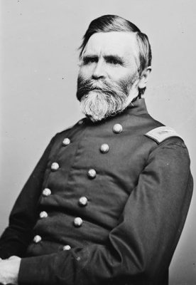
  2. 1809Born hereAlexander S. Diven is born here
  3. 1829Post officeThe Catherine post office opens
  4. 1846Post officeThe Cayutaville post office opens
  5. 1852Post officeThe Alpine post office opens
  6. 1860CensusPopulation peaks at 3,688
  7. 1874In the archiveCatharine (Township)
  8. 1898On the mapFirst mapped by the U.S. Geological Survey
  9. 20th century
  10. 1902Post officeThe Cayutaville post office closes
  11. 1911Post officeThe Catherine post office closes
By decade

Catharine, decade by decade

One decade in the archive so far: the 1870s. Scroll each row; tap a photo for its story.

Then & now

Stand where they stood

No then-and-now pairs yet. Take a photo from the same spot as an old one and they appear here side by side.

Catharine (Township)
Retake this viewCatharine (Township), 1874

Find the spot, match the angle, and add your photo. It becomes the first then-and-now pair on Catharine’s page.

Retake this view · +15
On the National Register

2 historic places in Catharine

The country’s official list of buildings and places worth saving.

places listed
2
National Historic Landmarks
0
none yet
historic buildings protected
2
each building in a district counts
first listed
1984
Lattin-Crandall Octagon Barn
Buildings

Architectural styles listings

Octagon Mode1
All 2 listings

National Park Service, National Register of Historic Places. Photos from Wikimedia Commons, credited on each place’s page.

People over time

Catharine, census by census

05001,0001,5002,0002,5003,0003,5004,0001850190019502000Peak: 3,688

Peaked at 3,688 in 1860; 1,656 people lived here in 2020.

21 censuses, 1820–2020.

U.S. Census Bureau decennial counts, from the census table on Catharine’s Wikipedia page.

Stories next door

History across the town line

Each neighbor’s History grade, on the same three inputs.

Questions about Catharine’s history

How does Catharine rank for history?

Catharine is more historic than 89% of U.S. towns. The History grade combines the town’s founding era, the share of homes built before 1940 and its National Register listings. It’s a character grade, so it isn’t part of the overall grade. How it works.

What is on the National Register in Catharine?

Two places: the Lattin-Crandall Octagon Barn (listed 1984) and the Lawrence Memorial Chapel and Cemetery (2025).

How old are the homes in Catharine?

46% of Catharine’s homes were built before 1940 (Census estimate, ±7.8 points), against a typical 27% for a New York town; the median home was built in 1953.

Memory lane

What the archives can’t tell you, neighbors can.

Town Square →
Start a conversation
Sources

Where this page comes from

Founding dates: Wikidata, Wikipedia, the U.S. post office records of Blevins & Helbock (CC0) and the Census. Homes by year built: Census ACS 2020–24. National Register of Historic Places: National Park Service (list of May 22, 2026). Old photos, postcards and papers: Wikimedia Commons, the Library of Congress and other public archives, credited on each item’s page. Maps: U.S. Geological Survey historical topographic maps (via Esri) and Sanborn fire-insurance maps (Library of Congress). History text and census tables: Wikipedia (CC BY-SA 4.0). Places that used to be: USGS Geographic Names Information System (2021).

From Wikimedia Commons (2), the National Register of Historic Places (2), Wikipedia, Wikidata and Wikipedia for famous people, U.S. Geological Survey historical maps, U.S. Census counts (via Wikipedia), the US Post Offices dataset (Blevins & Helbock), the USGS Geographic Names Information System and old county and town histories (Internet Archive). Archive images are copied here with their credits and licenses, shown on each photo’s page. Refreshed monthly.